Day 108 – The Rim trail
Start: Crater lake – 1822.7
End: northern border of CLNP – 1845.7
Miles: 14.4
Ascent: 2119 ft | Descent: 2340 ft
PCT Mile makers: 1845.7 – 1840.3 = 5.4 miles
Rim trail = 9 miles
Total = 14.4 miles
Start time: 9:45 am
End time: 6:10 pm
Current elevation: 6079 ft
Total PCT miles: 1108.3
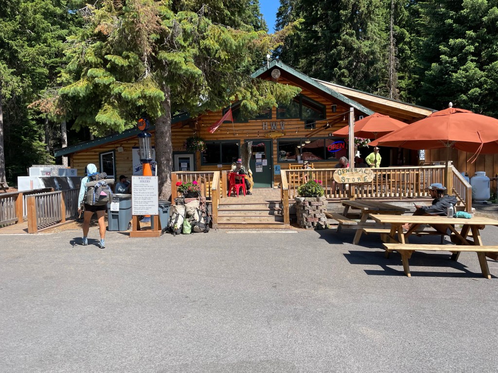
We got up a little later than usual. The restaurant didn’t open until 7 am and the first trolley to the rim wasn’t until 9 am. We packed up most of our stuff before breakfast. We had decided to take the trolley along with all the other hikers to the rim instead of hiking the trail. This avoids a 6 mile hike uphill in the woods with lots of snow and mosquitoes. We figured we had done plenty of extra miles that weren’t in the PCT that weren’t counted.
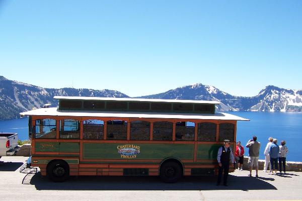
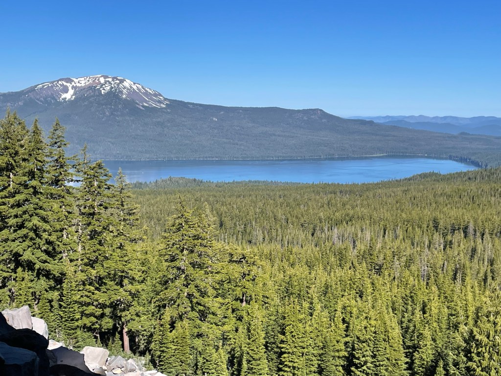
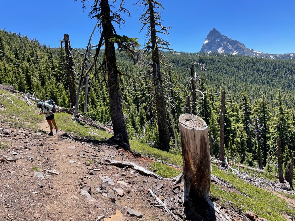
So after breakfast we finished packing and headed for the trolley. The only people in the trolley were PCT hikers … kind of funny. Once at the rim we found the Rim Trail which is a “PCT alternate”. For some reason, the main PCT route winds through the woods far from the rim and without any views of the lake. Who wants to hike that?
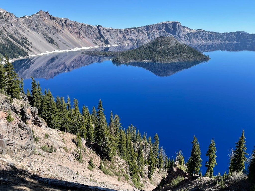
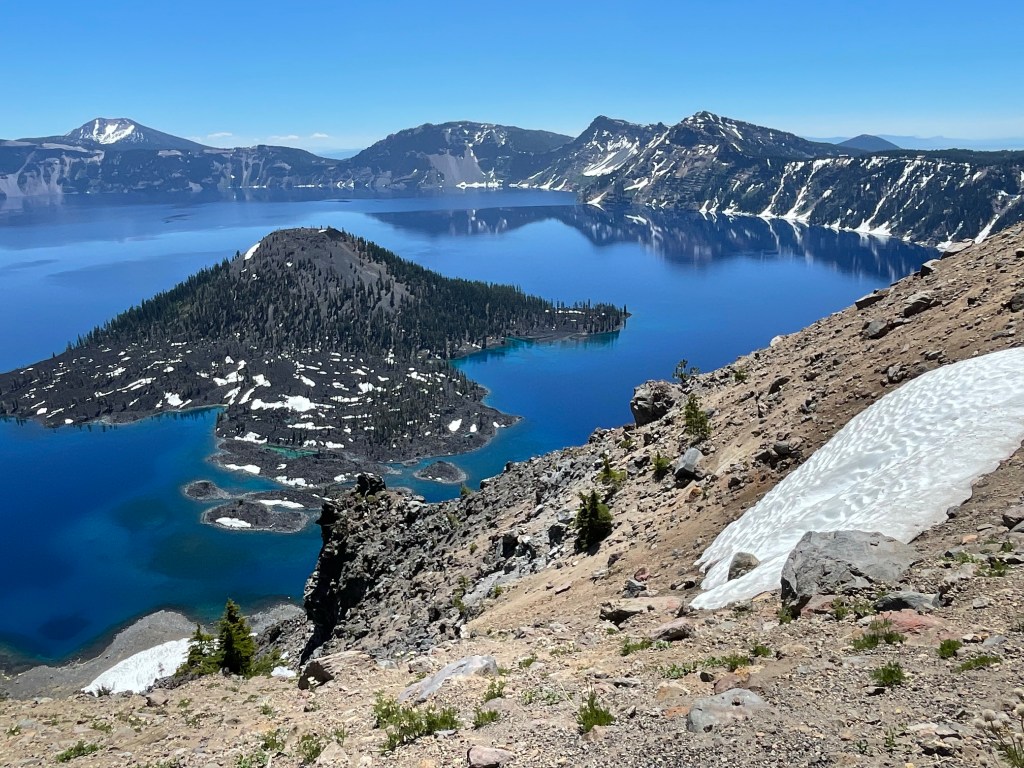
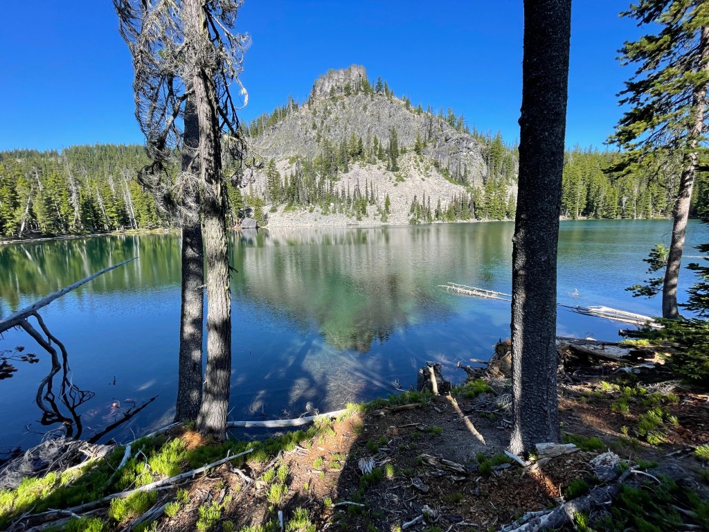
The hike along the rim trail had great views of the lake and we got to see the lake and wizard island from various angles. We had lunch at the last spot we could see the lake before the rim trail left the rim and joined the PCT some 3 miles later.
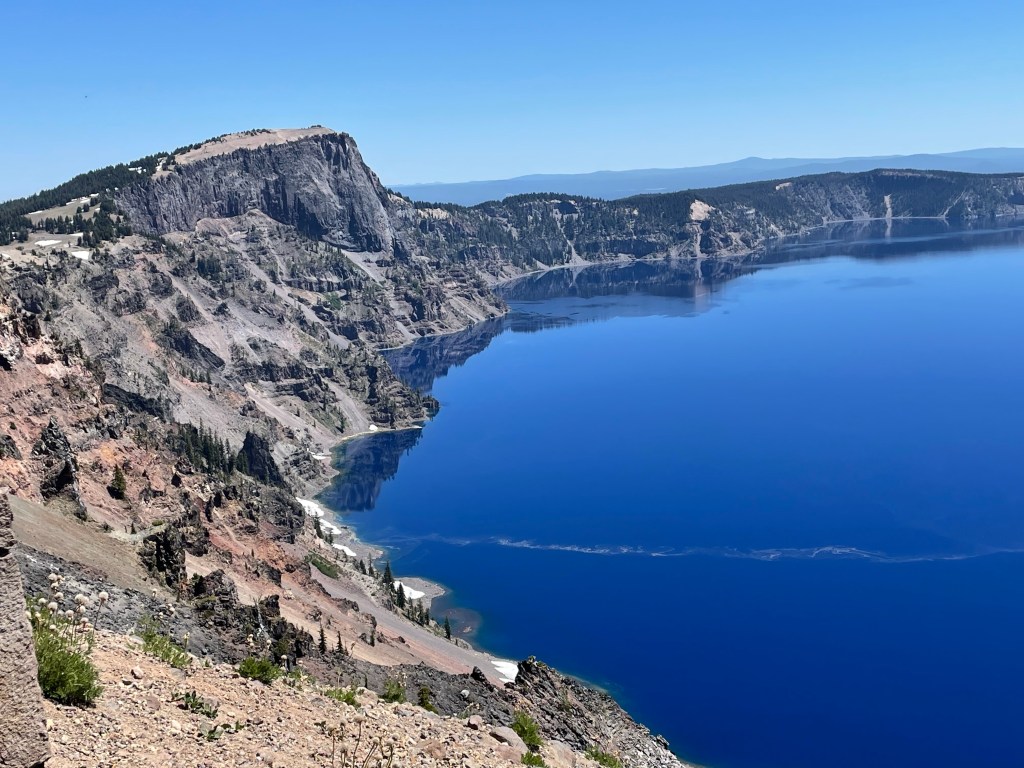
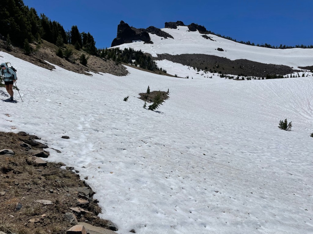
Once the rim trail past Watchman Tower the trail became more snow covered. There were a few sketchy spots near the tower. We put our whippet picks back on our trekking poles and micro spikes on our feet, then slowly made our way across the traverses. The snow was really soft, but there were good boot tracks.
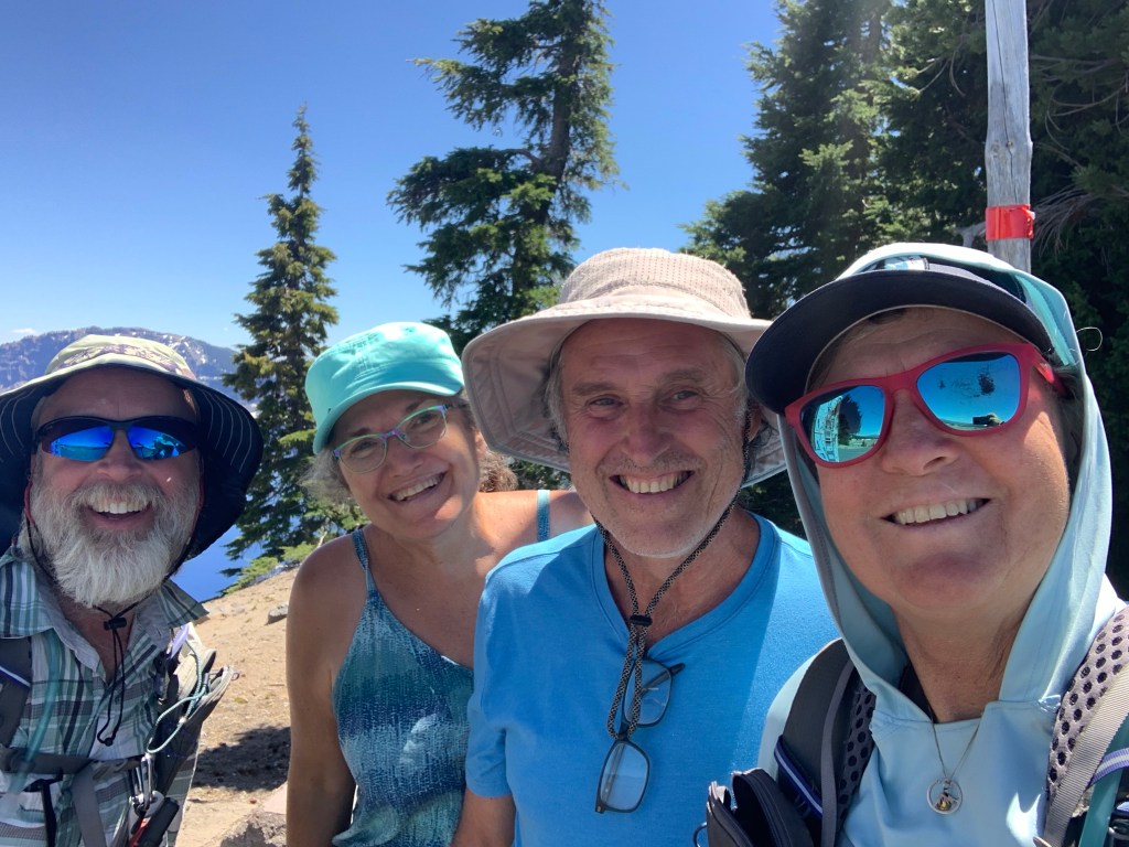
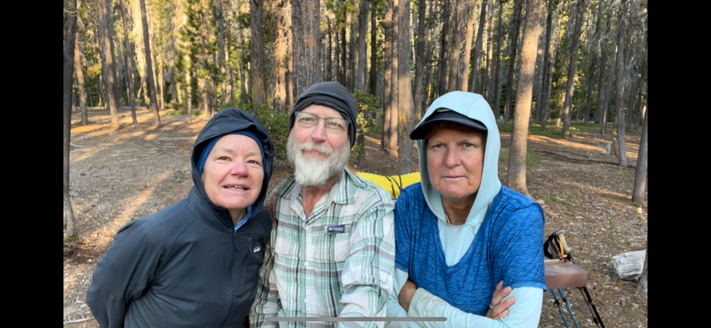
As we approached the last viewpoint of the lake we met a couple that was having lunch in their camper. Art and Melody were very interested in our hike as it is Art’s dream to also hike the PCT. We encouraged them and shared with them some of our experiences. They were really nice and even gave us two mangos to take on trail.
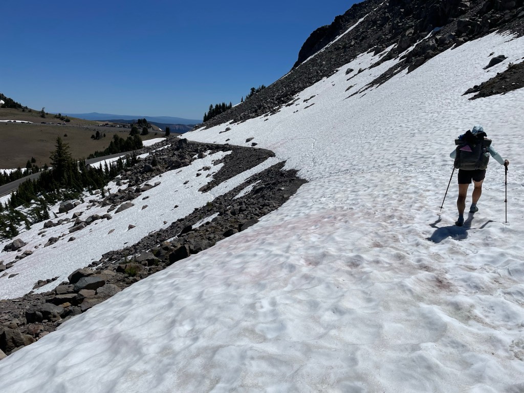
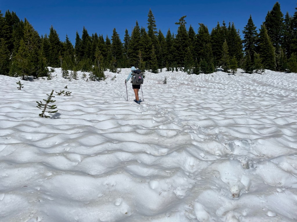
The last 3 miles of the trail were mainly snowfields. They were slippery and very slow going. We noticed on the map that the highway pretty much ran parallel to the rim trail and would interest the PCT in about 2.8 miles. Since we got such a late start we decided to walk the highway. We made great time and we were back on the PCT in just over an hour.
From this junction it was 8.8 miles to a dirt road just outside the park with a water cache. To our surprise, the PCT in southern Oregon is very dry. There are not many water sources. The trail was nice and open for the first mile and then the blowdowns started. The snow had disappeared for now and it wasn’t too bad.
Once we got back into the thicker forest all bets were off. Our nemeses were back in full force. The blow downs continued for about a mile before the forest finally opened up and we got a breeze. The breeze helped blow the mosquitoes away. At this point it was 4:30 pm. We decided to take a “pack off break” when we noticed another hiker was sitting about 50 feet down the trail.
Christina (trail name Freulien) was a German hiker about our age. She had walked the trail from Mazama village and was ready to set up camp. We talked with her a little bit. For us it was a little too early to call it a day. Freulien decided to continue on and hike with us.
We got back into the thick forest with snow and the mosquitoes were now out in full force. There were relentless. Ellen put in her rain pants to keep the mosquitoes from eating her legs. This made for a very hot and sweaty hike for the next hour.
We finally found a spot with a little breeze and more open forest where the mosquitoes were not too bad. They were there but tolerable.
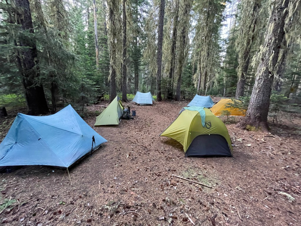
We all set up camp and had dinner together. After dinner it was time to get some peace from our tiny buzzing friends. As usual, Ellen did todays journal entry while Jeff edited video clips.
Day 109 -Mt. Thielsen and more snow
Start: northern border of CLNP – 1845.7
End: Maida Lake – 1867.0
Miles: 21.3
Ascent: 2581 ft | Descent: 2477 ft
Start time: 6:06 am
End time: 6:20 pm
Current elevation at Maidu Lake: 5984 ft
Total miles today: 21.3 + 0.8 = 22.1 miles
We got up a half hour earlier than usual so we could get some miles in before the onslaught of mosquitoes. Sure enough, an hour later they came out. Not bad at first but as the day wore on they got worse.
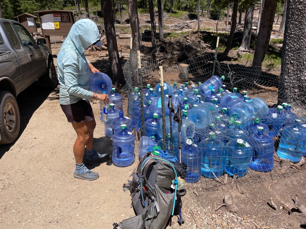
After 3.4 miles we made it to the northern border of Crater Lake NP. About 1/4 mile later at the dirt road was a water cache. We filled up with 2 liters since we knew there was Thielsen Creek in 8 miles.
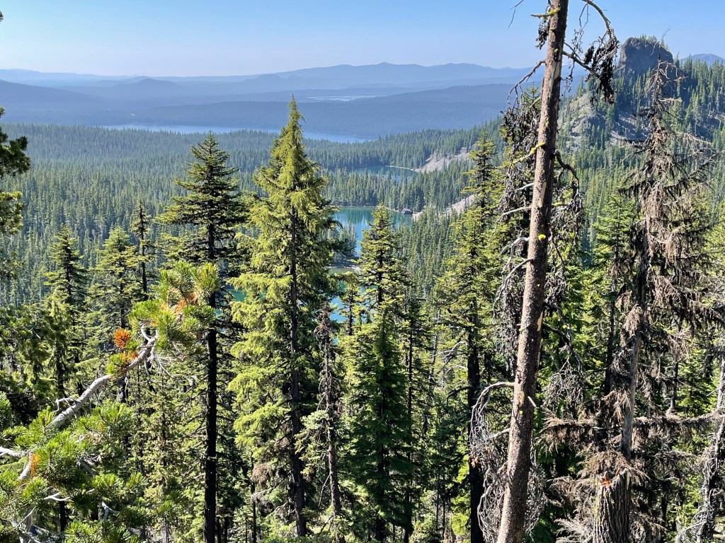
Now it was time to slowly go up the slopes of Mt. Thielsen. It was a nice gradual grade with a few blowdowns. We made great time. Along the way we finally got some views of the valley below that contained Diamond Lake and Diamond Mt.
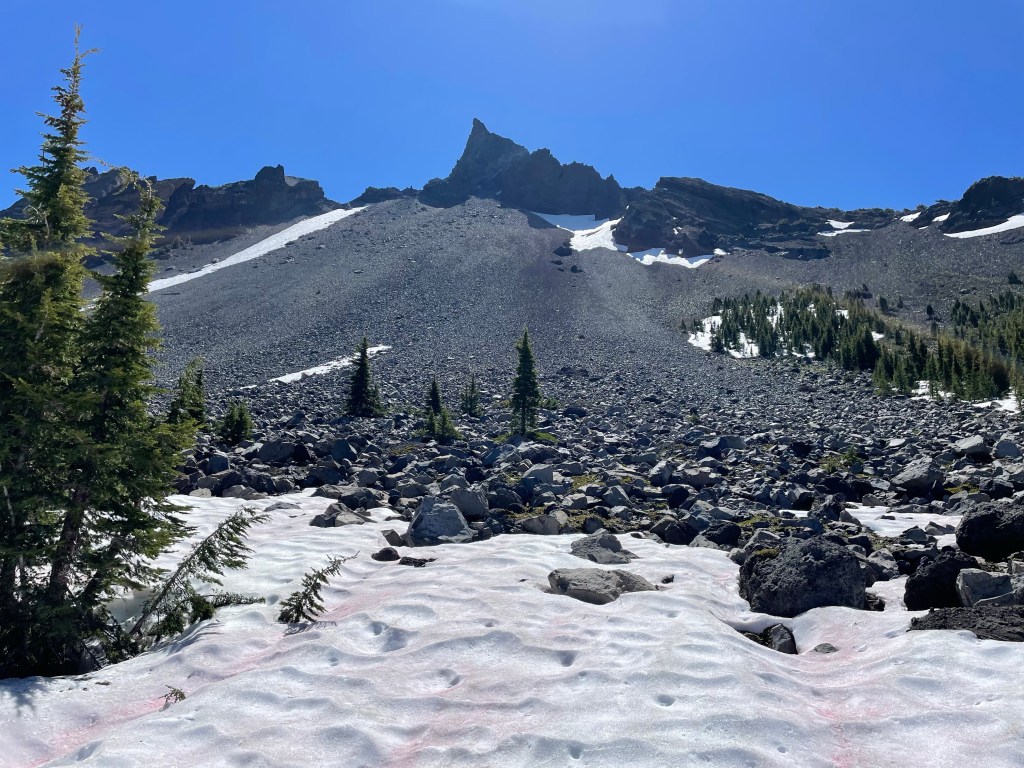
The higher we got the more snow appeared. There were a couple of snow covered scree slopes that had some exposure, but we took our time and made it safely across. We did have our whippet picks attached to our poles.
We got to the trail junction with trail that leads to the summit of Mt. Thielsen before 10 am and we did 10 miles. That’s a goal of every PCT hiker is to the 10 before 10. We had a snack in the nice breeze with Freulien, Sagebrush, and ET. We saw a lot of day hikers and some trail runners coming down from Mt. Thielsen.
It was time to see what was on the north side of Mt. Thielsen. It actually was not bad at all. However, we did put on our microspikes just to have some traction on the sloppy snow. After a couple hours we made it to Thielsen creek. Most of it was frozen over but there was one hole where we could some water.
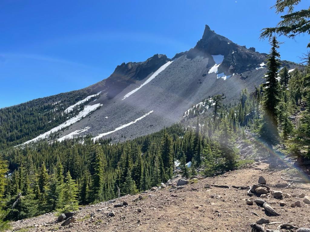
As we were hiking down we looked back and saw some great views of the mountain and the snow covered slopes. It was very pretty.
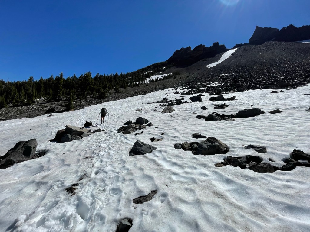
We made good progress coming down the mountain. But then it was time for one more climb and get to the highest point on the PCT for both Oregon and Washington. The climb up was a very slow slog through the woods on slushy snow. The hard part was trying to find the trail. We finally made it to the top of the climb but we missed the sign for the highest point.
The decent was a lot easier as the trail was next to open snow fields. We followed the snowfields and made great time. We still had 6.2 miles to go to the junction with the trail to Maidu Lake. There was 3.7 miles of snow to go through before we got on snow free trail.
And guess what? The mosquitoes decided it was now time to really torture hikers. It was late in the afternoon and now they were out. We could not even out hike them. Finally, we made it to the junction to Maidu Lake. It was now 0.8 miles down. The mosquitoes were now actually worse on this trail.
We got to the lake and found 4 other PCT hikers. All of who we’ve seen along the trail these past few months. One hiker we actually met when we were doing our 500 mile dance. The others we had met in Wrightwood. They all flipped north to Cascade Locks and were hiking southbound.

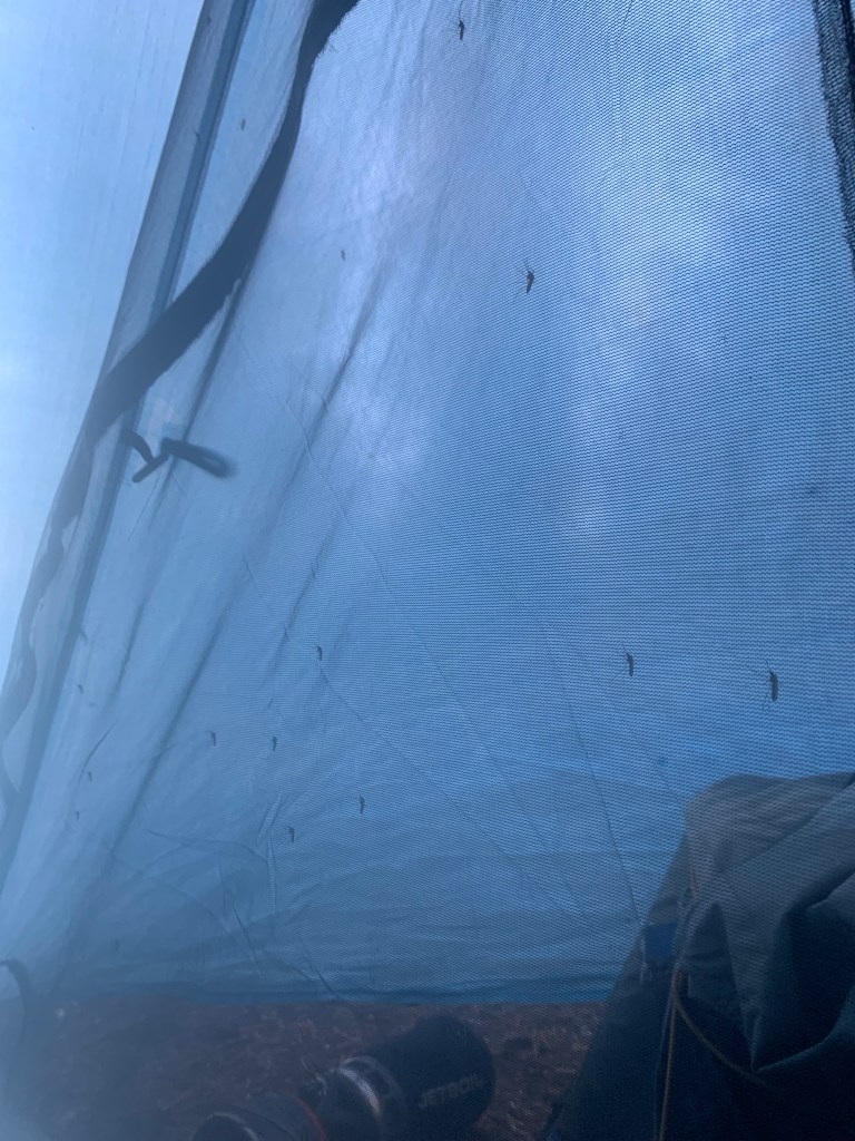
We set up camp and had dinner as quick as we could so we could get into our tent and be free from the mosquitoes. The mesh on our tent was covered a bunch of mosquitoes. We tried taking a picture but you could not see them all. The picture below is an example. There are about a dozen mosquitoes on the mesh.
So today we had two milestones: we made it to the highest point on the PCT for both Oregon and Washington, and we did our highest miles to date – 22.1.
Day 110 – Bigger Miles!
Start: Maida Lake – 1867.0
End: whitefish horse camp – 1889.3
Miles: 22.3
Start time: 6:39 am
End time: 5:20 pm
Current elevation:4887 ft
Total miles: 0.8 to PCT + 13.3 PCT + 10.5 PCT alt = 24.6 miles
At Maidu lake there were 7 hikers and a couple of them were gone by 5 am going SOBO. We left at 6:39 am, a little later than the rest of the group. First order of business was to get back to the PCT. At the junction we saw the tents of Sagebrush and ET and relayed the message about the PCT alternate.
It was 13.3 miles to the road at Windago Pass. There was a water source at 6.2 miles from Maidu Lake. It did not take us very long to get there as the trail was easy, no snow, a few blowdowns and the mosquitos weren’t that bad, yet.
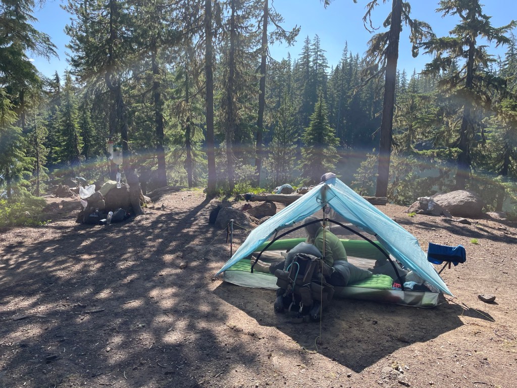
We got to Horseshoe springs, the water source, and Jeff chose to go down to the spring. A 7 minute steep climb down. Several other hikers were already by here and some had set up their tents to wait for their hiking partners and to get away from the mosquitoes. Ellen did the same and the sanctuary of the tent was nice.
While Jeff was getting water, Ellen was talking to the hikers about the PCT alternate. This alternate was suggested by a couple of SOBO hikers yesterday. This would bypass a long stretch of snow and rumored sketchy snow traverses along Diamond Peak. Everyone we’d talked to stated they were probably going to take the alternate. The four young hikers (in their 20s) who went SOBO last said they did the alternate.
It was another 6.1 miles to Windago Pass and again the terrain was good and the mosquitos had almost disappeared. Once at the pass which was actually a dirt road, we noticed a large water cache. We filled up our water bottles even though there was lots of water ahead. Now it was a 0.5 road walk to the trail that would lead us to Crescent Lake.
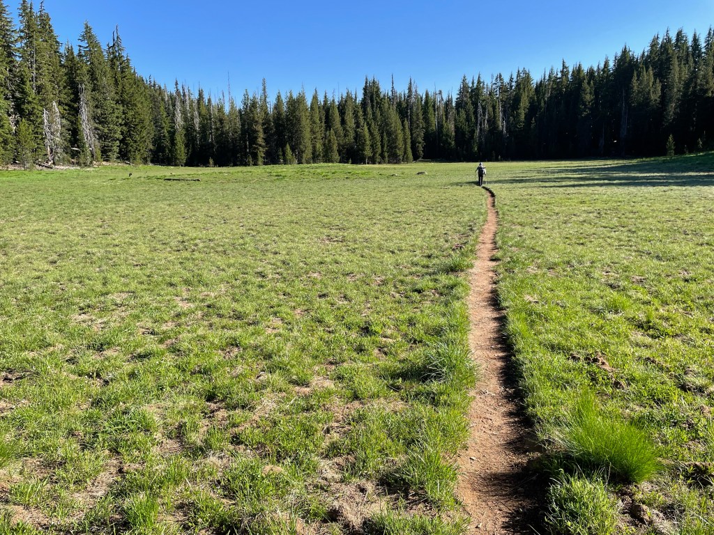
The trail was in an old burn area. It was now 1 pm and we still had 10 miles to go. The sun was hot and we did not have a lot of shade. We passed several lakes along the way but since we had enough water we didn’t stop. The trail was up and down for the first few miles and then it straightened out and became mostly flat.
It was a long hot afternoon, but we finally made it to Whitefish Horse Campground. It had a picnic table, pit toilet, and potable water. What a treat. We are now only 10 miles from Shelter Cove and will spent 4th of July at the lake. Rumor has it the the resort was doing a charity fundraiser BBQ, can’t wait!
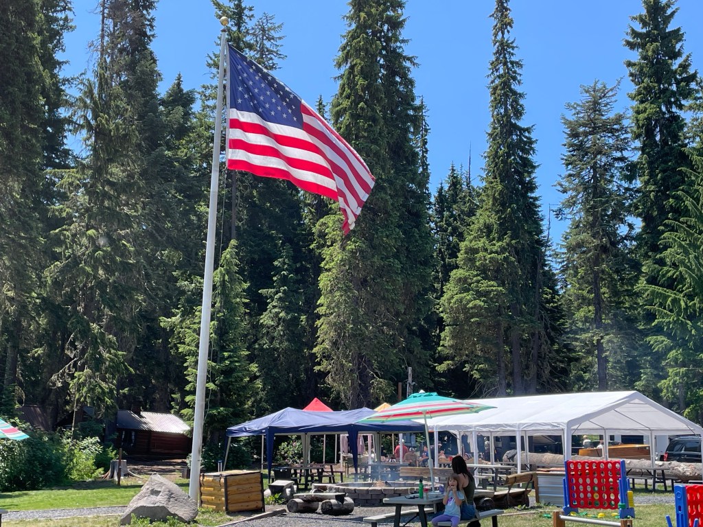
Day 111 – Fourth of July
Start: whitefish horse camp – 1889.3
End: Shelter Cove – 1907.6
Miles: 18.3
Start time: 7:03 am
End time: 10:45 am
Current elevation: 4849’ at Shelter Cove
Miles hiked: 10.2 on alternate
We pretty much ran to Shelter Cove today. We got going just after 7 am and did the first 4.2 miles in 1 hour and 45 minutes. That’s pretty fast for us. Plus this part was uphill with a nice slow grade.
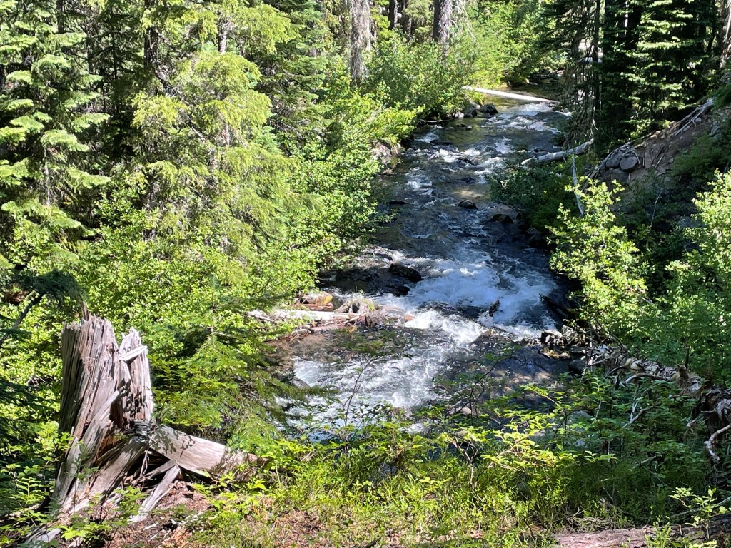
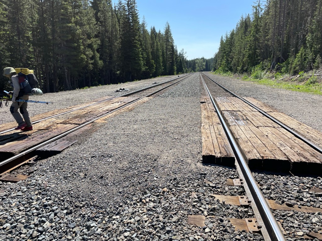
We tried to have a quick break, but the mosquitoes were back with a vengeance. That’s probably one of the reasons we hiked so fast. The last section was beautiful. The trail ran parallel to a fast flowing creek. It wasn’t long before we got to the railroad tracks outside of Shelter Cove. We averaged 2.7 mph – that is pretty fast.
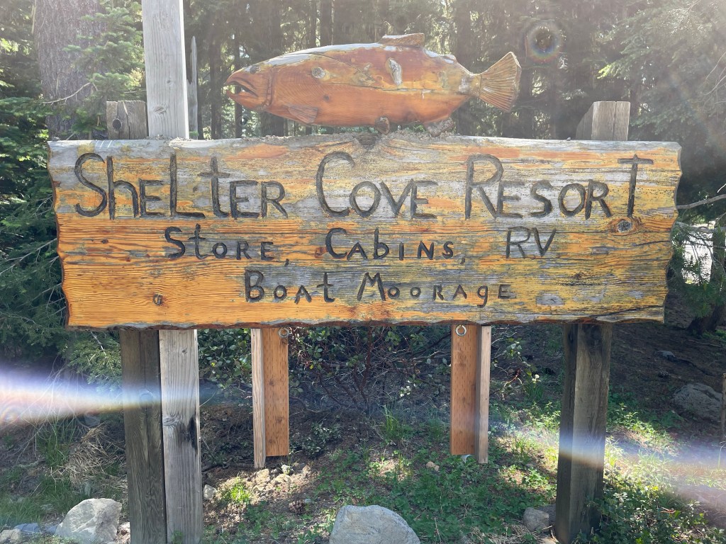
Once at Shelter Cove we found out that there was going to be a cookout and everyone was invited. But that wasn’t until 1 pm and we were hungry now. We ordered a large pizza to split between the three of us. We then inventoried our food situation for the next section. Next was to go to the PCT camping area and set up our camp.

Freulien, Sagebrush and ET all had resupply boxes sent to Shelter Cove and realized that they had way too much food. They offered us some of their leftovers which we gladly took. No need to purchase food here as the food options were very minimal.
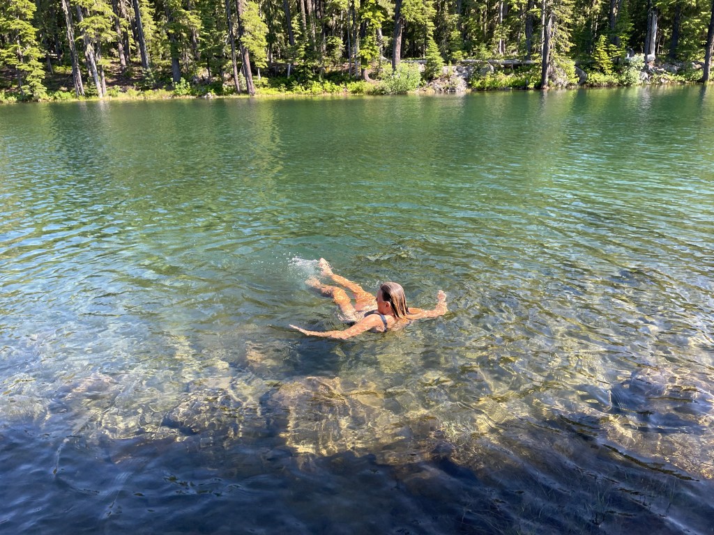
The rest of the day we spent relaxing by the hiker tent hangout, chatting with other hikers and swimming in Odell Lake. That was really refreshing. It was an really chill day that felt like a true zero with nothing to do.
As we were getting ready to head back to our campsite, a gentleman from a family group came over and asked if we were still hungry. They had cooked way too much food and did not want to throw it away. He went and found most of the hikers still near the store. We had fruit salad, shishcabob, and fish caught in the lake called Kokanee, it is a land locked salmon. The family was very interested in what all of us where doing and wanted to hear about our experiences. What a way to end a great day, especially since it was the 4th of July.

Day 112 – Beautiful lake
Start: Shelter Cove – 1907.6
End: Charlton Lake – 1926.1
Miles: 18.5
Ascent: 2972 ft| Descent: 2163 ft
Start time: 6:29 am
End time: 3:32 pm
Current elevation: 5554 ft
Total PCT miles: 1188.7
Total miles today: 1.5 to PCT + 18.5 PCT + 0.5 Bobby lake = 20.5 miles
When we got up at 5 am and looked out our tent we saw a sea of other tents. Many hikers had shown up at Shelter Cove during the day and early evening. All of them needing a spot to pitch their tents. Any flat spot was taken by a tent and it was a maze trying to get out of the camping area.
We threw our stuff in our backpacks while trying to be as quiet as possible. We ate breakfast and properly packed our backpacks. We were back on the road/trail by 6:30 am.
First we had to hike 1.5 miles from Shelter Cove to the PCT. The trail today was easy. We had a couple of climbs but the grades here in Oregon are not too steep.

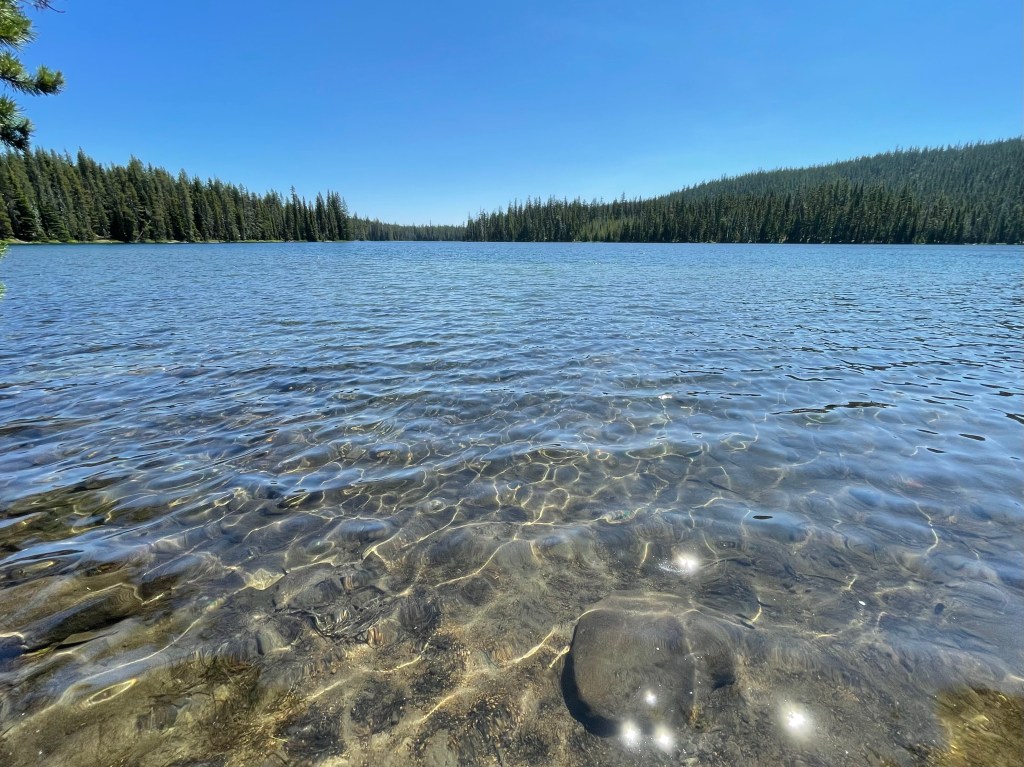
Our first water source was only 3.7 miles away so we only carried 1 liter. We made quick time of that 3.7 miles as we made it to Lower Rosary Lake before 8 am. This chain of lakes were beautiful. Lower, middle and north Rosary Lakes all sit below an old volcano core.
Then it was a small climb to get on top of the ridge. From there we saw all the lakes we had last the last couple of days: Crescent Lake, Odell Lake, and the three Rosary Lakes. It was a nice view and for the most part was our only view of the day.
It was 7 miles to Bobby Lake for our next water. And yes, the mosquitoes were back. Most of the 7 miles was in the green tunnel. Not our favorite type of hiking. Bobby lake was really nice. The lake reminded us of the lakes we paddled in the Boundary Waters Canoe Area or Quetico Provincial park.
By the time we got to Bobby Lake we had done 12.5 miles and it was lunch time. Lucky for us there was a little breeze to keep the mosquitoes at bay.
Our next target was Charlton Lake, 7.5 miles down the trail. The trail continued to be great. The trail was soft and the blowdowns were minimal. As we climbed higher, yes there was another climb involved, the snow made a reappearance. The snow was very patchy and reminded us the more snow is down the trail that we’ll see in a few days.
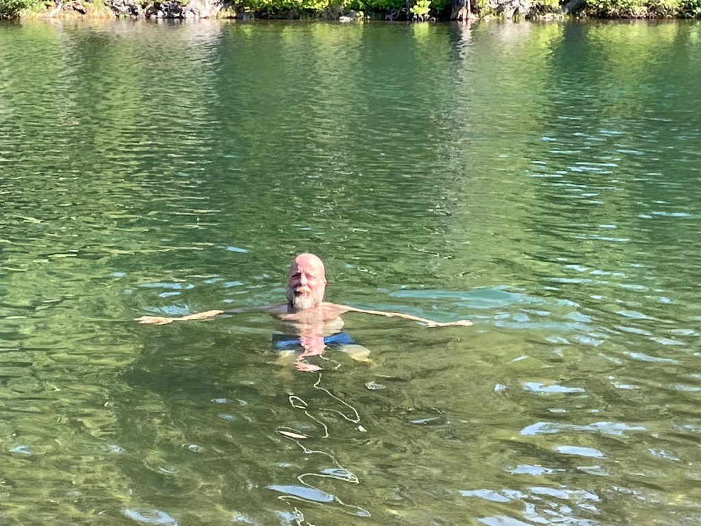
We made it to Charlton Lake around 3:30 pm. That’s actually early for us but we did 18.5 PCT miles and our feet were tired. It was time for a swim. Ellen was in the water as soon as we got there. It was immediately determined that this was home for the night. There was a nice breeze that kept the mosquitoes at bay by the water. However, near the woods they were thick!
Another hiker, Ludricis, also showed up and went for a swim. She was going to go further but two fishermen came by and reminded us of the burn area we were going to see tomorrow. Ludricis decided to stay and camp with us.
Jeff decided they he wanted to have a fire and went in search of some dead wood. We made dinner at the peninsula where the wind was the strongest. Then we had a nice fire.

Several hikers came down the trail looking for a camping spot. We told them they could stay here or one of the many other sites along the lakeshore.
The mosquitoes were actually crazy thick by our tent. When we each got in we brought a dozen with us inside our tent. One thing we’ve learned is that mosquitoes will fly towards the corners of the tent trying to get out. This makes for easy elimination of them buggers!
Day 113 – More swimming
Start: Charlton Lake – 1926.1
End: Dumbbell Lake – 1948.2
Miles: 22.1
Ascent: 2087 ft | Descent: 2265 ft
Start time: 6:09 am
End time: 4:15 pm
Current elevation: 5510 ft
Total PCT miles: 1210.8
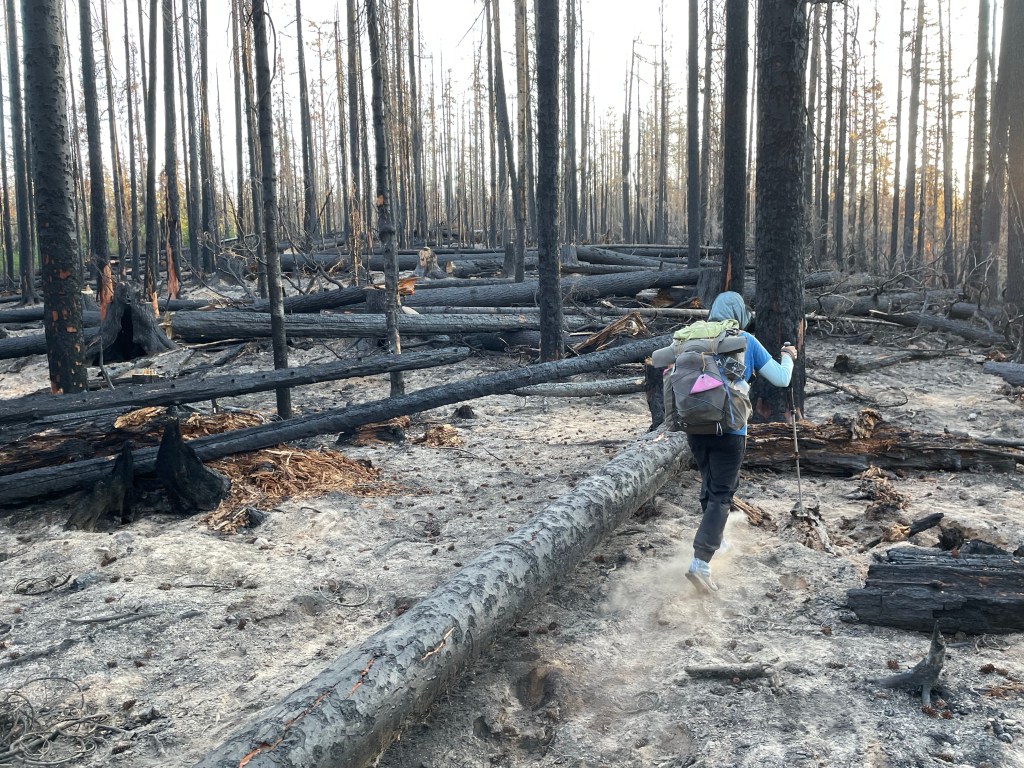
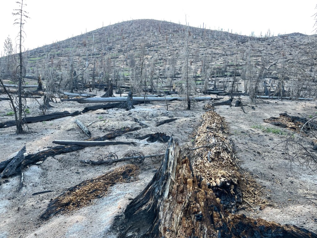
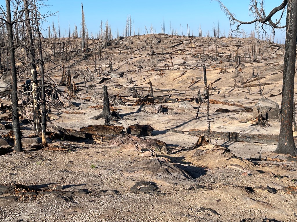
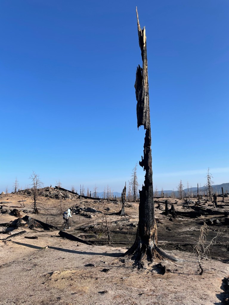
We woke up early to try to have a reprieve from the mosquitoes in the morning. No such luck. The minute we got out of our tent they were swarming. We packed up quickly and ate breakfast on the way. After about 15 minutes we were in the burn zone from last years Cedar Creek fire.
The good thing about a burn zone was that the mosquitoes were gone. We had 2 1/2 hours of no mosquitoes. The sad thing was that the Cedar Creek fire was devastating. Some areas burned so hot that nothing was left standing and the ground was scorched.
After the burn zone we were back in the woods and yes, the mosquitoes were back. We’ve never worn our bug head net for this long of a duration. Basically all day. We were back in the green tunnel with ponds and lakes every couple of miles.
When it was time for lunch we found a somewhat flat spot and pitched our tent. When we set up the tent we found hundreds of mosquito carcasses. Pretty gross! We had a nice quiet lunch. We had done 12 miles already, but still had 10 more to go. We cleaned up the tent from the dead bugs and went on our way.
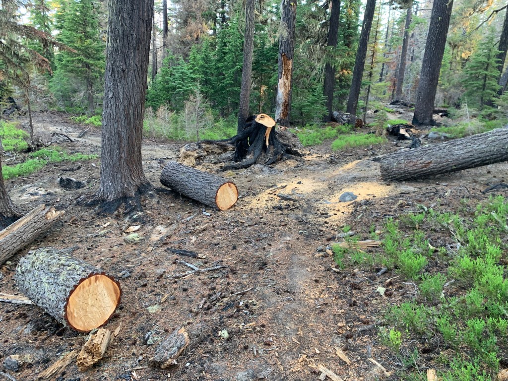
The trail all day was easy peazy. Smooth and soft with a few blowdowns. A trail crew had come through and cleaned a section of trail. Thank you!Before we knew it we finished our last 10 miles and made it to Dumbbell Lake.
After setting up our tent it was time for a swim. David (the German hiker from yesterday) and Ludicris got to the lake an hour earlier. The campsite was on a peninsula with a good swimming spot. The water was almost warm. We actually stayed in the water longer than 10 seconds.
After dinner we got into our tent to get away from you know who. It was hot in the tent as the sun was shining right on it and it was still early. We hope that the breeze continues all night long.
Day 114 – Bend, OR
Start: Dumbbell Lake – 1948.2
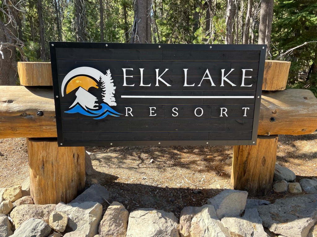
End: Elk Lake resort TH – 1953.6
Miles: 5.4
Ascent: 353 ft | Descent: 587 ft
Start time: 7:06 am
End time: 9: 35 am
Current elevation: 3736 ft in Bend, OR
Total PCT miles: 1216.2
Plus 1.5 miles to resort
We slept in until 6 am! The mosquitoes were back but not as bad. We packed up and had breakfast in the tent. We got on trail just after 7 am with only 5.7 PCT miles to go.
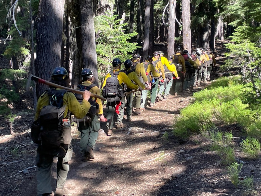
The trail continued to be in the forest. We saw a little more snow which brought out more of our little friends. As we got closer to the junction we saw a large group of forest fire fighters (hotshots) coming up the trail. They mentioned that there was a very small fire about four miles up the trail. We weren’t exactly where but they didn’t seem too worried. They were impressive with all the gear they had with them.
Before we knew it, we were at the junction to Elk Lake resort and a half hour later we were at the resort. We found a covered picnic table and put our stuff down.
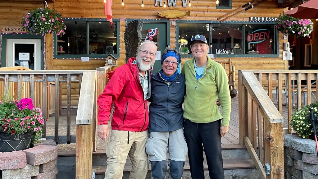
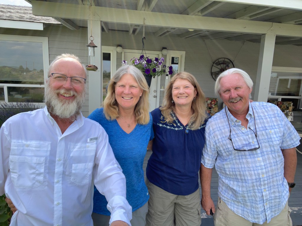
Our friends of friends, Ron and Karen, arrived an hour later. We sat and chatted for a while and then left for their house outside of Bend, OR.
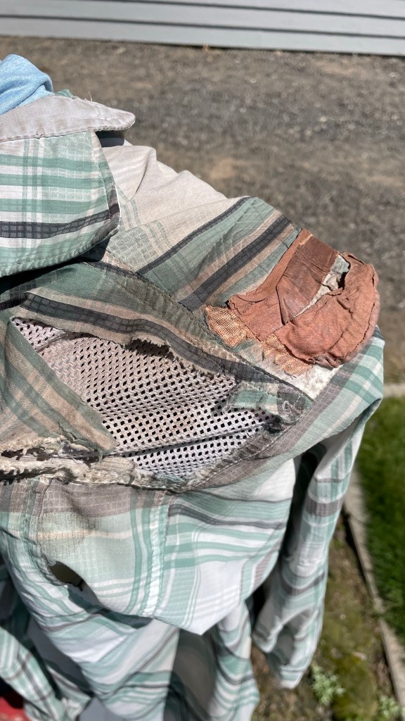
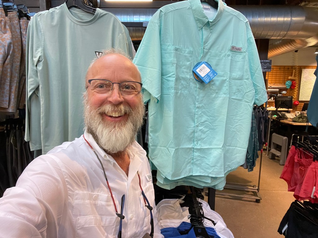
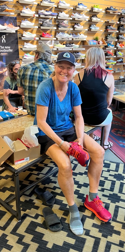
Once at their house we showered, borrowed some clothes so we could do laundry and had lunch. After lunch we drove back to Bend for some gear shopping. Of course a trip to REI. Jeff needed a new hiking shirt as his shirt had pretty much disintegrated. He also needed some insoles. Ellen needed new trail runners. We also went to the Columbia outlet store where Ellen found some zip-off pants to keep those mosquitoes off her legs.
Then back to the house where Karen made a great dinner. Ellen sprayed all of her clothes and her shoes with permethrin. The rest of the evening was spent sharing stores and getting to know each other.

Day 115 – “Zero” day in Bend at Ron and Karen’s house
Start: Elk Lake resort TH – 1953.6
End: Elk Lake resort th – 1953.6
Miles: 0.0
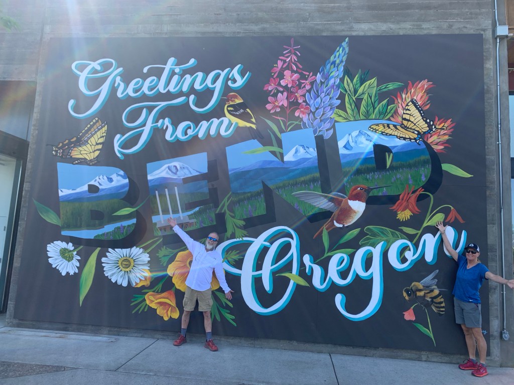
Today was all about resupplying for the remainder Oregon. We went to the Old Mill district as had to take an “Instagram” picture.
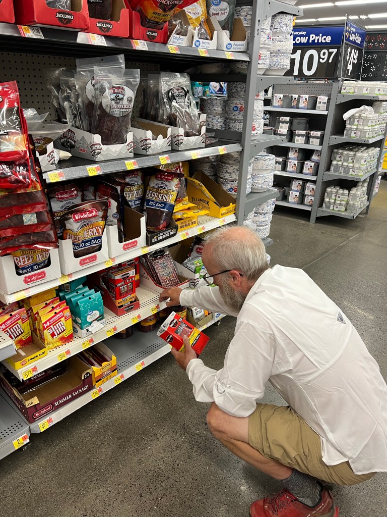
We got to Walmart before 8:30 am and got enough food for the next two weeks. Then another trip back to REI for more permethrin. Also, a trip to Whole Foods to find some protein powder that does not contain or need milk.
Once back at the house we spent two hours putting together our resupply boxes to send to Big Lake Youth Camp, Timberline Lodge and Cascade Locks. We also send a box home of stuff we didn’t need anymore. Ron went to the post office to mail our boxes.
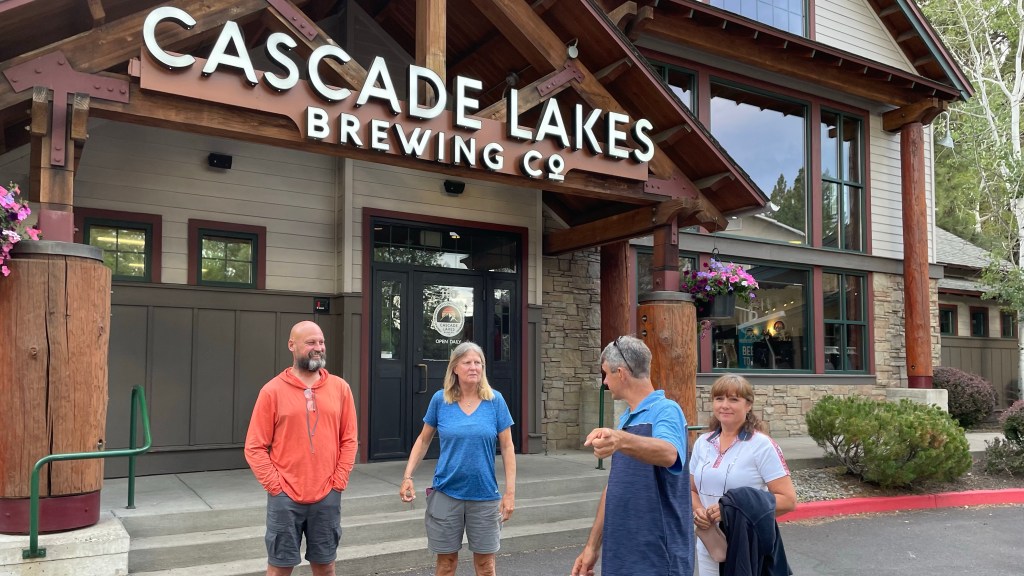
Then it was relaxation time. We all took a nap. We had heard that Tickman was in Bend for three zeros because his wife Katya flew in from Florida. Plus, All In had made it to Bend by doing some big miles. We all decided to go out to dinner.
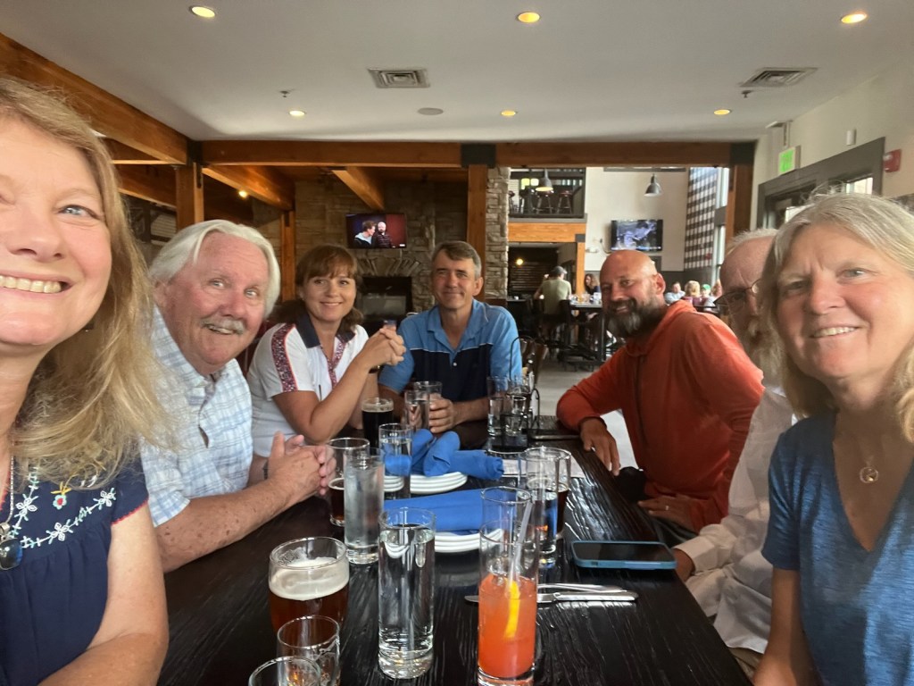
We had a great time at dinner getting to know everyone a little better. After dinner we went home and packed our gear. It was a great couple of days with Ron and Karen. They were most gracious hosts. Tomorrow back on trail for the last 200 miles of Oregon!
Here’s the next video!
