Day 144 – Back on trail!
Start: Hwy3 /Scott summit – 1561.4
End: creek overlooking meadow – 1572.2
Miles: 10.8
Ascent: 2732 ft| Descent: 961 ft
Start time: 12:53 pm
End time: 6:01 pm
Current elevation: 7096 ft
Total PCT miles: 1571
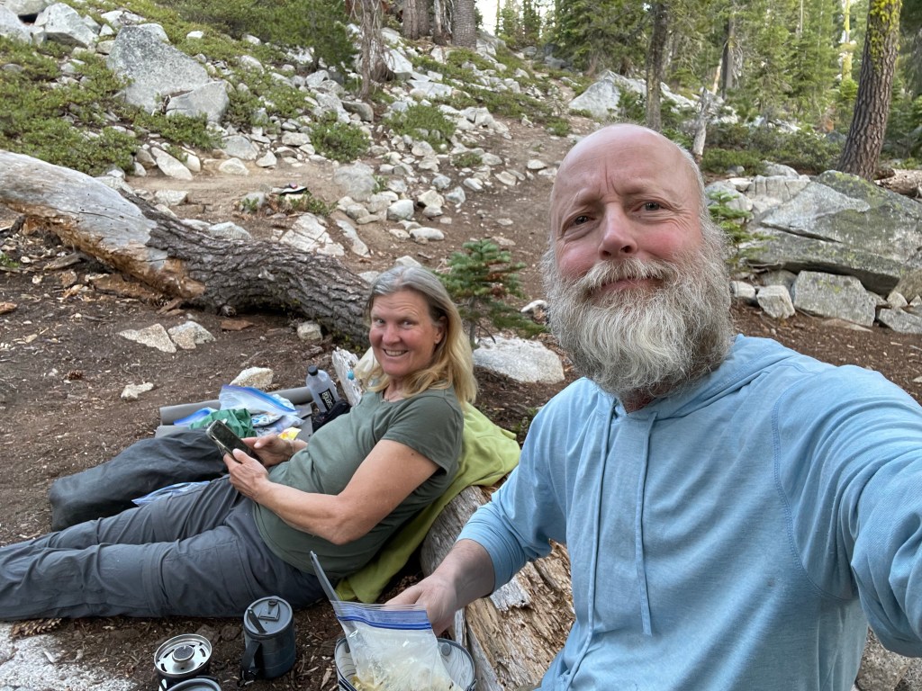
We had a wonderful time recuperating and visiting with our daughter in Salt Lake City for a week. Thanks Katie!
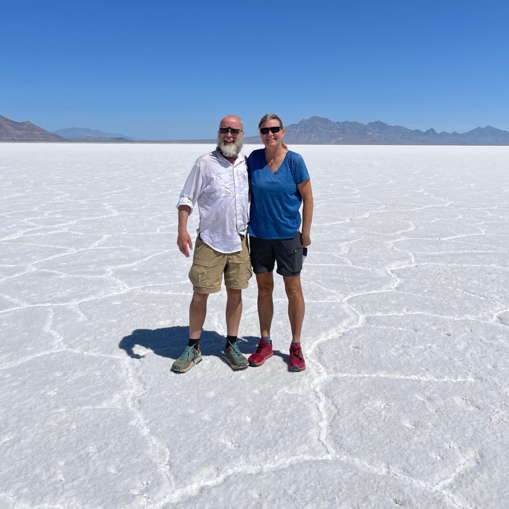
Driving back to the trail we stopped at the Bonneville Salt Flats. A highway rest stop provides easy access for people to walk right out onto this starting white landscape.

That evening we pulled over and camped near the Klamath River about 58 miles east of Medford Oregon. We woke and then got back on the road around 7:45 am. We stopped for some tea and coffee at a local store and then got going. After only about 6 miles we actually drove past Fish Lake and where the PCT crosses the highway. We were at that location back in late June.
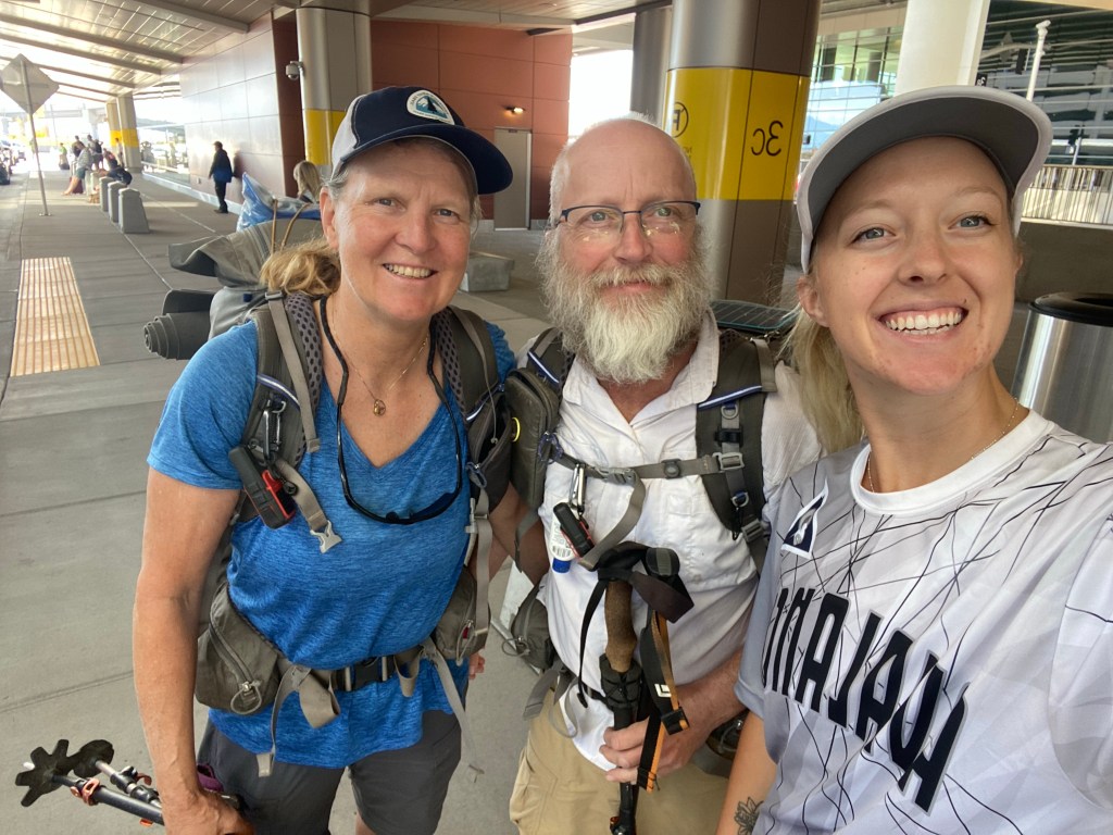
We realized pretty quick that we were going to be in Medford sooner than expected. So, we contacted our trail Angel Angela to see if she was available today and if she could take us all the way to Etna. She said yes! She would meet us at the Medford airport around 10 am.
Sure enough she showed up a few minutes before 10 am. We had great conversation on the hour or so drive to Etna. We could not hike this trail without the aid of kind people like Angela. We did compensate her for her time and gas.
We got to Etna just after 11 am. Angela’s car had a loose battery cable so we fixed that before saying goodbye. We organized our stuff a little better and filed our water bottles. Now it was time to find a ride to the trail head to finish the section from Etna to Seiad Valley that we skipped due to snow back in June.
We stood by the highway for about 20 minutes when Mark stopped and offered us a ride. He lives in Weaverville and Scott Summit was on his way. While talking to Mark we discovered that he had met our friend MileMarker (Dave) back in early June near Burney Falls. Mark had been camping with his son and some others from his school when he met a PCT hiker who was carrying snow shoes. Mark described the hiker and we immediately recognized the hiker as MileMarker. What a small world!
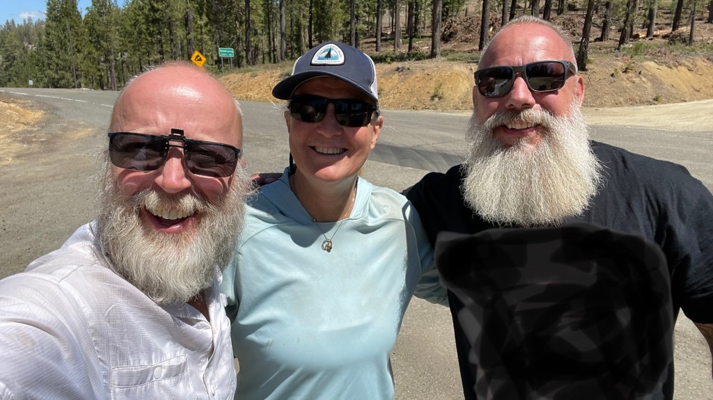
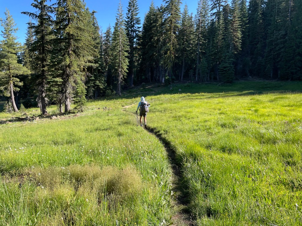
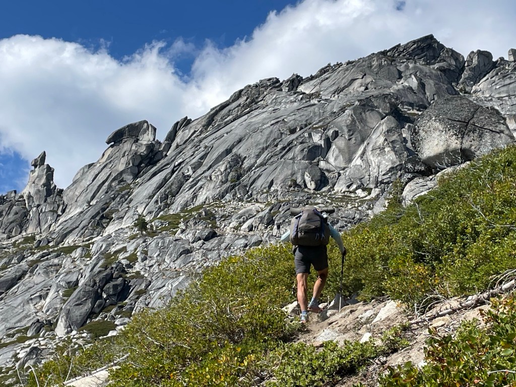
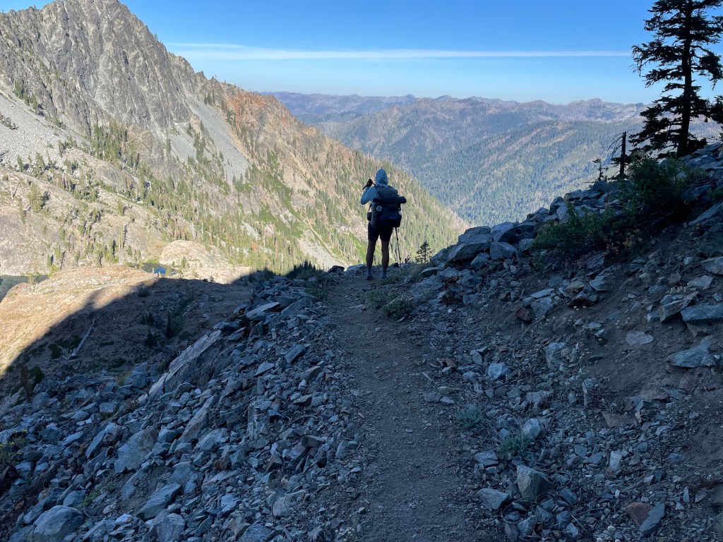
We got to the PCT trailhead at Scott Summit around 12:15 pm. We were hungry so we ate lunch right away. Finally at 12:53 pm it was time to go hiking. We both recognized the trail but it was just a little different. The vegetation had grown bigger and the snow was all gone.

After about 2 hours we got to the meadow where we had camped back in June. Then we passed the creek we had previously crossed on a log because the water was flowing really hard. This time it was just a rock hop across.
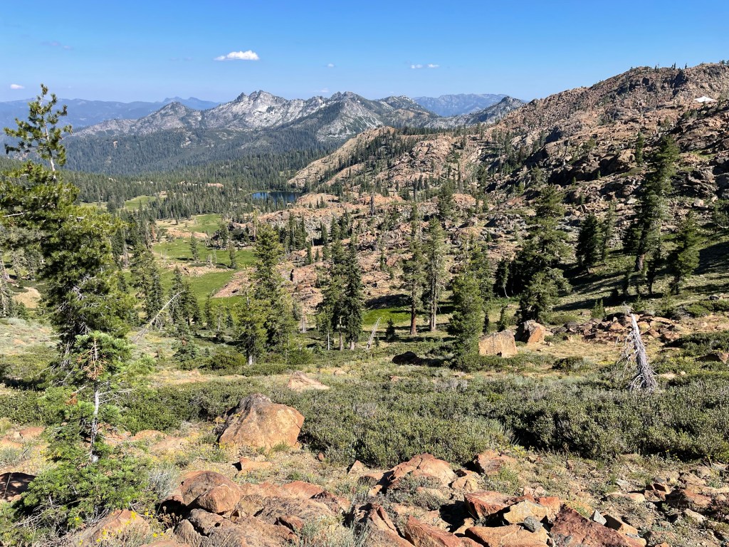
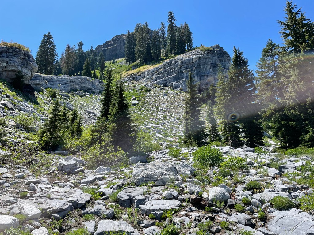
We had about 2.6 miles to the junction with East Boulder Lake. We looked across the valley to see beautiful green meadows and no snow anywhere in both the valley and on the mountain sides. What a difference! Just 7 weeks ago we were wearing crampons over the snow.
We hiked on and passed the spot where we turned around in June. Without the snow it did not look the same at all. It did not appear as steep and the trail seemed a lot wider. It was an easy walk to the top of the ridge.
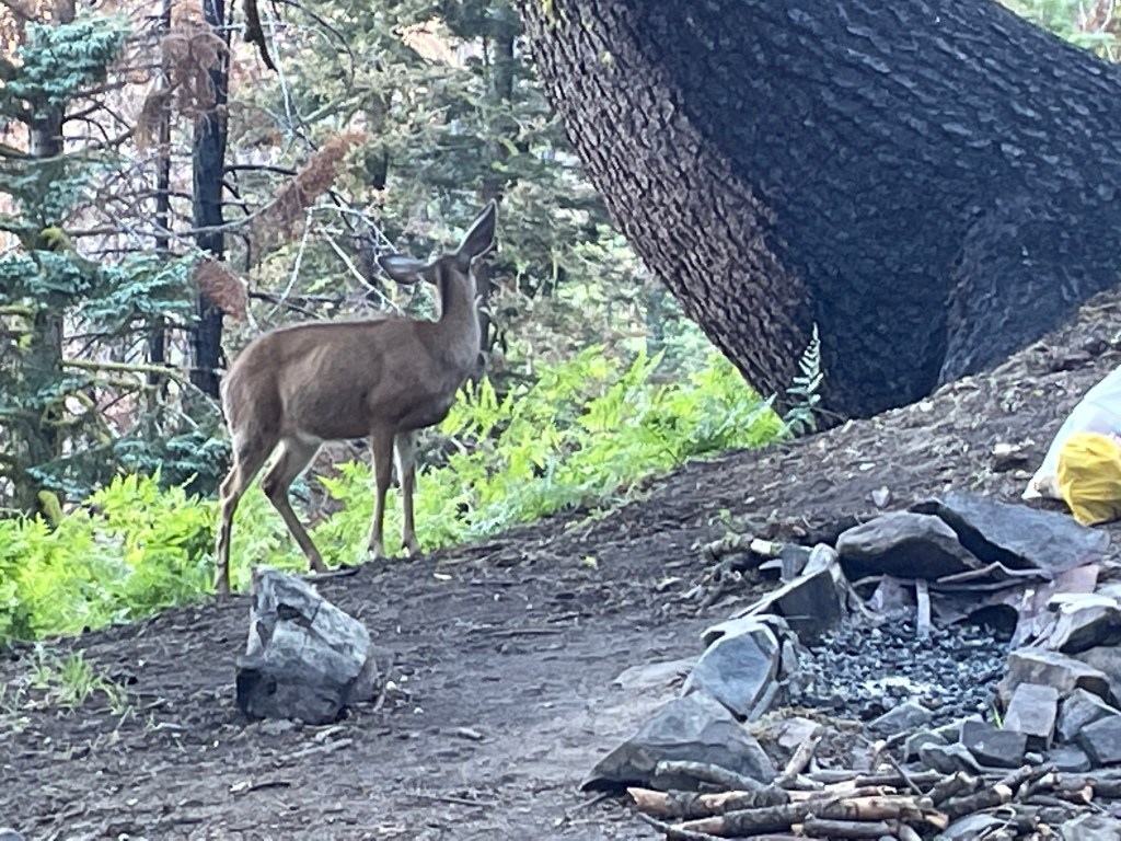
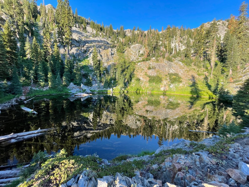
It was another 2.5 miles to the next water source and our intended campsite. We got there about 6 pm. It was a great site overlooking a valley. Hopefully we’ll see some wildlife in the morning. But we did have a deer visit us as we were prepping for dinner. The deer walked right into our campsite without a care in the world.
It felt great to be hiking again, but our 9 days off trail had some negative effect on our endurance.
Day 145 – more views
Start: creek overlooking meadow – 1572.2
End: Paynes Lake – 1595.1
Miles: 22.9
Ascent: 4190 ft| Descent: 4809 ft
Start time: 7:05 am
End time: 6:39 pm
Current elevation: 6474 ft
Total PCT miles: 1593.9
We got a later start then we were use to. Sunrise was later now at 6 am but it was beautiful and the deer also came and visit us during breakfast. There is just a hint of smoke in the air which is unfortunate but it does make for great sunrises and sunsets. We hit the trail an hour after waking up.
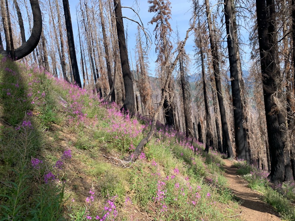
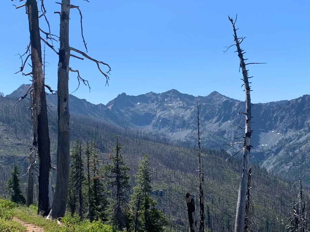
For the first few hours of the day we walked through a burn area but it was beautiful in its own way. We did a short climb and then it was mainly downhill until lunch time.
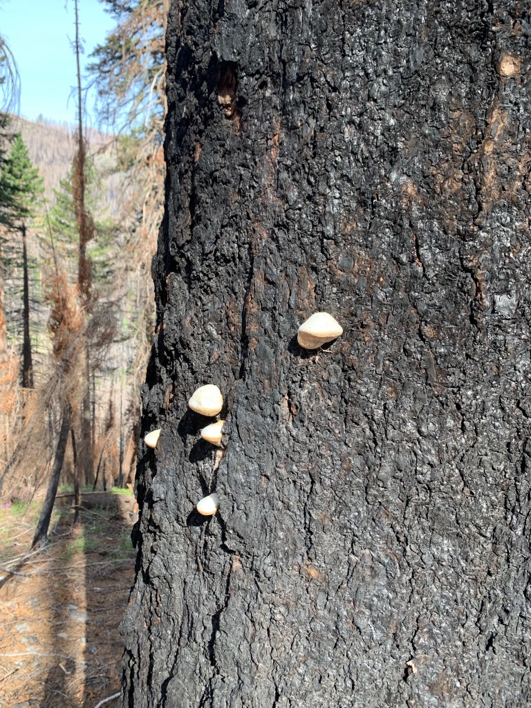
The contrast of colors was really noticeable when we got to a spring in the burn zone. The bright green of the grasses by the water and the black and gray of the burned trees. In other areas the the purple post-fire flowers contrasted beautifully.
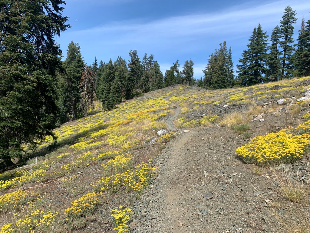
Then we started noticing small bright white mushrooms on the trunks of blackened trees. On one of our climbs the hill was covered in yellow flowers.
We made great time and at lunch time we were halfway done with the miles we had planned. We had hopes of getting to our site around 5 pm but that didn’t happen as the afternoon sun heated up and slowed us down. It did not help that the two big climbs that afternoon were on hot exposed traverses.
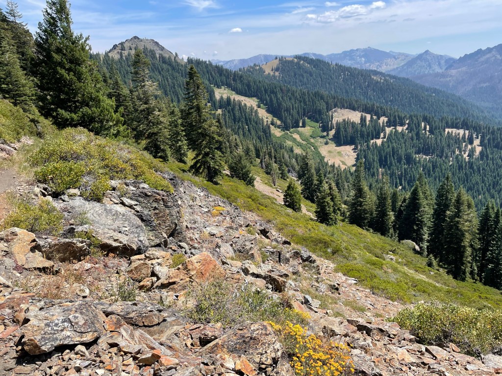
We left the Trinity Alps Wilderness right after lunch and entered the Russian Wilderness. The Russian Wilderness was beautiful. There were some great views.
We finally made it to Paynes Lake, our campsite for the night. We had been dreaming all day about going for a swim but the lake was mostly shallow and the bottom too soft. We did find a large rock to sit on shore and we were able to rinse off the grime.

It had been a long day and we finally got to bed at 8:45 pm just as it was getting dark.
Day 146 – Mountains!
Start: Paynes Lake – 1595.1
End: Fischer Lake – 1614.8
Miles: 19.7
Ascent: 3465 ft| Descent: 3793 ft
Start time: 7:06 am
End time: 6:05 pm
Current elevation: 6221 ft
Total PCT miles: 1613.4
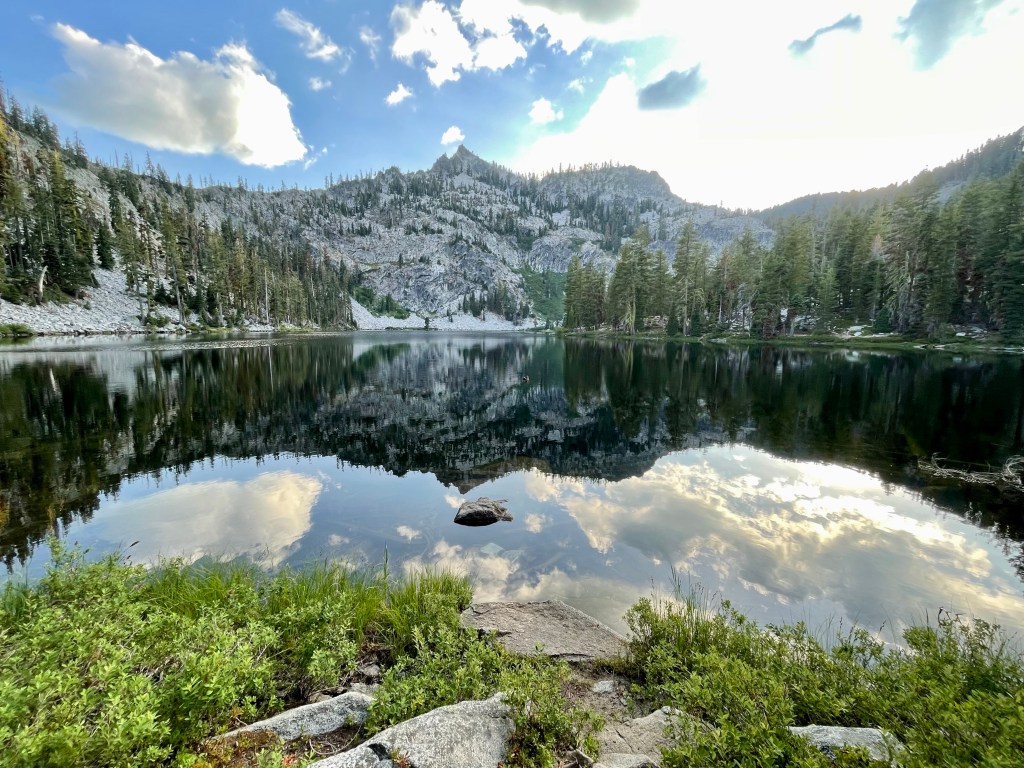
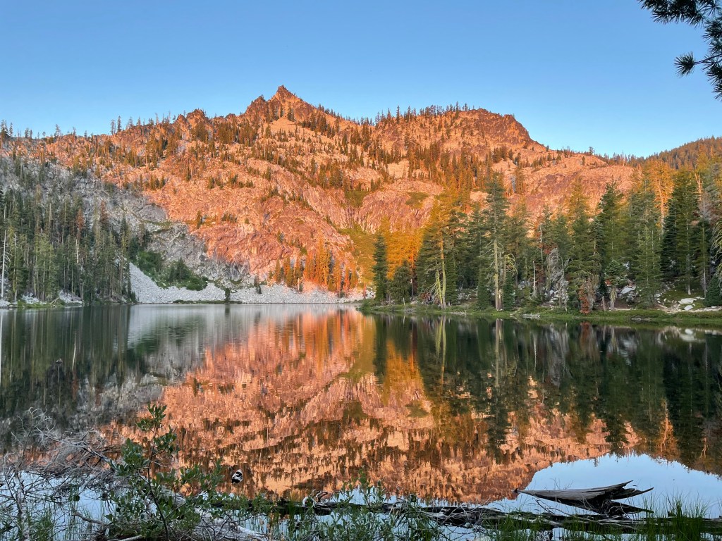
As we woke up the sun was just rising and lit up the mountain behind Paynes Lake. The water was still and the mountains reflection in the water was beautiful. In the middle of the night Ellen kept hearing chipmunks going through our gear. Ellen did find that a chipmunk chewed on her brand new bite valve on her hydration hose. She was not a happy camper!
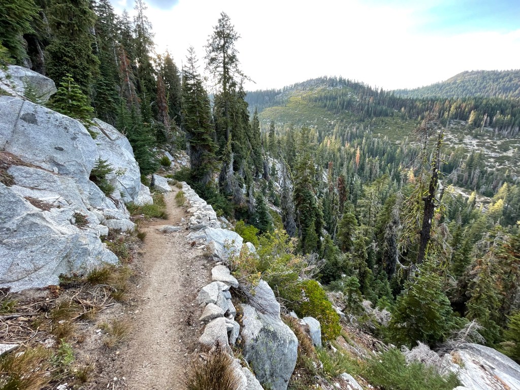
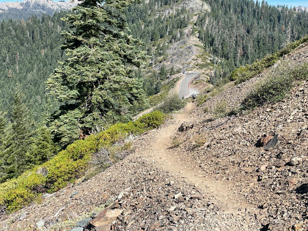
We got going a little after 7 am. Of course the first thing we had to do was go up. The climb was about 2.5 miles and was very pretty. We passed a lake that was below us called Smith Lake. Passing over the saddle on top of the climb it was time for a long downhill to the Etna Summit Road. The trail was steep and rocky but the views were great.


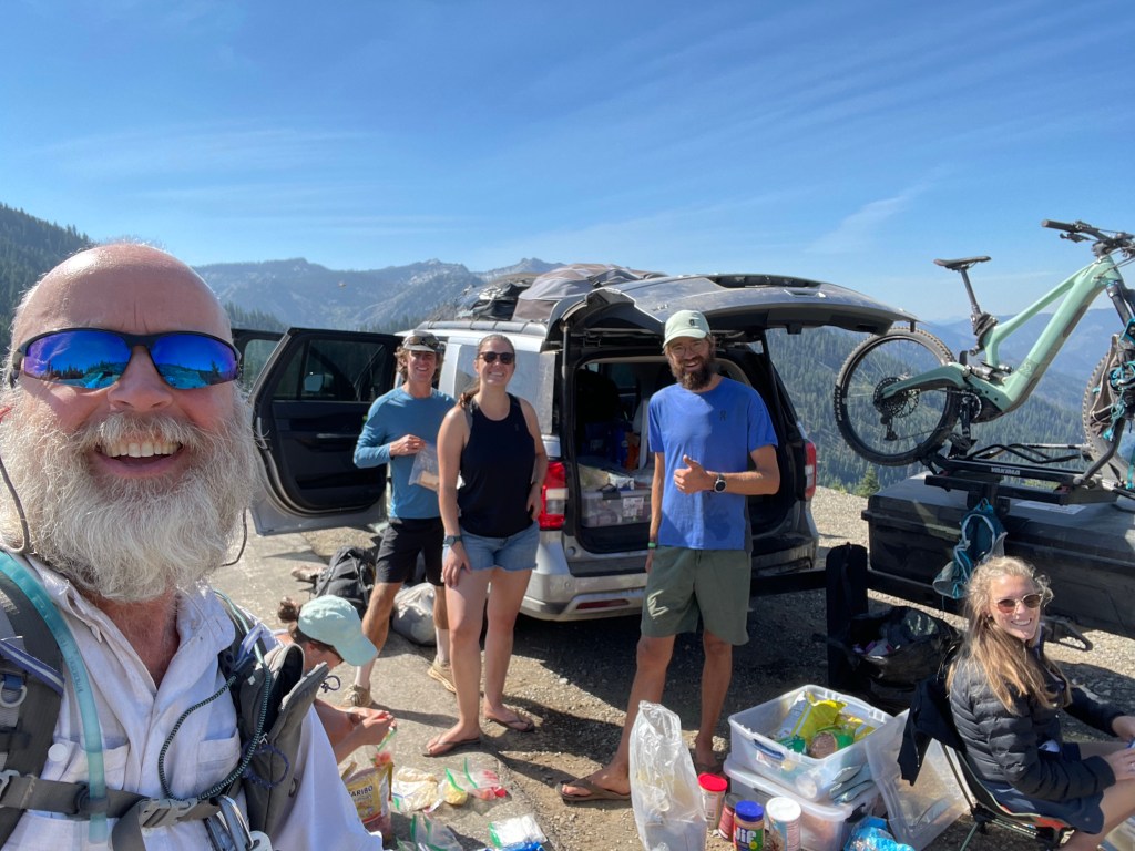
Once at the road we noticed a van parked and supplies strewn about. As we approached we learned that they were the support crew for an FKT trail runner trying to reclaim the record. A FKT is a “fastest known time.” The runner was Karel Sabbe from Belgium and he had previously run the PCT in only 53 days! He and his buddy runner later passed us a few miles down the trail. While we visited with his support crew, they were kind enough to give us some food and beverages!

Hiking back up the trail, we were now entering the Marble Mountain Wilderness. The trail was facing west and very exposed to the sun. The temperature also had increased and it was so hot. The sun heated up the rocks and the light colored rocks reflected back on us. The trail was also very rocky and rough with made for slower hiking. But the views were awesome! At some point Jeff had a misstep and found a sharp pain in his left knee.

After a long day we finally made it to Fisher Lake. Not the best swimming lake but it worked. Ellen sat on a rock rock and rinsed off while Jeff did go in and swam. It always felt great swimming or getting wet after a long day on the trail. It also made for better sleeping.


Day 147 – more rocky terrain with great vie
Start time: 6:53 am
End time 3:58 pm
Current elevation: 6132
Total PCT miles: 1628.7
Start: Fischer Lake – 1614.8
End: Paradise Lake – 1630.1
Miles: 15.3
Ascent: 3247 ft| Descent: 3297 ft
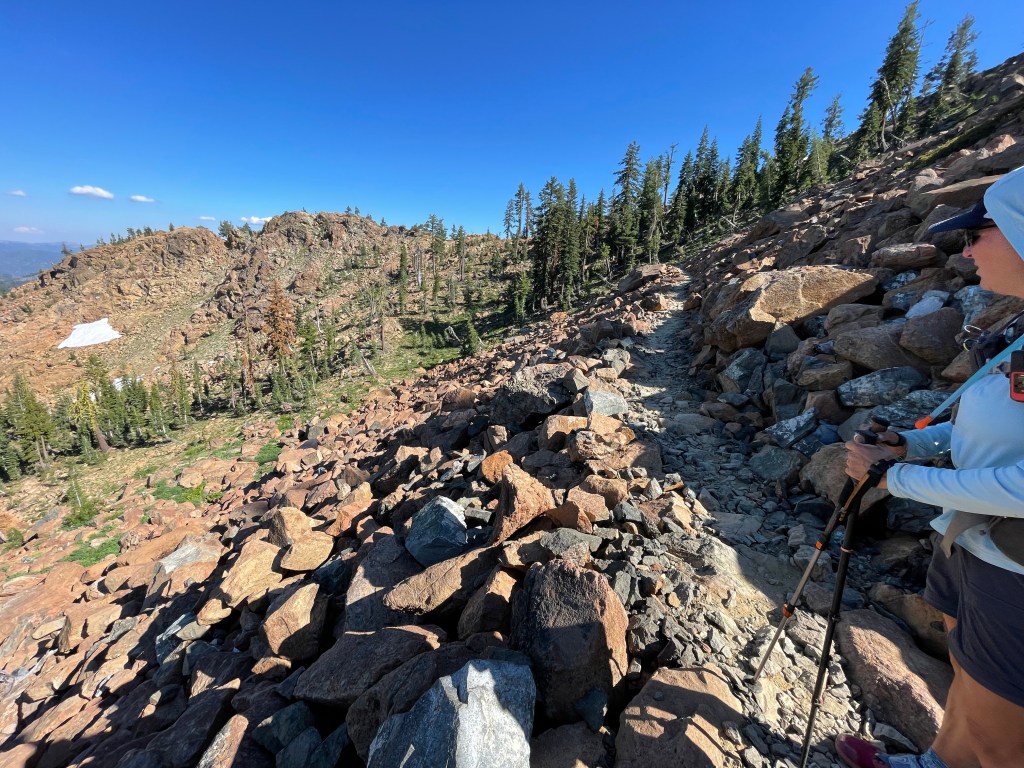
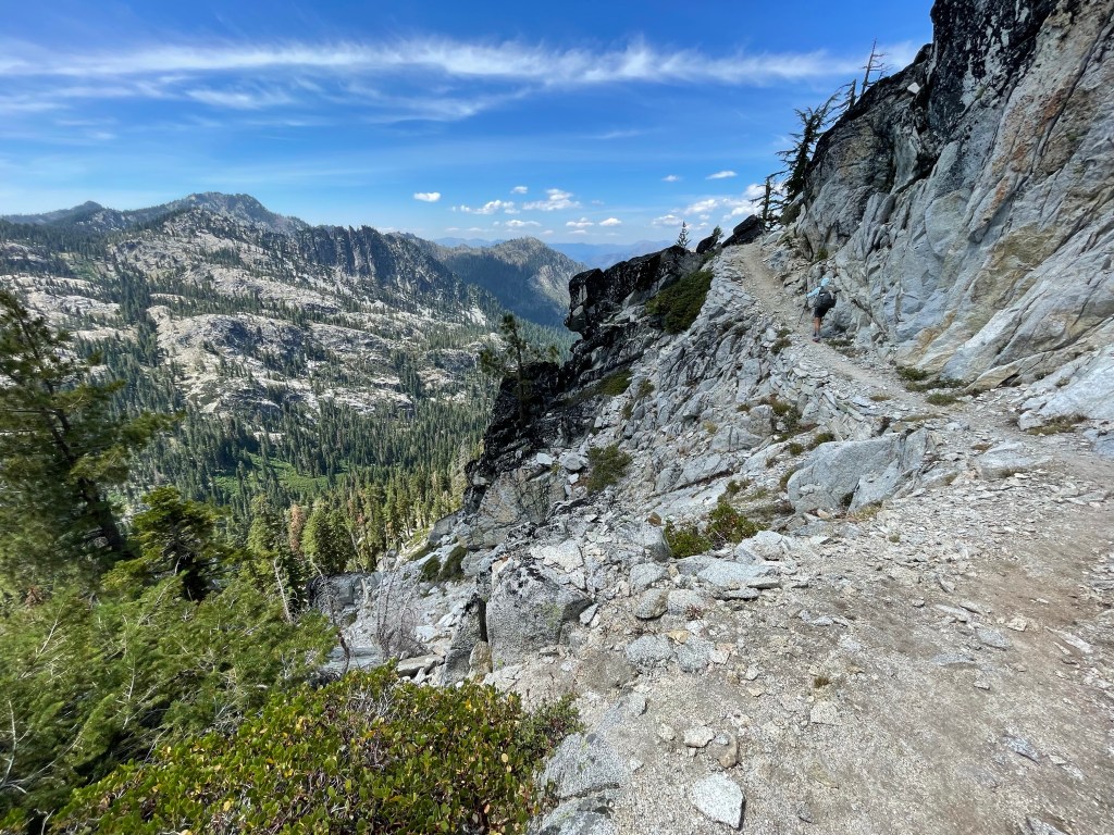
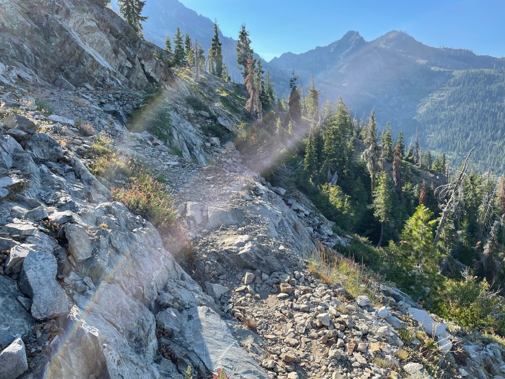
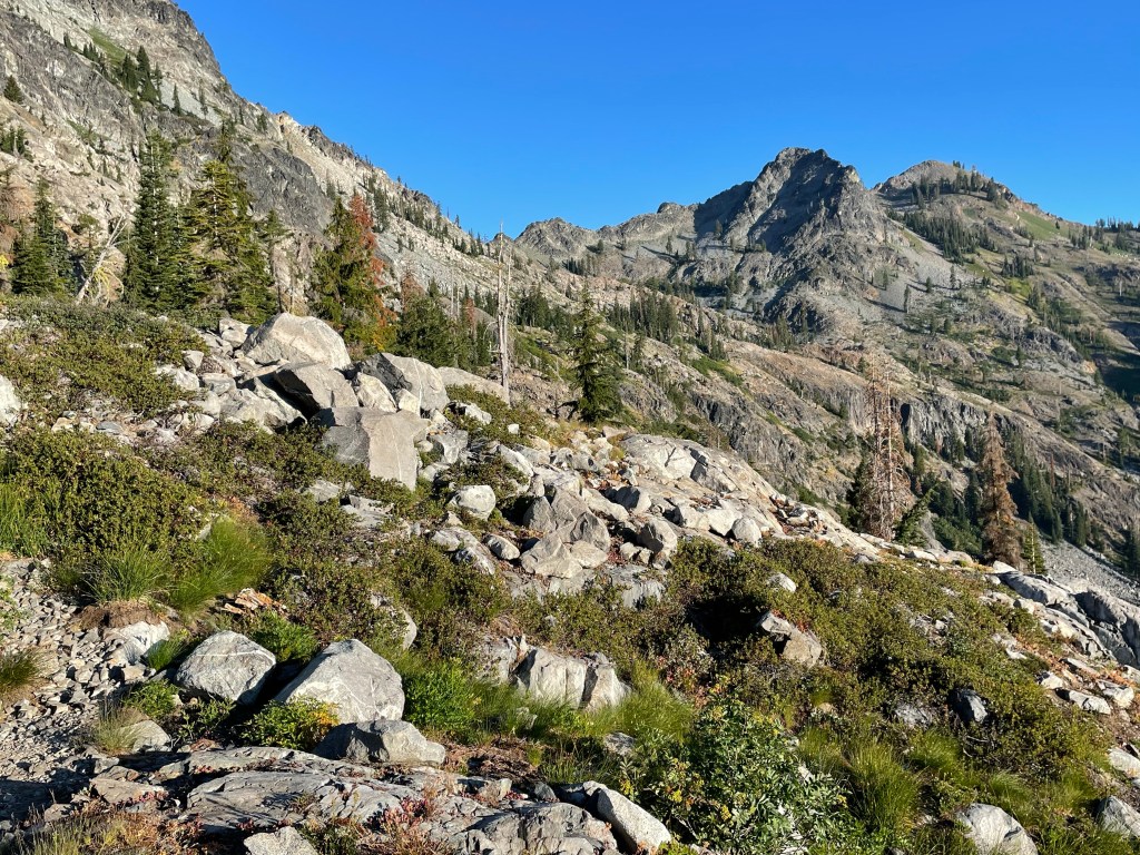
We left camp just before 7 am with plans for a shorter day. The first section of trail was along a rough mountain side and it was difficult to to imagine where the trail would go, but somehow amongst the rocks there was indeed a trail.
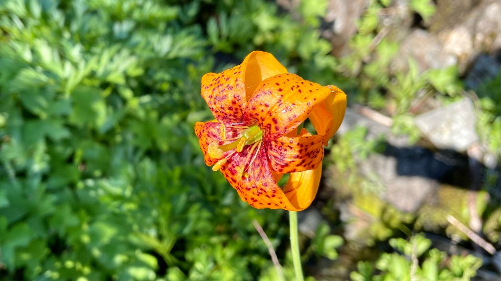
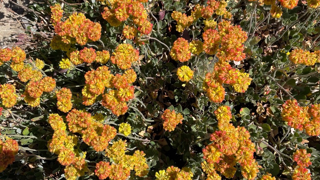
Along the way we found beautiful flowers!


We ascended to a small gap in the mountain and took a very quick break. Then it was downhill, and boy the views from the gap was amazing. There was a stunning alpine lake at the bottom of a very steep mountain called Man Eaten Lake. That would have been a great place to camp if it wasn’t only mid morning.


The trail continued down and remained rocky and rough. We took it slow as not to twist an ankle or knee.

The trail wound its way along the sides of mountains dipping in and out of canyons and we could see the mountain gap disappearing behind us.
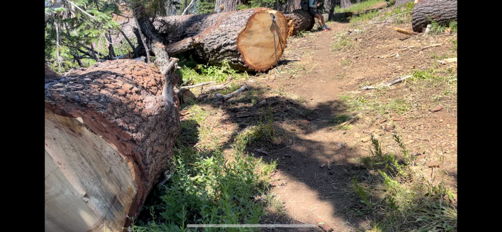
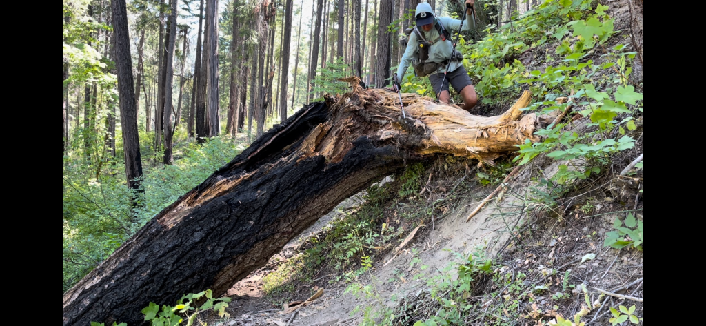
We got to a burn area and noticed that a trail crew had recently cleared the blown down trees. Thank you trail crews!
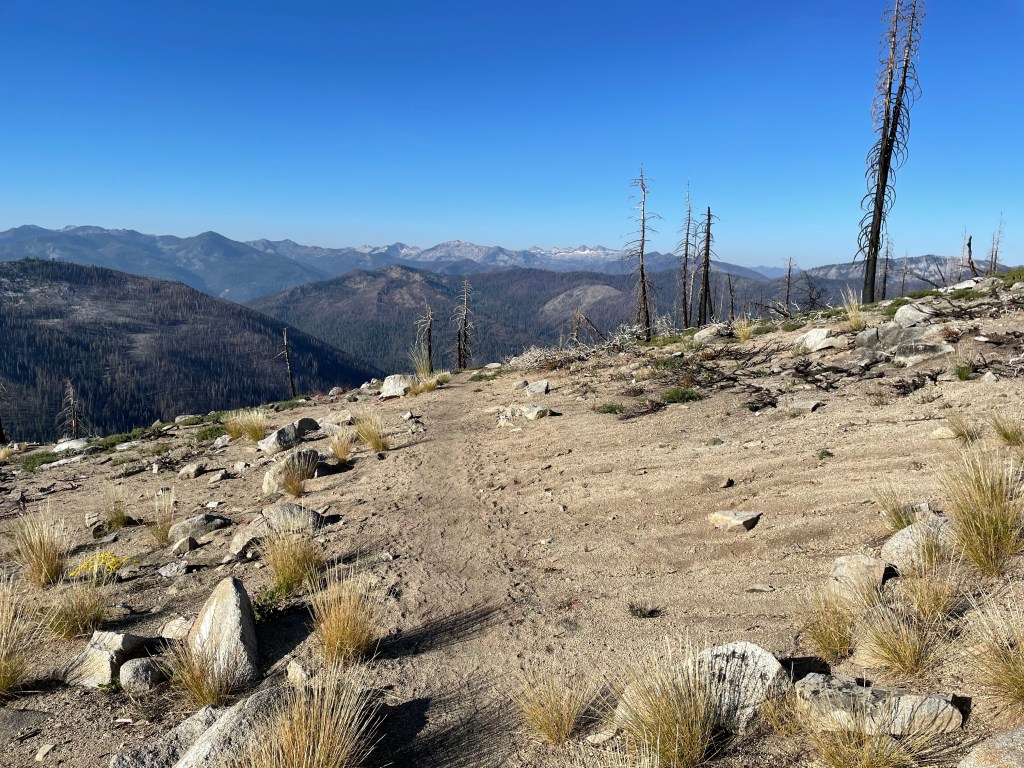
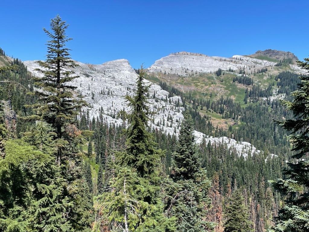
As we crested a ridge we noticed some really stark white peaks in the distance. It turned out that those peaks were indeed some form of marble, hence the name Marble Mountains.
We had lunch near a ranger cabin and a creek. It felt good to sit and relax our feet. After lunch it was a steep climb out of the valley and then it was just little ups and downs.


We decided to make this day a little shorter as water and camping opportunities would be scarce further ahead. We camped at Paradise Lake and were hoping for swim but this lake was very shallow and had a soft bottom.
We had read comments in the FarOut app that the deer in the area were very bold and would eat everyone’s gear. Basically the deer are attracted to the salt deposits from sweaty hikers.
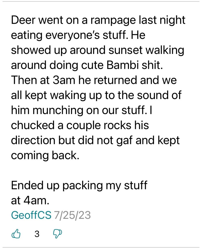
We set up camp and gathered some water to rinse off. It was nice stopping a little early to relax. The deer did not bother us during the night. Maybe we keep a tidy camp?
Day 148 – And down we go
Start: Paradise Lake – 1630.1
End: Grider Campground – 1650.6
Miles: 20.5
Ascent: 1854 ft| Descent: 6356 ft
Start time: 7:11 am
End time: 5:05 pm
Total PCT miles: 1649.2
Current elevation: 1679 ft
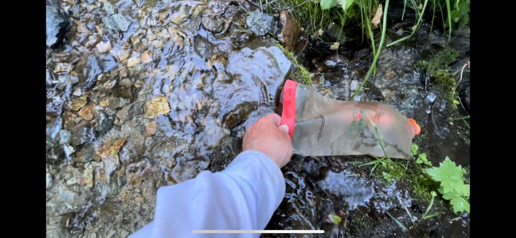
We got going after 7 am and of course we had to climb right away. After a few miles of ups and downs it would be all downhill to the Seiad Valley. We stopped at Buckhorn Spring to get some water. The trail would follow a creek up ahead but accessibility would be difficult for many miles.
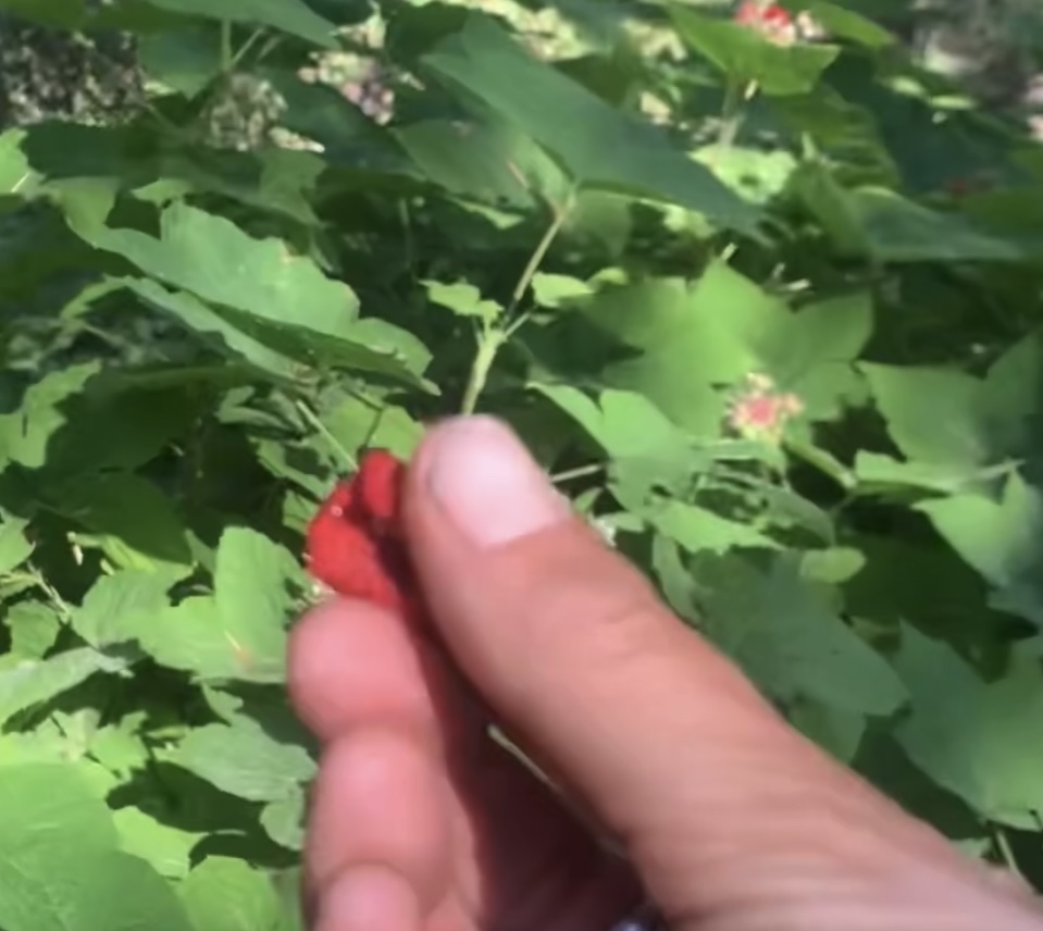
The trail down was again rocky but downhill. The first 7 miles of the day we had great views. But then the trail went into in a steep canyon. No views, no breeze and it was hot. We could hear the creek down below us, teasing us. Fortunately the trail was often lined with yummy thimbleberries!
At lunchtime we crossed a fast flowing Grider Creek and stopped for lunch. Ellen soaked her feet in the cold water during lunch. We also met three older gentleman at this spot who were section hiking. We would see them the next day in Seiad Valley.
The trail was now a little softer and made it easier on our feet. However it was still downhill and steep in some sections … a few blowdowns. Not good on the knees!
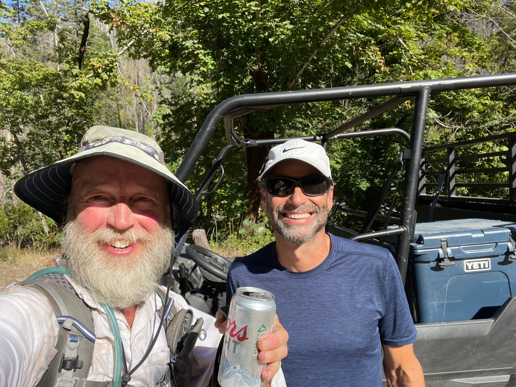
We finally made it to the Grider Creek Campground and happened upon a local man named Brian who had driven up to the creek and campground to give his dog a swim. He had brought a cooler of ice cold beverages for any hikers he might encounter … like us!
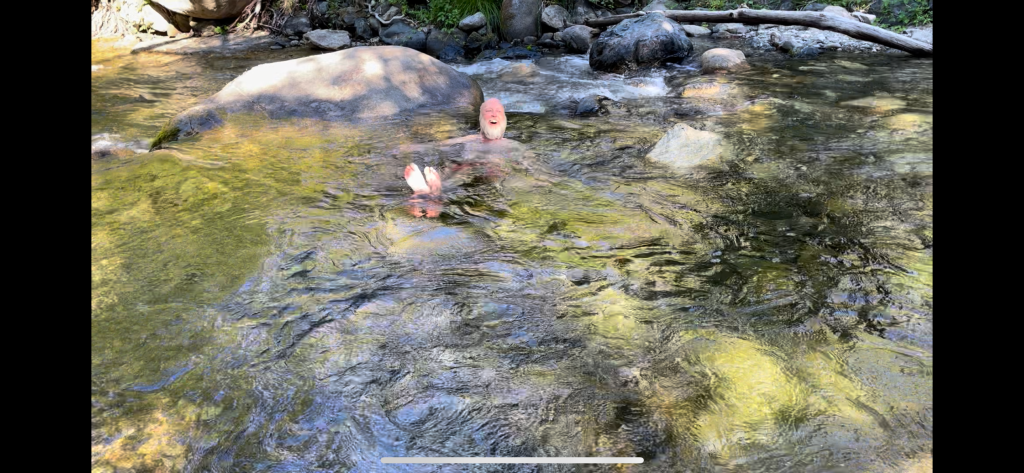
Before we set up camp we went swimming in the creek below the bridge. It felt sooo good. We then set up camp, made dinner and called it a day.
Day 149 – A very long 40 hours
Start: Grider Campground – 1650.6
End: Wildwood RV park/ Seiad Valley – 1657.4
Miles: 6.8
Ascent: 413 ft| Descent: 798 ft
Start time: 7:05 am
End time: 10:30 am
Total PCT miles: 1656
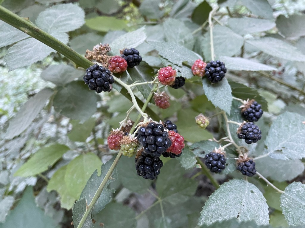
We took our time in the morning as we only had about 7 miles to the valley and it was all a road walk. The first couple miles were in a dirt road lined with blackberries. We kept stopping and eating them this not making good progress. But hey, wild blackberries must be eaten, right?
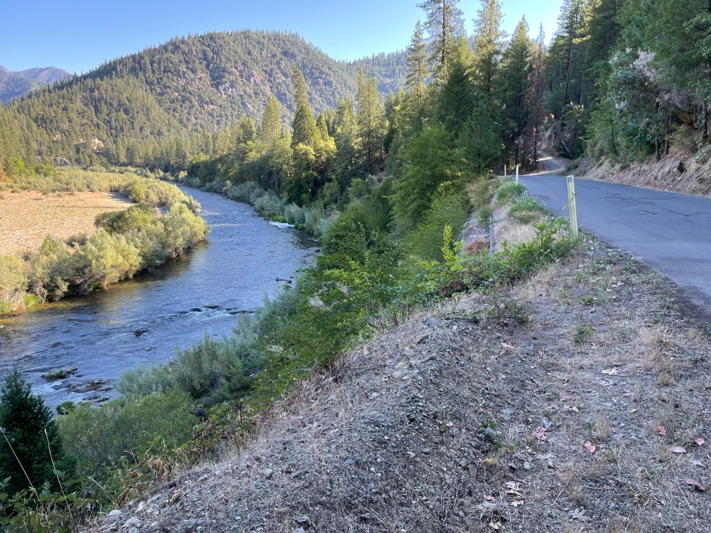
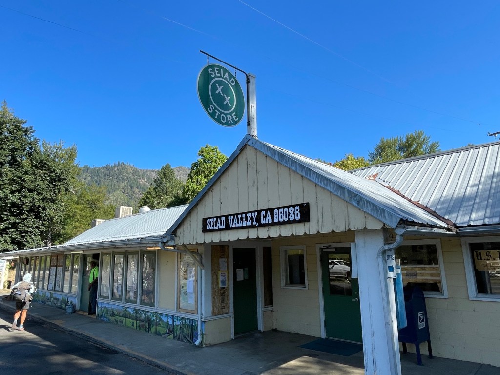
Once on the pavement we followed the Klamath River for a couple miles and then we walked alongside busy Hwy 96. We made great time and after about 3.5 hours were at the grocery store in Seiad Valley.
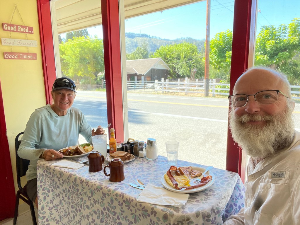
Ellen picked up her new shoes at the post office and then we went next door to the cafe. We both ordered pretty sizable breakfast as we were both hungry.
After breakfast we walked down the road to the Wildwood RV park to take showers and do laundry.
Whole recuperating in Salt Lake City we had decided that this PCT trail segment would be our last for this year. It has been almost 5 months, we both had some aches and pains, and we had to stop somewhere. We also had learned of the passing of one of our friends back home and we really wanted to attend the memorial service.
So now begins a new adventure … how to get from a Seiad Valley, a small out of the way town in extreme Northern California, back to Costa Mesa in Southern California. This is how it went using public transportation.
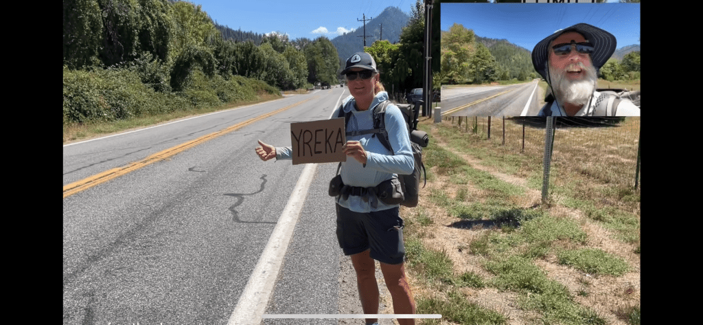
Step 1: we hitchhiked from Seiad Valley to Yreka (thanks Dave and Aiden) – 1 hour car ride on the twisty hwy 96
Step 2: Take the Sage bus to Dunsmuir – 1.5 hours on a short bus with many stops. Arrived 7:30 pm.


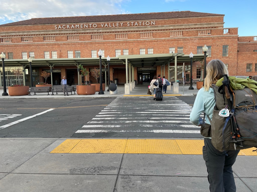
Step 3: Take the 12:45 am Amtrak train to Sacramento. But we didn’t leave until 1:53 am. Arrived in Sacramento at 6:00 am … no sleep.
Step 4: Take the bus to the Stockton train station – 1 hour ride. Arrived 10:45 am. No photos of this dump
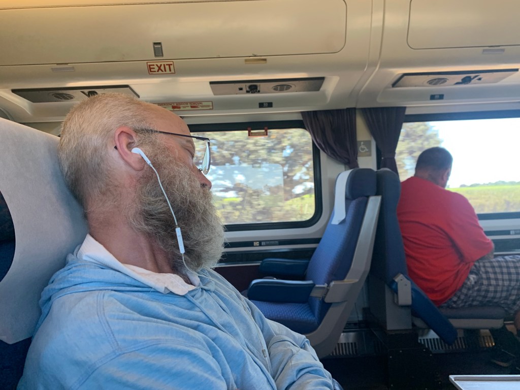
Step 5: Take the Amtrak train to Bakersfield – 3.5 hour ride. Arrived 2 pm.
Step 6: Take the bus to LA Union Station – 2.5 hour bumpy ride. Arrived 4:25 pm.
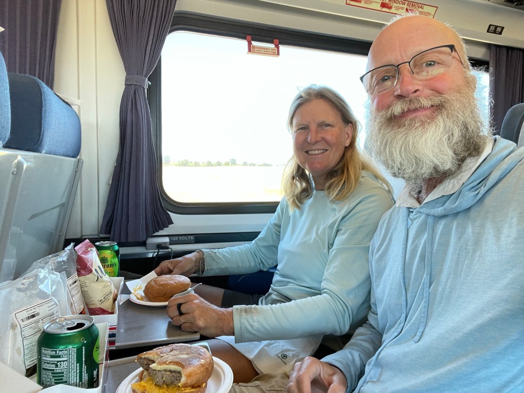
Step 7: Take the Amtrak train to Anaheim – 45 minute ride. Business Class this time!
Step 8: Debbie picked us up from train station at 6 pm and took us to Ellen’s dad’s house.
What a long day! We finally went to bed around 9 pm after getting up at 5:30 am the previous day.
Here is the next video!

So glad to see you were able to get back on trail and finish up that Nor Cal section. Be glad you finished OR when you did! I backpacked through Central OR just a week ago and got off trail on the McKenzie River just before the trail closed down the next day from the Lookout Fire! It blew up and the whole state (including where I’m at in SW WA is so smokey!) Wishing you all the best with your upcoming adventures! Glad to hear Ellen’s leg has healed! Hope you’ll be able to come out next year or some upcoming year and finish the PCT sections you missed! I’ll be following your adventures and was so glad to meet you in Cascade Locks when you came through! Happy Trails!
LikeLike