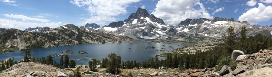
Day 128 – Washington!
Start: Bridge of the Gods – 2149.5
End: dirt road after climb – 2162.7
Miles: 13.2
Ascent: 4228 ft | Descent: 1186 ft
Start time: 12:14 pm
End time: 6:56 pm
Current elevation: 2998 ft
Total PCT miles: 1425.3
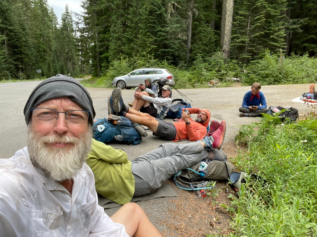
We got a late start hiking today since we had to wait for the mail to show up with All In’s new shoes. Plus we had to walk to the post office ourselves to mail our resupply boxes ahead on the trail.
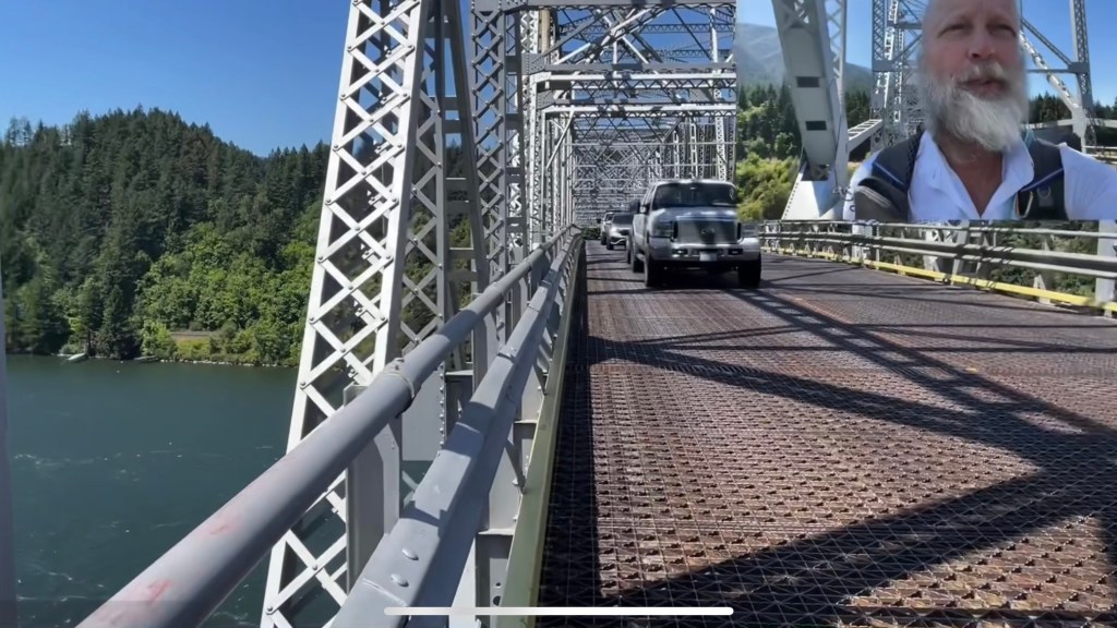
After breakfast and the post office we took the bus from Hood River back to Cascade Locks. As we got off the bus we saw Sherpa Cheryl and TownStop. They were on their way to Portland to visit Sherpa’s husband and Townstop’s fiancé. We also saw Went by the post office. We enjoyed a quick reunion with him and then started walking to the bridge.
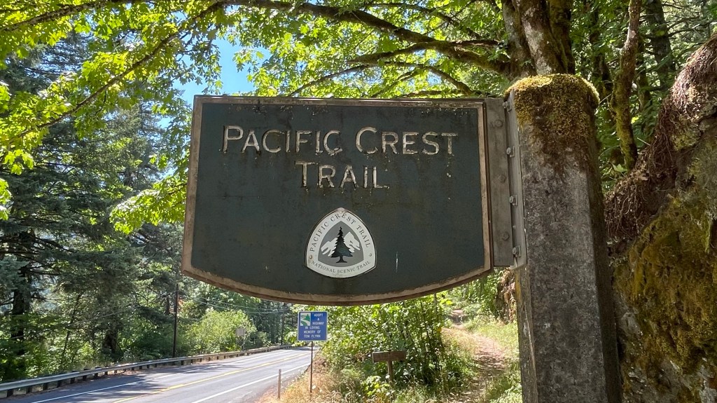
We walked across the bridge and at the midpoint entered Washington … for real this time! It was tight with only a single lane for cars in each direction (and no walkway), but at no time did we feel unsafe. The bridge is a designated part of the PCT. Several cars waved and gave thumbs up to us, seemingly knowing what we’ve been doing these past few months. One vehicle slowed to talk.


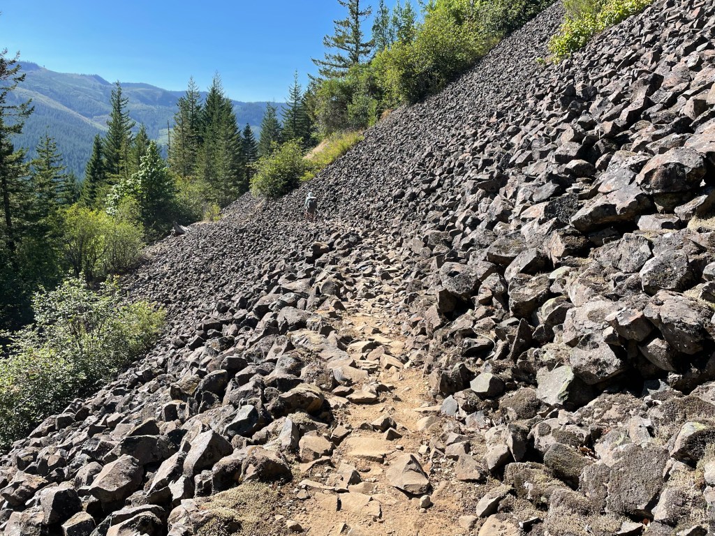
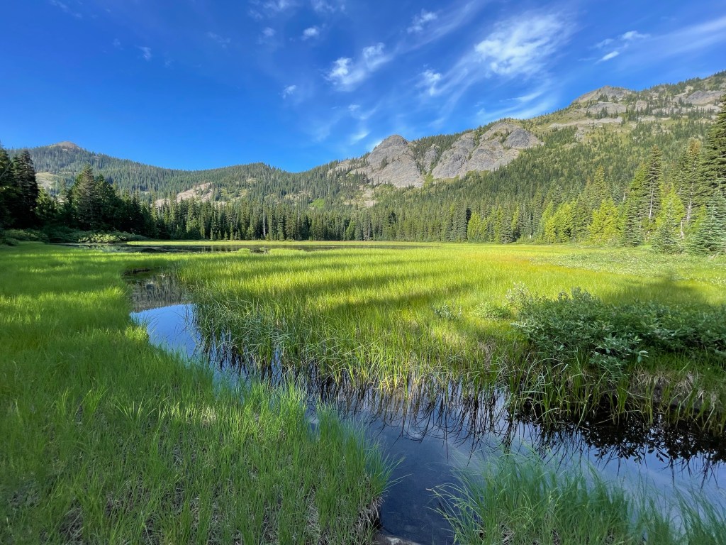
We got back on the trail and it was right back into the forest … and up up up! The PCT is at its lowest elevation while crossing the Columbia River and so we had some elevation to regain.
With 10 miles remaining until our intended campsite, we stopped at a small trickle of water. This would be the last water source for the day and into the next morning. Tonight we’ll be dry-camping and so we all carried out 3.5 liters to get us through today’s hike, evening meal, breakfast, and hike out tomorrow morning.
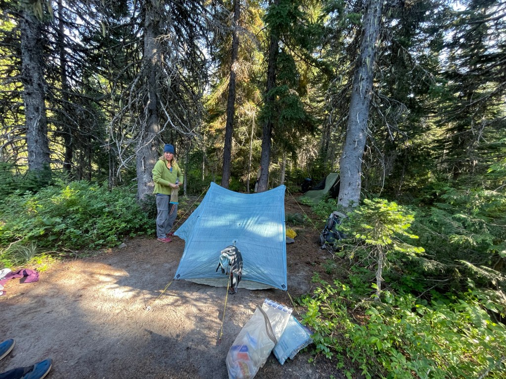
Jeff arrived first at our intended campsite and found three ladies had already set up their tents in one of the many flat areas atop this ridgecrest. One of them came over to visit as Jeff was setting up. They both thought the other looked familiar but did not know from where.
Day 129 – Another 20+ mile day
Start: dirt road after climb – 2162.7
End: Panther creek cg – 2184.7
Miles: 22.0
Ascent: 3631 ft| Descent: 5366 ft
Start time: 6:06 am
End time: 4:54 pm
Current elevation: 948 ft
Total PCT miles: 1447.3
We got up around 5 am and noticed that it was just getting light. Seems weird, but less than a month ago the days were getting longer … now they’re getting shorter. Still, we hit the trail just after 6 am.
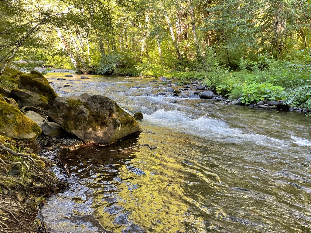
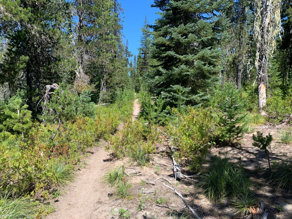
First order of business was short steep climb and then back down. The slope of the trail in Washington has been noticeably steeper and today was no exception. Most of the trail was again in forest, aka the green tunnel. However, the foot path was nice and soft with only occasional rocky sections. We found our first water source around 8:30 am and filled up.
Next was a short climb and once at the top we had some cell service. Ellen used this opportunity to check the scores for the Women’s Word Cup!
At lunch time the trail passed adjacent to Rock Creek road (just a two-track through the woods). We found a nice large flat spot in the shade and took our time eating as we had already done over half of our intended miles for the day. Then it was 5.6 miles to next water and 10.5 miles to camp.
It was mostly downhill at this point and still in the green tunnel. We all made quick time of the downhill and within 2 hours we were at the water – Trout Creek. Then it was just 5 miles to Panther Creek forest service campground.
It is nice to sometimes stay at an actual campground with piped water and vault toilets. However, as we walked into the campground we noticed the sign said it was full. It was the weekend and so there were many drive-in campers. Jeff asked a camper for the location of the camp host and the nice lady asked if were PCT hikers in need of a campsite. She then offered us their extra campsite since their friends were no-shows. Later, her husband brought us a beer. People are so nice!
We set up camp, walked down to Panther Creek to wash up, and then had dinner. We were all tired and were in bed before 7 pm. Tomorrow looks like a beast of a day!
Day 130 – Swimming
Start: Panther Creek FS Campground – 2184.7
End: Blue Lake – 2207.9
Miles: 23.2
Ascent: 5950 ft| Descent: 2211 ft
Start time: 6:38 am
End time: 5:16 pm
Current elevation: 4639 ft
Total PCT miles: 1470.5
It was a very quiet night at the Panther Creek campground (thank you campers). We got going after a quick breakfast and then stopped at Panther Creek to filter water. We had a big climb ahead and next water was 10 miles away.
The climb started immediately with 8 switchbacks. In spite of the steep grade we made great time and after less than 2 hours we did 5.1 miles. It was yet another 4.4 miles to the top of Mt. Huckleberry. The trail itself was smooth but steep through the green tunnel. We took a packs-off-break and enjoyed a view of Mt. Hood, now far to the south.

The trail proceeded downhill now and we anticipated an off-trail spring rumored to still have a trickle of water. We found the side trail and Jeff went down to fill both of our cnoc bags. A half mile later we stopped to have lunch. We had done 13.2 miles and it was only 12:15 pm. It was 10.1 more miles to Blue Lake, our intended campsite for the night.
It was now mid afternoon and it was hot. We went through an area with lots of ponds and now the mosquitoes were back. They were tiny though and not as aggressive as the skeeters in Oregon.
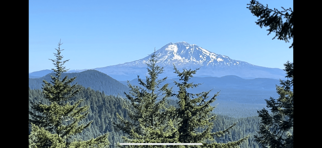
As we crested a ridge, we had a view of Mt. St. Helens on the west and Mt. Adams on the east.
As is always the case, the last couple of miles of the day always take forever. We had to do one more set of uphill switchbacks and then it was downhill with another uphill bump.
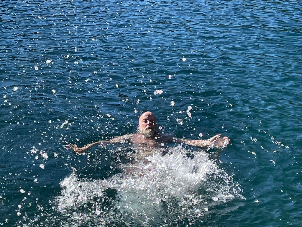
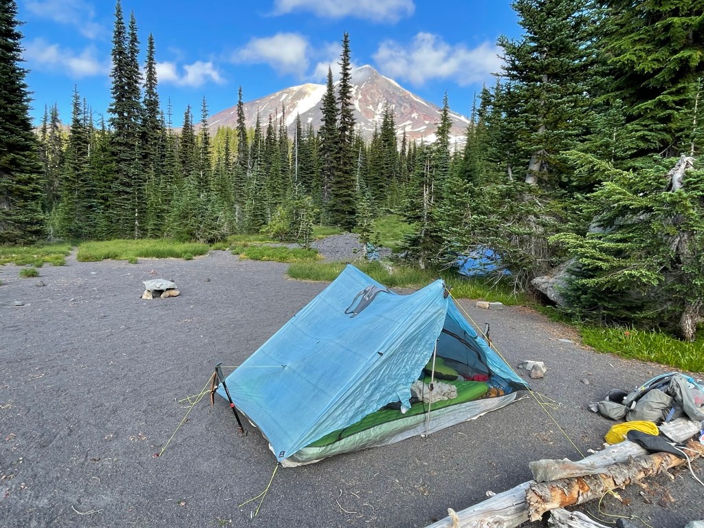
We made it to gorgeous Blue Lake with enough daylight and sun to go for a swim. The water was really clear and the shore had a rocky platform to jump off. It get great to rinse off after a hot and sweaty day of climbing. We had our biggest day of climbing, almost 6000 ft.

The same three ladies camped on the ridge two nights ago were also now camped here at Blue Lake.
As we were eating dinner, the woman Jeff was speaking with two nights ago asked if Ellen was “Ellen”. Ellen then immediately recognized the hiker as “Onward”, a female hiker about our age. I guess our appearances have changed a lot since starting this hike! We met Onward way back in March in the Southern California desert and had since loosely kept in contact. It was great catching up with her and hopefully we’ll be able to hike together again.

Blue Lake was popular and the campsite was full with 8 tents. We would not say the trail is “crowded” but we are now competing for campsites with southbound PCT hikers who started from the northern terminus in July. Remaining northbound PCT hikers are also now concentrated in Oregon and Washington, having skipped over the Sierras. Of course there are also weekend and section hikers on trail. However, if there is a flat spot available, everyone is willing to share.
Day 131 – Our personal best!
Start: Blue Lake – 2207.9
End: Trout Lake rd – 2231.6
Miles: 23.7
Ascent: 3071 ft| Descent: 3766 ft
Start time: 6:08 am
End time: 3:36 pm
Current elevation in Trout Lake: 1896 ft
Total PCT miles: 1494.2
We woke up at 4:45am, packed our gear, and had a quick breakfast. We had plans to hike almost 24 miles to a forest service road and catch the shuttle to the town of Trout Lake by 4:30 pm.
We got to walking just after 6 am and did our morning video by the lake. The early morning hike was nice. We actually got some really cool views of Mt. Adams and one distant view of Mt. St. Helens. After that it was back to the green tunnel. We also saw a bit of snow. No, not that white stuff again! We also hiked along the edge of a very ancient lava flow.


By 10 am we had hiked 10 miles, a so called “10 by 10”. There were some climbs and descents but the trail was really nice and smooth and this makes for really fast hiking.
We crossed a forest road and saw All In sitting down and having a snack. As we passed we yelled “20 by 2!”, implying that our goal was 20 miles by 2 pm. We kept hiking to the next water source and around 11:30 am we decided to have a quick lunch. All In came hiking by really fast and said the “20 by 2” really got him motivated.
We were both calculating time and distance to the road in our heads and we kept our lunch break to only 15 minutes. Trying to finish off our remaining food, Jeff’s lunch included almost half a can of spam on a tortilla.

We actually did 20 miles in 8 hours including lunch and other short breaks. It really helped that the hike was all in the green tunnel and there were no views to be distracted. We were pretty proud of ourselves. The last 1.3 miles was up hill and we still had another 3.6 miles to get to the road. The last 2.3 miles was all steep downhill but we made quick time of the miles and at 3:35 pm we were at the road for the shuttle pickup.
At some point this afternoon, we heard an animal which we did not recognize. It repeatedly barked a sharp “raff, raff, raff” every 10 seconds or so as we passed close by. It sounded almost canine … but not. Later, when Onward arrived at the road, she shared a video clip of the animal we assume had made these noises. It was a beautiful black fox pacing excitedly across the trail in front of her! His coat was jet black except for silver highlights on his back and bright white on the tip of his tail. We did not get a photo but here is an example:

At 4:30 pm the “shuttle” arrived and we all hopped in the truck. The guys were in the bed of the pickup truck with the backpacks while the ladies got to sit inside. Trout Lake is an important resupply point on the PCT and so volunteers from the town send vehicles up the road to the trail at 8am, 12pm, and 4pm each day during hiking season. The drive from the trailhead to town took only 20 minutes. Once there, we retrieved the resupply boxes we had mailed to the general store.

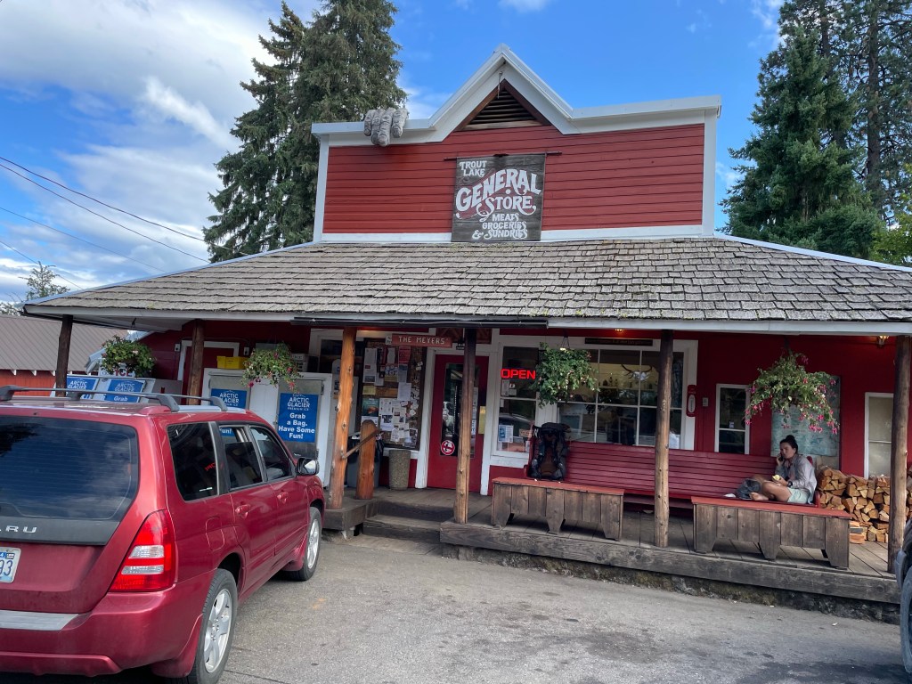
While we at the top of our climb, All In made a call to a Trail Angel and got us rooms at her house with dinner, showers and laundry included. After checking out the grocery store we walked over to Joanna’s place. She showed us around and started making dinner. We all took showers and then did laundry. Joanna has been hosting hikers for a few years.
We had a great dinner and then retreated to our bedrooms to rest and catch up on the outside world. Ellen got to watch some World Cup soccer. It was a great day and it felt good to get clean and sleep in a bed. Thank you Joanna!

Day 132 – Back to work
Start: Trout Lake rd – 2231.6
End: Riley’s Creek – 2241.8
Miles: 10.2
Ascent: 2466 ft| Descent: 570 ft
Start time: 12:27 pm
End time: 4:57 pm
Current elevation: 5772 ft
Total PCT miles: 1504.4
We had a restful evening. We are actually quite comfortable sleeping in the tent on our air mattresses and sometimes more so than a bed. But it is always very nice to have a roof over our heads and all the conveniences of modern life.
We went to breakfast at the local cafe and then to the grocery store for some resupply items. The store did a great job with stocking up on hiker specific foods. After the store we went back to Joanna’s to pack our food and other gear. We then just hung out until 11 am when the taco truck opened.
We had visions of really yummy food from the taco truck but the food was rather bland. We guess we’re used to spicy foods. After our lunch we went caught the 12 pm shuttle back to the trail.
Neither of us were really in the mood to go for a hike as we all had full stomachs and we were tired. But we had miles to hike so off we went. The first few miles were a climb through the forest, of course.

Then after 5.8 miles for the day we hit our personal 1500 mile mark. We can’t believe we’ve walked 1500 miles! Unfortunately, we didn’t do any kind of celebration.
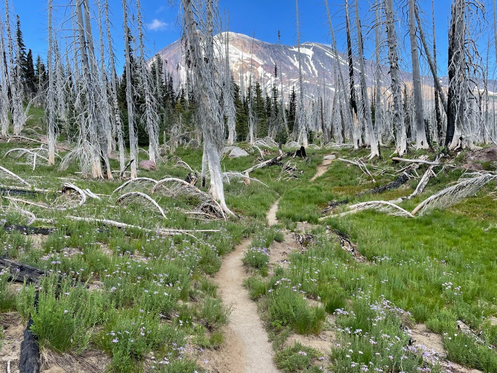
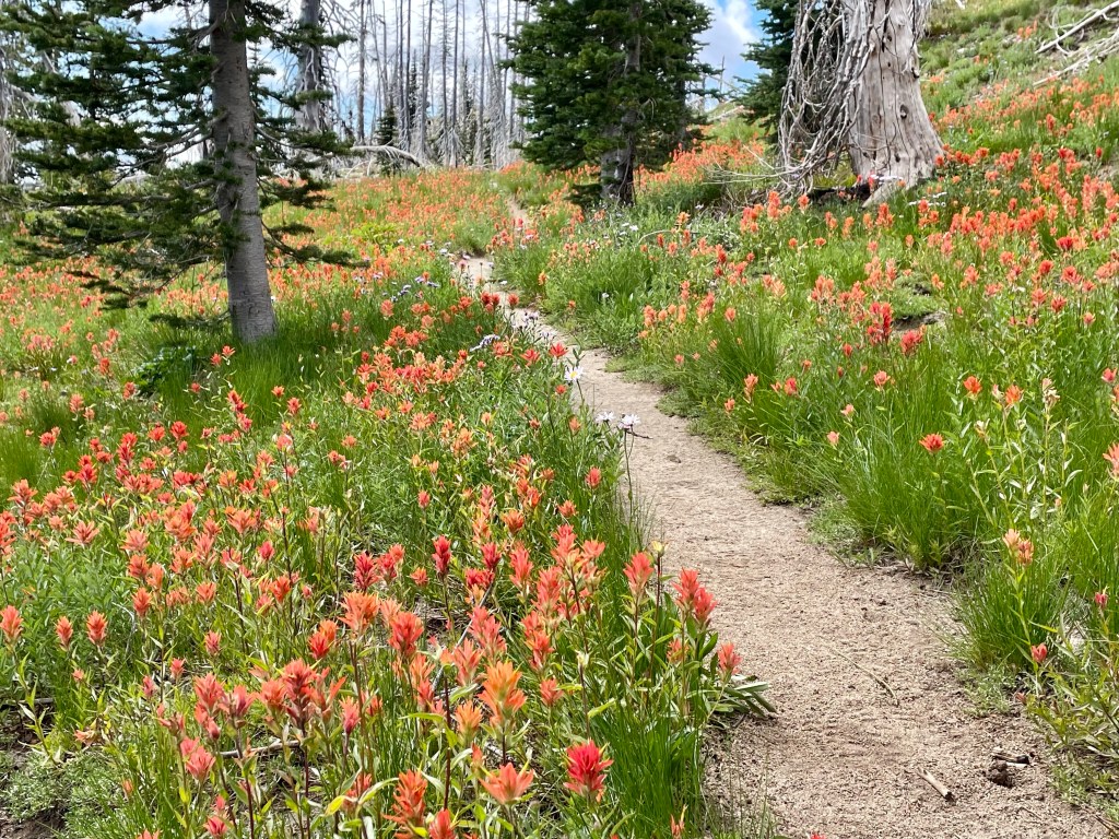
We continued to walk on a traverse facing west in a burned area. This allowed us to have some views to the west of Mt. St. Helen and other distance mountains. It was really nice to have something else to look at besides trees and bushes.
We also hiked through several meadows with lots of wildflowers that we’ve seen before in alpine settings.


We made it to Riley Creek after 10.2 miles and just before 5 pm. Not a long or big day in terms of miles but we were still all tired. Hopefully tomorrow we’ll hike some better and bigger miles as the terrain looks favorable.
We were camped in a meadow below Mt. Adams and next to Riley Creek. The creek was glacial melt from Pinnacle Glacier on Mt. Adams. The water was not too silty as it typical for glacial streams. We had one of the levelest and flattest spots since we started this trail. It sure beat the tree root that was under our tent two nights ago at Blue Lake.
Day 133 – Big miles again
Start: Riley’s Creek – 2241.8
End: Walupt creek – 2267.3
Miles: 25.5
Ascent: 2885 ft| Descent: 3618 ft
Start time: 6:11 am
End time: 5:47 pm
Current elevation: 4933 ft
Total PCT miles: 1529.9
We woke up to frost on our tent. We didn’t realize it would get that cold! But it did make sense since we were in a low valley next to a creek.
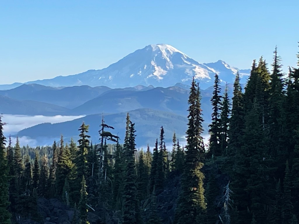
The day started out beautiful. As we went up the little trail from our valley campsite, Mt. Adams was looking sharp. After a few minutes we rounded a corner and saw Mt. Rainer in the distance with the valley below socked in with low clouds.
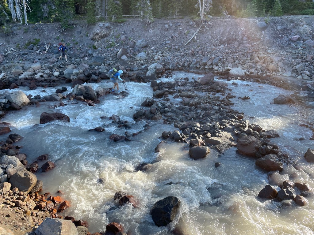
About an hour later we crossed one of several lava fields. Then it was time to cross Adams creek, a glacial creek from Adams Glacier on Mt. Adams. All In decided to use a log to cross and promptly slipped on the slippery log. No harm, only one foot wet. We decided to go upstream a little bit and just wade through at a safe spot.
The trail then went back into the forest. A couple hours later the trail followed the border of the Yakima Indian Reservation. The trail was very straight and exposed to the sun. At one point there was a giant lava wall next to the trail.
The rest of the afternoon was very uneventful. The trail again was in the forest and the green tunnel was back. Once in a while we got a glimpse of Mt. Rainier and the Goat Rocks Mountains ahead.
After 25.5 miles we made camp by a trail junction and by a pond for water. We had decided to push the miles today so that tomorrow we can take our time hiking along the Knifes Edge trail in the Goat Rocks Wilderness. The Knifes Edge is often said to be one of the most spectacular sections on the PCT.
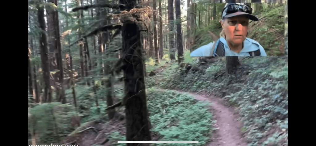
Here is the next video!

Sent from my iPad
<
div dir=”ltr”>
<
blockquote type=”cite”>
LikeLike
Your spectacular views continue! I laughed at Jeff’s tortilla spamwich. You’ve got this!
LikeLike