Day 119 – Blow down city!
Start: Big Lake Youth Camp – 1996.1
End: Rockslide lake – 2016.4
Miles: 20.3
Ascent: 3233 ft| Descent: 1914 ft
Start time: 6:16 am
End time: 4:23 pm
Current elevation: 6258 ft
Total PCT miles: 1279
We got an early start for todays hike. However, the oatmeal mix we got from the hiker box however was terrible. But we choked it down anyway just for some calories.
The hike between the youth camp and Santiam Pass was about 4 miles and was pretty uneventful. It was mainly flat. The only interesting item was that someone had made really nice signs for the x-country ski trails and the PCT. They were way up on the trees to accommodate the snow fall.
Once at Hwy 20/ Santiam Pass it was time to climb. Our next water source was 10 miles away at Koko Lake. As luck would have it, someone had left a half full 2 gallon jug of water. Ellen filled up her bottle so everyone now had 2 liters.
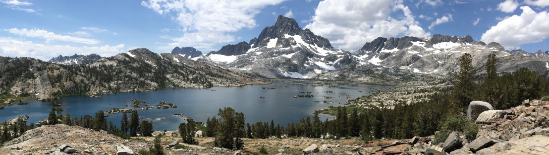
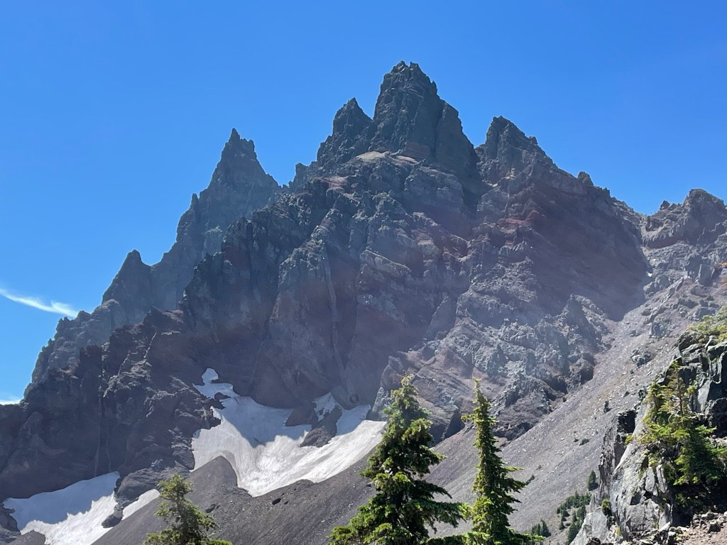
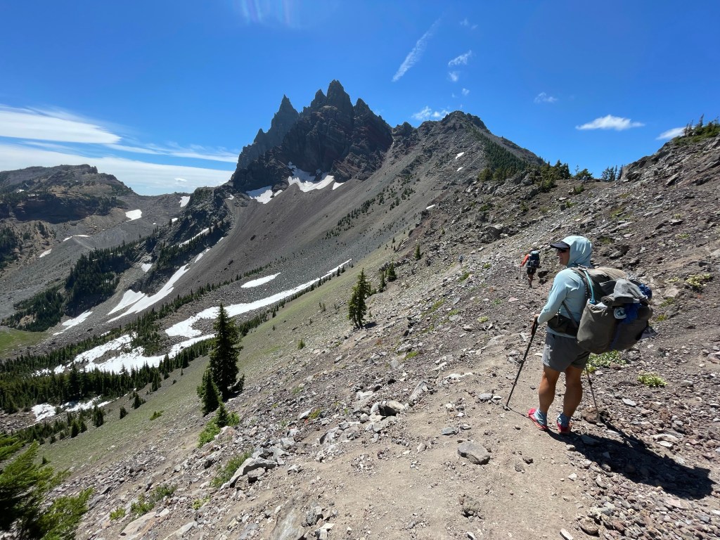
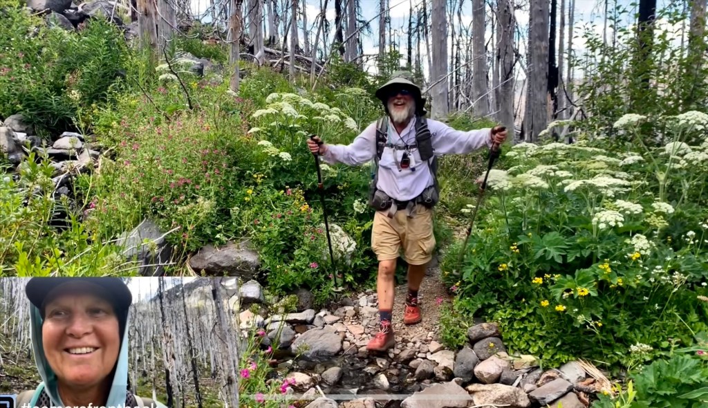
Next was the slow climb up to Three Finger Jack. It was mainly in the forest and so there were not many views. Plus the trail was also in an old burn area with some blowdowns. We made good time and at 10 am we rounded the corner and we were right underneath Three Fingered Jack. It was pretty spectacular. We decided to keep going to Koko lake for lunch.
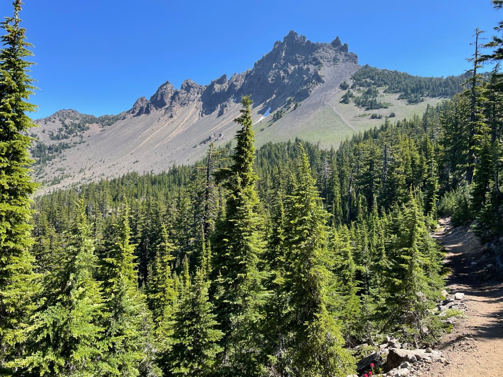

However, we changed our minds about lunch as we rounded another corner and we now faced the north side of Three Fingered Jack. We were on a saddle and it was breezy. But the views we amazing. The rock face of north side of Three Finger Jack was striped in bright red and black rock.
We decided to have lunch at this spot because the view was so amazing. We took our time as it was only 2.5 miles to water and 7.1 miles to our campsite. The only downside was that Jeff sat on an ant nest and got bit on his rear. Boy did he jump high!
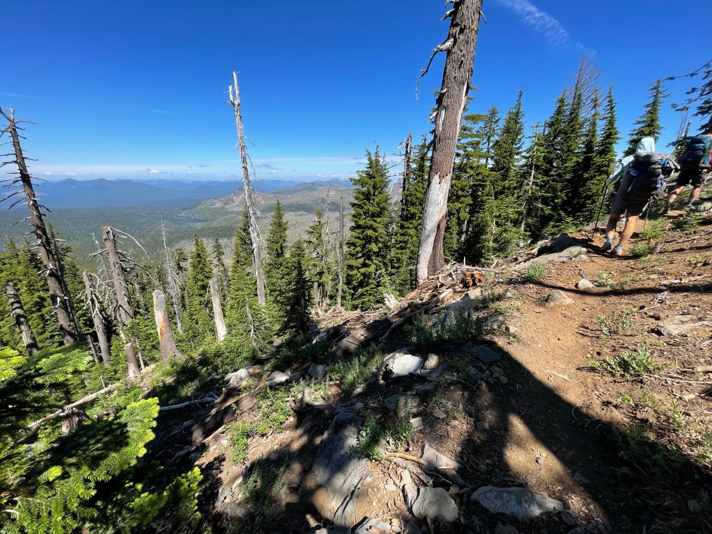
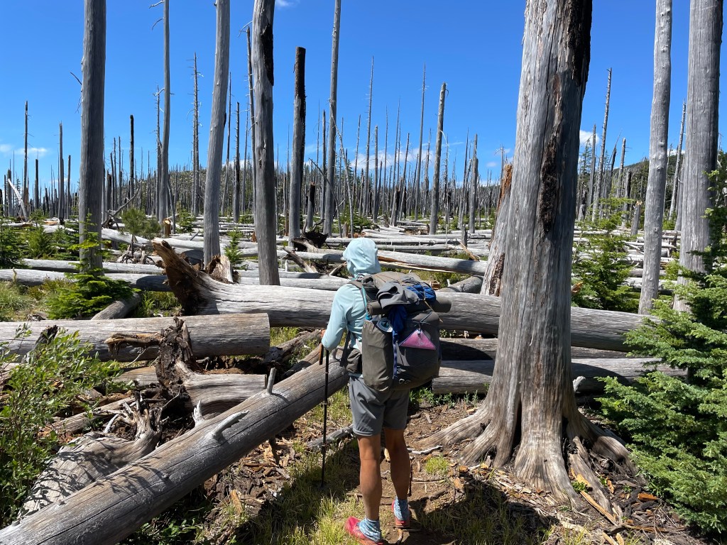
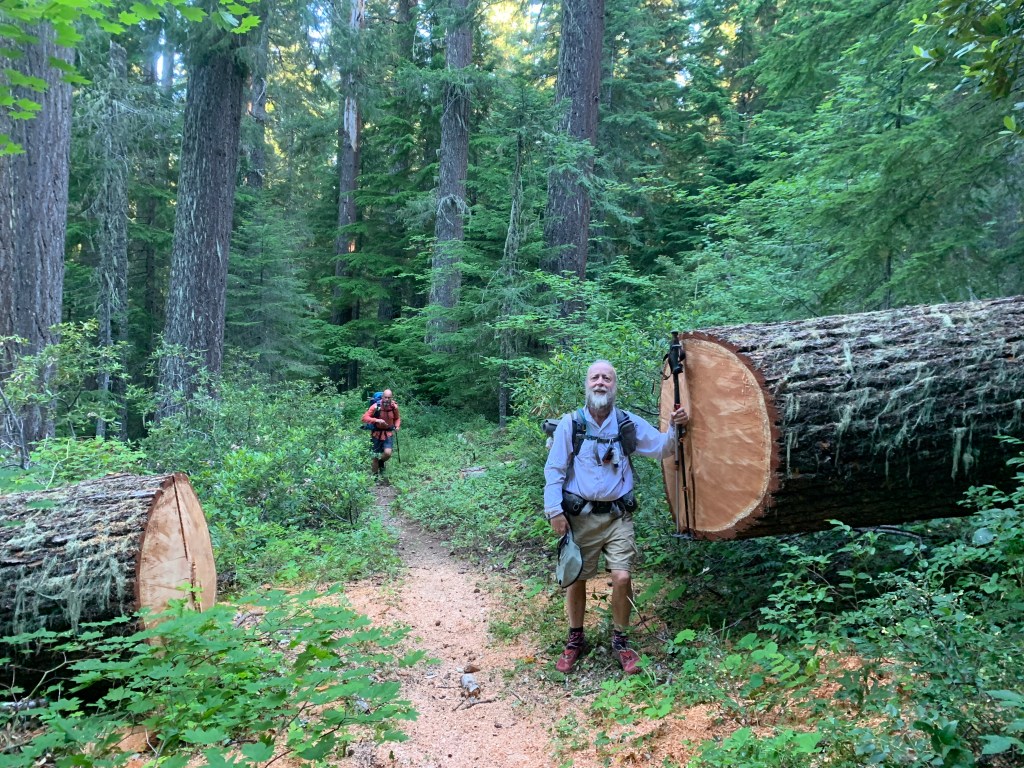
We had been warned that there were many blowdowns from this point until Rockpile Lake, our campsite for tonight. By now however, we’ve seen so many blowdowns and so we mostly disregard these well meaning but often exaggerated warnings.
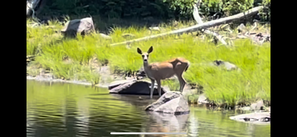
In spite of the blowdowns, we made decent time to Koko Lake. We took our packs off and took a break while filtering some water. Four other hikers showed up and all were from the Czech Republic. A black tailed deer also came by the lake for water. She was not afraid of us but simply kept her distance and approached the lake on the other side. After about a half hour it was time to go.
Start time: 7:40 am
End time: 5:27 pm
Current elevation: 5017 ft
Total PCT miles: 1323.5
The next 5 miles was again through a burn area and you guessed it, more blowdowns. At one point the area was covered with trees that were laying on the ground instead of standing. This made for what we called slow motion hurdles with backpacks. The trees that were burned a long time ago, now have smooth trunks and makes climbing over easy. When new trees fall it has all of its branches and makes a real mess of the trail. Plus it is harder to get around them.
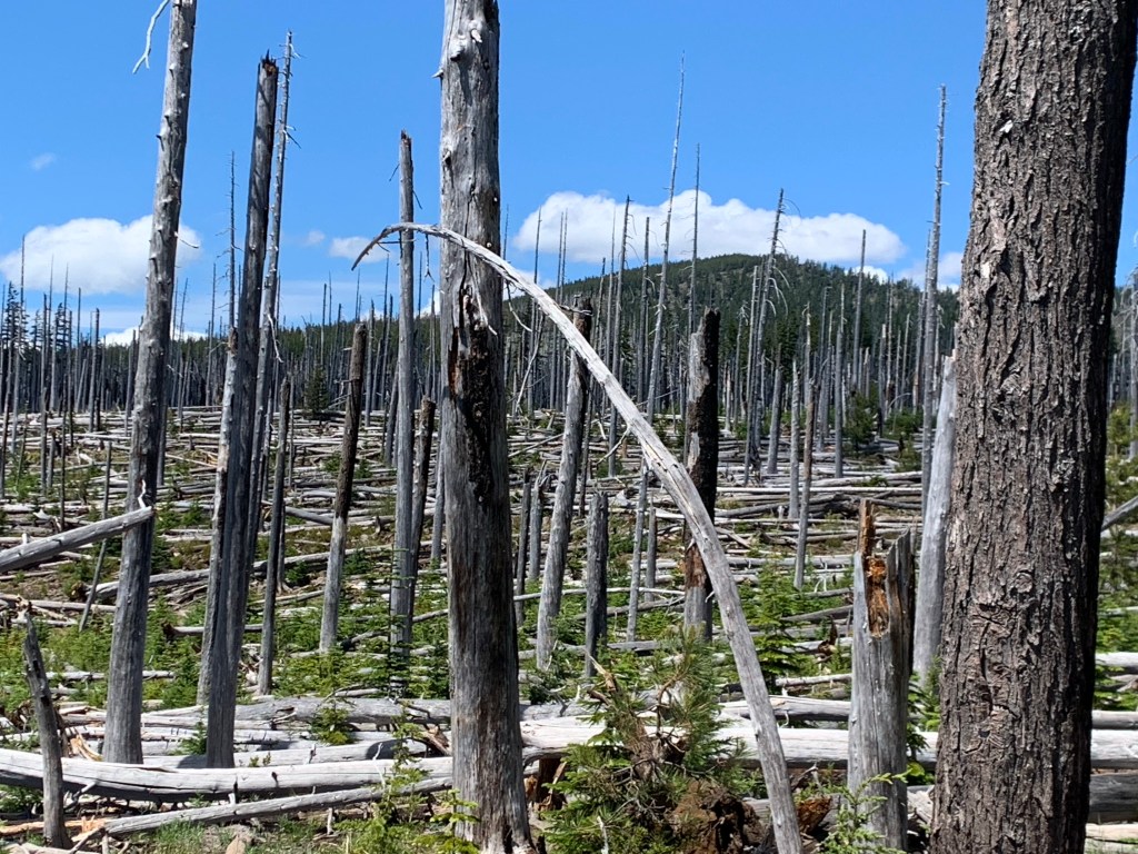


One thing we’ve learned about Oregon is that it is both easy hiking and hard hiking. Climbing over blow downs is very tiring and exhausting.
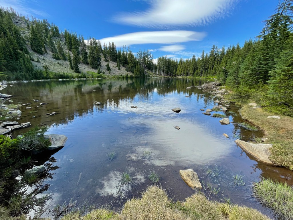
Finally, we found some smooth trail to our campsite at Rockpile Lake. The guys sort of bathed in the shallow lake. We had dinner and retreated to our tents to lie down. It was a good day with some great views of the mountains we had passed in the last few days.
Day 120 – Another record day
cation: Northern Oregon
Start: Rockslide lake – 2016.4
End: Breitenbush CG – 2042.1
Miles: 25.7
Ascent: 4407 ft| Descent: 5021 ft
Start time: 6:24 am
End time: 7:41 pm
Current elevation: 5515 ft
Total PCT miles: 1304.7
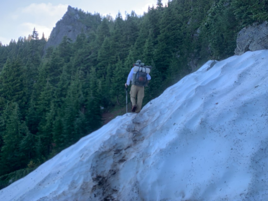
We woke up and saw the hill by the lake was lit up orange from the sunrise. Really pretty. Ass we resumed the trail there were some patches of snow but nothing serious.
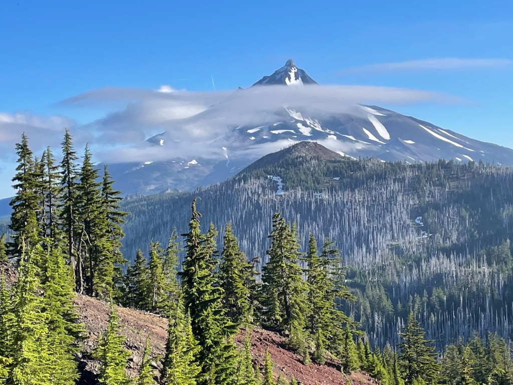
The trail was fairly flat with some small up and downs for the first couple hours. The trail was actually going around the base of Mt. Jefferson and every so often we got a glimpse. It is pretty cool to see these mountains from all angles and up close.
For a little while we kept seeing a lake down in the valley that had a bunch of trees floating. We were wondering how they’d had gotten there. We soon found out. We got to an area where years ago a big avalanche had torn a path straight to the lake.
We had lunch by Milk Creek. It was fast flowing with nice clear water. Then it was time for a 9.1 mile climb. We already had done 12.8 miles and we were feeling pretty confident that we’d get to our campsite by 6 pm. Boy, we were wrong.

After lunch and the slow climb up, we past the Woodpecker Trail junction and immediately got into a burn zone. Usually that meant lots of blowdowns. Lucky for us the trail was smooth with only a few nuisance tree trunks in our way. A little ways down we came to Jeff Creek.
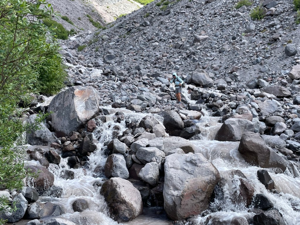
Around 3 pm we made it to Russell Creek. It was flowing pretty good and the water was silty. All this water came down from Russell Glacier on Mt. Jefferson. We climbed up the bank of the creek about 100 yards to find a spot to cross. Once crossed we had to climb back down the other bank back to the trail. The actual creek crossing was much shallower than expected and easy compared to the rock scramble we had to do on both sides of the creek.

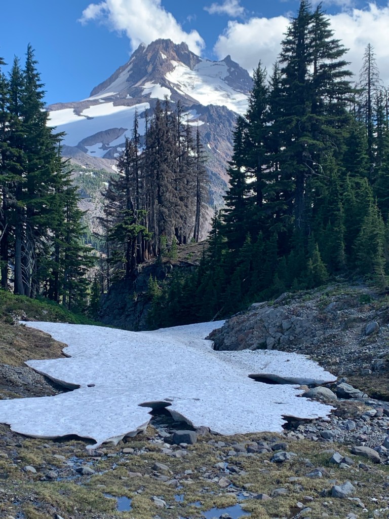
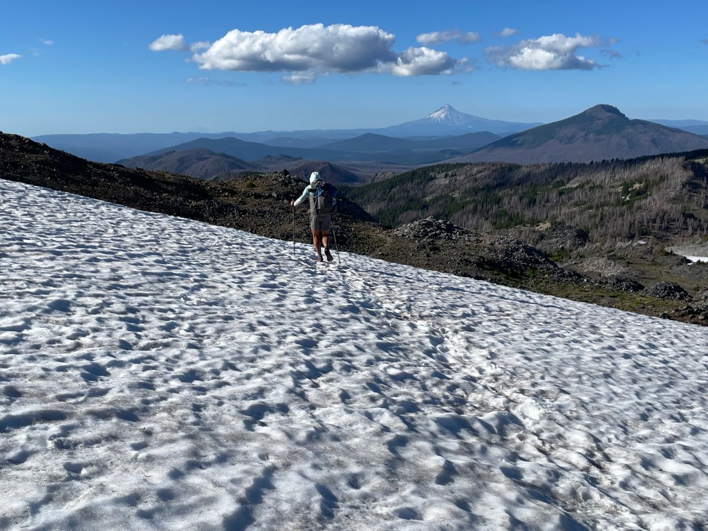
We still had 5 miles of climbing to do plus another 3.6 downhill. The climb up was steep in some parts. With about 2 miles to the top we got to a beautiful meadow with views of the north side of Mt. Jefferson. It was stunning! The steep rocky climb up from there was pretty horrendous this late in the day.
Finally at 5:46 pm we made it to the top. At the top you could see Mt. Hood in the distance and Mt. Jefferson behind us. There were several awesome campsites right at the top. This would have made an epic evening and campsite. However, we had plans to hike another 3.6 miles.
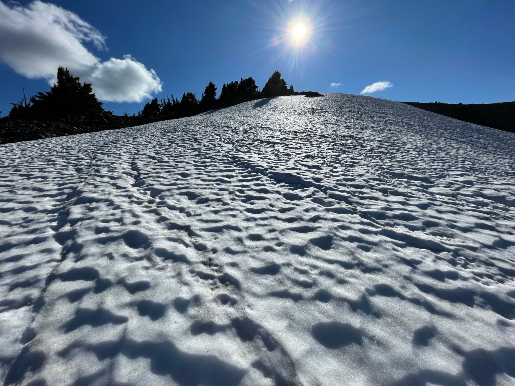
There was still a lot of snow on this north side of the ridge. The trail was also very rocky and uneven, which made for slow hiking. We kept looking back at the ridge and the snow. It was pretty.
About 2 hours later we finally made it to Breitenbush campground. What a disappointment. The area was recently burned and the campground was an overgrown mess. Blowdowns and tall grass everywhere. Come to find out we were also on tribal land where visitors were not allowed to swim in the lake. This was a big bummer as we were both pretty dirty from all the dust and sweat. We cleaned up as best as we could using a wash cloth and water from our CNOC bags.

After 13 hours and 17 minutes we hiked 25.7 miles. A new high mileage day.
Day 121 – Ollalie Lake
Start: Breitenbush CG – 2042.1
End: Pinhead Saddle – 2060.9
Miles: 18.8
Ascent: 2251 ft | Descent: 2813 ft
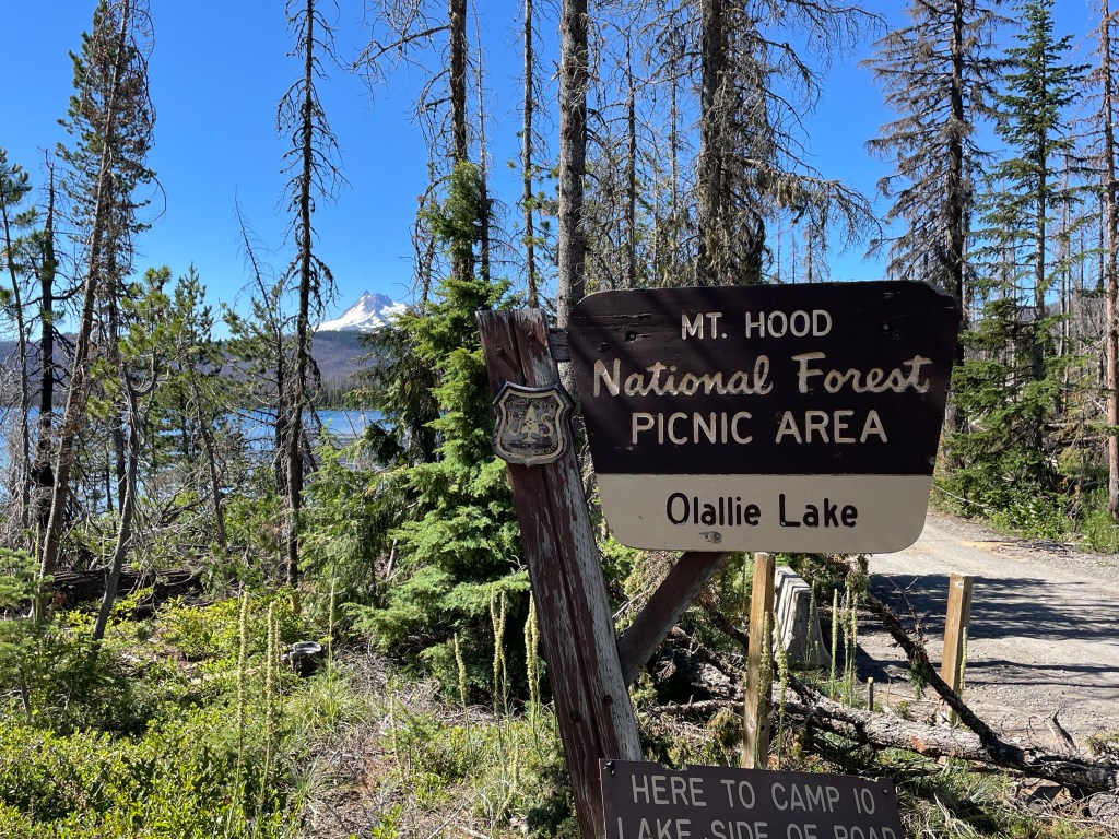
After our long day yesterday, we decided to sleep in. We got going about a hour later than usual. First order of business was a small climb in a burn area from last year. It looked like the fire burned really hot as not much was left. We had 6.5 miles to Ollalie Lake Resort and all of it was thru the burn area. The morning really dragged on as it was already hot and the trail was really dusty.
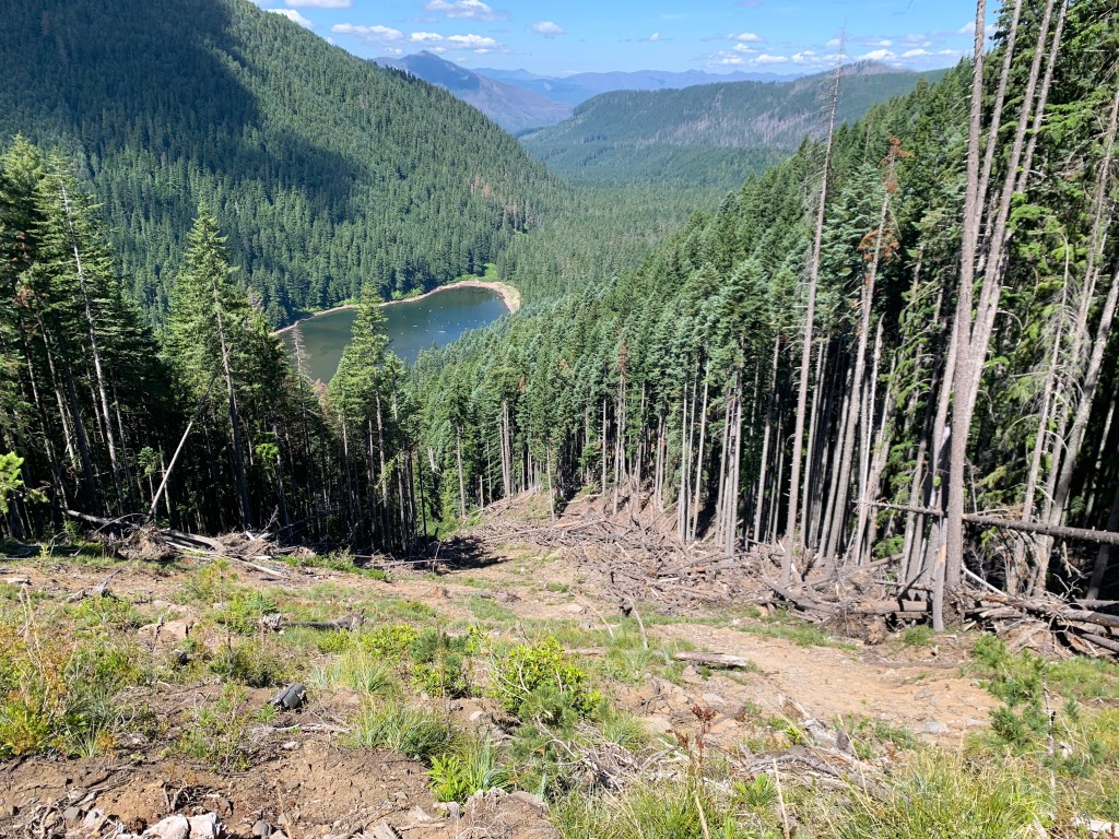
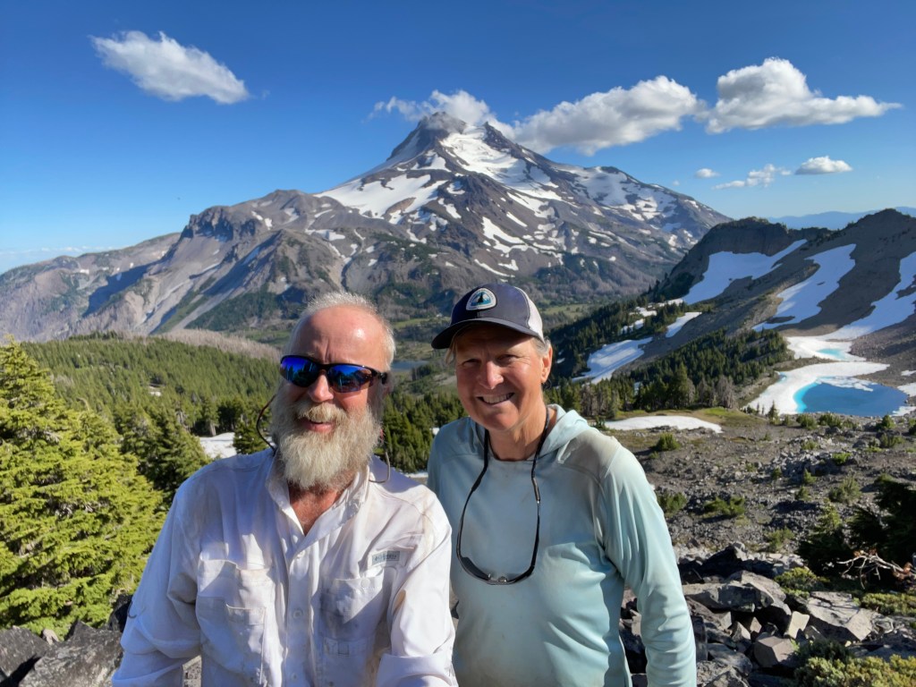
We finally made it to the resort on Ollalie Lake. It has a beautiful view of Mt. Jefferson to the south. In the picture below you can see the ridge to the right where we were just yesterday. It’s amazing how far you can travel by just walking all day!
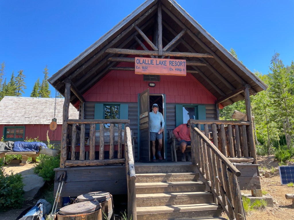
We topped off our food supplies enough to get us to Mt Hood and Timberline Lodge in a few days. We also got a soda and some snacks and ate them on the porch. The people at the store were really nice and they had a good variety of hiker oriented resupply items.
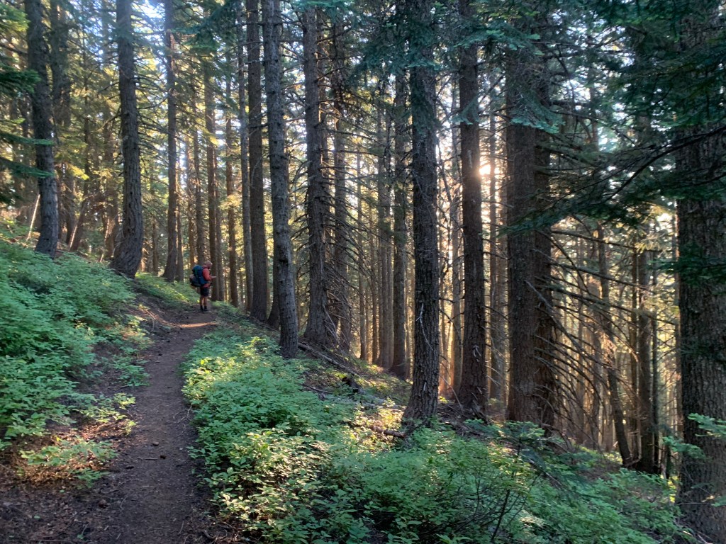
Around 11:15 am it was time to get back on trail. There was water after 3.6 miles and it’s where we ate lunch. Then it was another 5.6 miles to the last water source before our campsite for the night. We left the burn zone after 3 miles from Ollalie Lake and after that the trail was simply awesome! It was easy going as the trail crews had recently cleared many of the blow downs. We love the trail crews! Makes life so much easier.
At the foot bridge that crossed Lemiti Creek we decided to wash our legs and feet from all the dust from the burn zone. Jeff even rinsed his new white shirt. We each loaded up with 4 liters of water to take us to our campsite 3.4 miles away.
As we were making our way up to the saddle we were mainly in forest. However, every once in a while we got a glimpse of Mt. Hood, now only less than 40 miles away!
We made it to camp around 5:30 pm. Ellen decided to use the extra water she carried (it was planned) to wash or at least rinse out some of the grime from her blue hoodie. Jeff decided to make a “shower” using his CNOC bag and a water bottle cap punctured with holes. It worked decently as he cleaned his legs and feet.
Our campsite was at Pinhead saddle where we found a couple of sites with a little breeze to keep the mosquitoes at bay. Yes, they are still around. But since Elk Lake, these mosquitoes seem different and not as numerous or aggressive as the ones in southern Oregon.
Day 122 – Smooth trail
Start: Pinhead Saddle – 2060.9
End: north end of Timothy Lake – 2080.5
Miles: 19.6
Ascent: 1608 ft| Descent: 3381 ft
Start time: 6:12 am
End time: 3:29 pm
Current elevation: 3246 ft
Total PCT miles: 1345.1
We got an early start and it was already warm. We’ve also noticed that first light and sunrise is already getting later and later. As the sun rose it was orange and lit up the trees. It was very pretty.
We got to our first water source for the day fairly quickly, around 8:30 am, Warm Springs river. At this point Jeff announced that he would love to do 30 miles today. He figured that the trail conditions were perfect, no major climbs and fairly flat. We decided to see how we were doing by lunch time. Jeff was feeling his oats, because he took off like a bat out of hell. We didn’t see him until later 10 am.
The trail continued to be well maintained and we saw more evidence of trail crews clearing downed trees. After lunch we started noticing orange flag tape and orange cones along the trail. About every 1/4 mile there was a cone. We figured it was some trail run event and this turned out to be correct. We caught up with Jeff relaxing at an aid station for the event and talking to the volunteers. They gave us some watermelon and boy was that yummy!

The event was a 50 mile ultra marathon with part of the course being run on the PCT. Supposedly there were about 150 runners. We only ran into about 50.
As we passed through a horse camp around 12:15 pm, we had already had hiked over 15 miles. We had some lunch and talked with one of four Czech hikers we had been “leapfrogging” the past couple of days. We had thoughts of hiking up to thirty miles today, but it was very hot and we wanted to camp by Timothy Lake and go for a swim.
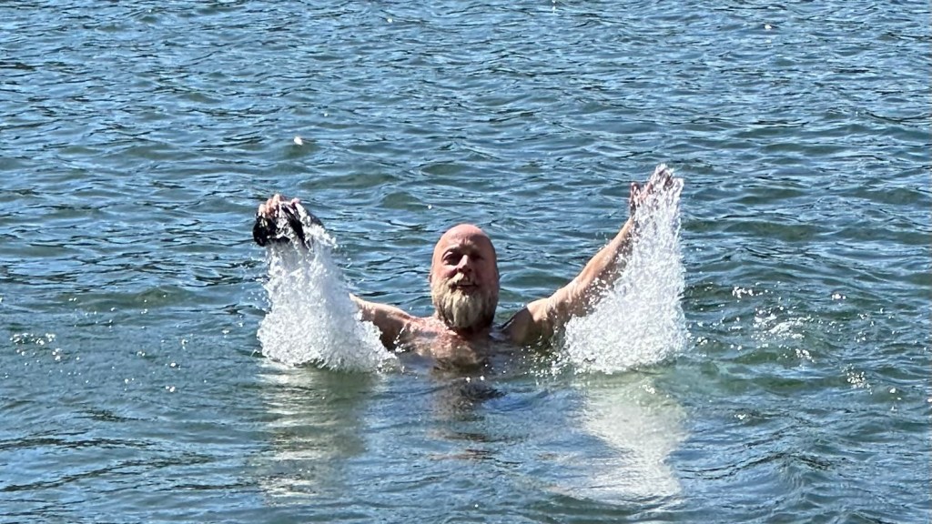
We left the horse camp around 1:25 pm after a long lunch. We only had 5 miles to go and the trail was cruizie. We got to a site by the north end of Timothy Lake around 3:15 pm. We quickly set up camp and went for a swim and also rinsed our shirts and socks in the lake.


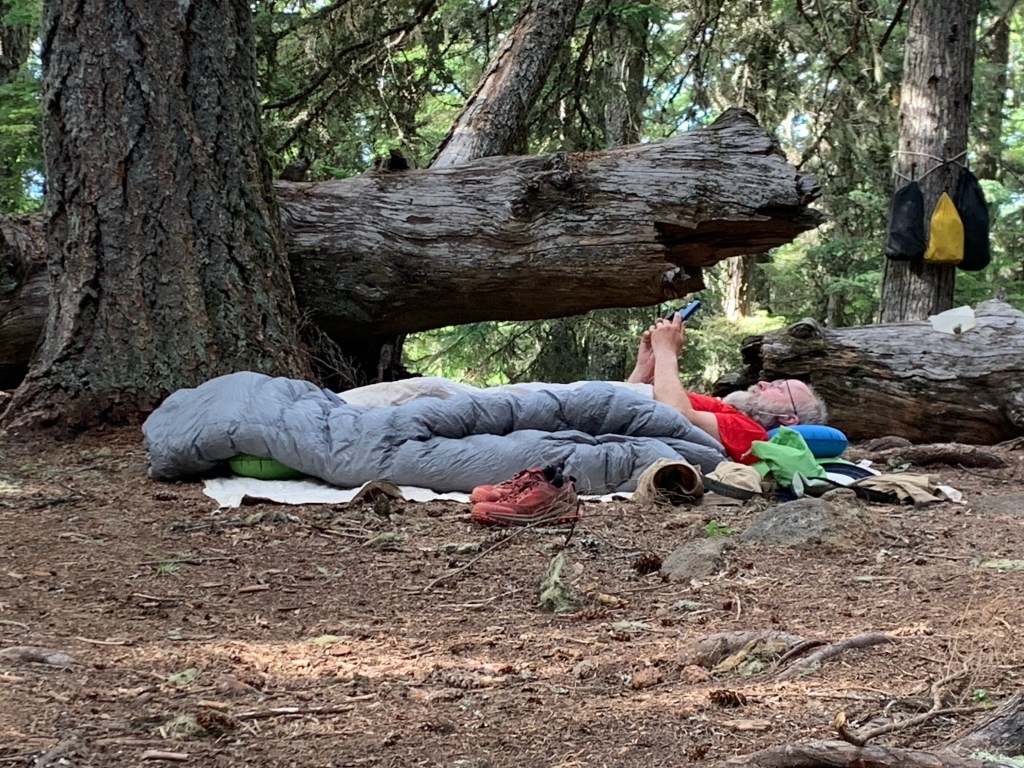
Jeff then announced that he was going to cowboy camp. That means sleeping in the ground without a tent. Now Ellen had the whole tent to herself. We all tried to get to sleep early. It was a good day and tomorrow we’ll be at Timberline Lodge.
Day 123 – Mt. Hood
Start: north end of Timothy Lake – 2080.5
End: Timberline lodge – 2099.6
Miles: 19.1
Ascent: 3956 ft | Descent: 1224 ft
Start time: 6:27 am
End time: 2:45 pm
Current elevation: 6017 ft
Total PCT miles: 1366.6
We had an interesting evening after we went to bed. Jeff was cowboy camping when 3 young European hikers showed up at 7:30 pm, right around “hiker midnight”. Timothy Lake was actually crowded with weekenders from Portland and there were not many options to camp. These new arrivals wanted to set up camp by us because it was quiet. Then they wanted to cook a fish that a fisherman gave them. Jeff said: “No way!” They ended up cooking by the lake and didn’t go to bed until well after 9 pm.
This morning they were up very early and out of campy by 5:30 am. Yay! We got going just before 6:30 am with Timberline Lodge and good food on our minds. Just over 19 miles away.
The trail again was still very smooth with hardly any blow downs. There was again, however, another trail running event ongoing and using the PCT trail. After a while it was getting old hearing runners come up behind us and us stepping aside to let them by. Most of them were polite, but there are always a few who are rude.
After about 9 miles, we were clear of the trail runners we were on our last 10 miles to Mt. Hood. The trail continued to be soft underfoot with few blow downs. However, most of the day was spent in the green tunnel (forest) with occasional glimpses of Mt. Hood.
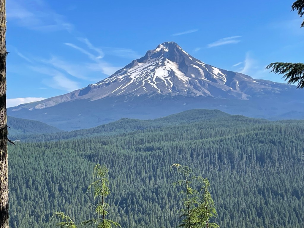
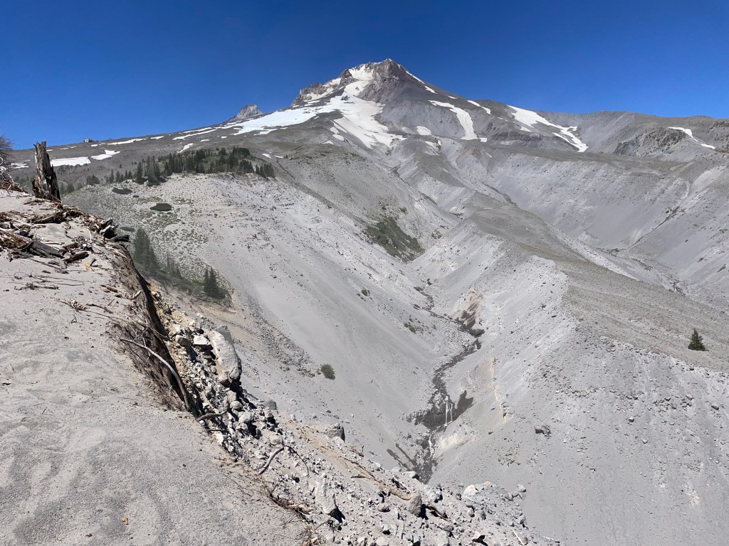
We made great time today. At lunch time we had covered 14 miles with only 5 miles to go. 1.5 miles from the lodge we were above tree line and in full view of the mountain. We saw deep ravines that may have been the result of receding glaciers and deep erosion.
The last half mile took forever! The trail was now soft sand and steep uphill. Timberline Lodge seemed so close but yet so far. It took over 20 minutes to do half a mile which had been taking only 12 minutes.
Timberline Lodge is a famous lodge that has been around since the 1930s. They allow PCT hikers to camp just up the hill in and grove of pine trees. All In pretty much ran to the lodge as he wanted to partake of their lunch buffet. He had found a couple of great tent sites in the pines that gave some cover from the wind.
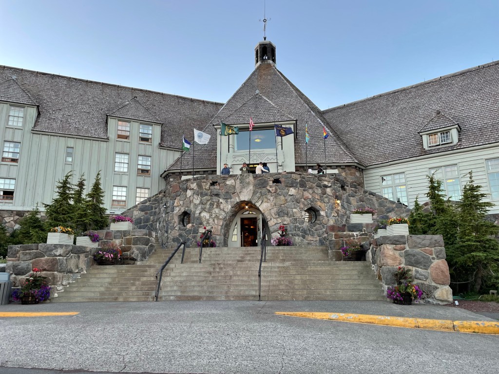

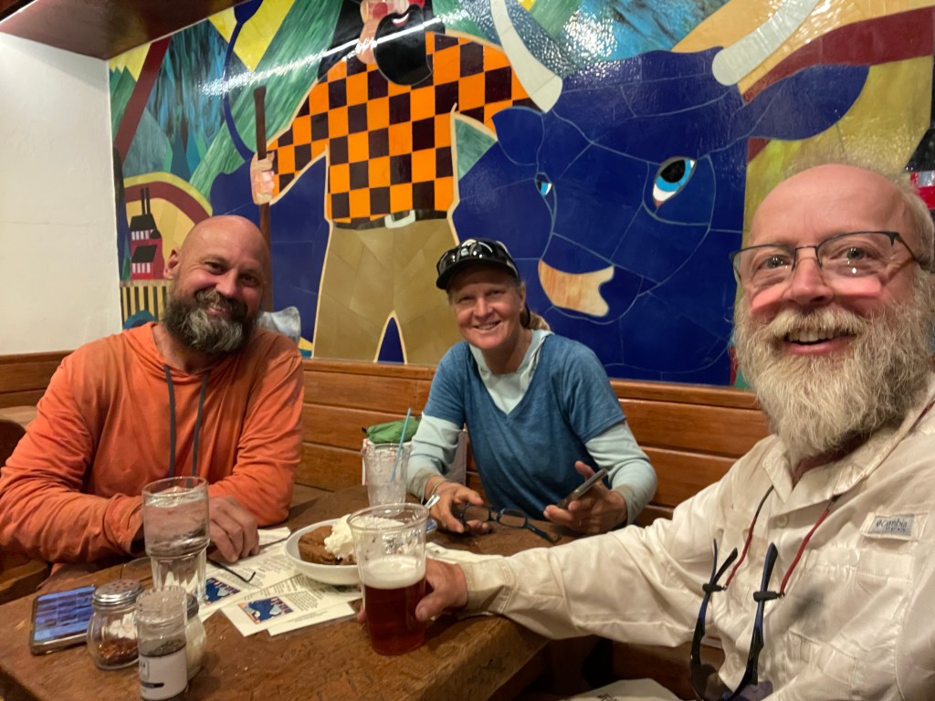
We set up our tents and threw in our packs and off to the lodge we went for some food. We got a pizza and then a very large cookie with ice cream. We then sat around in the lobby to work on videos and the blog while charging our electronics.


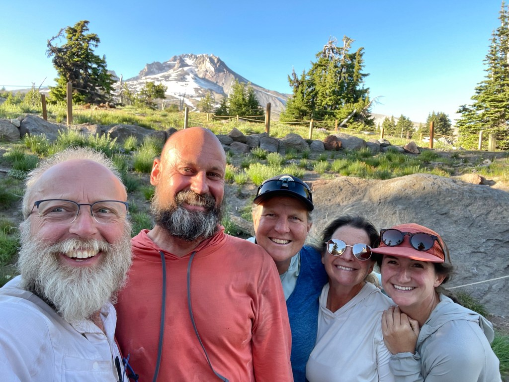
We were happy to see Sherpa Cheryl and TownStop, a mother/daughter team that we met way back in Etna. We chatted with them for a while before they headed back on trail. They had gotten to the lodge last night around 9 pm after a 38 mile day.
Once they left it was time for more food. We went upstairs to the Ramshead restaurant for some sandwiches. Food was decent but not worth the price. After a very later dinner we went to our tents. It was very windy. It was extremely windy so we made sure our tent was staked down good. We were well protected by the pine trees. We didn’t get to sleepy till almost 10 pm.
Here is the next video!

You two are amazing keep pushing on!!!!!
Stacee & Tom Hamm
LikeLike