Day 101 – Another milestone!
Start: Old Hwy 99 – 1719.7
End: south of pond – 1738.0
Miles: 18.3
Ascent: 3325 ft | Descent: 2818 ft
Start time: 8:55 am
End time: 6:46 pm
Current elevation: 4630 ft
Total PCT miles: 1000.6
Our trail angel ride back to trail was scheduled for 8:30am so this allowed us time in the morning to finally finish the video and blog. We had gotten behind because we’ve been with other hikers at camp socializing. Then when we went to bed we were too tired to do our nightly editing and writing.
Anyway, Angela our TA picked us up right on time. She is a new TA but is off ti a great start. She even had a basket in the car with some goodies. Awesome! We got back to the trail head just before 9 am and after the usual photos with our TA we were off.
Tickman (Igor) said he was going to do 20 miles because he needed to be in Crater Lake in 5 days. So we said: “See ya later.” We hope to see him again down the trail.
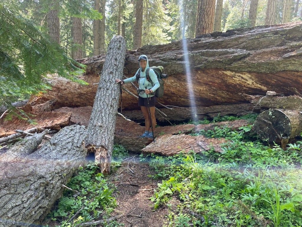
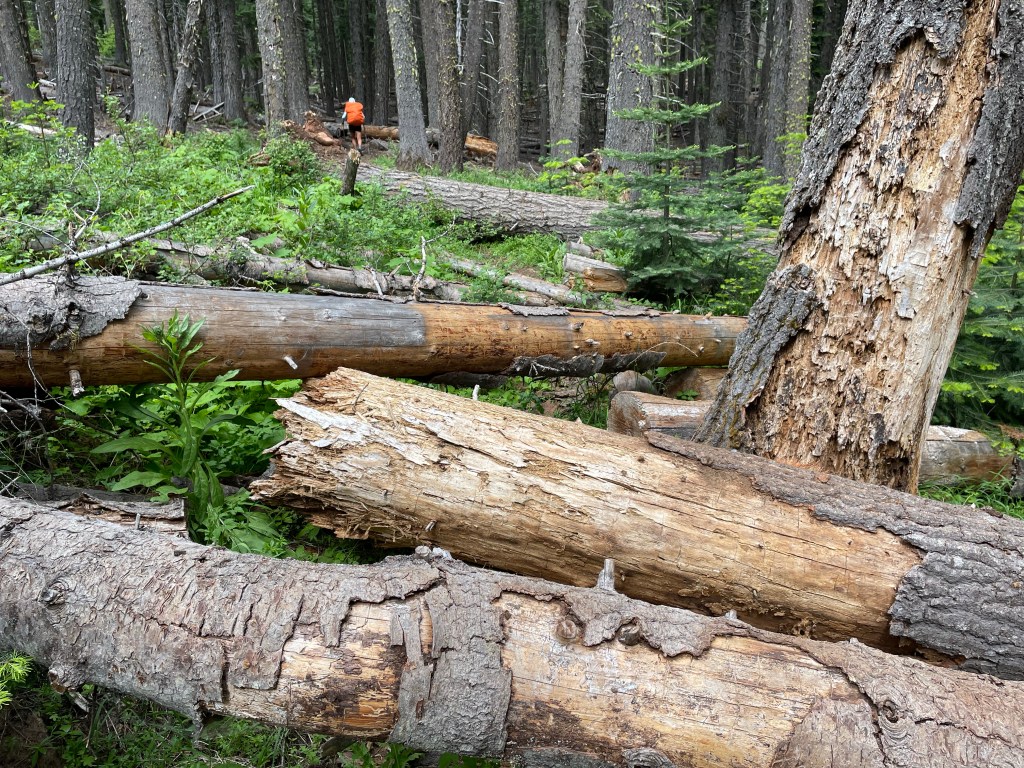
The trail was awesome! It was smooth, no annoying sticks to trip on and most of the blowdowns from this past winter had been cleared by trail crews. We met two PCTA volunteers who had been clearing downed trees from the trail. One thing we have learned so far about Oregon’s trail, the uphill sections are steep, but short.
We saw a few hikers both NOBO and SOBO. In the afternoon we got to Hobart Bluff parking lot with a outhouse. Ellen will not pass up an outhouse. There were also a bunch of cars and people in the lot. The people we’re taking a Master Naturalist course. One of the participants came by us and offered us some snacks. Again, people are so nice.
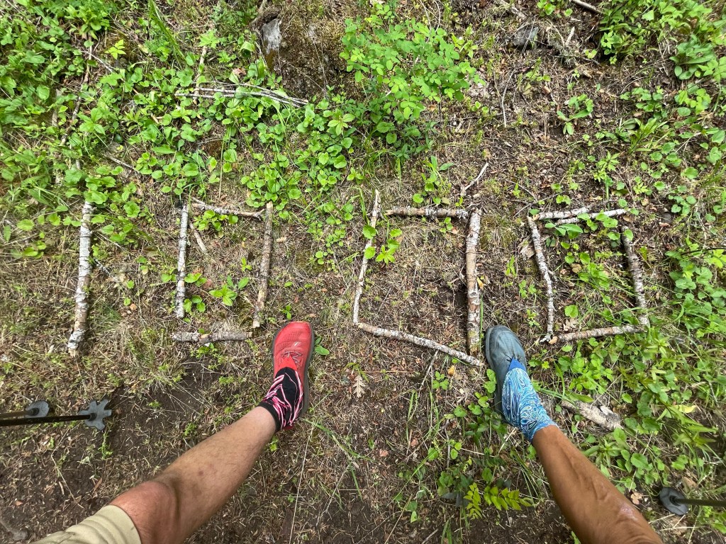
We had a few more miles to go to another milestone for this trip. At 6:07 pm we reached our personal 1000 mile mark on the PCT. We actually had walked more than that, but officially we walked 1000 miles. That just seemed crazy to us, even though this is day 101 of the trip and we had 16 days that were off trail events that really don’t count. Therefore it took us 85 days, including on trail zeros and neros, to walk 1000 miles.
Day 102 – Cruizie trail
Start: south of pond – 1738.0
End: by piped spring – 1756.2
Miles: 18.2
Ascent: 3162 ft| Descent: 2241 ft
Start time: 6:56 am
End time: 4:29 pm
Current elevation: 5695 ft
Total PCT miles: 1018.8
Today started of fairly normal. We packed up and had breakfast and went down the cruizie trail. About a hour in, we met a person who claimed to be a Trail Ranger. He told us all kind of stories that frankly we need to be fact checked. It was interesting encounter.
The trail was similar to yesterday, a forest then an open area and back to forest. We were making pretty good miles despite the many stops for various reasons.
Water sources, however, were pretty far apart. But each time we saw water we filled up 2 liters just to be sure. We are not drinking as much water as we did on prior sections. We think that’s mainly due to the relatively easy trail and abundant shade. No real steep and long climbs.
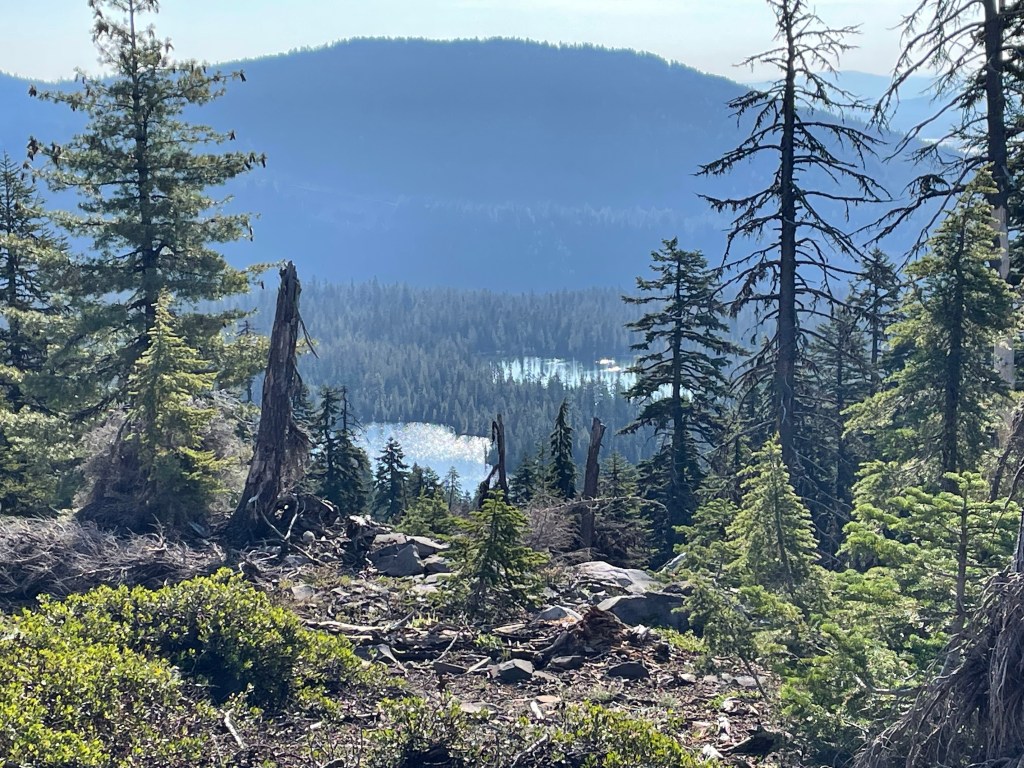
We had a later break so we decided to have a little later lunch at Howard Prairie Lake campground. Of course it had flush toilets and water. We ate our lunch at a picnic table by the lake. The water levels at the lake seemed really low and we only saw one boat on the lake.
We had done 13.4 miles by 1:30 pm and our campsite was only 5.2 miles away. We took our time at lunch and by 2 pm we decided we better get going. Right about their time the sky started to darken and we kept hearing thunder in the distance.
Of course as in typical PCT style, the last 3 miles to calm was steep uphill with many blow downs. We were back in the forest jungle gym again. To be fair, it was actually kind of fun trying to figure out how to get over massive trees with lots of branches. It did make the trail interesting.
We found a campsite around 4:30 pm right by a side trail that leads to spring about 100 yards away. We set up camp and went to spring to get water and wash off a bit.
While eating dinner the sky kept threatening rain. The thunder was getting closer. But after about an hour all of a sudden the thunder stopped. The sun came out and it turned out to be a pleasant evening. The mosquitos were not too bad either. All in all it was good day to be on trail.
Day 103 – Lava fields
Location: Southern Oregon
Start: by piped spring – 1756.2
End: Fish Lake Resort – 1774.2
Miles: 18.0
Ascent: 1799 ft| Descent: 2434 ft
Start time: 6:39 am
End time: 4:45 pm
Current elevation: 4641 ft
Total PCT miles: 1036.8
Today: 18 pct + 2 to FLR = 20 miles
We had full intentions of getting an early start. We woke up at 5 am but somehow we didn’t leave until after 6:30 am. Oh well. Our first task of course was a climb. But recently we’ve found that in Oregon have been pretty easy. But it’s a climb none the less.
We were on the east side of Old Baldy mountain when guess who made one more appearance? Yes, Mt. Shasta showed herself one more time. We did our morning video with Shasta in the background. We were pretty sure that this will be the last time we Shasta.
After the climb it was time to go back down hill. We had about 8 miles to go to the next water source at South Brown Mountain Shelter. As we got closer to the shelter the trail got wetter. Last night’s thunder actually dumped a LOT of rain just a few miles north of where we were camped. The trail was also overgrown with now wet bushes. We were getting pretty wet and it still was a pretty chilly morning.
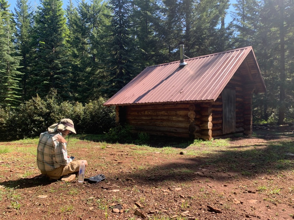
Once at the shelter, we sat in the sun to warm up. We also got some water from the well. The shelter is actually a cabin maintained by the local snowmobile club. It was pretty cool.
Aside from the trail being wet, it was mostly clear of blowdowns. We cruised right along and by lunch time at 11:30 am we had already done 10.3 miles. We only had 7.7 miles to the junction to Fish Lake Resort. We thought that we’d be at the resort by 3 pm.
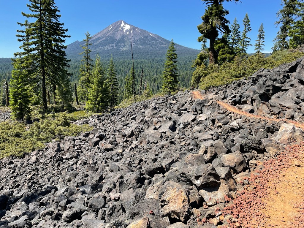
Wrong! As soon as we rounded the corner from our lunch spot and last water source for the day, the lava fields started. The trail designers created a trail right across the fields and used smaller rocks for the path. The bad thing was that the we felt most of the rocks right through our shoes. The good thing was that we had new views of Mt McLaughlin.
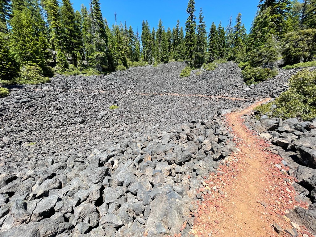
What we thought would only take 3 hours turned into a 4 hour long afternoon. Jeff’s shoes are on their last miles and he really felt every rock. We made it to the junction around 4 pm. We still had 2 miles to the resort. The path to the resort was heavenly. A wide smooth path.
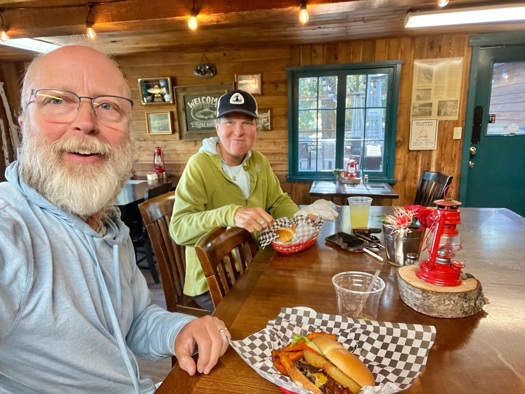
Once at the resort we ordered burger and fries. We also did a small resupply. The choices were limited as a big group of hikers just had come through and bought most of the food. But we managed. They offered free PCT camping on the other side of the lake.

Day 104 – Oregon blues
Start: Fish Lake Resort – 1774.2
End: top of climb by Fly lake – 1793.0
Ascent: 2676 ft | Descent: 1038 ft
Start time: 6:56 am
End time: 5:22 pm
Current elevation: 6550 ft
Total PCT miles: 1055.6
Total miles today: 18.8 PCT miles + 2 miles from Fish Lake = 20.8 miles
We had a nice quiet night by the lake. Neither one of us wanted to get out of bed. We stayed up way too late as the sun doesn’t set until after 9 pm.
However, we finally got going just before 7 am. First we had to walk the 2 miles back to the PCT. As we’re hiking along, Ellen heard a noise in the woods and saw a bear. She told Jeff but he only saw a flash of something moving. The bear was running and crashing through the woods. It’s back was light colored and it looked like it was a good size bear. Sorry no pictures as it as happens so fast.
On the other side of the highway the trail went alongside a beautiful fast flowing creek. Then it was time for the green tunnel walk.
For the entire morning we only had a couple of views of Mt. McLoughlin but the remaining time was looking at trees, climbing over downed trees, and fighting mosquitos. We were both getting bored with this section of trail. This is what PCT hikers call the “Oregon blues”.
We had a quick lunch at a spot that had a little breeze to keep the mosquitos at bay. After lunch we only had 7.8 miles to go but they were long miles. The trail was littered with blowdowns and the mosquitos were relentless. We also were each carrying 3 liters of water as there was not water for 15 miles.
The snow also made a reappearance and caused us to loose sight of the trail. This slowing us really down as we had to frequently check our position and navigate through the woods. We should be seeing more snow tomorrow.
We finally made it to camp and found a site that’s a little open and not in the woods. We’d hoped that the mosquitos would not be so bad, but we were wrong. We ended up eating in the tent. After dinner we quickly cleaned up, brushed our teeth and down back to our sanctuary from the mosquitos.
Day 105 – The views and snow are back.
Start: top of climb by Fly lake – 1793.0
End: outside burn area – 1811.1
Miles: 18.1
Ascent: 2369 ft| Descent: 2910 ft
Start time: 6:54 am
End time: 5:48 pm
Current elevation: 6045 ft
Total PCT miles: 1073.7
We woke up a few minutes later as usual. Guess what, the mosquitoes were still at camp. We didn’t boil any water as all we wanted to do was get going and out hike the mosquitos. As we were packing, our neighbors about 100 ft from us asked if we saw the “visitors” early this morning . Apparently, three bears were in their camp at 4:30 am. They also said one of bears was close to our camp. We didn’t hear a thing. We were both sound asleep with earplugs. Maybe ignorance is bliss?
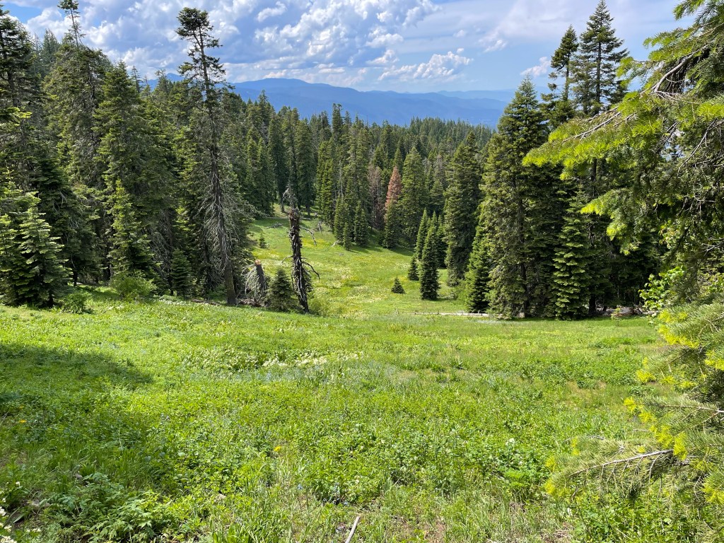
We finally got going after that excitement. After a half hour the terrain totally changed. We were now on a ridge in burn area from a 2014 fire. There was a breeze and the mosquitos were gone! Plus we got some views of 4 mile lake, Mt. McLoughlin, and surrounding mountains. This made a positive change in our attitudes.
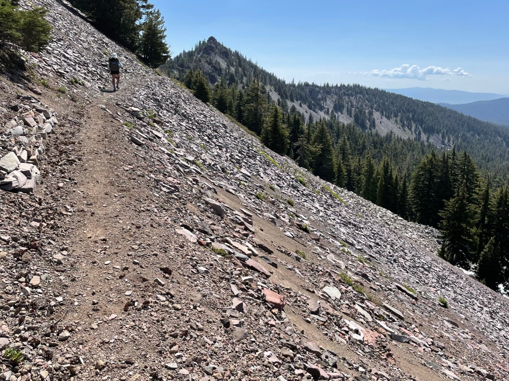
We had about a 4 mile ridge walk until we reached a saddle next to Devil’s Peak and a steep area rumored to be holding significant snow. Once at the saddle we indeed saw lots of snow. However, we also saw that people glissaded down from the top. The consequences were not high and the traverse looked fairly straight forward.
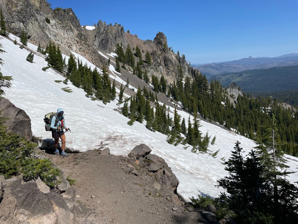
We put on our crampons and our whippet picks were already on our poles. Jeff went first and kicked in some good steps. The snow was soft but firm enough for our crampons to bite. It wasn’t bad at all and Ellen’s confidence on steep snow was returning.
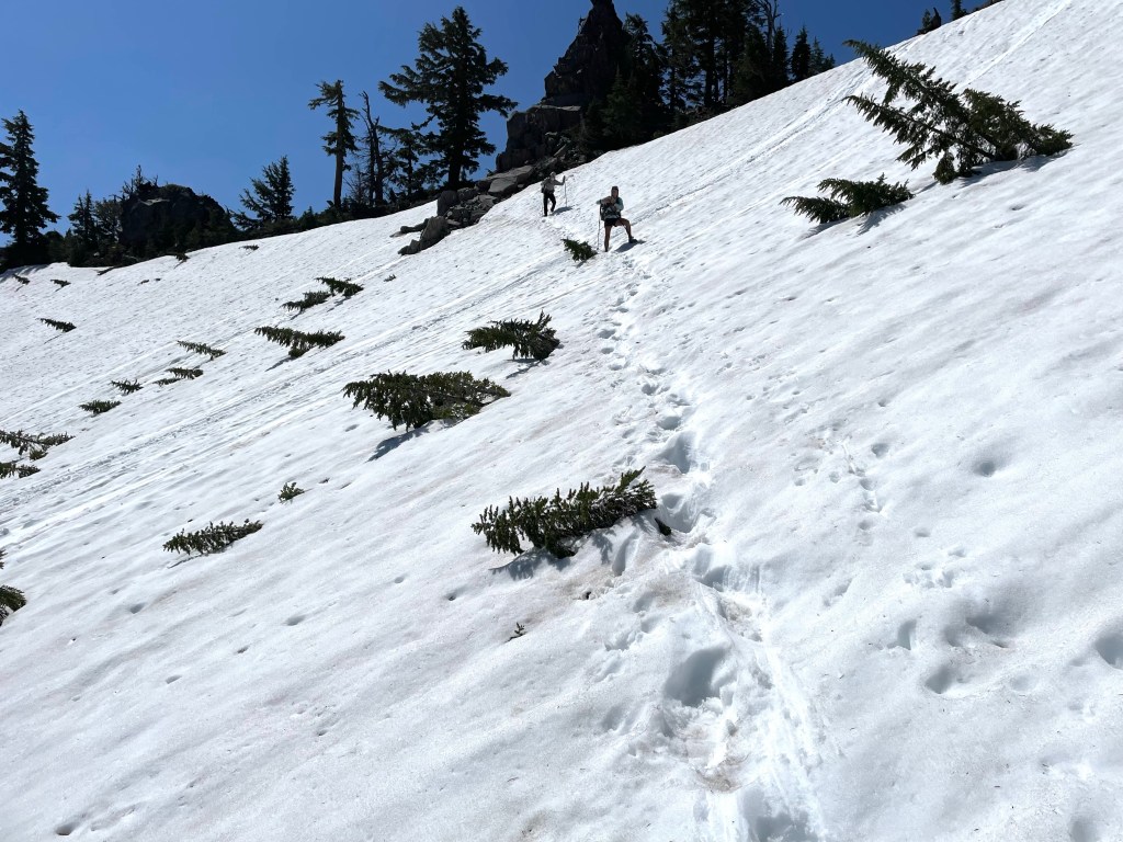

Once down the initial decent we had more snow through the woods but nothing crazy. For the next couple of hours we made a slow decent as most of the trail was snow covered. We got to a stream of snow melt and decided to have lunch.

Our next water source was Honeymoon Creek and then there would be nothing until Crater Lake. We loaded up on water for the rest of the day, for dinner, and for tomorrow morning. We still had almost 8 miles before camp.
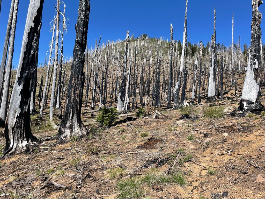
The last few hours of the day was spent walking through the burn area of the 2008 Middle Fork Complex fire. It looked like that fire burned really hot as most of the trees were scorched and the ground was black. The good thing was there was a breeze and the skeeters were gone! Yay!
The last few hours of the day did drag on a bit as both of our feet were toast. They were tired. We have been doing some big miles lately and our feet are feeling it.
We found a nice flat and level spot just off trail. we set up camp, made dinner, attempted the wash our feet, and crawled in our tent once the mosquitos got bad. All in all, it was a good day.
Day 106 – Mosquito hell!
Start: outside burn area – 1811.1
End: Crater Lake – 1822.7
Miles: 11.6
Ascent: 1675 ft| Descent: 1387 ft
Start time: 6:54 am
End time: 1:56 pm
Current elevation: 6020 ft at Mazama CG
Total PCT miles: 1085.3
Today: 11.6 PCT miles + 1.2 trail to Mazama CG
We got up to no mosquitos for about an hour. We were able to have breakfast in peace. But then the sun came out to our campsite and here they came. Buggers!
We hiked for a few more miles in the burn area from the 2008 fire. There were tons of blowdowns. Seeing all those dead burned trees was sad but we realized that is nature. Good thing was, no mosquitoes.
Around 11 am we made it to the southern border of Crater Lake NP. The burn area continued for about a mile but then the trees came back. With the tree cover also came the snow. The terrain was fairly flat but there was lots of snow on the ground. It was slow going and frustrating as we kept loosing the trail.
Also, with all the snow and the warm temperatures the mosquitoes were out in full force! It was actually worse when we were walking on the snow. We walked a few hours in the forest with the trail snow covered.
We made it to highway 62. We could have walked the highway straight into Mazama Village, but we opted to continue on the PCT and then the Annie Spring trail into the village.
Once at the village we scoped out the area. Found out the post office is at the park headquarters, a 4.1 mile road walk. Yuk! First thing of course was find the restaurant and eat! We each had fish and chips.
We were able to take free showers and do laundry. They offer PCT hikers a free area to camp but it was a ways down the road and the bathrooms were still closed. We opted to stay in the paid camp area close to the restrooms and camp store.
We hung around the store for the free wifi along with several other hikers. By the store there was a charging station for the hikers.
We had a later and light dinner when we saw Tickman in the restaurant. He got to Crater Lake the day before and will be going back on trail tomorrow. We hung around the restaurant a little bit more just to stay away from the mosquitoes.
Day 107 – “zero” day at Crater Lake
Start: Crater Lake – 1822.7
End: Crater lake – 1822.7
Miles: 0.0
We got up lazily since the cafe didn’t open until 7 am. Today was all about planning for the next couple of sections, seeing Crater Lake and having fast wifi to upload video and the blog.
We had a yummy breakfast and then spent a small fortune at the camp store for our resupply. We should have mailed boxes of food here instead.
We went back to our campsite and sorted most do our food. We then took the free trolley to the park headquarters and post office. We mailed home our crampons and some other items and picked our microspikes which Ellen’s brother had mailed to us.
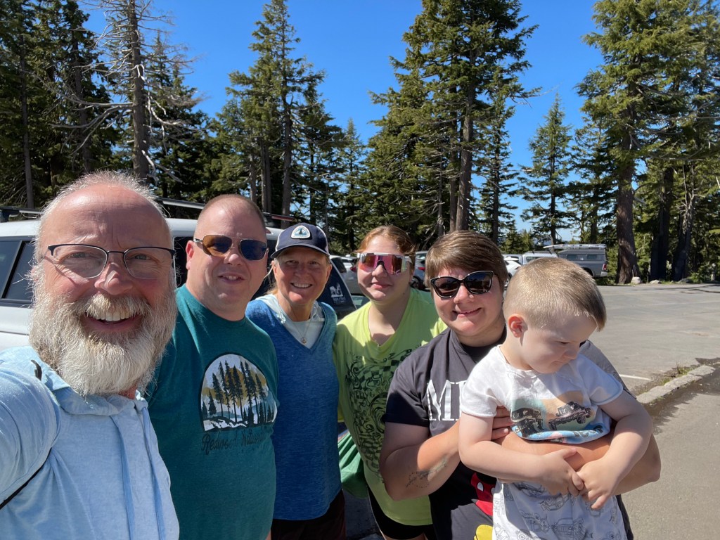
We then needed a ride to the actual lake. After about 10 minutes, Brian and Irena and their kids picked us up. They figured we were PCT hikers.
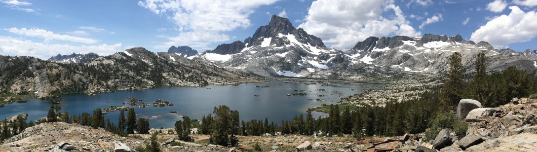
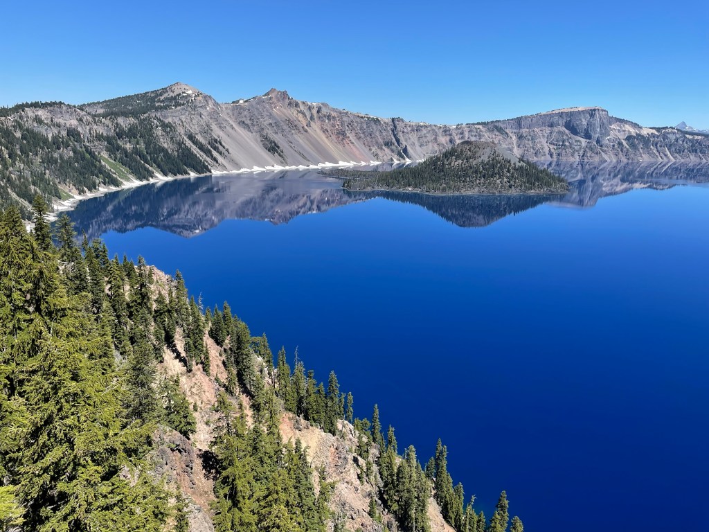
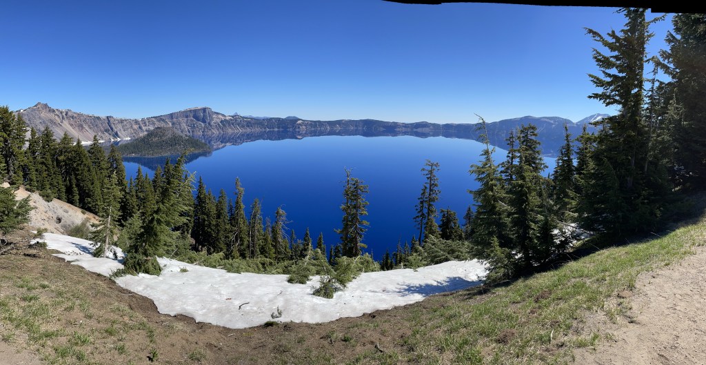
We walked up to the rim of Crater Lake and it felt just like walking up to the rim of the Grand Canyon for the first time. Crater Lake blew our minds away. It was gorgeous. The water is sooo blue. We would walk 10 feet and take a picture, walk 10 more feet and taken another picture. We’d walk a little bit along the rim and the view would change. The lake was like glass and all the surrounding mountains were reflected into the lake. It was beautiful.
We walked around a little bit and then got some lunch at the cafe. They had an upstairs room that for some reason had the heat on. We found a corner spot with a small view of the lake where there was an outlet and spent the next few hours charging our electronics and working on the blog and video. We opened up the windows to get a breeze coming into the room.
Before we knew it it was time to go back to Mazama village. We almost missed the last trolley down the hill but they waited for us. Once back at the village it was about time for dinner.
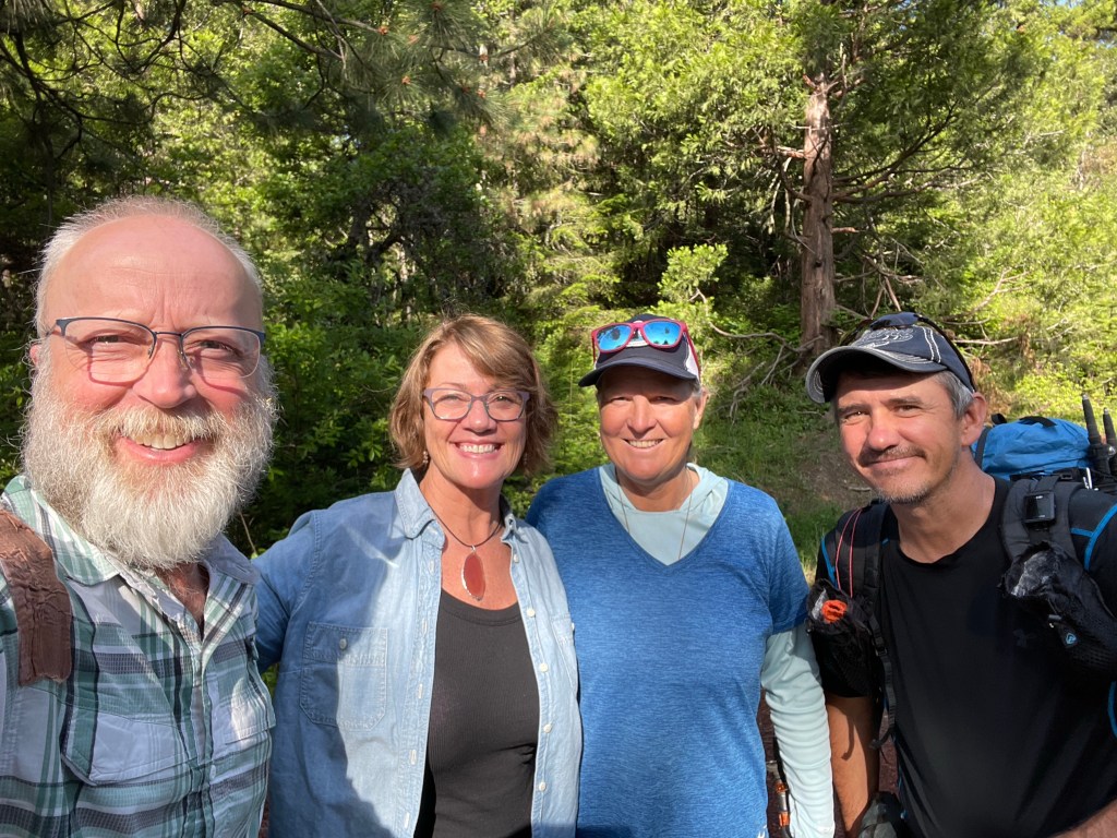
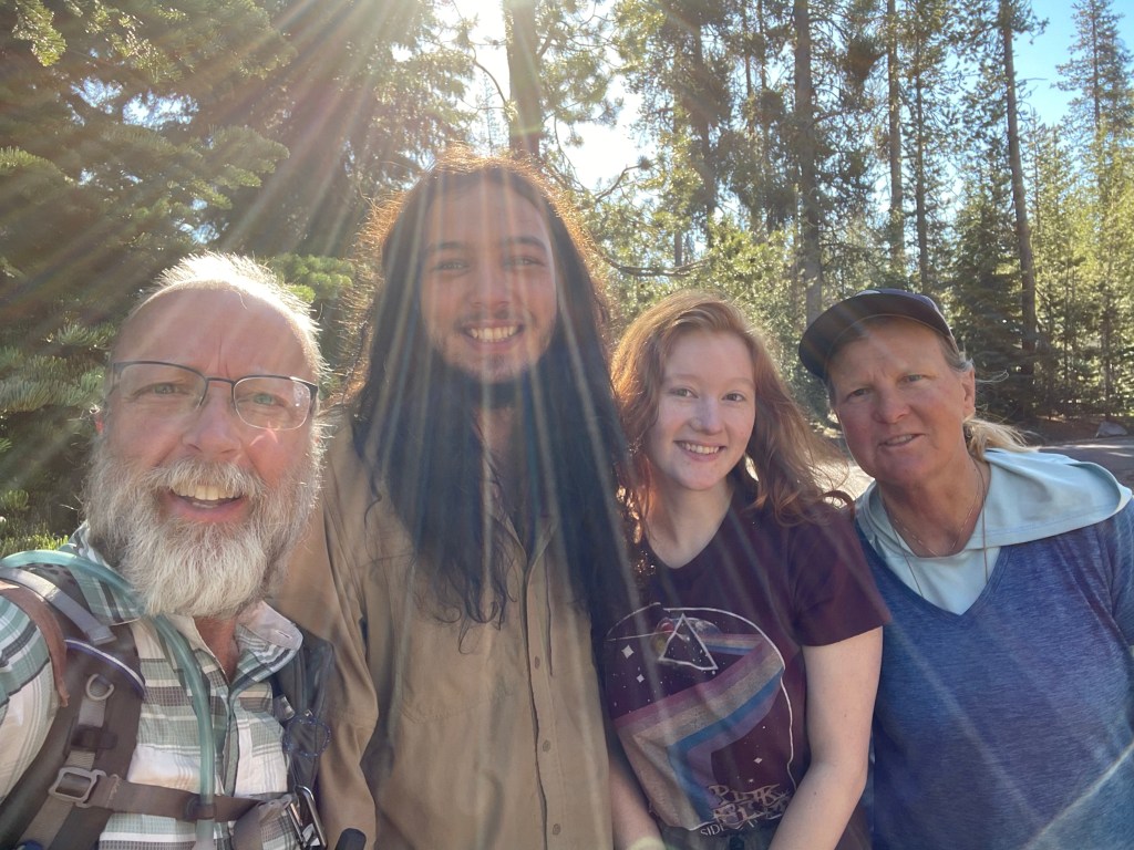
We walked over to the restaurant and saw a couple of hikers we had met a few days ago who we thought had continued on. Isaac (Bowie) & Hannah got to the rim and then realized that the next section would have more snow. This was Hannah’s first ever backpacking and she had enough of the snow. So they are flipping north and continuing their Oregon hike near Mt. Hood.
Since yesterday, a whole lot of hikers have shown up and the free PCT camping was about full. We had purchased a campsite near the open bathrooms and offered up some space at our site to Isaac and Hannah. The took us up on our offer. They pitched their tent and went to the store to get the ingredients to make s’mores. Jeff had made a fire with the firewood that was left in our campsite bear box.
We spent the rest of the evening getting to know each other and eating lots of s’mores. Tomorrow it’s back to “work”.
Here is the next video!

Hi Jeff and Ellen,
Hooray you made it to Oregon! I lived in Grants Pass (about 45 minutes north of Ashland) for 19 years. As a reminder, I’m happy to be your Trail Angel when you arrive at Cascade Locks – just let me know approximately when that will be. I work 7:30-4PM, but can make arrangements as needed. Only time I’m unavailable is July 14-16 when I’ll be backpacking at Mt. St. Helen’s. Enjoy a photo of my sister, her husband, and me snowshoeing last December at Crater Lake (attached). I think I gave you my contact info, but in case not, here it is again – 541-660-3152. Call or text. 🙂 Aside from the mosquitoes, the PCT through Oregon is beautiful – especially when you get near Three Sisters!
I think I gave you my contact info, but in case not, here it is again – 541-660-3152. Call or text. 🙂
Maureen O’Bryan
LikeLike