Day 96 – Isn’t it summer?
Start: Seiad Valley-Wildwood RV park – 1657.4
End: Seiad Creek road jct – 1671.8
Miles: 14.4
Ascent: 5466 ft | Descent: 1892 ft
Start time: 7:03 am
End time: 4:13 pm
Current elevation: 4635 ft
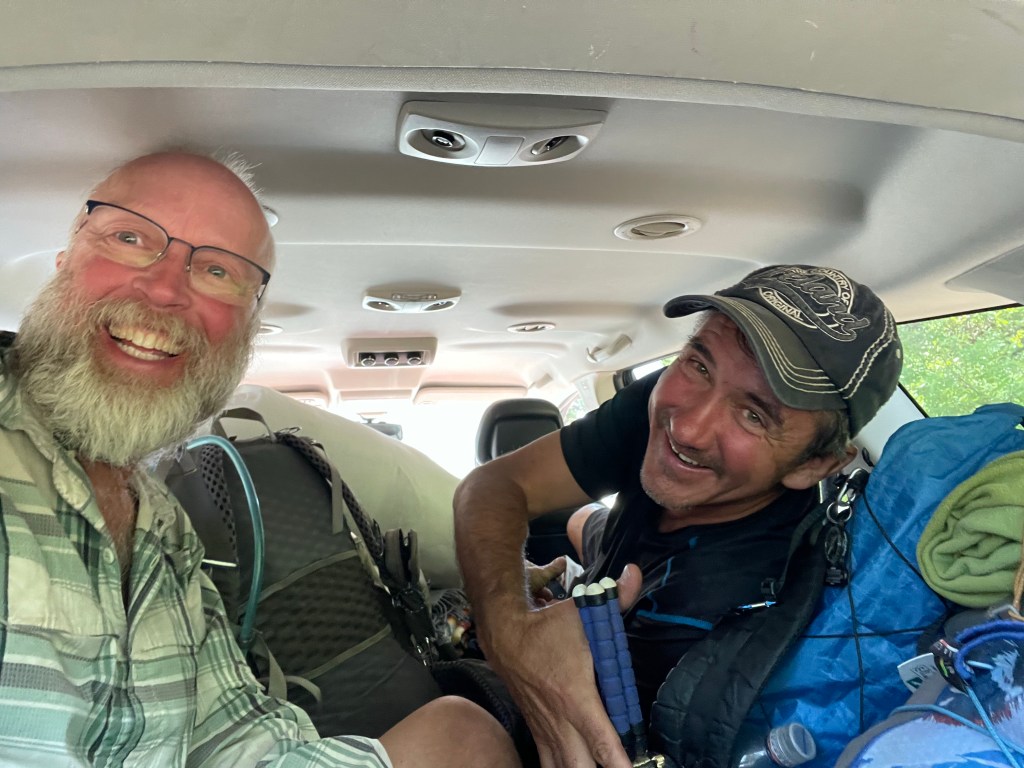
It rained a little before day break and that should have been a hint of what the day would be like. We got going just after 7 am after thanking Lehel and saying goodbye. We totally forgot to take a picture with Lehel and Cherry or any pictures with Bill last night.
The climb out of Seiad Valley is known as one of the steepest and longest climbs on the PCT. And they weren’t kidding. It was steep! Lehel also warned us about ticks for the first couple of miles. As we went through some of the tall grasses we checked our legs often for ticks. None were found! Yay! We did see a lot of poison oak in the first mile and stayed away!
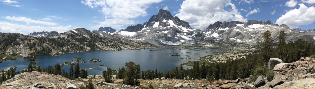
The climb was steep but it gave us beautiful views of the valley below us.
A couple times we ended up on a ridge and saw the valley in the other side that was just as beautiful. The trail in some sections was so overgrown it was hard to see the trail at all.
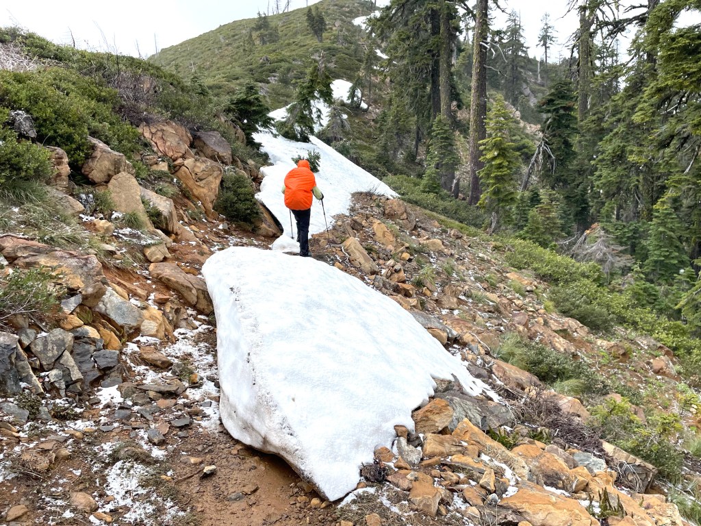
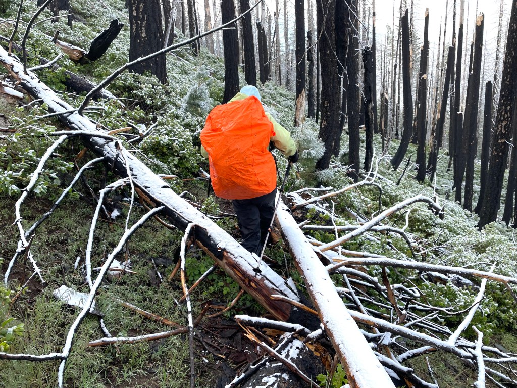
Around 10 am we noticed a change in the sky and weather. The temperature started to drop and the sky was gray and it looked windy. We rounded a corner and saw what was coming. We put on our rain jackets and a few minutes later Ellen put on her rain pants because it had started snowing! We couldn’t believe our eyes. It’s June 19 and we are in the middle of a snow storm.
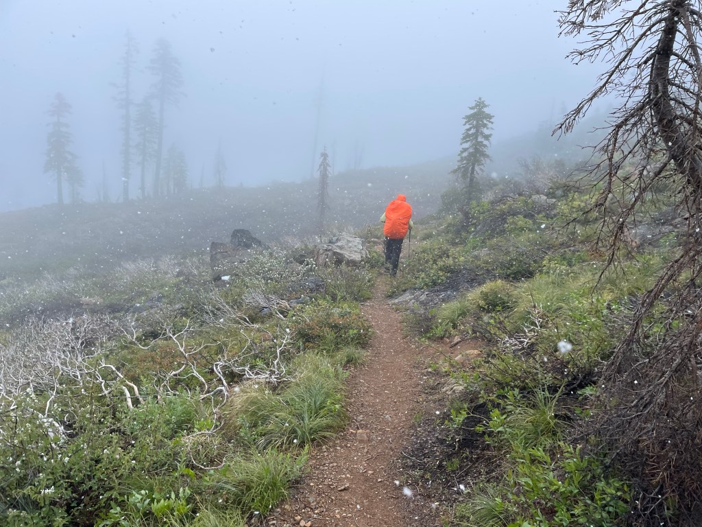
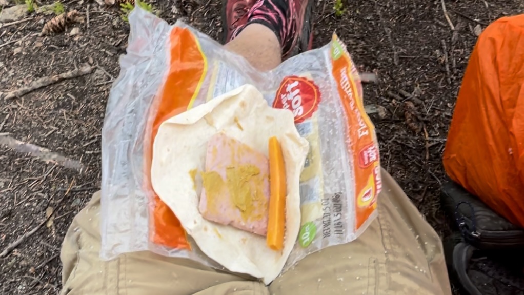
In between snow squalls the sun would peek out and warm us up just a little. At noon we were hungry so we found a couple of trees with small dry spots underneath. We quickly ate lunch as the snow and now hail was starting to come down again. The snow and hail by themselves were fine, it was the wind that made it a lot colder.
After a couple hours we made it to Kangaroo Spring. We filled our water bottles as we had 4.8 miles more to our intended campsite.

As we continued to hike the snow and hail kept coming down. It was pretty but we were wet and starting to get chilled and wanted to get to camp. The last 2 miles was all downhill with many blown down trees and some snow.
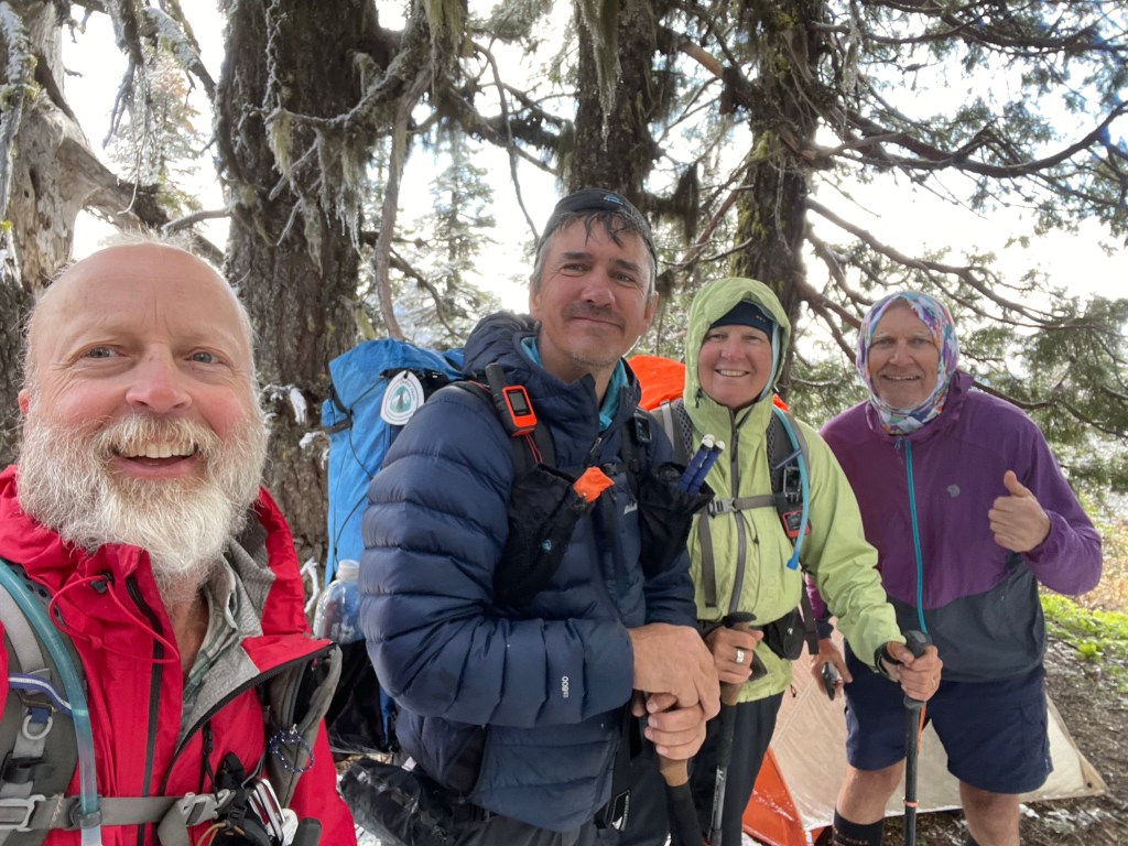
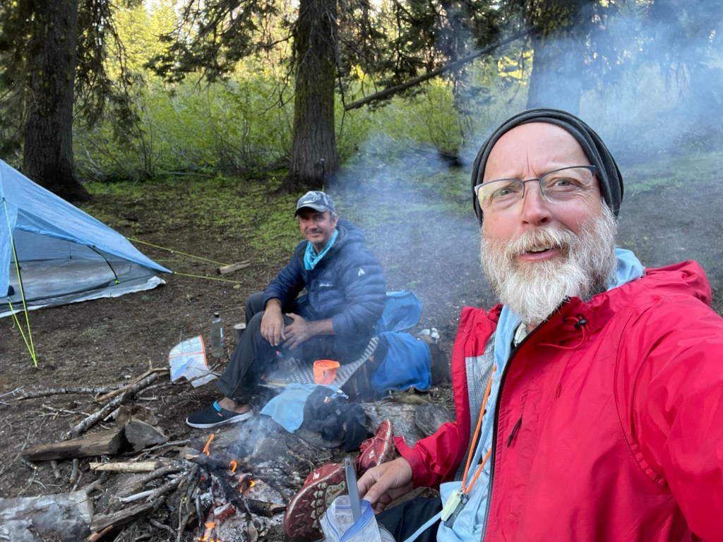
We finally made it to the junction with Seiad Creek (dirt) road, where to our surprise there were already two other tents. We were impressed for see that one hiker had made a small campfire. We talked to Igor (trail name “Tick Man”) and learned that he is a Russian born Ukrainian who left in Russia in 2010 and now lives in Florida.
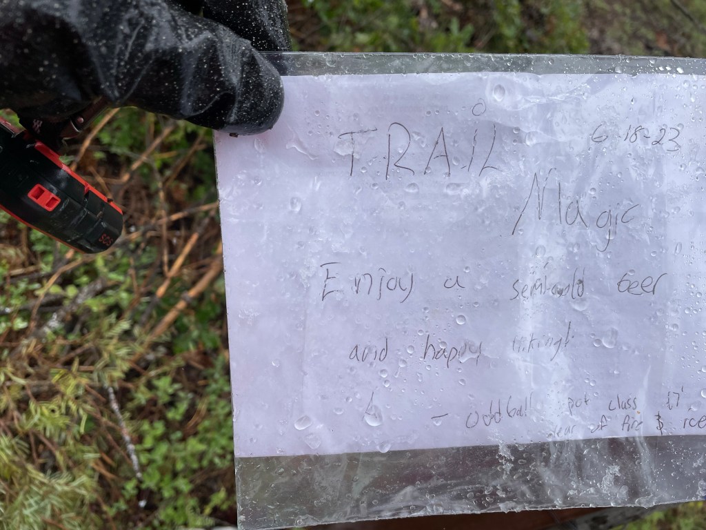
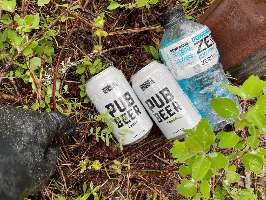
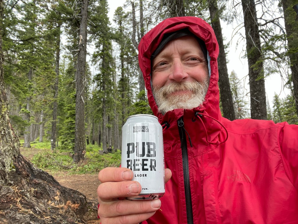
Across the road where the trail resumes, Jeff saw a note posted to the sign. The note was from a 2017 PCT hiker who had left some “trail magic” there in the form of some beers and Gatorade. Nice! Jeff grabbed a beer to drink with dinner.
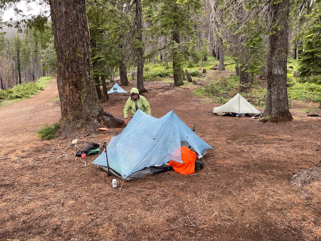
We quickly set up our tent and made dinner when the snow and now rain had stopped. As soon as we finished dinner the rain started again. We cleaned up and dove into the tent and into our sleeping bags. Carefully not to get everything wet from our rain gear.
It was supposed to be a cold night with rain continuing on until late into the evening. We have not had this cold of a day and night in a long time. Today also ended up being our biggest ascent day of the trip.
Day 97 – It’s raining but it’s not.
Start: Seiad Creek road jct – 1671.8
End: Bearground Springs – 1688.7
Miles: 16.9
Ascent: 3596 ft| Descent: 2504 ft
Start time: 7:03 am
End time: 5:15 pm
Current elevation: 5959 ft
All of the trees and vegetation were wet from the past day’s snow and rain. Now hiking through it all, we were quickly as well.
The next several miles had some of the most frequent blowdowns we had yet seen on trail and also some of the most difficult to get past. The downed trees were intertwined and covered in an inch or two of new snow.
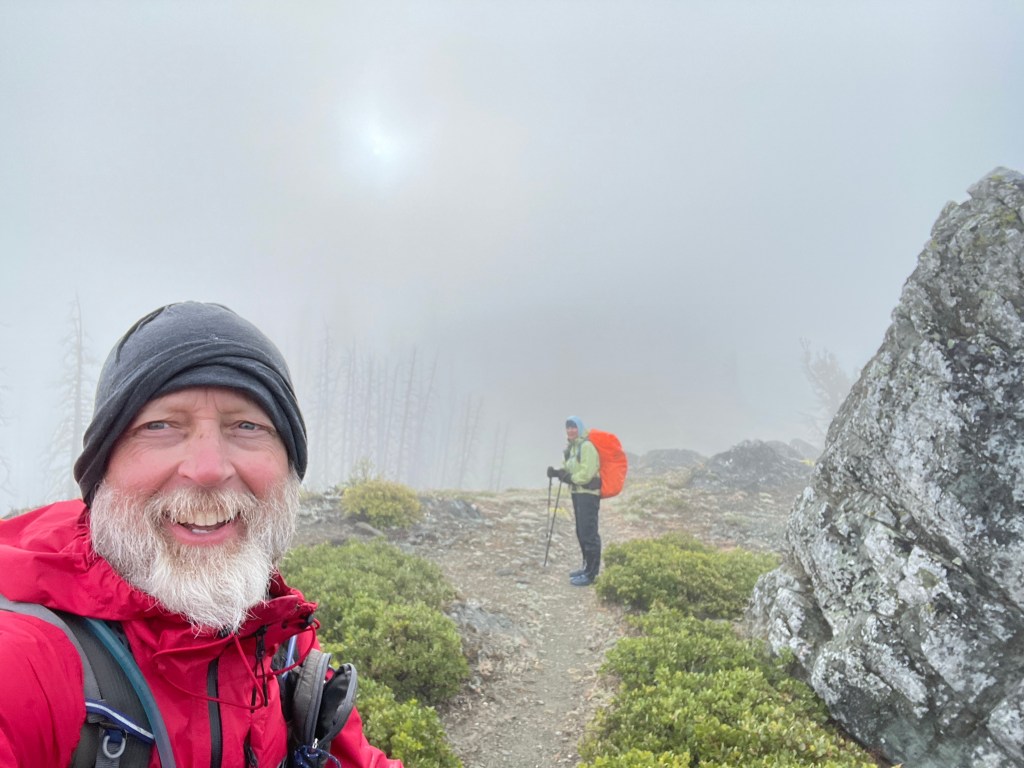
A little further up the trail, we caught up with Igor who was talking with “Taiwan Dale” who was just breaking camp.
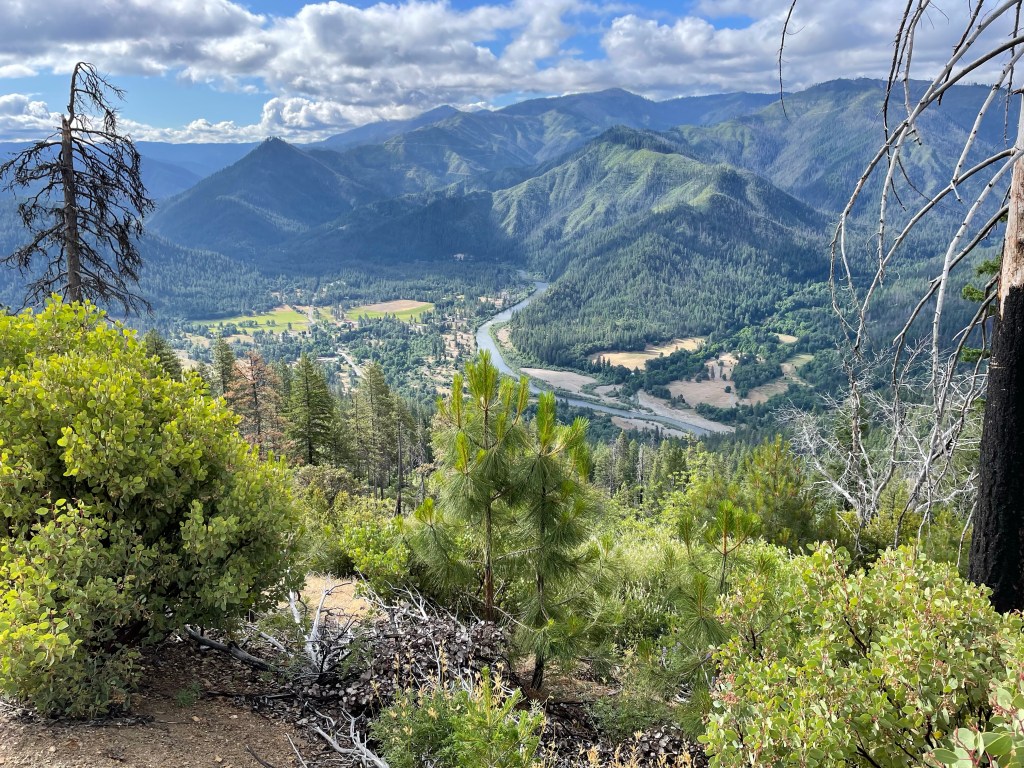
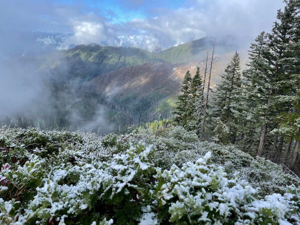
Once at the bottom we decided to take the forest service road that paralleled the trail for two miles. This avoided the trail that was still covered with snow on a steep grade. Taking this road walk also had the advantage of providing great views of the valley below and the mountains in the distance. That includes Mt. Shasta, yes she keeps peaking at us.
As we ascended in elevation, we encountered more snow. Up to three inches had fallen the day before, and now all that snow was melting from the trees and soaking us from above as well as below.
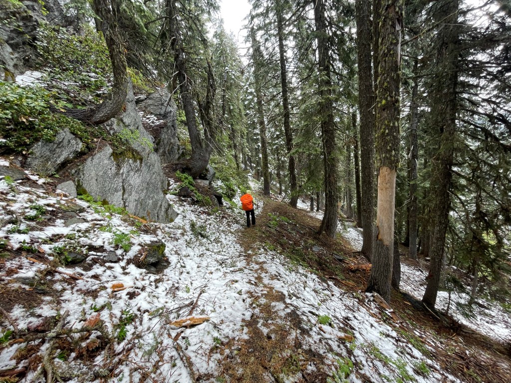
Some parts of the trail, especially on the north facing slopes, still had continuous snow and snow drifts from winter. We avoided one of these sketchy areas by hiking a forest road which parallels the trail but atop the ridge. This was a safer route but was still snow covered and very slow going.
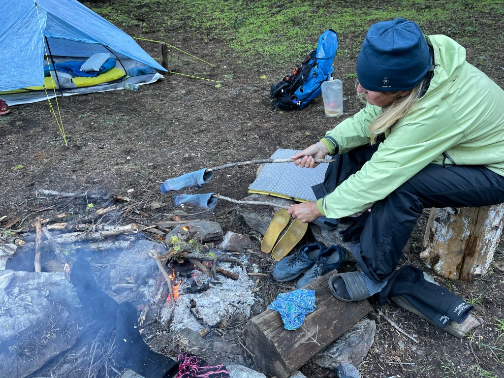
Eventually we arrived at our intended campsite and found that Igor was already there and had a fire going again. Very much appreciated! Later, Taiwan Dale arrived, followed by a French hiker who Carrie’s a small teddy bear and thus named Teddy Bear. The five of us enjoyed Igor’s fire, talked, and dried out some clothing.
Day 98 – Summer Solstice and welcome to Oregon.
Start: Bearground Springs – 1688.7
End: Grouse Gap shelter – 1709.2
Miles: 20.5
Ascent: 3931 ft| Descent: 3222 ft
Start time: 7:06 am
End time: 6:25 pm
Current elevation: 6242 ft
Total PCT miles: 971.8
We woke up to a very cold morning but with blue skies. Once again, Igor already had a fire going. It was great to eat breakfast by a fire for once.
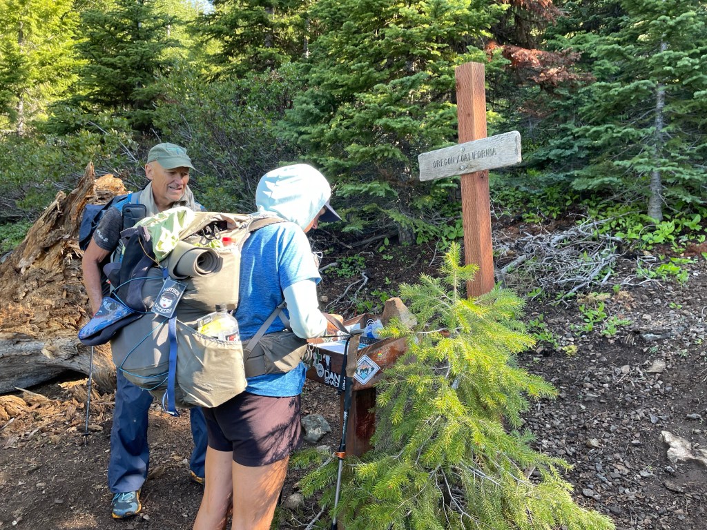
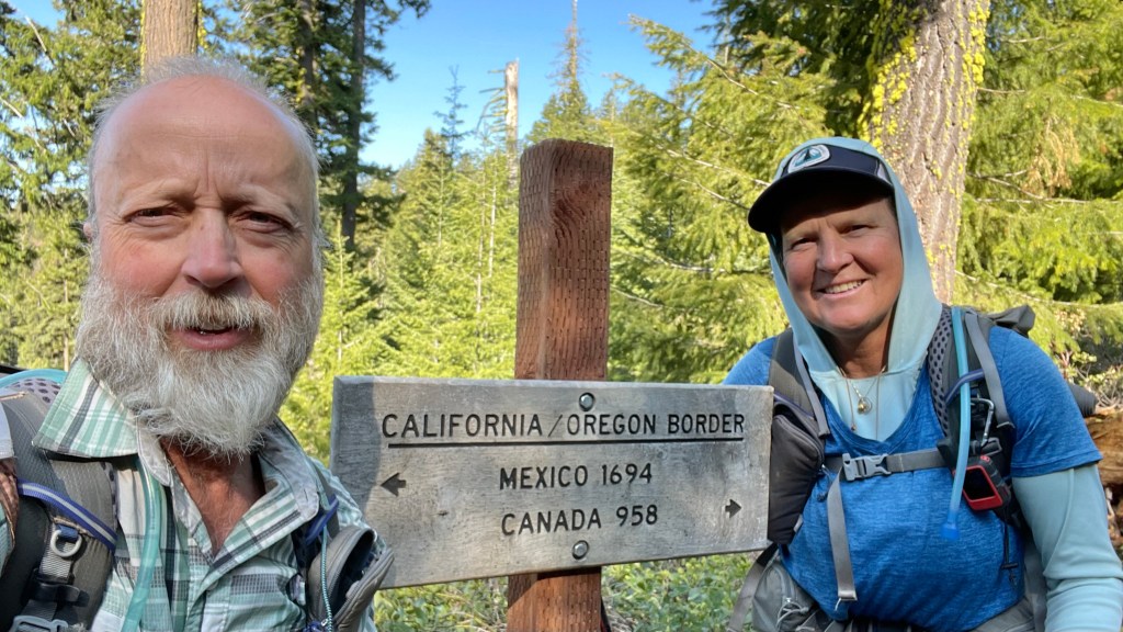
Along the first few miles out of camp the trail was a mess … Blowdown City! It took us three hours to go less than 2 miles. After 3.9 miles we made it to the California/Oregon border. We signed the trail registry and took some pictures.
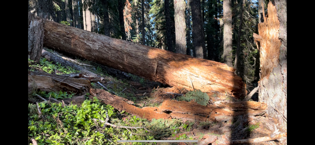
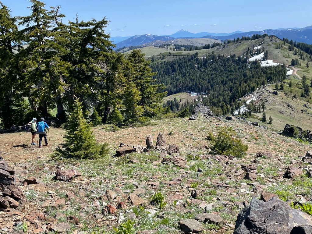
For the first few miles in Oregon the trail still had numerous blowdowns. After that the trail was amazing. It was clear, smooth, and gently graded through the woods.
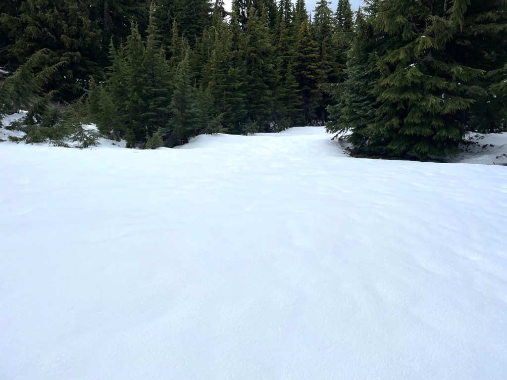
When we got to Observation Peak the trail was under deep snow on the slopes below the ridge. We decided to walk along the top of the ridge instead, on the rock above the snow or at least far from the snowy edge.
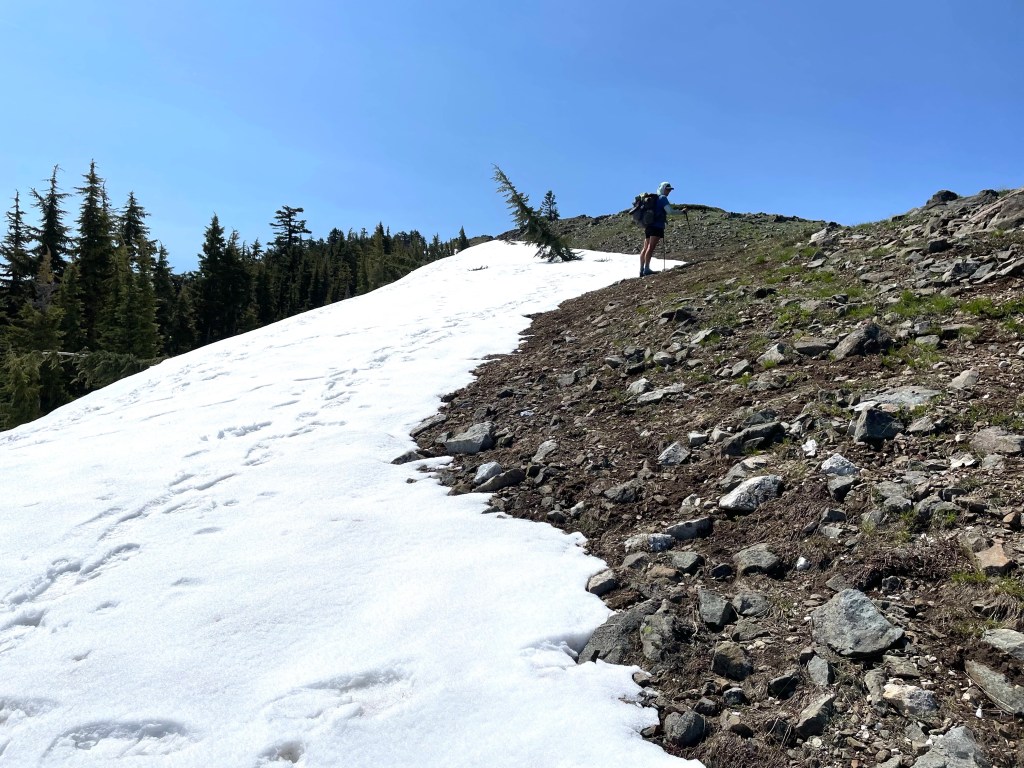
How, now that we were on the peak, how to get down? Although steep and rocky, it looked feasible to scramble down the other side. This was still much safer than walking on the sketchy snow and it did eventually lead down to the trail.
Once back on trail we did lunch before going around Big Red Mountain. The trail was great. On the north side there were several sections of trail covered in snow that we had to traverse. But there was no exposure to steep long slopes and so that helped Ellen get some of her confidence back.
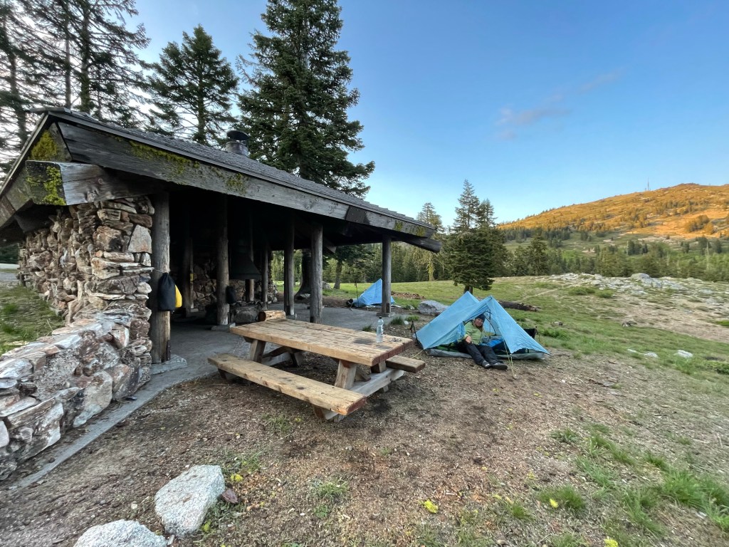
Once around the mountain the snow was pretty much gone. We hiked for another 6 miles to our campsite for the night. We stayed outside a stone shelter with an outhouse nearby and picnic table. What a treat!
So far the PCT in Oregon has been delightful. Smooth trail with great views.
Day 99 – Summer solstice and Oregon
Start: Grouse Gap shelter – 1709.2 End: Old Hwy 99 – 1719.7
Miles: 10.5
Ascent: 826 ft| Descent: 3266 ft
Start time: 7:52 am
End time: 11:38 am
Current elevation: in Ashland 1975 ft
Total PCT miles: 982.3
We only had 10.5 miles until Old Hwy 99 where we will be picked up. We got up around 6:20 am and slowly packed up. A lady who was camping in her car nearby offered us some snacks as we made our way back towards the trail. People are so nice when they find out what we’re doing.
The trail was mostly downhill, however there were a few steep uphill sections. We saw a few day hikers and a couple southbound PCT hikers. Before we knew it we were at the highway.
Around 12:15 pm, our TA Kitchy picked us up. She’s a search and rescue volunteer for southern Oregon and also works at the Mt. Ashland ski resort. She took us to our hotel in Ashland and would not take any gas money. True trail angels are the best!
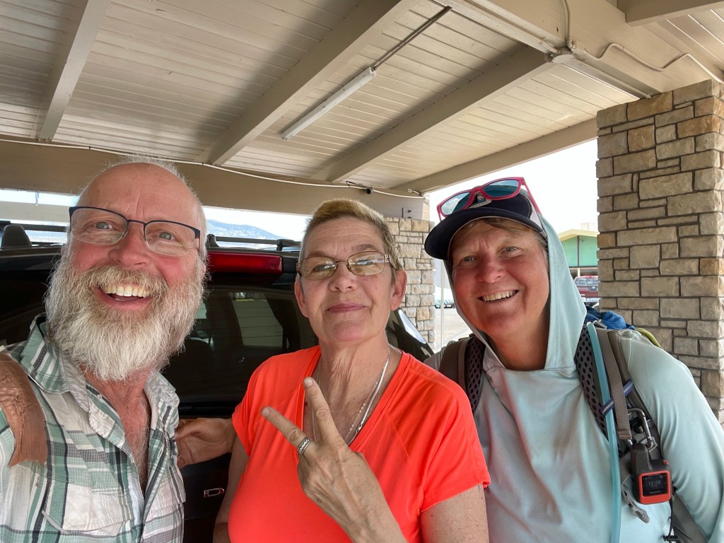
We couldn’t check into the hotel yet so Tickman offered to take us out to lunch. We gratefully accepted and walked to a Mexican restaurant. After lunch the motel let us check in a couple hours early.
The plan was to resupply, do laundry, get Jeff’s shoes in Medford and then back on trail tomorrow. However, we realized that that was a lot of stuff that needed to be done in a few hours. Plus we would not get any rest. The decision was made to take a zero and do our town chores without rushing.
Once checked in, we showered and decided to take the bus to Medford. It only cost us $2 each! What a bargain. However, the whole trip ended up being a bust. Jeff couldn’t find new shoes or a new shirt. So after 3 hours we came back with just some gas for our stove and we ate dinner at the bus stop from Trader Joe’s.
The rest of the evening we spent going through our gear, editing videos and the blog.
Day 100 – Zero day in Ashland
Today was mostly spend doing our town chores. After breakfast of muffins and a banana from Trader Joe’s from yesterdays excursion, Ellen went and did laundry while Jeff edited videos.
Lunch was at Subway and then resupply at Albertsons. The rest of the day was relaxing. We cleaned some gear and Ellen made strawberry-banana shake mixes for the trail.
The recipe was given to us by All In. However we had to modify it a little. So, what’s in that shake you ask. We usually use Nido dry milk but all the store had was dry buttermilk. Then we grind up freeze dried strawberry-yogurt drops that is found in the baby food aisle. Plus some freeze dried strawberries and bananas. We also add a package of vanilla breakfast essentials. Put all of that in a ziplock bag and in trail add water and drink. It’s actually really yummy.
In the evening we relaxed and watched ‘Catch me if you can’. We were glad we took the zero today. We are ready to get back on trail and head towards Crater Lake National Park.

You guys are doing great! I’m enjoying living vicariously through you both. What a great journey and meeting all those wonderful people on and off trail. That grown over trail was beautiful and the valley views from the ridges amazing! Thanks for documenting so much and sharing. Keep making good decisions and staying safe. Recovery days a beneficial or I guess you call it a zero day😃
LikeLike
Again, amazing thing you are doing! Helen
LikeLike