Day 70 – a Zero” day in Lone Pine.
Start: Mulkey pass – 745.7
End: Mulkey Pass – 745.7
Miles: 0.0
We spent the day planning our next move. We also did laundry at an AirBnB that some other hikers had rented. We had met them at Kennedy Meadows earlier in the week. They had an awesome place with an indoor pool!
We also ate … a lot. We love food trucks and we found a Mexican food truck that served awesome burritos! It was a nice lazy day.
Day 71 – Travel Day
We decided yesterday that we would skip ahead to Old Station in Northern California. It was late May and all of the remaining PCT north to Canada was covered in snow. However, we had learned that there was a 125 mile section with “only” 30 or so miles of snow in the Lassen/Shasta National Forests.
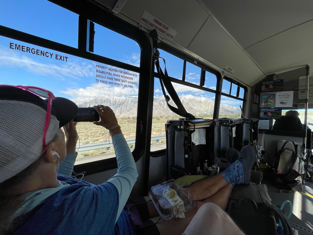
So today was a travel day. First we took the Eastern Sierra Transit Authority bus to Reno. This bus is like the typical rickety short buses used as airport parking shuttles … not very comfortable. Our first leg was from Lone Pine to Bishop. The driver of this bus decided to play military marching music VERY loud … and very annoying. We could barely converse.
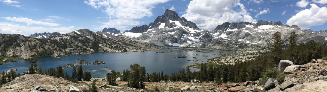
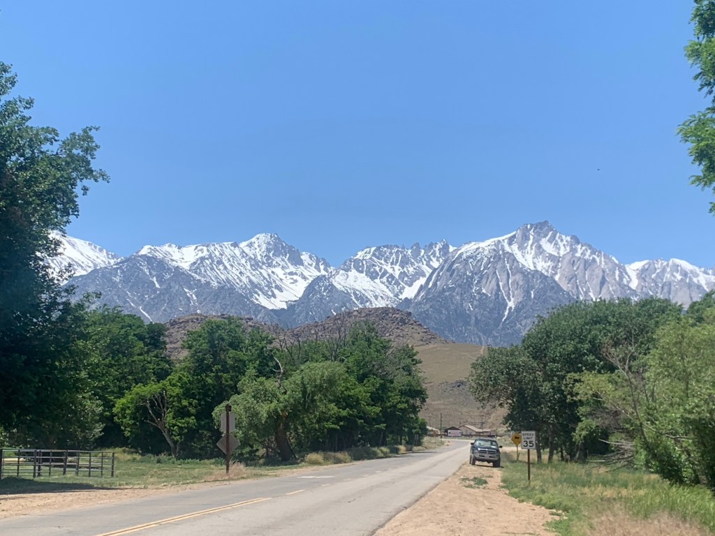
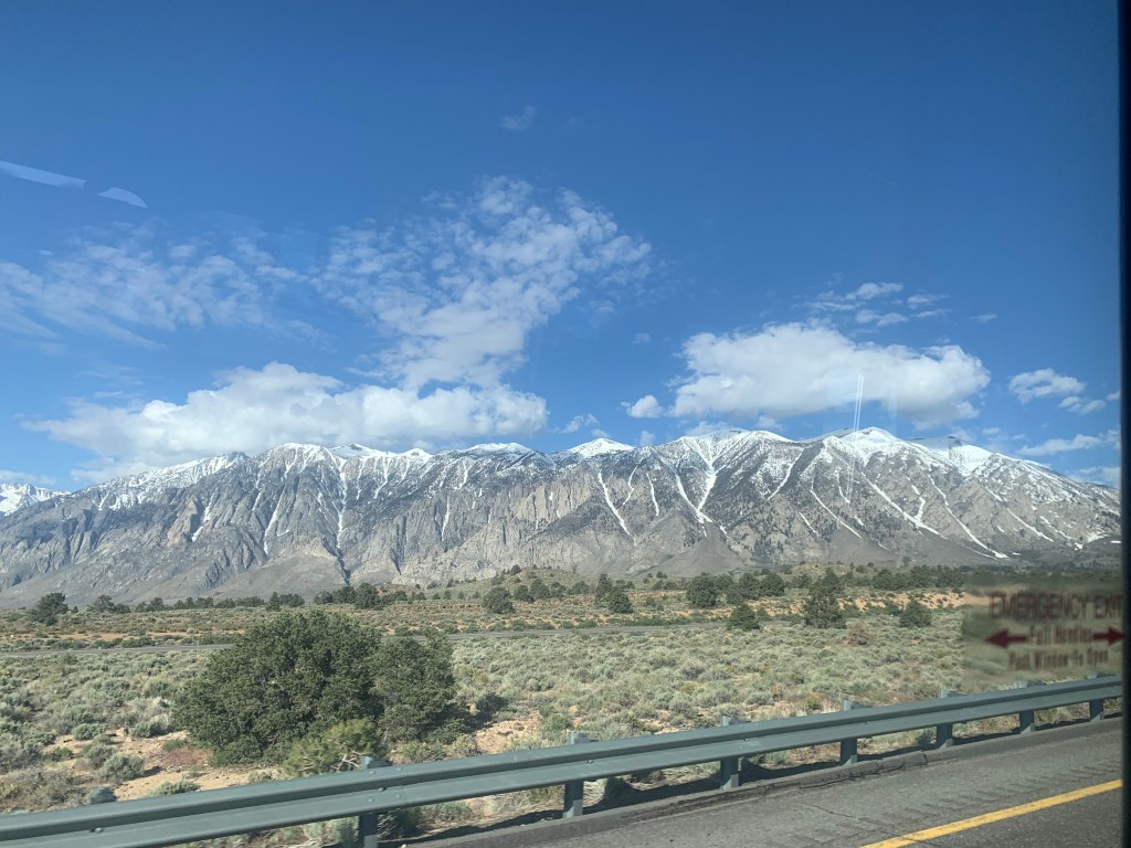
The drive north on highway 395 to Bishop (our first stop) was only an hour but the views of the snow capped Sierras were stunning. Too bad we had to skip this section of trail. We’ll be back!
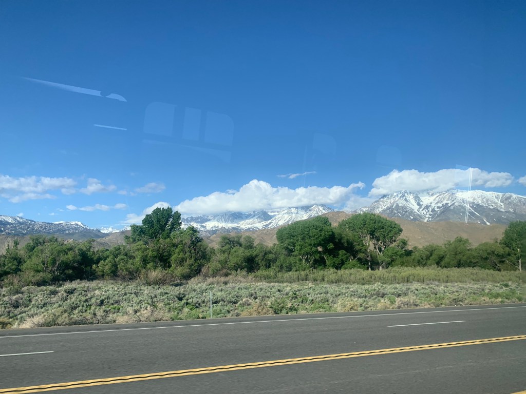
Next we took a similar bus from Bishop to Reno. This ride took five hours and again the scenery was amazing … and this time no marching music. We got to Reno around 12:30 pm.

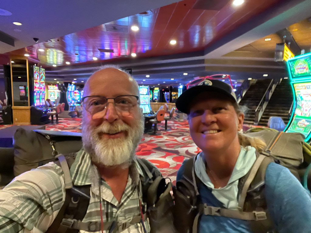
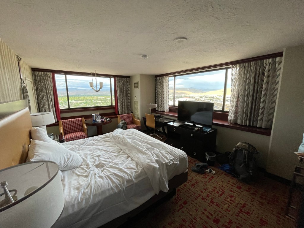
We checked into the Nugget Casino and Resort. We got a corner room with view of the foothills, which was pretty cool. Neither one of us are gamblers so we just ate at the restaurants and hung out in our room working on the blog and videos.
Day 72 – More travel
Travel day to Old Station via Susanville.
We got up at a leisurely hour, showered and went for a late breakfast. What a change from our early trail departures. Check out time was at 11 and our bus ride to Susanville wasn’t until 1:30 pm.
We had the casino shuttle take us back to the airport to wait for our bus. The bus was the same style as our bus from Lone Pine to Reno.
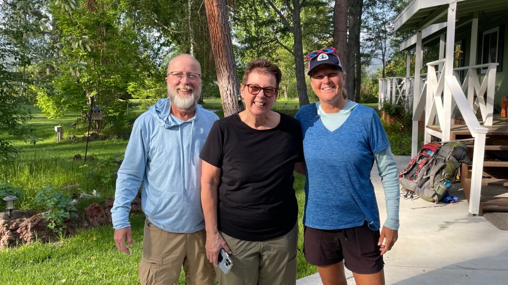
The ride took about 2 hours with just a few stops along the way. We made it to Susanville around 3:30 pm where our trail angel “NeedtoFeed” (aka Chris) picked us up.
We drove a couple miles to a car rental place where we picked up 4 more hikers. Then it was an hour drive to Old Station. The area we drove through was part of the 2021 Dixie fire that destroyed a lot of the forest and threatened several communities in the area.
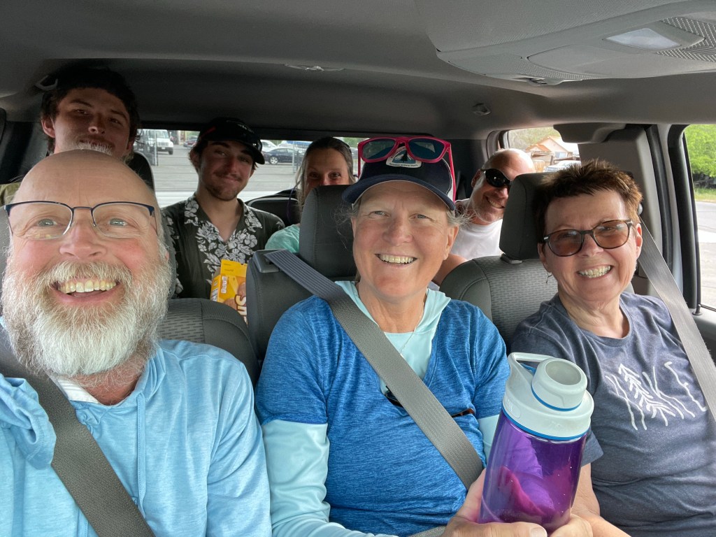
Two of the hikers wanted to be dropped off at the trail right away while the rest of us opted to stay at Chris’s place on Hat Creek. The two other PCT hikers were young men who we had met on the bus from Lone Pine to Reno.
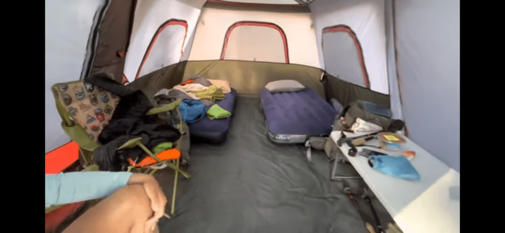
NeedtoFeed had a great set up for hikers. There were 3 large cabin tents each with air mattresses, power cords, and Wi-Fi . We got the Taj Mahal of the tents. It was a great tent including ceiling lights, small table, two separate air mattresses, and two chairs.
Once we put our stuff away in our tent it was time for dinner. NeedtoFeed has prepared a great meal of oven roasted chicken and veggies, crab salad, garden salad, Indian style rice with homemade mint chutney. It was delicious and satisfied our hiker hungers.
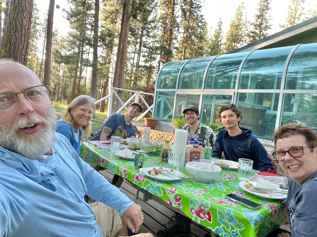
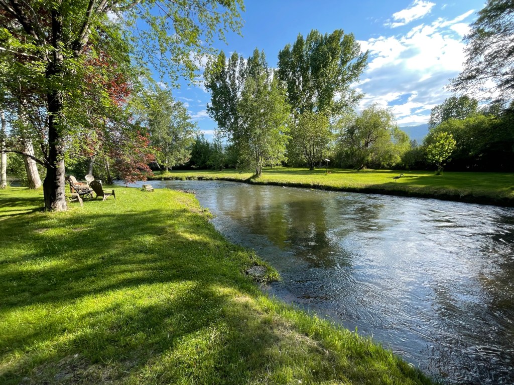
After dinner we chatted and viewed their property. NeedtoFeed, her husband and son were most gracious hosts and made us feel right at home.
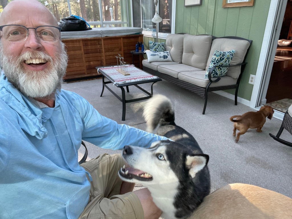
Their three dogs were also very friendly and welcoming.
Day 73 – Back on Trail
Start: Old Station – 1374.5
End: Lost Creek – 1386.6
Miles: 12.1
Ascent: 1089 ft| Descent: 906 ft
Start time: 8:45 am
End time: 4:10 pm
Current elevation: 4820 ft
Anyways, back to the day. We sort of slept in as breakfast wouldn’t be ready until 7 am. We slowly packed up our stuff, charged our phones and made our way to the house. We offered to help with breakfast but NeedtoFeed had everything under control. Breakfast was delicious.
After breakfast NeedtoFeed drove us to the trailhead and we said our goodbyes.
It’s always tough to resume hiking after multiple “zero” days. Today was no exception. Our packs were heavy with snow gear we wouldn’t need for 4 to 5 days plus a lot of food. Here is a break down of the extra gear: Bear canister: 43 oz, Snow gear: 43.1 oz (seal skinz dry socks, whippet, crampons with bag, snow gaiters). That’s a total of 5.4 lbs of extra gear that made the packs heavier than they needed to be.
The trail for the day should have been easy. There was only one climb which was neither long nor steep. However, with the hot weather, heavy packs. and with a lot of sitting the past three days, it was slow going.
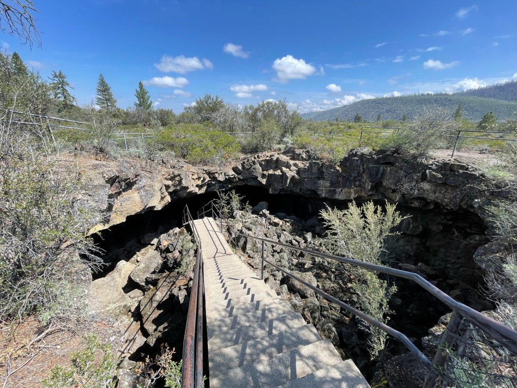
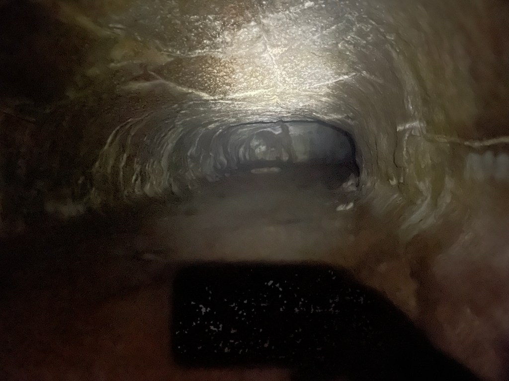
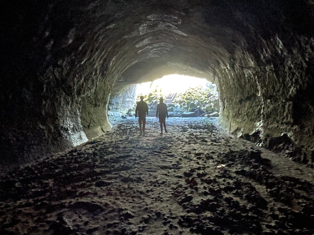
After 4 miles we came to Subway Cave, a lava tube that is about 1500 ft in length that can be explored end to end. Jeff went down but Ellen didn’t as the batteries in her headlamp were very weak. The lava tube side trip added about 1 mile to our day but it was worth it.
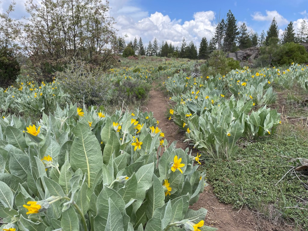
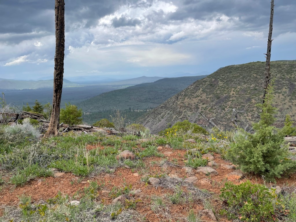
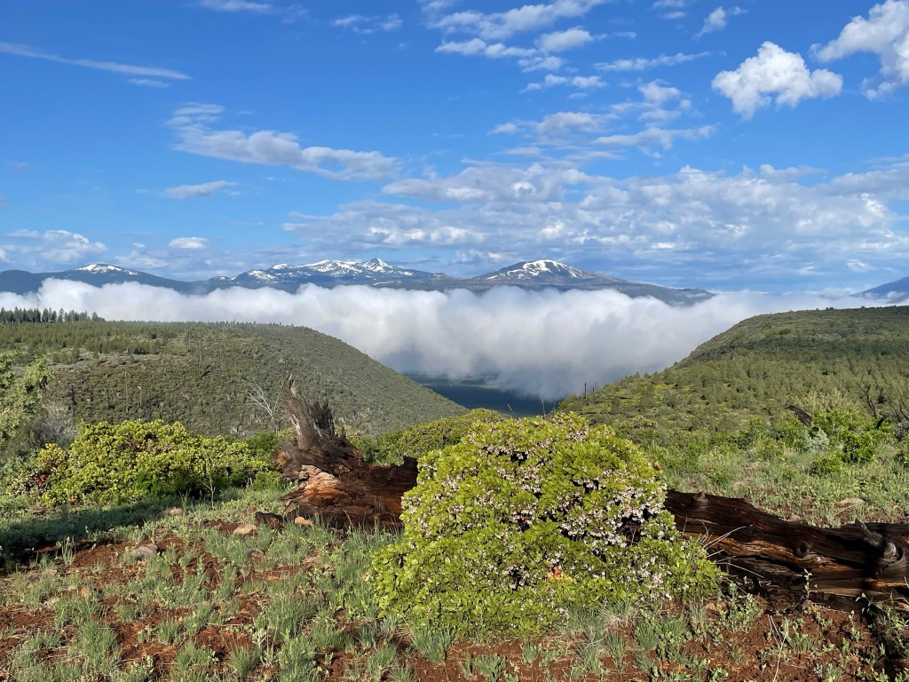
After the lava tube it was time to follow the PCT up over the Hat Creek Rim. We got to an overlook where one can see Mt. Lassen to the south and Mt. Shasta to the north. Both were snow covered. We couldn’t see Mt. Shasta as there were clouds in the area.
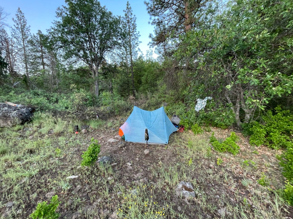
The trail then stayed on the rim’s edge with occasional small ups and downs. Unfortunately, we were both feeling the weight of our packs on our shoulders and we were getting tired. After 12 miles we were at the Lost Creek trail junction. Our last water source for another 8 miles.
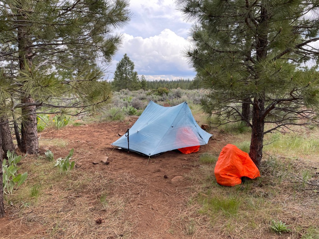
We set up the tent quickly because the forecasted thunderstorm and rain had arrived. Then it was time to go to Lost Creek which was a quarter mile down a steep side trail. But we made good time and we each brought back 4 liters each. This water, filtered through volcanic rock, is said to be amongst the best in the world.
We finished setting up camp, had dinner and cleaned up. Tomorrow we hoped to get our trail legs back and make better miles.
Day 74 – Mosquitos have arrived!
Start: Lost Creek – 1386.6
End: Hydro electric plant – 1408.0
Miles: 21.4
Ascent: 1002 ft| Descent: 2736 ft
Start time: 7:09 am
End time: 6:07 pm
Current elevation: 3011 ft
It was a loud and thunderous evening. A storm came in about 9 pm and lasted a few hours. The rain blew in on Ellen’s side of the tent and got her sleeping bag wet. In the morning the tent was soaking wet and very muddy from all the rain splashing the mud onto the tent. We’ve become accustomed to living in the dirt, but geez!
We got going a little later than usual but that’s OK. The days are now significantly longer and so we had plenty of time. We had about 8 miles to our next water source – “Cache 22”. The trail wound its way along the ridge with great views of both Mt. Lassen and Mt. Shasta. The valley below was all socked in with low clouds.
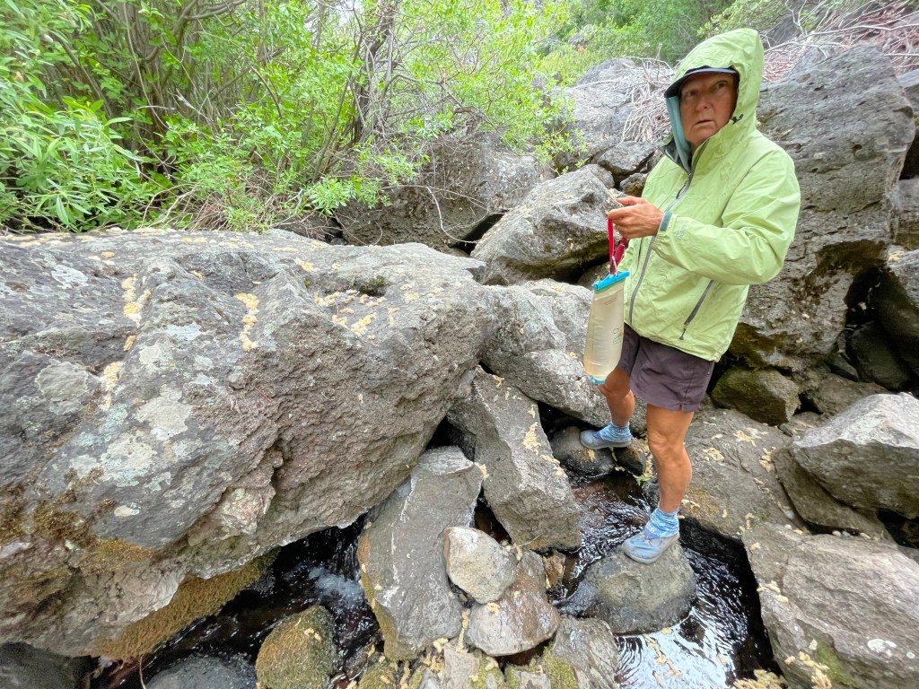
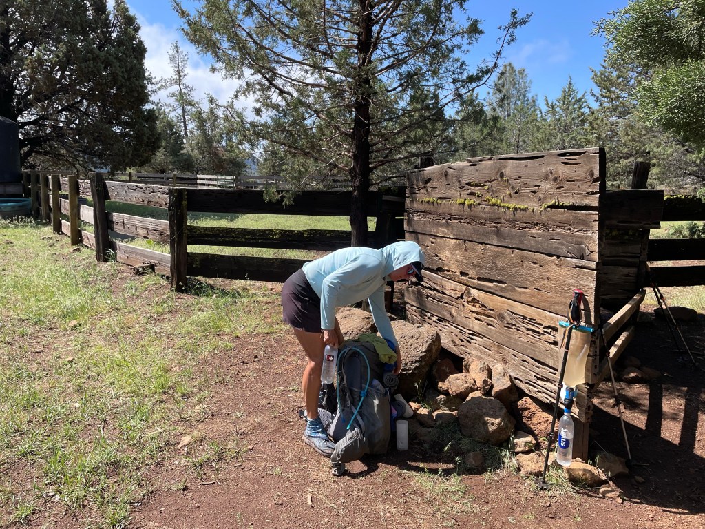
Cache 22 is a large water tank maintained by a trail angel. … possibly the rancher, not sure. We both had snacks and protein shakes and filtered water into our bottles. Two liters each should enough as it was only 9.6 miles to the next water source and the trail was mainly downhill.
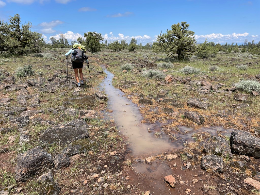
Right before lunch we got to a meadow on top of the ridge where the trail was either covered with water or thick slick and sticky mud. Last nights rain really soaked the trail and it was slow going. We were a mess!
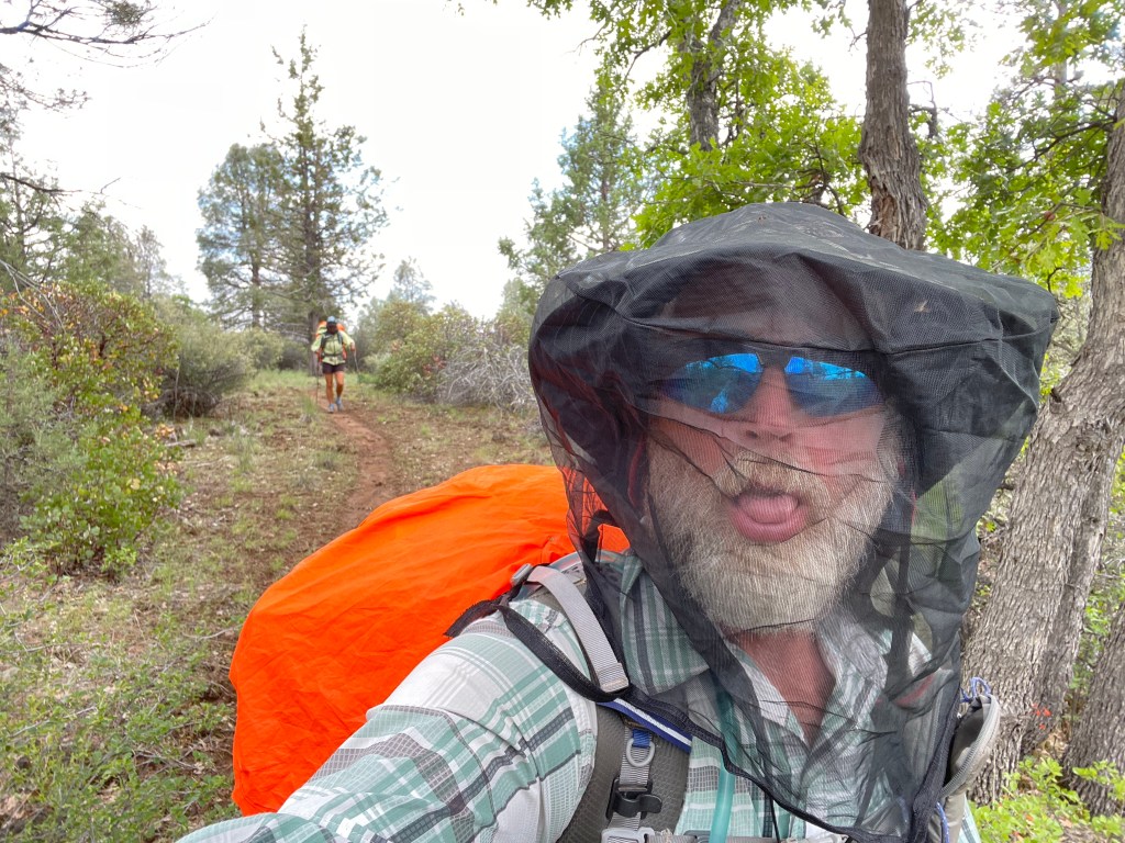
The trail eventually went downhill towards the meadows and this is where the mosquitos appeared. They were relentless and frankly quick a shock. Until now we did not have to deal with many bugs in trail but is is now late spring and they are out! The skeeters seemed to love Ellen’s blue sun hoody so she put on her rain jacket. We both got out our head nets. They weren’t as annoying as we were walking. But as soon as you stopped they swarmed.
We arrived at the next water cache but it was only 4:15 pm. This was a small metal box with a limited supply of water jugs. The next water was an actual creek 3.6 miles away. We needed to wipe off the mud and sweat and so we decided to continue on. We were already tired but since it wouldn’t get dark till 9 pm we had plenty of daylight.
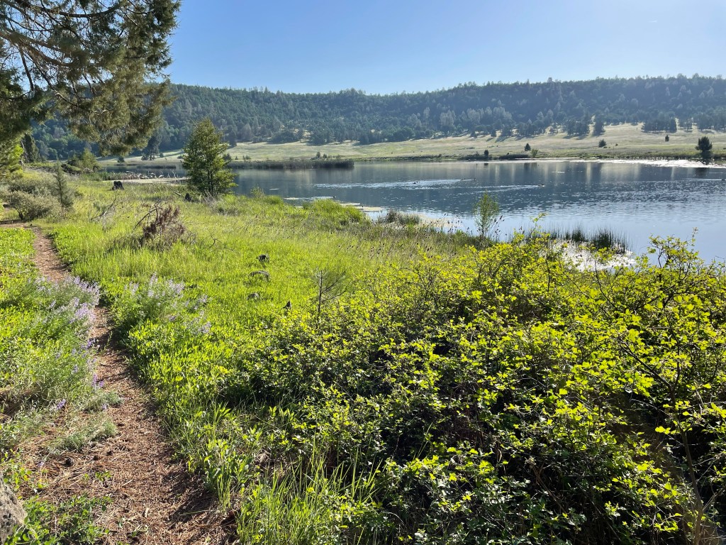
We finally made it to the creek near a small hydro electric plant. We quickly set up the tent, rinsed off, got dinner going, and then dove into the tent to escape those mosquitoes. After dinner we quickly put all of our gear away and put our food and other smelly items in our bear canisters. Then back into the tent for relief.
The area we have been walking through for the past couple days is volcanic. The trail is either very nice soft dirt or sharp volcanic rocks. Both of our feet after today felt like hamburger. With our light trail running shoes we feel all of the rocks and that really wears on our feet.
Day 75 –
Start: Hydro electrical plant – 1408.0
End: Burney falls ch – 1420.1
Miles: 12.1
Ascent: 627 ft | Descent: 841 ft
Start time: 7:21 am
End time: 4:02 pm
Current elevation: 2899 ft
We woke up to a really wet tent, both inside and outside. We knew this would happen as we were by a creek and the dew point was high. It seemed that the mosquitoes were still asleep and so we broke camp quickly and had breakfast. As we were leaving, the skeeters were on assault and so we donned our mosquito repellent clothing – Ellen wore her rain pants and jacket along with a big head net. Jeff had long pants, rain jacket and big head net. Fortunately, about an half hour later the mosquitoes were not bad so we went back to our normal hiking clothes.
We had only 4.4 miles to intersect with highway 299 which leads to the small town of Burney. In less than 2 1/2 hours we were at the road. Now to get a hitch otherwise it’s a 7 mile road walk. Nobody wants to do that.
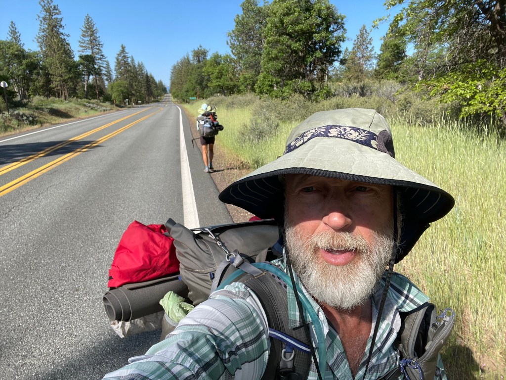
We walked only a minute or two when Ellen stuck out her thumb and a car immediately pulled over. Tom and Judy live in the area and they said we were the first PCT hikers they’d seen this year. Nice folks! They gave us a ride to the Safeway in town.
At the Safeway we supplemented our food supplies for 6 more more days that would get us to I-5, about 94 miles away. Outside the Safeway was a Mexican food truck that Tom and Judy said was really good. Since it was now close to 11:30 am it was lunch time. We both ordered the carne asada breakfast burrito!
Time to get back to the trail. Within just a few minutes, a couple locals, Magellan and Sarah, stopped and drove us the seven miles back to the trail. Yay!
By now it was getting really hot and we still had 6.7 miles to Burney Falls State Park. Our packs were still heavier with the additional food and we were feeling that extra weight. How did we ever carry 9 days of food into the Sierras? It must have been the excitement and adrenaline.
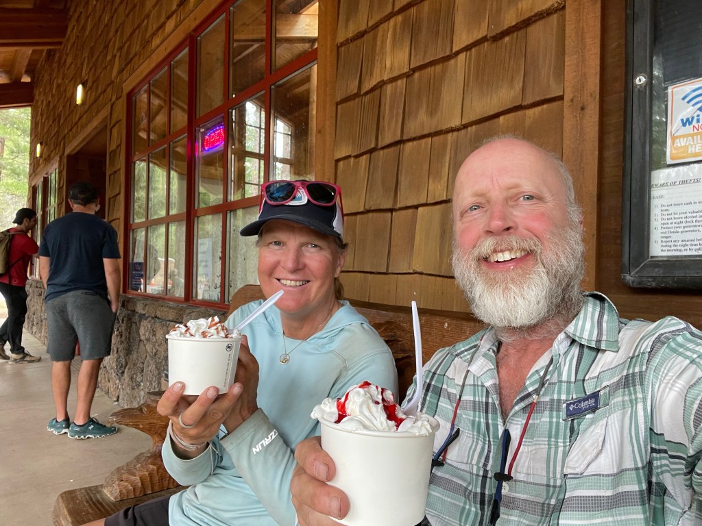
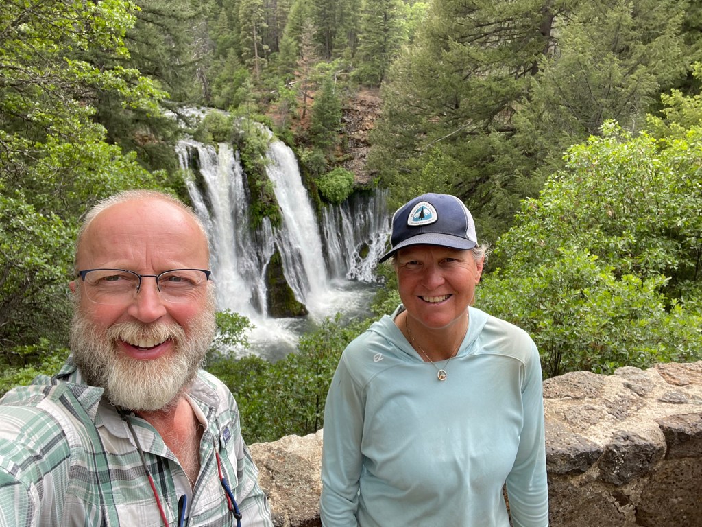
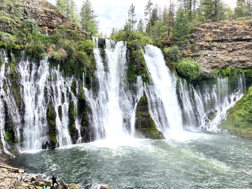
The afternoon dragged on and it took us 4 hours to do only 6.7 miles … so slow! Once at Burney falls we decided to get a site in an actual campground. We set up our camp, secured our food and went back to the general store for some soft serve ice cream! That was some of the best soft serve we had ever had.
After the ice cream time it was time to go see the falls. Wow, they were beautiful. The water is snow melt from Burney Mountain. The water goes underground through all the volcanic rock and some of it comes right out of the side of the cliff while most of the water comes downs from Burney Creek.
We sat around and watched the water falls for a bit. We went back to camp and made a slight detour and took advantage of the showers at the campground. However they needed tokens. But we each found one of the showers that had a trickle of water so we took advantage of the small trickle and rinsed off as best as we could.
Once back at camp we made dinner. Of course as soon as we sat down to eat the mosquitoes came out with a vengeance. They had been absent but now they were back! It was a short day mileage wise but yesterday we had a big day and it might have worn us out a little bit. We’ll see what happens tomorrow.
Here is the next video! Watch for Part 2 of this segment soon. Spoiler alert: we made it 😉

I love the photo of Lassen and Shasta peeking above the clouds. Spectacular! I’m sorry to hear about the mosquitos but know that you two are old pros at managing them after your time in the boundary waters. Praying for strong legs and good conditions.
LikeLike
You guys continue to amaze us. Keep posting and we will continue to read and watch. Doe and roger
LikeLike
It is so Amazing seeing all the pictures and video clips and hearing about the journey. Thanks so much for sharing it with us! -Prayers and blessings! -Pastor Craig
LikeLike