Day 66 – Into the Sierras
Start: KMS – 703.4
End: cow creek – 720.4
Miles: 17.0
Ascent: 3390 ft| Descent: 1153 ft
Start time : 7:26 am
End time: 5:29 pm
Current elevation: 8323 ft
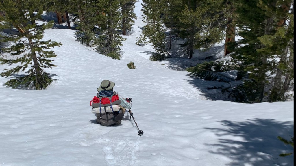
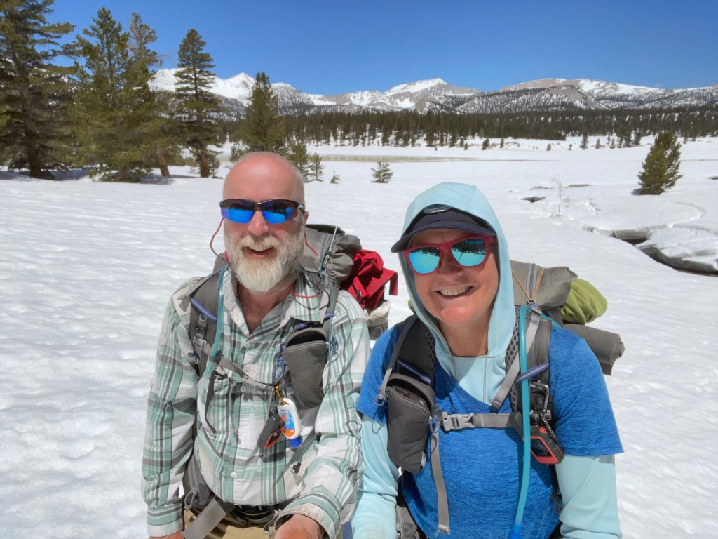
It was finally time to head into the Sierra Nevada Mountains. The talking and planning was done. We weighed our packs before heading out. Both our packs weighed 44 lbs., All In’s pack weighed almost 50 lbs. We had 9 days of food plus the required bear proof canisters. Only four days food was required to exit over Mulkey Pass but we thought there was still a chance we might hike further.
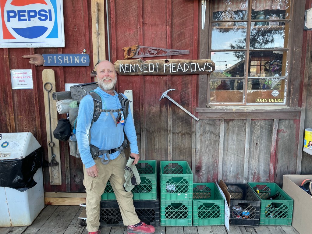
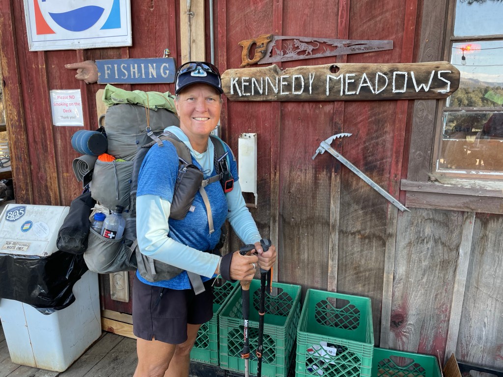
First up was the 0.7 mile road walk from the general store to the trail head. It went quick and the three of us were finally back on the PCT. The first few miles were a very gentle incline and along the Kern river.
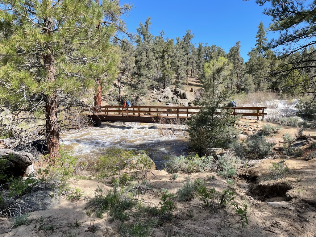
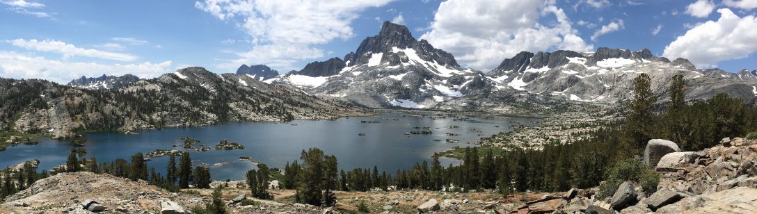
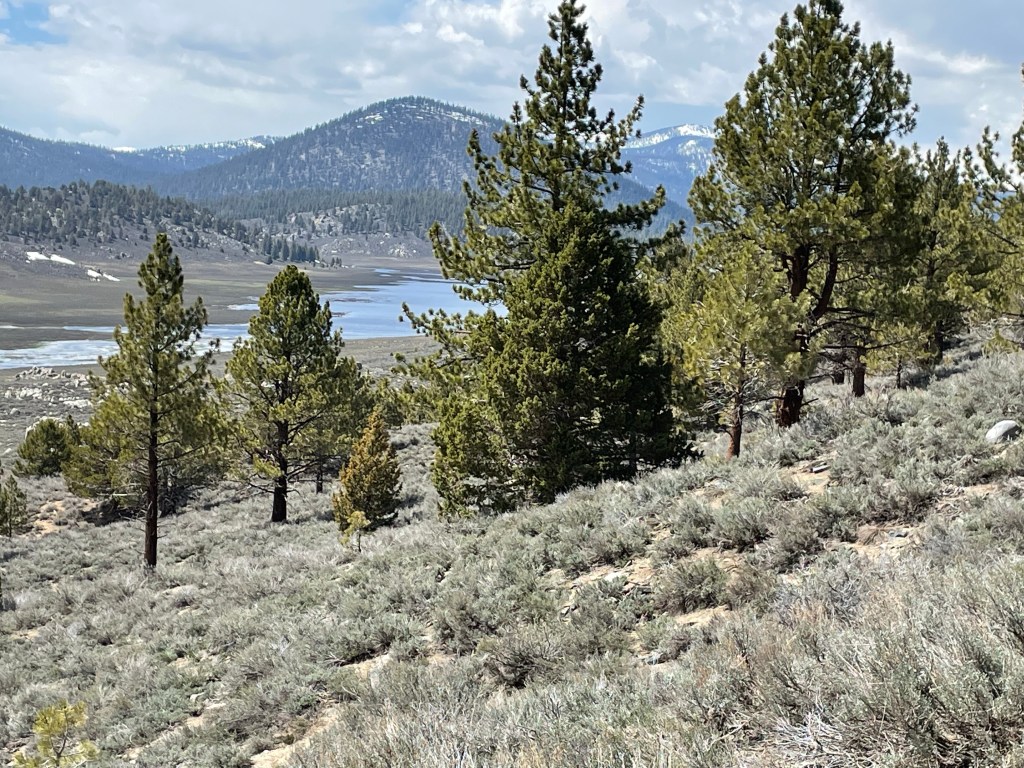
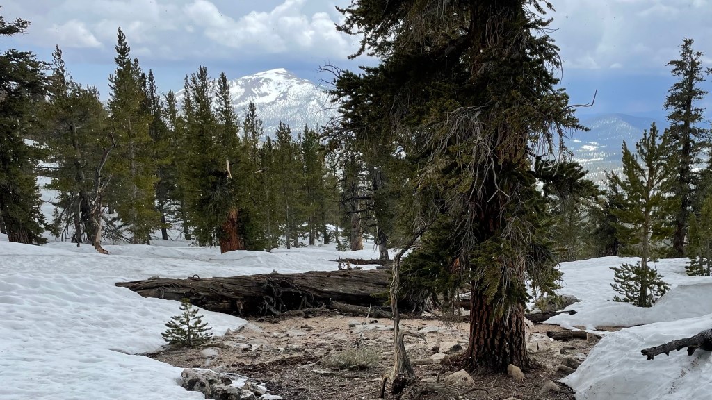
Once we crossed the wooden footbridge and the trail veered away from the Kern River and headed north west. The trail wound itself along the valley and slowly went up. After about 4 miles we went over a saddle and then the scenery totally changed. In front of us was a beautiful valley with snow capped mountains in the background. Now this is why we walked 700+ miles!
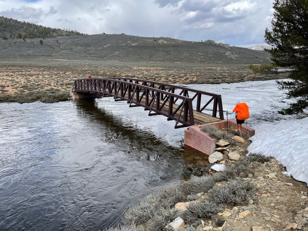
The trail followed the eastern end of the valley. Some hikers behind us saw a bear in the valley. Lucky them. After a few more miles the trail dropped down towards the Kern River again. We crossed the river over another footbridge and then it was 2.7 miles to camp.
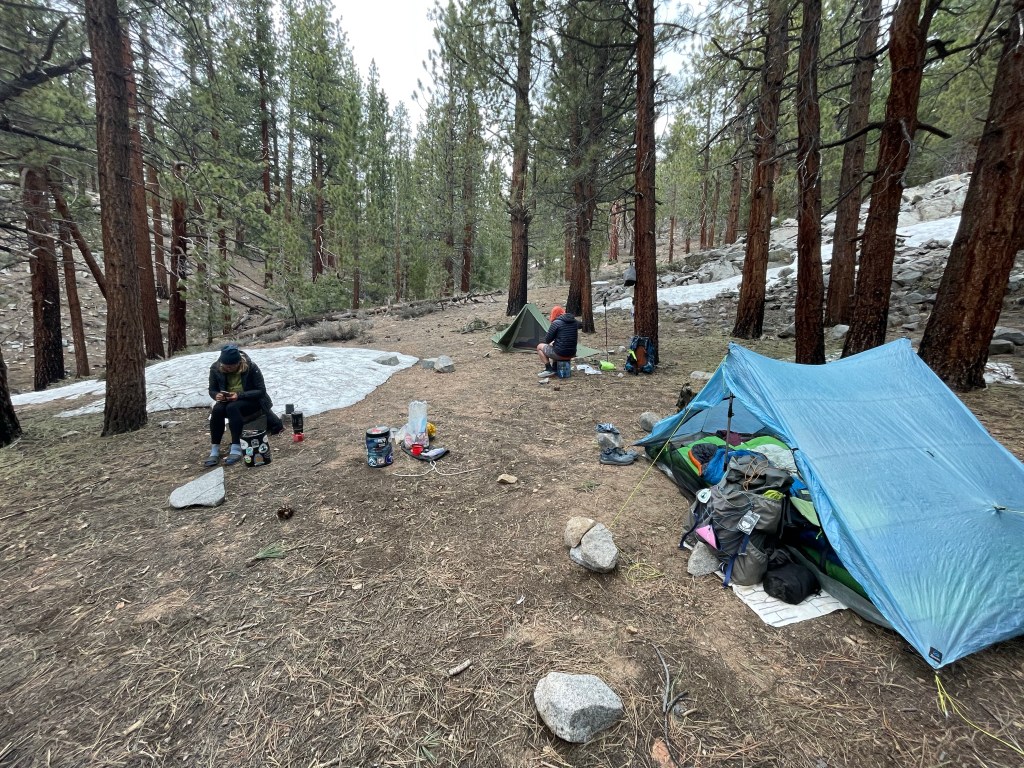
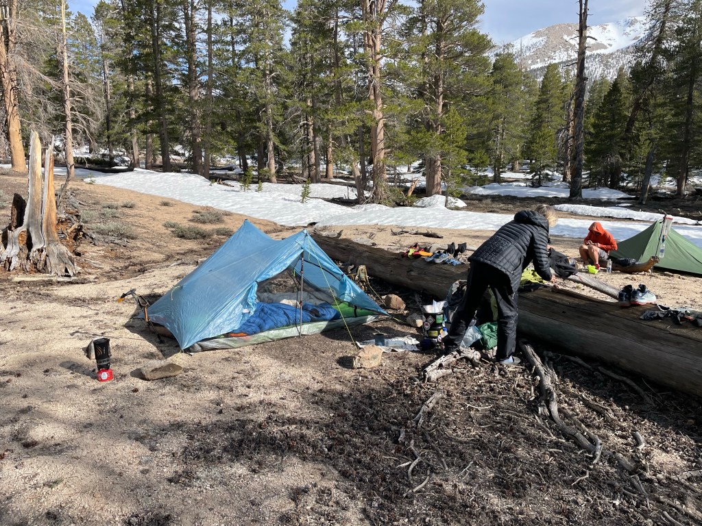
The trail was pretty easy, but we had heavy packs and after 15 miles we were super tired. However, we plugged along and after a 10 hour day we were at camp in the forest along Cow Creek. We set up camp, had dinner, cleaned up a bit and went to bed. Tomorrow we will be in the snow.
Day 67 – Snow is slow going!
Start: cow creek – 720.4
End: Bottom of. Olancha – 730.8
Miles: 10.4
Ascent: 2454 ft | Descent: 1658 ft
Start time: 6:39 am
End time: 4:16 pm
Current elevation: 9045 ft
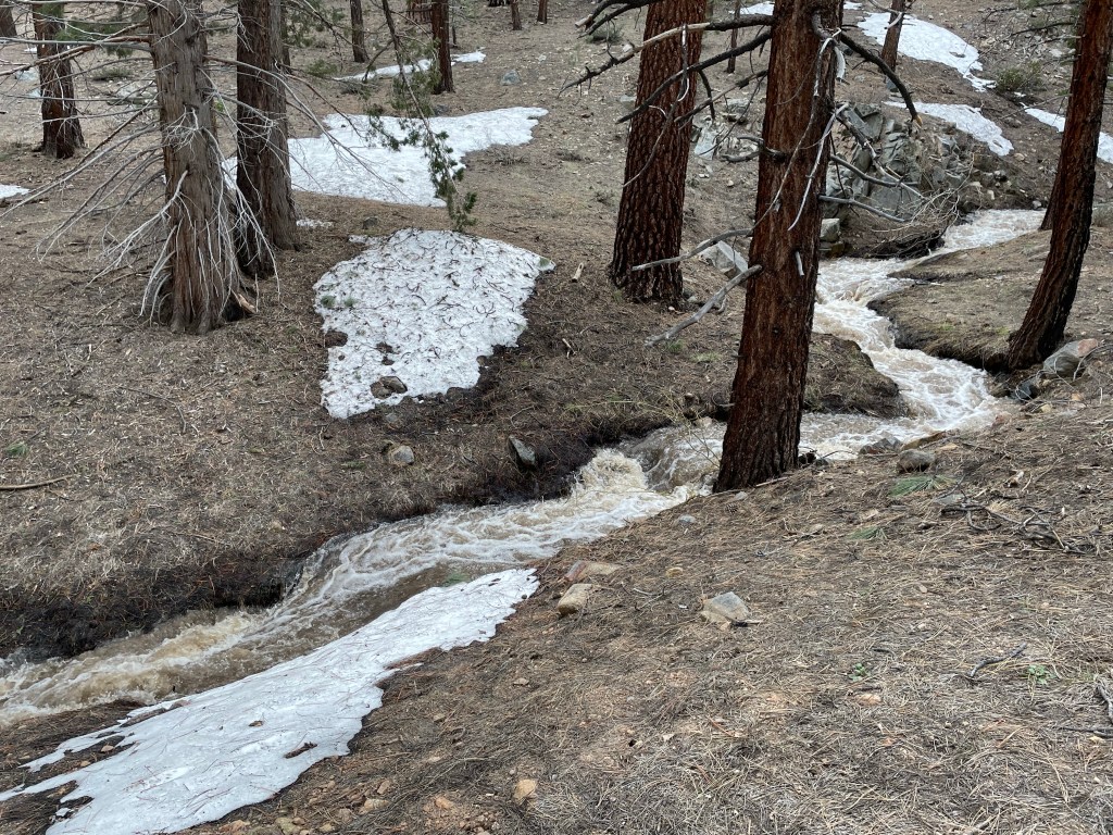
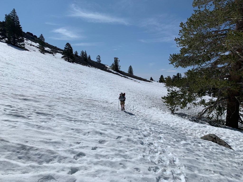
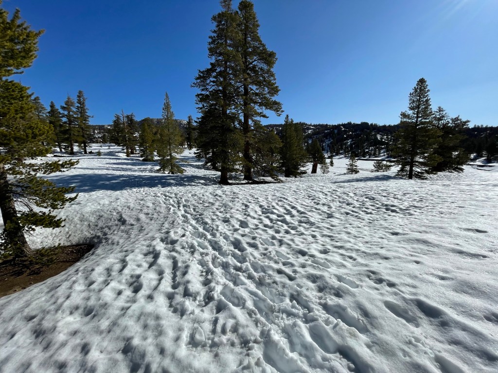
We got going per usual. First thing was to cross the creek by our campsite and then up the mountain. We were expecting snow and it finally appeared around 9500 feet of elevation. Once the snow was constant we decided to put on our crampons.
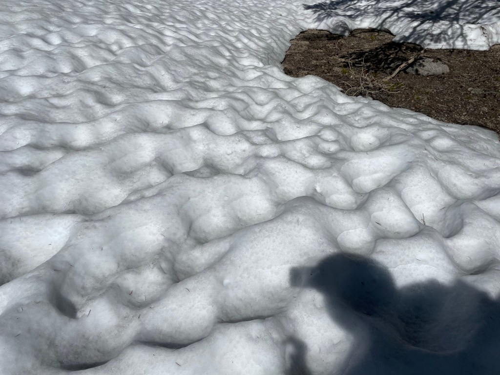
The snow was not hard and crunchy as we were hoping. The Sierras have been warming up and the temperatures are only approaching freezing overnight. As the sun warms up the snow quickly becomes very soft and mushy like mashed potatoes. It makes it very difficult to walk on as your feet sink deep into the snow (post holing) or slide around.
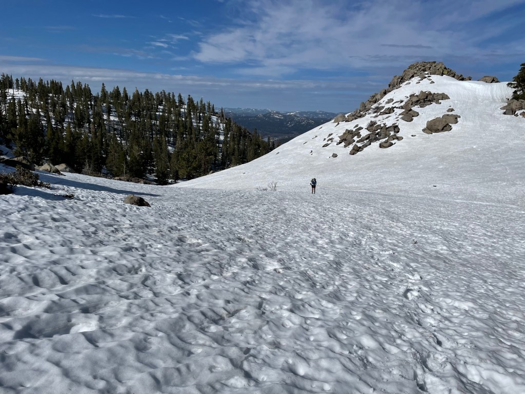
The “trail” was under snow so we were following boot tracks made by previous hikers. Those didn’t necessarily follow the trail but most of the times went straight up. Not the easiest of hiking nor the fastest.
After lunch the afternoon dragged on with small ups and downs in very mushy snow. We tired out pretty quickly. We descended in elevation and found a campsite below Olancha Peak. This was the peak we had seen from miles to the south as we approached Walker Pass.
We had a long hard day but we only did just a little more than 10 miles. We learned a lot and we’ll see how the next couple of days go.
Day 68 – Snow, hail and rain!
Start: Bottom of Olancha – 730.8
End: Diaz creek – 742.9
Miles: 12.1
Ascent: 2287 ft | Descent: 1667 ft
Start time: 6:09 am
End time: 6:23 pm
Current elevation: 9630 ft
Today was another long day. Anyone seeing a theme here yet? The PCT is hard work and becomes harder in the soft deep snow.
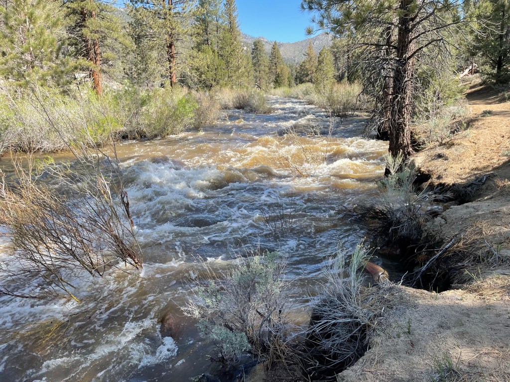
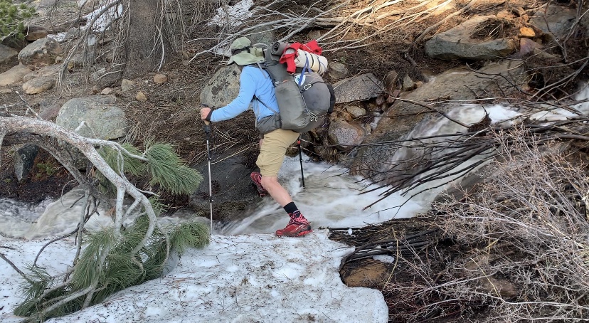
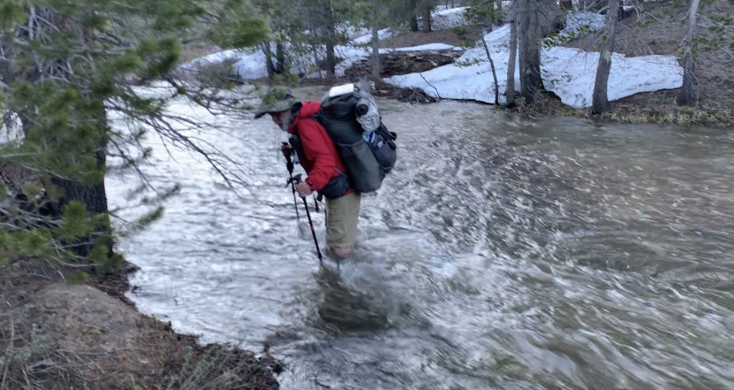
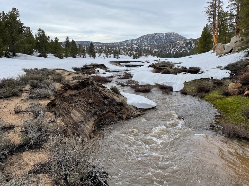
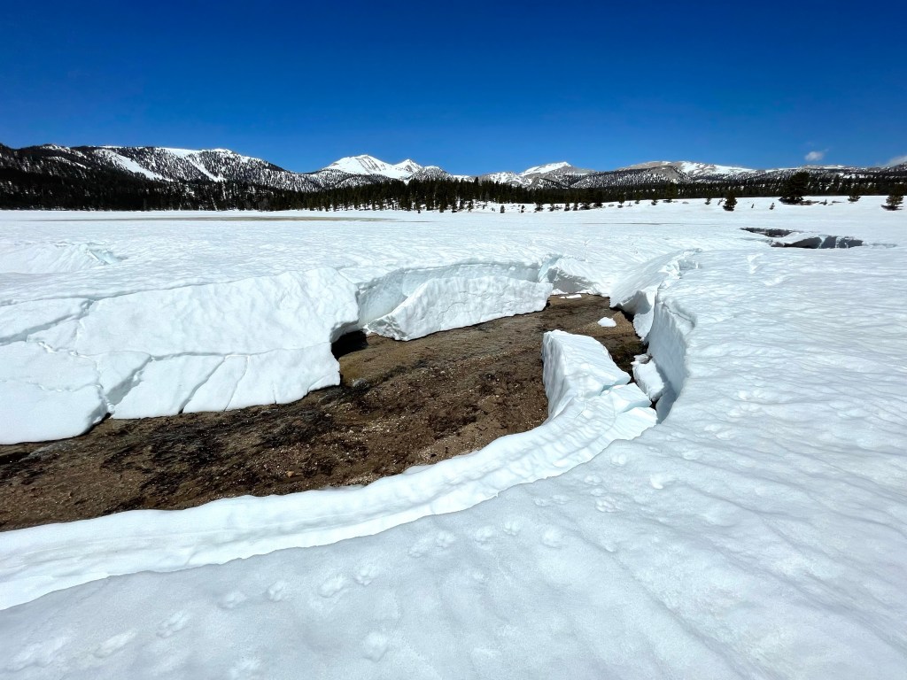
We got up super early to get a head start on the day hoping for crusty frozen snow. After about 45 min we made it to Death Canyon creek. This creek was roaring and we went a little up stream to find a wider and slower section. It ended up being pretty easy with a very short section only being just above the knees.
Then it was time to climb back up in elevation. As we were hiking we occasionally heard the roar of a fighter jet zipping low through the mountains. Edwards Air-force base is to the southeast.
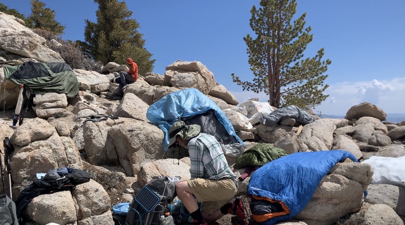
The climb was long and hard. We were still having a difficult time breathing due to the altitude. It was take 5-10 steps and stop to breath. After what seemed like forever we made the 4 mile climb to a beautiful view of Owens Valley.

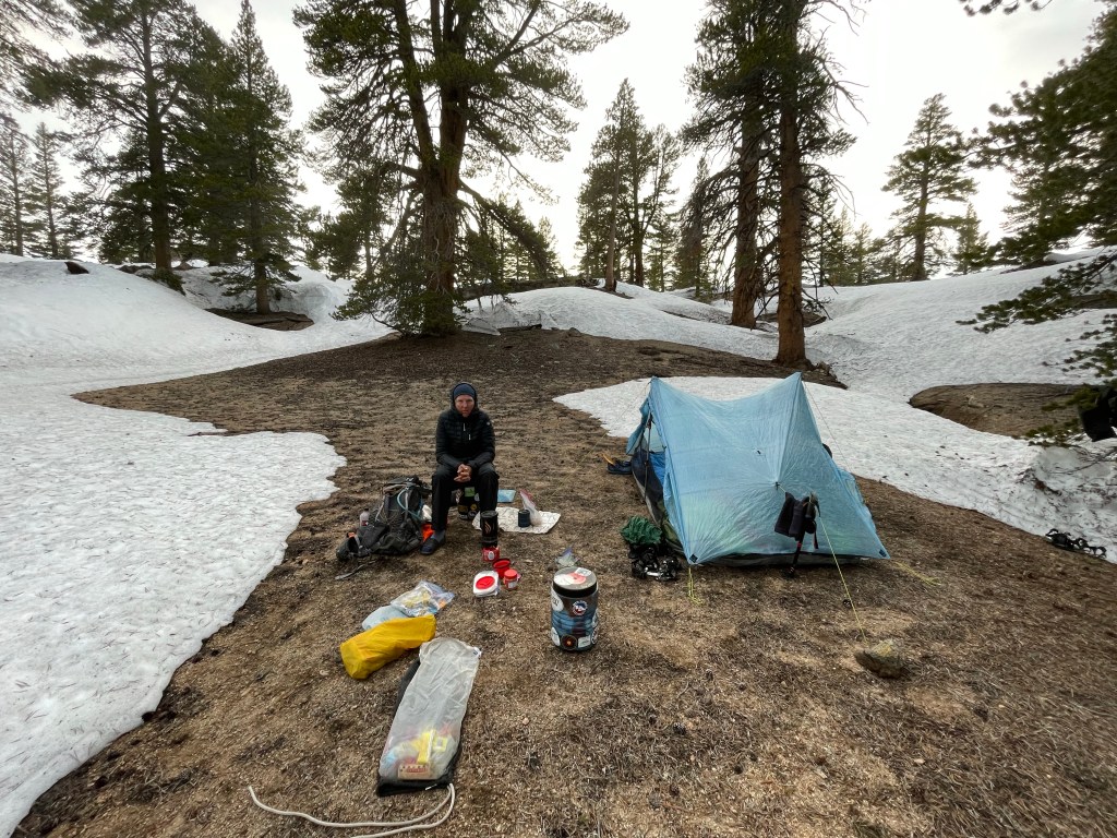
We stopped for lunch and also had a “garage sale”. This actually meant that we unpacked our packs and laid out all of our wet gear to dry in the sun.
After a nice break and lunch it was time to go again. The “trail” or route was mostly downhill with a few ups. The travel was a tiny bit faster but it was still a long slog. At one point we lost the trail and were about 100 feet below it. We lost about 45 minutes bushwhacking back up.
For the past few days the afternoon clouds had been forming and threatening precipitation. Well today we got it! It started to rain lightly and then later it started to hail on us! The hail was about pea sized but they still hurt.
All In was about a mile ahead of us and the plan was to meet at a campsite near Diaz Creek. Instead, we got separated and camped in different locations.
The only water nearby was Diaz Creek which was running like crazy and very muddy. We decided to camp just in the trees not far from Diaz creek on one of the very few dry spots. We set up camp, got some muddy water which we filtered and had dinner.
This was by far the longest day and hardest day on trail. We hiked for over 12 hours and only hiked 12.1 miles. That’s less than 1 mile per hour!
Day 69 – Oh the views!
Start: Diaz creek – 742.9
End: Mulkey pass – 745.7
Miles: 2.8
Start time: 8:09 am
End time: 3:22 pm
Mulkey Pass to Horseshoe Meadows Road: 1.9 miles. Road walk: 4.46 miles. Total miles: 9.2 miles.
After the last two days of hiking through the snow we had decided that we had had enough. We got a taste of what it’s like to hike through soft slippery snow. It was very hard work and by the afternoon we were both exhausted and getting cranky yesterday.
So as expected, we decided to hike off the mountains today. It was only 2.8 miles to Mulkey Pass but it again took us 3 hours. The views up to Mulkey Pass and looking back to where we came from were stunning. We were glad we had entered the Sierras to give it a try, even in these conditions.
Today was actually pretty awesome. The hike down Mulkey Pass was short and fun. We tried glissading (slide on your butt) but the snow was too soft and we didn’t go far.
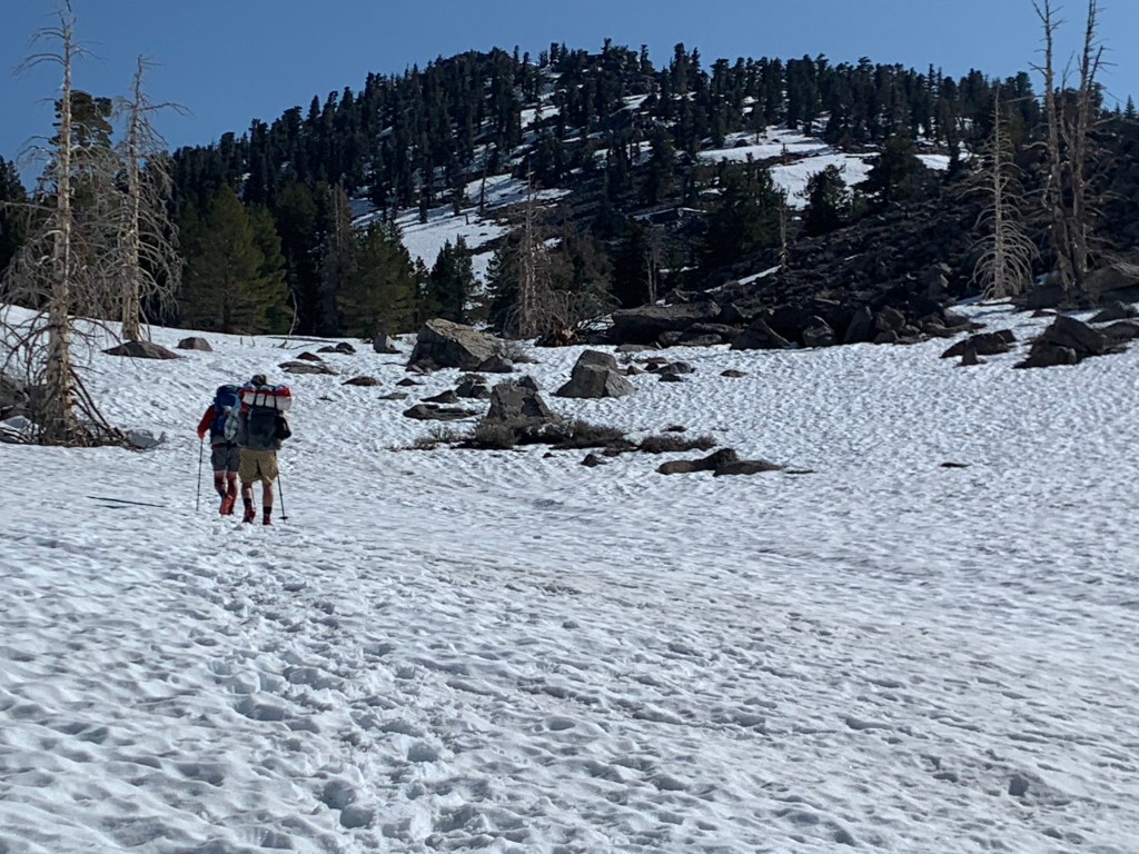
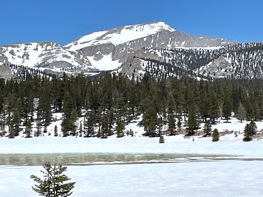
We then came to Horseshoe Meadows. Wow, what views! We thought we saw Mt. Whitney but later we realized it was actually Mt. Langley (Whitney was hiding behind Langley). We took our time getting across the meadow and enjoyed the scenery. No tracks meant that we may have been the first to walk this route through the valley.
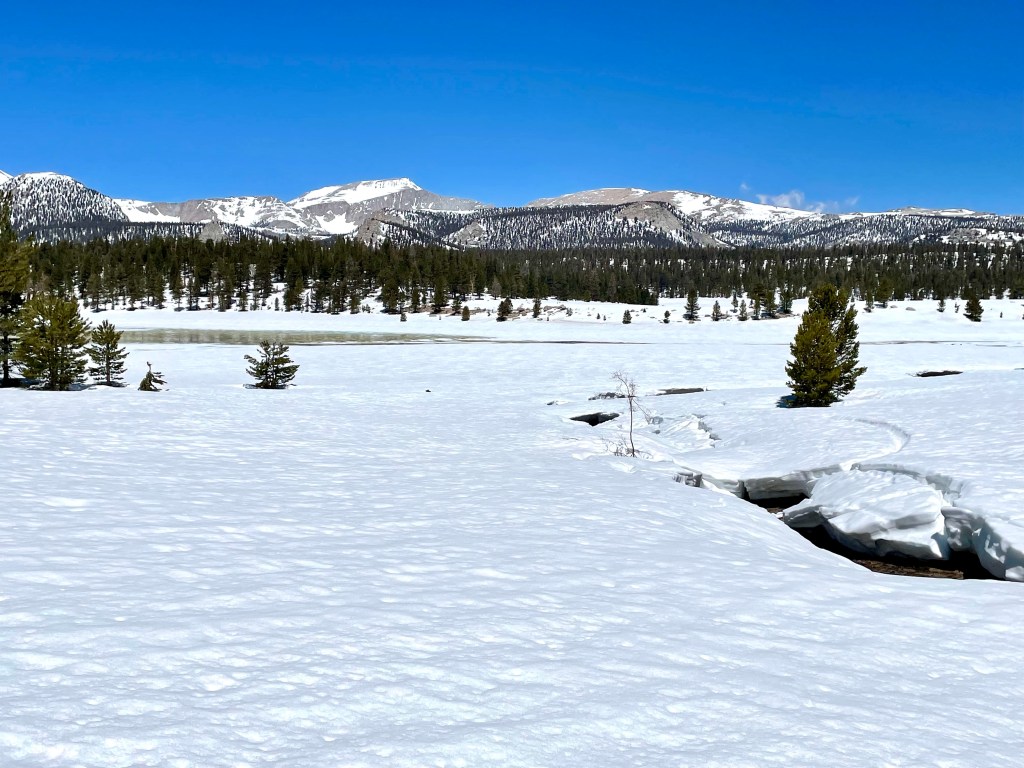
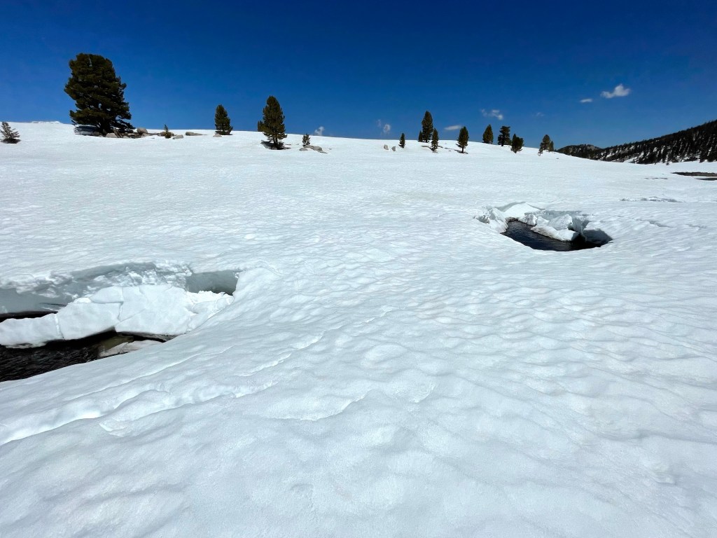
In the valley there were two creeks we had to cross and fortunately we found snow bridges still intact. We stopped on the other side of the meadow for a long lunch trying to decide what to do next. We had plenty of food and all the time in the world. Should we stay another night in this beautiful meadow or try to get to town?

We opted to start walking towards town. It was 21 miles to the main road. Horseshoe Meadows Road was closed and that would mean an 11 mile road walk to the locked gate and then hopefully a hitch the rest of the way into Lone Pine. We figured the road was mostly snow covered so we would get started our road walk and then camp along the way.
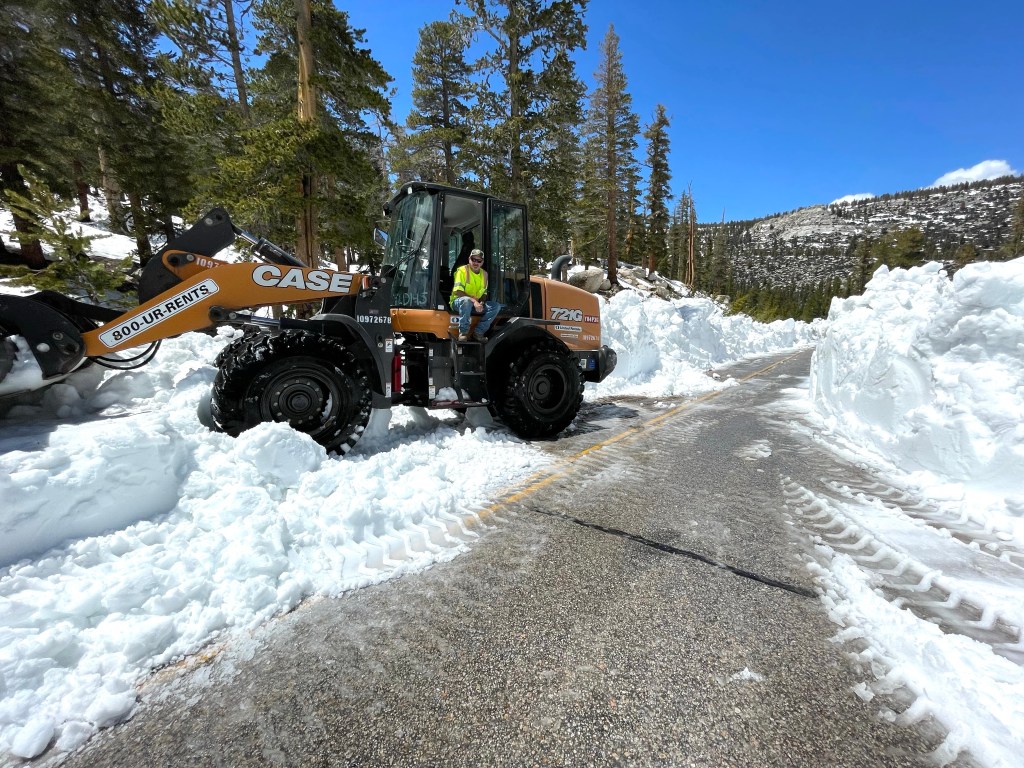
Well that didn’t happen. After about 3/4 of a mile we ran into a worker who was clearing the road. Surprise! We had a clear road. That was both good and bad. Hikers hate road walks and our feet hate them even more. We continued hiking down the road and then luckily got a ride down the rest of the mountain into Lone Pine.
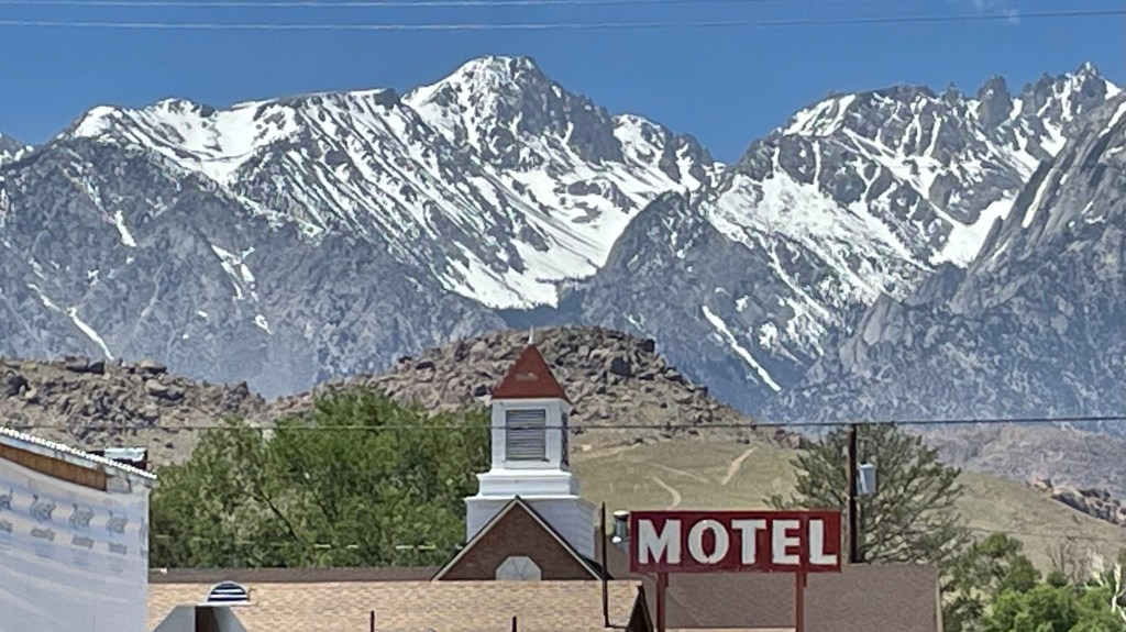
We really didn’t plan on being in town this early but we found a motel, showered and ate dinner.
What’s next? We don’t know. We’ll spent the next couple of days trying to figure out where on the PCT we can hike without snow and go from there.
Here is the next video!

It is impressive to see how you got through the snow. Those are some beautiful views!
LikeLiked by 1 person