Day 54 – Back on trail and sick
Start: Acorn TH – 363.4
End: Guffy CG – 364.4
Miles: 1.0
Ascent: 243 ft| Descent: 246 ft
Start time: 2:07 pm
End time: 4:50 pm
Current elevation: 8277 ft
We left Pete’s house around 9:40 am and drove north to Hesperia to drop off our rental car. We made a few stops along the way and made it to Enterprise just before 12 pm. They gave us a ride from them to the In-n-Out burger by the freeway. Then trail angel Brian picked us up and brought us back to the Wrightwood. We started up the Acorn Trail just after 2 pm.
Before leaving the trail to attend a wedding, Ellen started to get heavy chest congestion. She went to urgent care while in town and got some antibiotics. However, she was still struggling to breath while on trail.
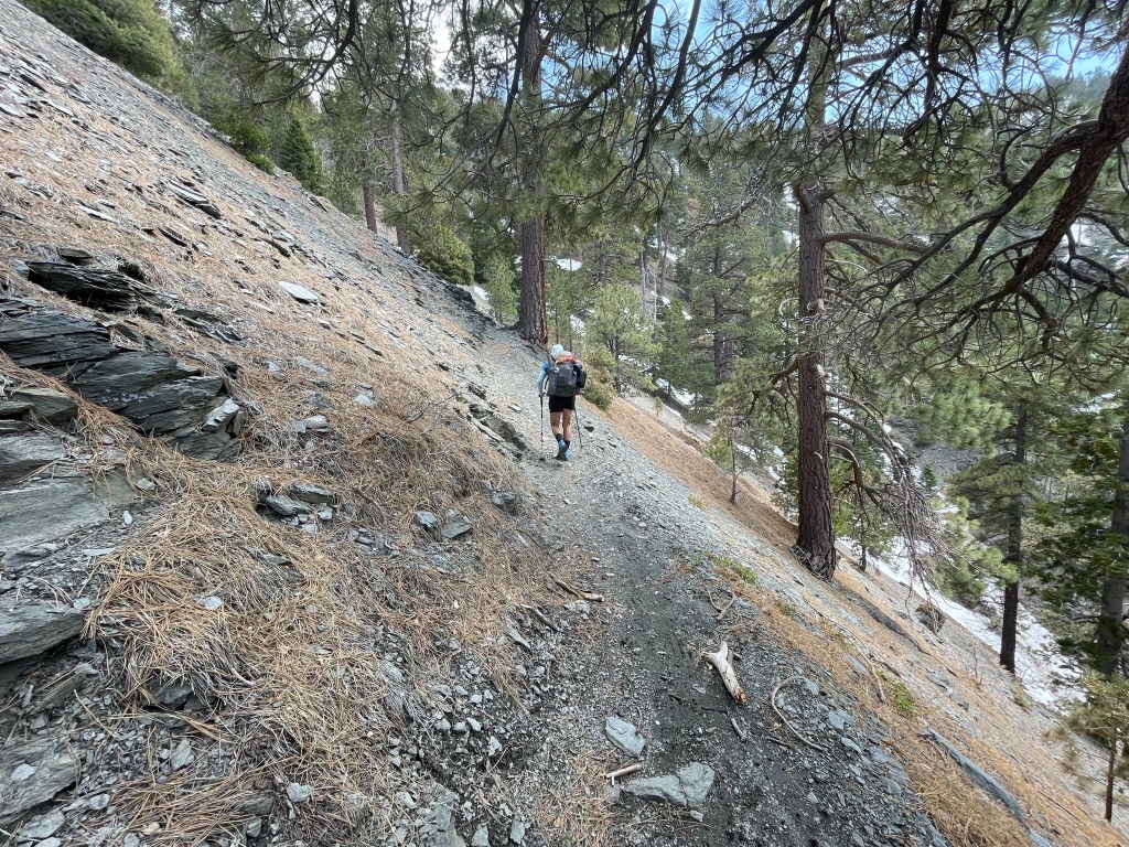
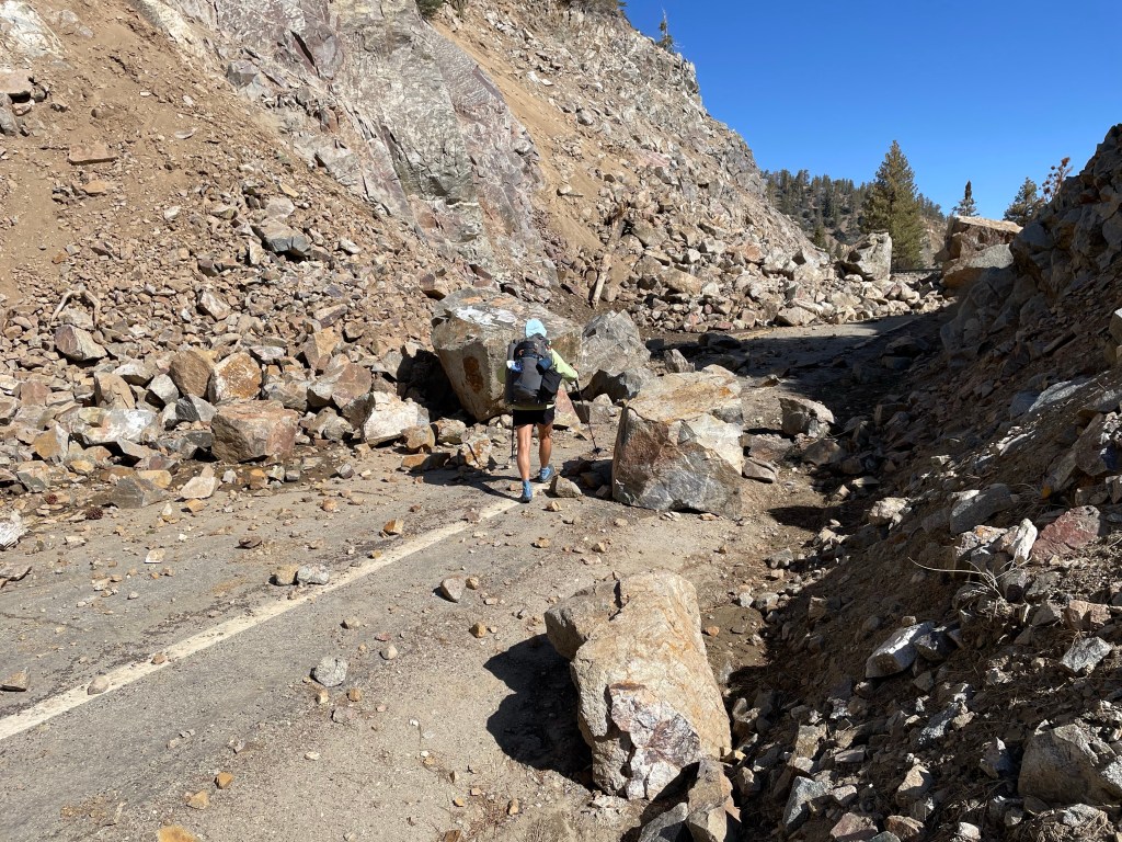
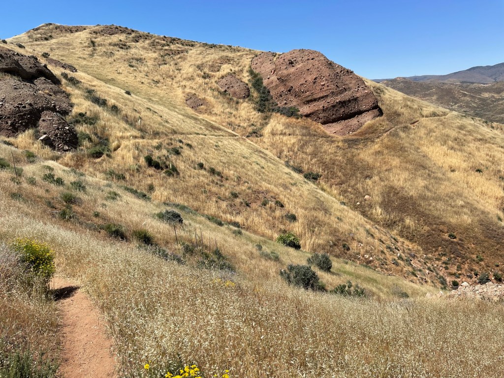
Acorn trail is only a couple miles but very steep with 1593 ft of elevation gain. When Jeff and Ryan day hiked some of it last week it was mostly snow covered. Lucky for us, five days of warm weather had melted much of the snow. We only encountered snow the last half mile or so. Being off trail for five days made us unsure on the snows and it took a while for our trail legs and sure footedness to come back.
After two miles we were back on the PCT. We only had one mile to go to Guffy Forest Service Campground. This was luxury camping – at least for us. Picnic tables and outhouses.

A little bit after we set up our tent, a German couple showed up. It was the same couple we actually started with way back in March and camped the first night together. We’ve now bumped into them twice along the trail.
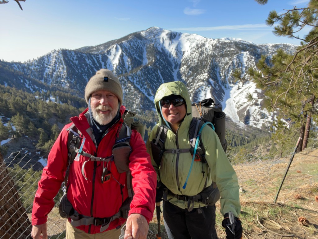
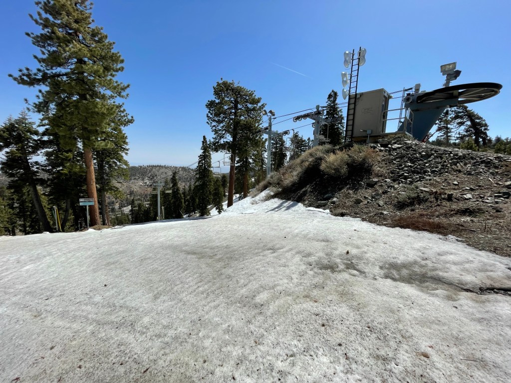
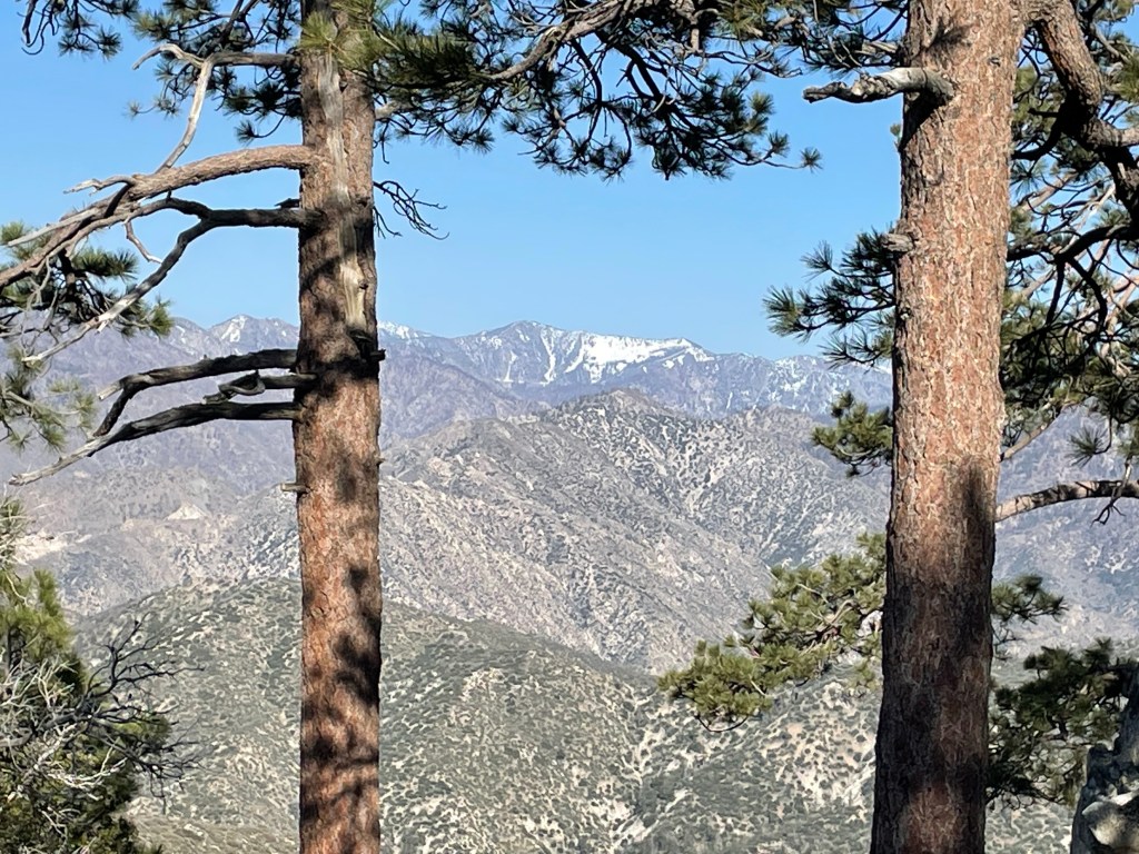
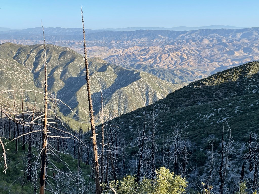
The view at our campsite was beautiful. We think it is Mt. San Antonio. Fully snow covered.
Day 55 – Lost our trail legs
Start: Guffy CH – 364.4
End: Vincent Gulch Divide- 374.0
Miles: 9.6
Ascent: 1227 ft | Descent: 2586 ft
Start time: 8:09 am
End time: 3:37 pm
Current elevation: 6592 ft
This was one of the toughest days physically. We had several things going against us:
- We had been off trail for 5 days.
- Most of those days were at sea level.
- Now we were back at higher altitude.
- Ellen had picked up a cold which had started going into her lungs and was on medication.
Our legs did not want to go up hill. Ellen had to keep stopping because she was out of breath every ten or so steps. It was really slow going.
After a little bit the trail went past Mountain High ski resort. There was still some snow on the ski slopes but not enough for the resort to be open.
At lunch time we found a nice flattish, soft spot along the trail. Ellen took a half hour or so nap and Jeff also dozed off.
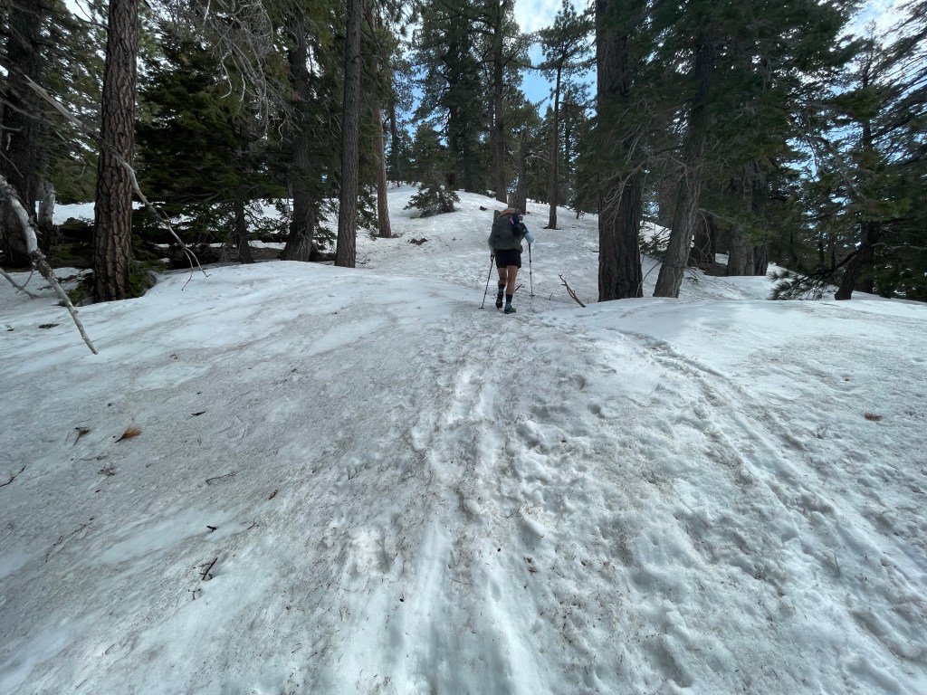
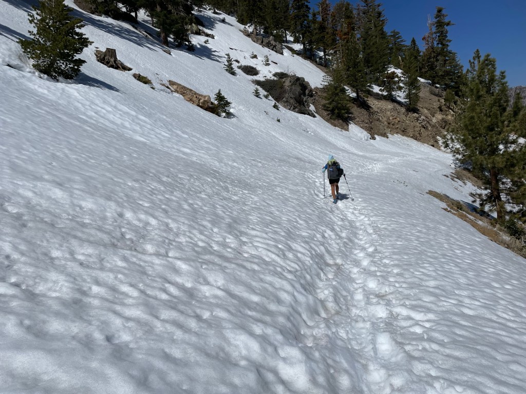
Once back on trail we had 3.5 miles to go. The trail wasn’t difficult but every 10 yards or so there was a snow drift we had to climb over. Again, slow going. We finally made it to our last climb and then it was a steep downhill to Vincent Gulch Divide at the base of the climb over Mt. Baden-Powell.
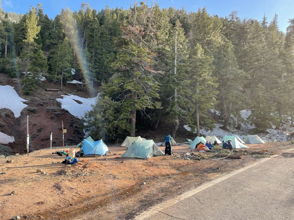
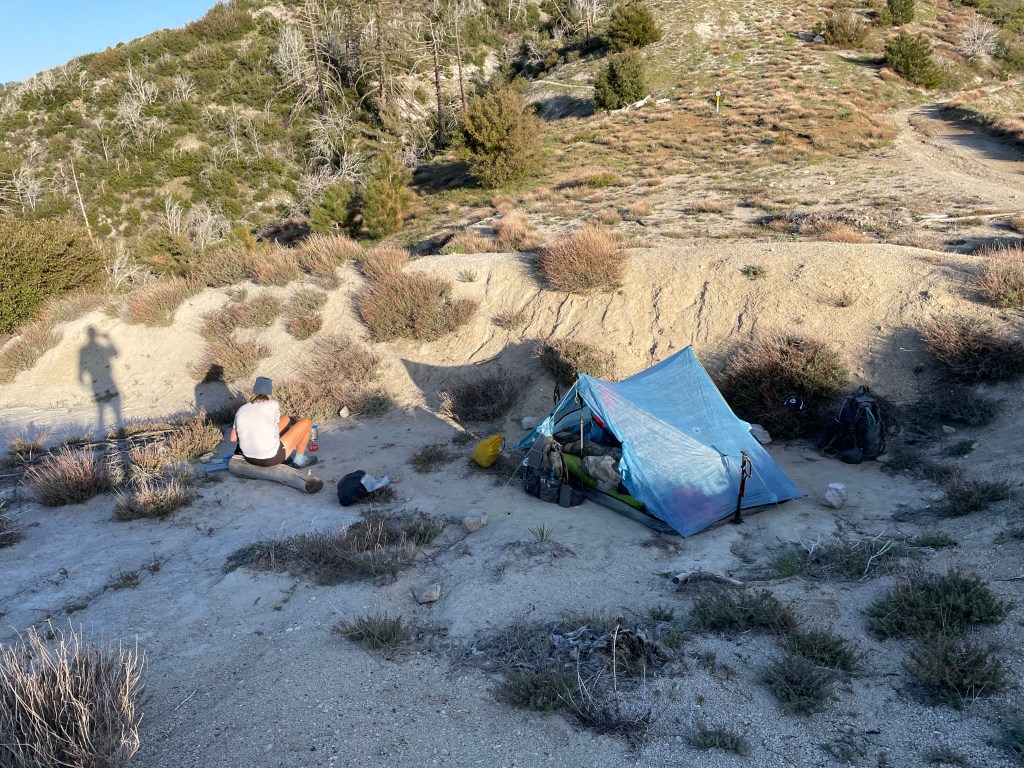
Luckily for us we found a flat site next to the closed road where there was some snow melt run off. We were pretty much out of water. Every half hour or so more hikers showed up. By the time we went to bed there was a small tent city at road pullout.
Since we got to camp pretty early it was nice to relax and determine our options for the next couple of days. Hopefully with a good night is rest, we can get our trail legs back, get adjusted to the altitude, and Ellen’s antibiotics kick in.
Day 56 – The road walk!
Start: Vincent Gulch Divide – 374.0
End: Cooper Canyon trail camp – 395.2
Miles: 21.2 Actual mileage is 20.75.
Start time: 7:09 am
End time: 5:48 pm
Current elevation: 7090 ft
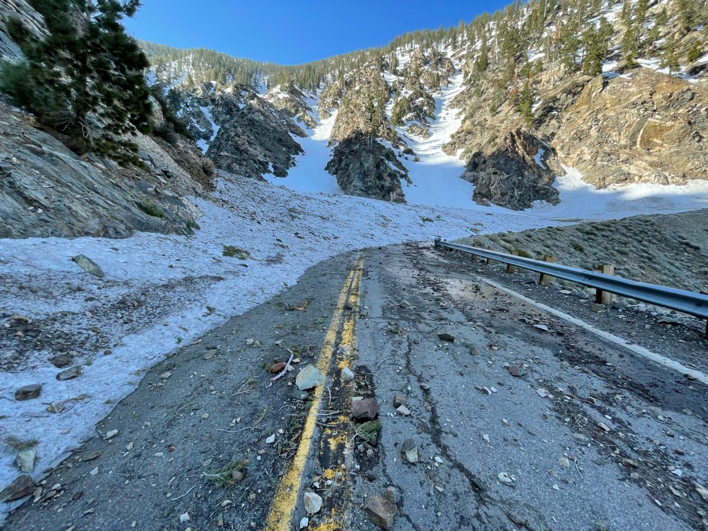
Another tough day. Based on how Ellen was feeling, we decided not to climb Mt. Baden-Powell this time. We had heard reports that the last section was basically climbing straight up on snow and so instead of hiking we would have been mountaineering. Then after the climb it would have been a 12 mile sketchy snow covered ridge walk. Not our cup of tea today. So we decided to be smart and safe and do the road walk along the closed hwy 2.
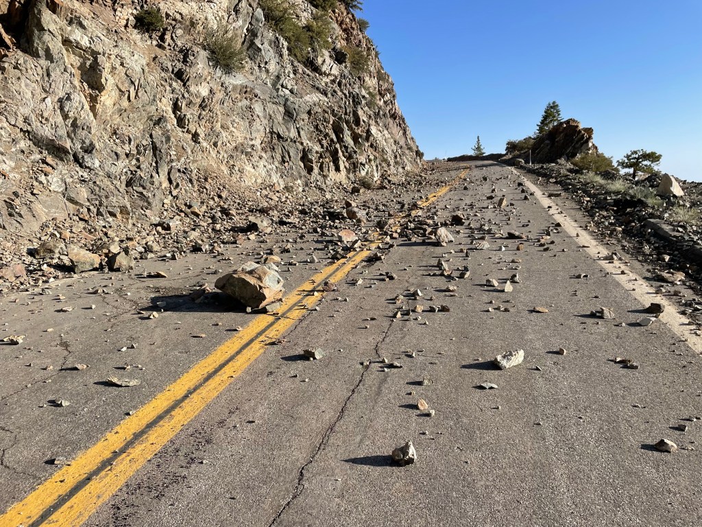
Hwy 2 is the Angeles Crest Scenic Highway. Right now it is closed from Wrightwood to Three Points, a stretch of about 25 miles. It is a winding road that is cut into the north side of the mountains. It gets lots of snow and subsequent avalanches and rock slides.

There were 7 of us that decided to do the road walk. The first 4 miles was a gradual up. We learned real quick why the road was closed. Plenty or rock slides and snow covered road from avalanches.
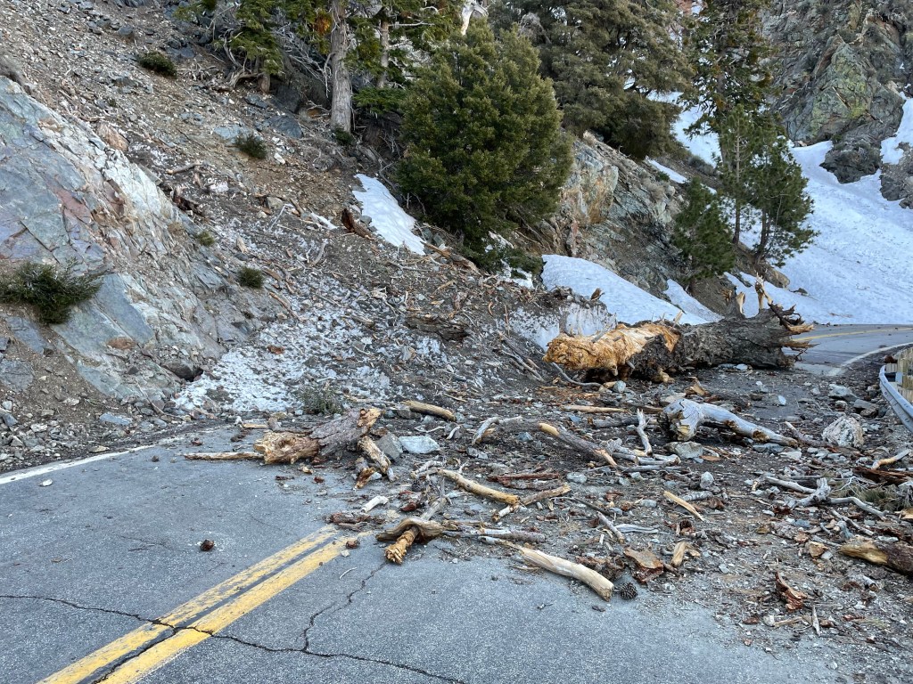
On the descent we encountered many large snow fields across the road but we didn’t need our crampons as it was hard pack sticky snow.
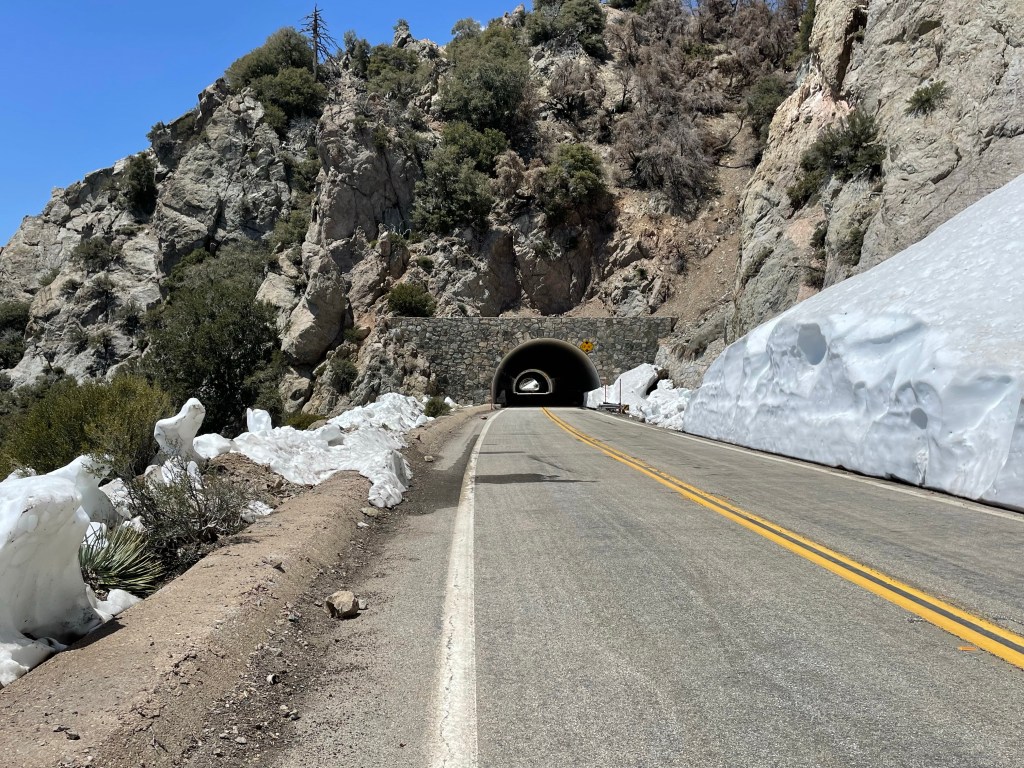
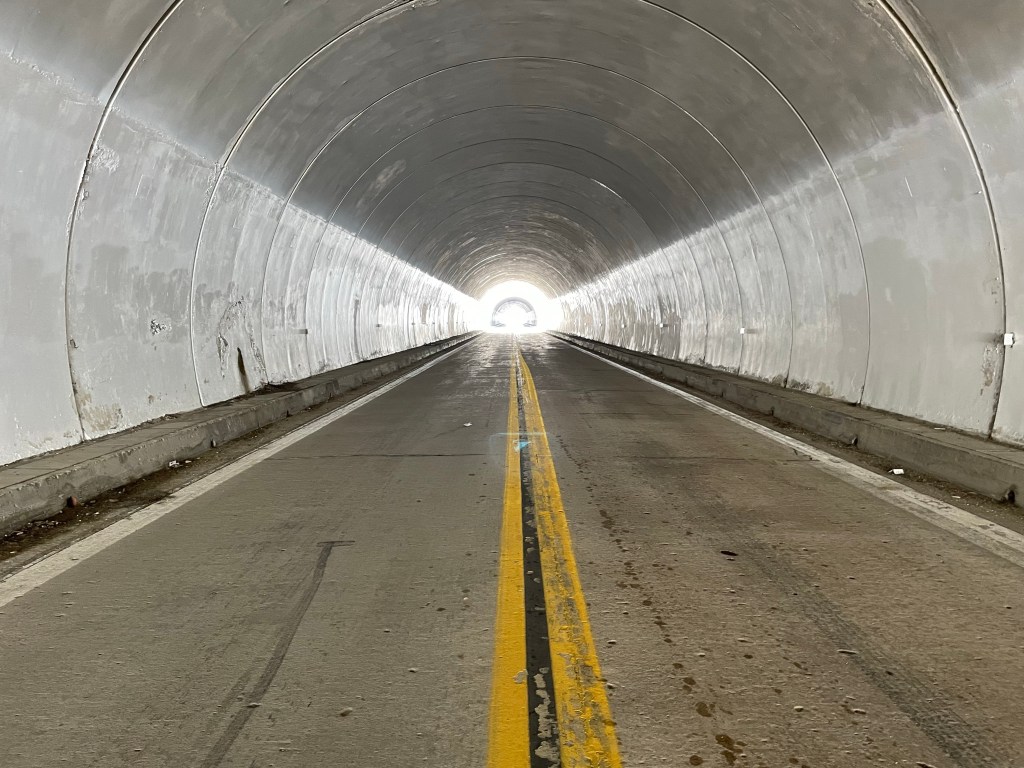
We found a nice spot for lunch by a water source that had some stonework and a rail to access the water. After lunch we were both feeling “done” with the road walk. The snow disappeared and it had become just a hard paved walk. After 13.5 miles the road went through a couple of tunnels. Very cool to walk through with no cars.
We then actually walked on trail for about 0.9 miles. Then back to the road as we were now on the mandatory bypass for the endangered Mountain Yellow Frog. The PCT was closed through this area so this added another 4 mile road walk.
We were both not paying attention and we missed the turn to the Buckhorn trail which would lead us back to the PCT. We turned around and backtracked the 0.4 miles. From there it was 2.2 miles back to the PCT and Cooper Canyon Trail Camp.
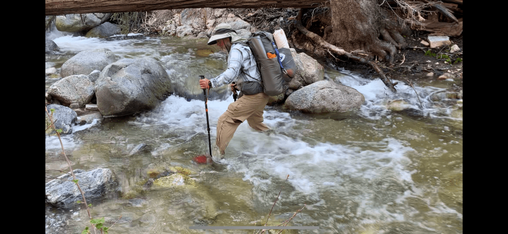
Luckily for us Buckhorn trail was mostly downhill. Unfortunately, we had to make 3 creek crossings. We didn’t like walking across a log so we just waded through them all.

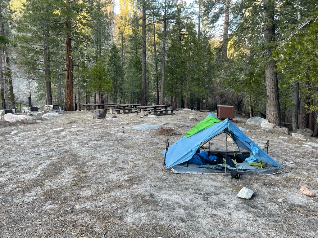
Once back on the PCT it was another 1.2 miles of gradual uphill to our campsite for the night. Pretty fancy with a clean pit toilet, large picnic tables, and bear lockers. Bonus, our tent was in a really flat and level spot. It was a long day but once it’s over we both felt satisfied.
Day 57 – The struggle is real / 600 miles!
Start: Cooper Canyon trail camp – 395.2
End: tent site on hill – 411.8
Miles: 16.6
Ascent: 3036 ft| Descent: 2740 ft
Start time: 7:09 am
End time: 4:39 pm
Current elevation: 6659 ft
We had a pretty good nights rest at the campsite. We got going after breakfast and packing up. It was a cold morning and our shoes and socks were frozen from the water crossings the afternoon before. They quickly thawed however. First order of business was a small climb. It went pretty quick. Water was not an issue today as there were plenty of snow melt streams along the trail.
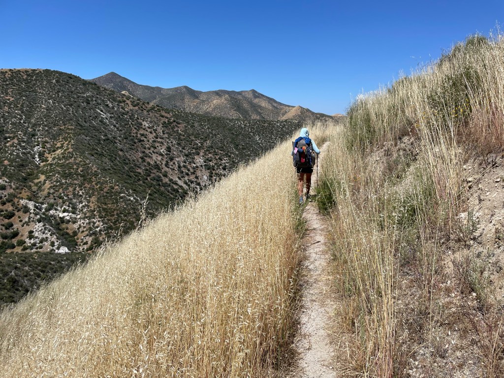
After crossing highway 2 for the last time we were now on the western edge of the San Gabriel mountains. The snow was gone but now we were again in the hit high desert environment. Mentally we were feeling “done” with this high desert. However, we did pass a huge milestone today … over 600 miles in trail!
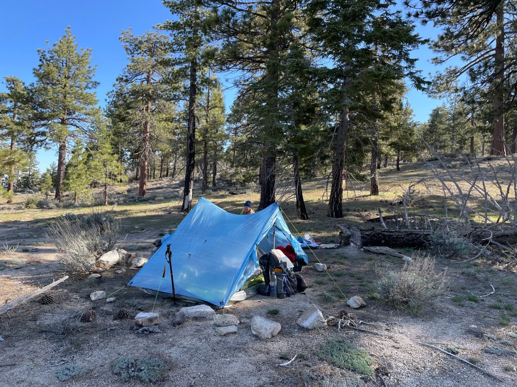
We got to the last water source before our campsite and filled up with water. After another climb we made it to the top of a hill and found some great campsites in the shade of tall pines. and the views were pretty good of the valley below.
Day 58 – Got our trail legs back
Start: tent site on hill – 411.8
End: Dirt road – 433.1
Miles: 21.3
Ascent: 3115 ft| Descent: 4378 ft
Start time: 6:43 am
End time: 6:18 pm
Current elevation: 5430 ft
We think we have our hiker legs back. We did 21.3 miles today and felt pretty good. We wanted to get as close to our exit at Aqua Dulce as possible.
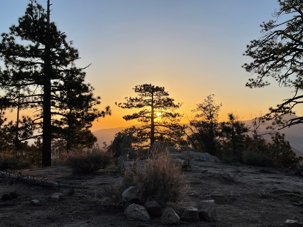
We got up extra early and saw a great sunrise over the mountains. It was a warm night and neither one of us slept well. We’re used to the cold nights and being bundled up in our sleeping bags.
The first order of business was a long decent to the Mill Creek picnic area and nearby fire station. They allow hikers to get water from their outside faucet. The water tasted like a garden hose but it was water.
Next up was a small climb back to higher elevation. Then the trail zigzagged in and out of canyons. We had a view of the valley below the entire way which was nice compared to yesterdays boring views.
Around 2 pm we had our last major climb of the day. We knew our trail legs were back and Ellen was back to herself as we made the 2.5 mile climb in about 90 minutes. That’s pretty good for a big climb at the end of the day.
Then we descended to what we thought might be our campsite for the night. Messenger Flat Campground was an oasis of pines but it was only 4:30 pm and if we stayed, then we would have had to hike over 24 miles the next day to get into town.
After another hour and a half we made it to a dirt road junction and found a dry dusty spot to pitch our tent. It was a terrible campsite but it was a good day as we got a new mileage high … and tomorrow is town day!
Day 59 – The slog and town day!
Start: Dirt road – 433.1
End: Vasquez Rocks – 453.6
Miles: 20.5
Ascent: 2889 ft| Descent: 5752 ft
Start time: 6:29 am
End time: 6:23 pm
Current elevation: 2481 ft
We decided to try a cold breakfast instead of boiling water for our hot cereal and Jeff’s coffee. Ellen had a Breakfast Essentials drink and Jeff had cold cereal and cold coffee. We got going a little earlier than usual today and it wasn’t long before it felt really hot.
We made quick work of the first six miles or so but then the long hot slog began. We were dropping in elevation which meant an increase in temperature.
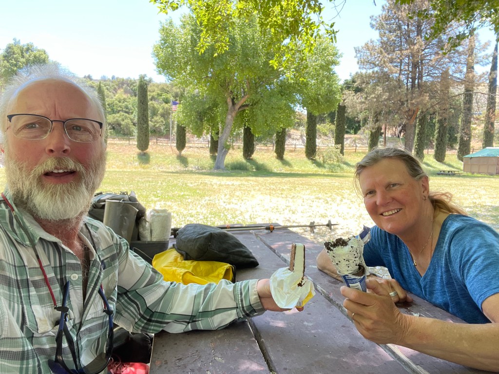
After 11 miles we made it to Acton and went to the LA RV park to fill our water and eat our lunch. Nothing too exciting about this park except some shade, bathrooms and ice cream! After an hour it was time to get moving again.
Now we had a big climb; it was 1:30 in the afternoon; and it was about 90 degrees. This does not make for fast hiking. We were both trying to regulate our pace and today Jeff was having more success than Ellen. We had to stop many times and without the shade, cooling down was difficult. However, we had no choice but to keep putting one foot in front of the other.
The rest of the afternoon continued to be difficult. After a small decent, we had another climb. Not as big as the last one, but it was still up. Around 4 pm we finally saw highway 14 in the distance. Unfortunately it was still 4 miles away by trail.
After what seemed like forever we finally got to the tunnel under the freeway. That only meant we were really close – 2.5 more miles to the visitor center at Vasquez Rocks.
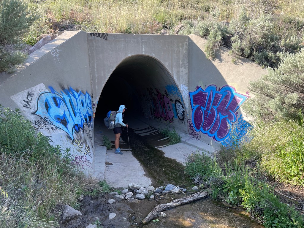
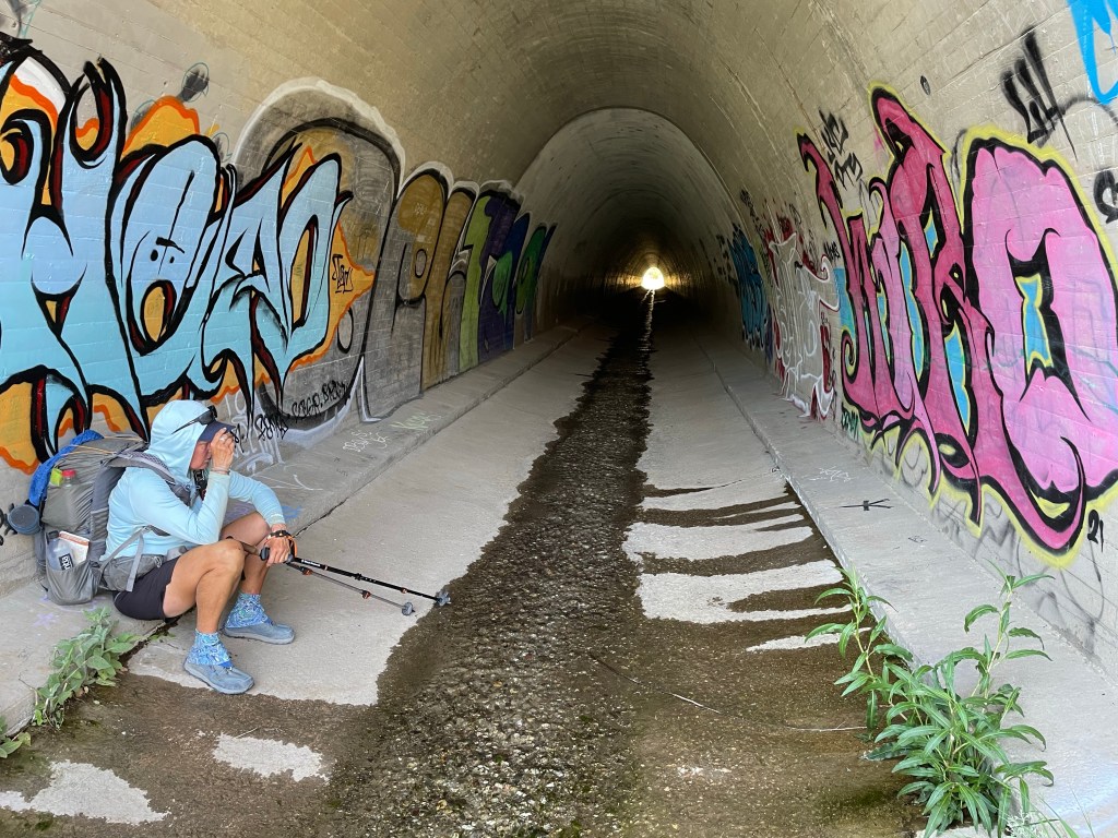
We were now in Vasquez Rocks Natural Area. You might recognize this area from movies and several Star Trek episodes. After making it through a small canyon, the trail decided we needed to do more climbing! Noooo!
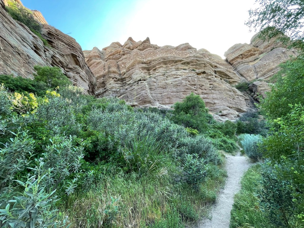
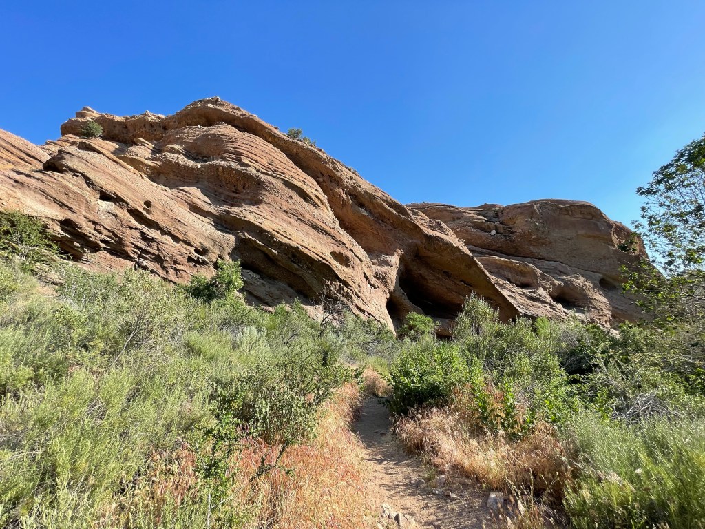
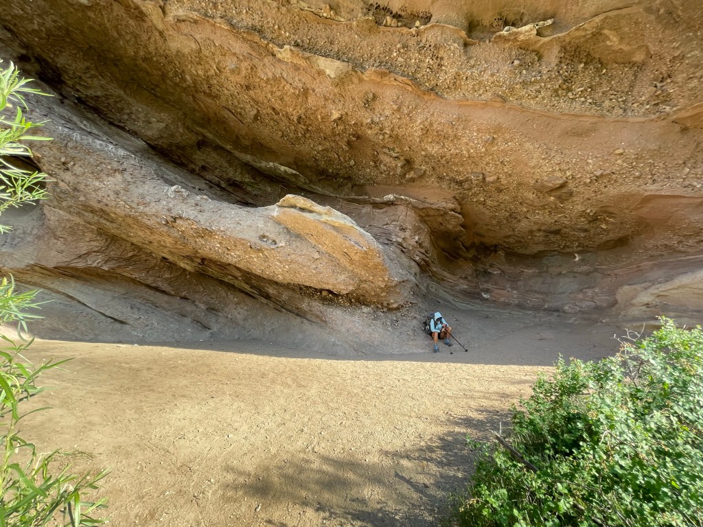
Finally, we arrived at the visitor center and the place we had been over six weeks ago when we flipped north. We were now done with the first 652 miles of the trail!
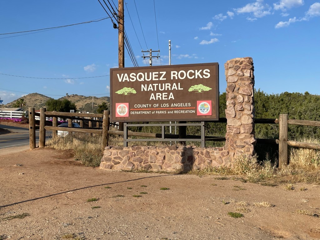
The initial plan was to stay at Serenity Oasis. Basically at a campground that provides showers, laundry and other hiker needs. But we both felt really disgusting and Jeff suggested getting a hotel room. So off to Palmdale to the Holiday Inn via a Uber. Tomorrow is a zero/travel day as we head back to Walker Pass.
Here is the next video!

Sorry to hear about your illness, Ellen – that sucks. Glad you’re feeling better. It’s awesome how you are sharing your journey. Vasquez Rocks looks otherworldly. I just got back from Alaska – hiked the Deer Mountain trail in Ketchikan & up Mt. Roberts – it was beautiful.
Trek on!
LikeLiked by 1 person
Just got back from out one day hiking trip to hocking hills with the girls… I survived. I think we totaled about 5 hours of day hiking. You guys are incredible. My trail name became TURTLE but you know what they say about slow and steady. And I kept remembering what Ellen always told me… walk your walk… hope to do more.
LikeLiked by 1 person
You two are doing fantastic! You are blowing through those 20 mile days like super-humans – so very inspiring. Glad youâre healthy again Ellen! A quarter of the the way through to your end goal – crazy awesome 😉 While you comment that you were âdoneâ with some of the scenery, it beats any scenery in SE MI! AND your peaceful mind time is a respite from all the hooha in our lives. Iâve missed some of your posts, but so pleased to get this email today! Iâm enjoying living vicariously through you two and appreciate your ups and downs of all types. Iâve gotten my butt back on the bike(s) and working to gain physical condition for the Tour des Trees in late September, Reno – Lake Tahoe – San Jose – ultimately to Half Moon Bay; 5 days 380 miles.
Love – Julie
Julie Stachecki Site Specific, Inc. ISA Certified Arborist MI-0650; TRAQ Qualified; MI Oak Wilt Qualified 810-599-0343
Riding my bike 380 miles in 2023 Tour des Trees to support tree research & education – Please consider a donation: https://tinyurl.com/Julie-TourDesTrees2023 https://tinyurl.com/Julie-TourDesTrees2023
>
LikeLiked by 1 person