Day 25
Start: Willow Springs Road- Tehachapi – 558.4
End: top of ridge – 572.9
Miles: 14.5
Ascent: 3596 ft| Descent: 1589 ft
Start time: 9:40 am
End time: 5:20 pm
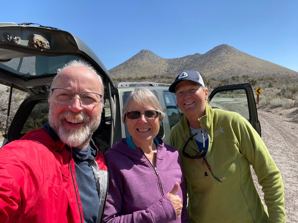
Long day of climbing (again). We had a nice breakfast at the hotel. Ellen went to the gas station and got 4 gallons of water that we used to cache ahead at Highway 58, eight miles into our intended path. Our trail angel “Split” (Mike) first drove us to Highway 58 to cache our water and then drove us further south to where we left off yesterday at Tehachapi-Willow Springs road.

We had 8 miles to go to get to the highway. The first half of course was up and through the wind farm. There was not breeze and with a relative late start it was warm. We also were carrying 6 days of food.

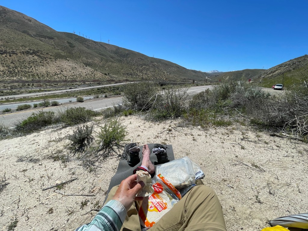
Once over the top it was a quick descent to the road and then a 1.5 mile road walk to our water cache. It took it about 3 1/2 hours to do the 8 miles. Not bad. We grabbed our water and sat down for an extended lunch break. The major discussion was if we had enough water for the next couple days. The next water source was 16.5 miles away.
As we left the highway, we noticed small painted rocks with encouraging message.


It was finally time to do the steep climb. The first 2 miles was along the freeways with a gradual climb. Then the fun began. The next 2 miles we’re straight up and in the hot sun. We were glad it was early April. We could not imagine doing this climb in late May or June. Hot hot hot.

Ryan pretty much raced up the mountain. The rest of us slowly made our way up. We got to our predetermined camping spot at 12.5 miles for the day. But Ryan was gone. We took a break and decided to do 2 more miles. And yes, more climbing. About an hour later we found Ryan at the next campsite. We were both tired and decided to stay while Ryan and All In did 2 more miles. We’ll see them in the morning as they are late sleepers.

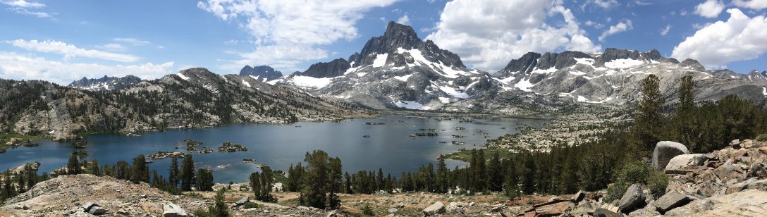
As we were climbing today we got a great view of the valley below and the mountains we climbed last week.
Day 26
Start: top of ridge – 572.9
End: the gate – 591.2
Miles: 18.3
Ascent: 2441 ft| Descent: 3374 ft
Start time: 7:22 am
End time: 5:23 pm
Another long day with a new personal mileage record. We got our usual start around 7:30 am. A couple of hours later we caught up with All In and Ryan. We had one more big climb to do today.
We finally got to Golden Oak Spring around noon. We did 10 miles in four and a half hours. We all lingered and took a long lunch.

Our next water source was another 16 miles away. We all decided to carry 5 liters of water and go another 8 miles to a gate that looked like it might some flat areas for camping.
Around 5:30 pm we made it to the gate. We doing a somewhat level site. All In and Ryan decided against going further and also found a space for their tents nearby.

We were all in agreement concerning this section so far … not great. The landscape is pretty boring, we have long water carries, and there are windmills everywhere.
Day 27
Start: the gate – 591.2
End: under the pines – 607.5
Miles: 16.3
Ascent: 3696 ft| Descent: 2333 ft
Start time: 7:22 am
End time: 6:22 pm
Today was another long day, which seems to be happening more … but we are in a groove. Our first goal was to get to Robin Bird Spring, a mere 12 miles from camp. It should only have taken us till about 1 pm based on what we did the day before. However, it was very slow going.

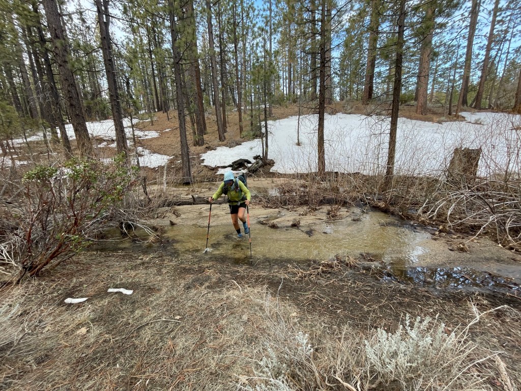
Immediately the blow downs started. With all the wind and snow this past winter, there were a lot of trees down across the trail. Ellen started counting them and after 16.3 miles we encountered 127 trees down. Some were small which just required an easy step over. Others were massive trees which required some fancy maneuvering to get by.

We finally made it to Tobin Bird Spring around 2:30 pm. We wanted to go at least 4 more miles to make 16 miles in for the day. We took a little rest and then resumed at 3 pm.
Immediately the fun began with the snow. We were now on the north side of the mountain and there was a lot of snow. The snow was soft so even with stepping other people’s foot prints, we often still post-holed. Fortunately, this only lasted a short distance.
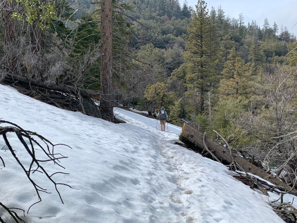
Before we knew it, we entered a pine forest with tall Ponderosa pines. We found a flat, dry spot nearby a fast flowing creek. All In and Ryan found their tent sites across the creek. We set up camp on the soft ground that was covered in pine needles.

We set up camp, made dinner and went to bed. It had been a long day and we were tired. But, wouldn’t have it any other way.
Day 28
Start: under the pines – 607.5
End: in the. Joshua trees – 625.5
Miles: 18.0
Ascent: 2372 ft| Descent: 3274 ft
Start time: 7:29 am
End time: 5:28 pm
Another great and challenging day. We started off on the nice pine forest and ended up on a windy ridge tenting between Joshua trees.
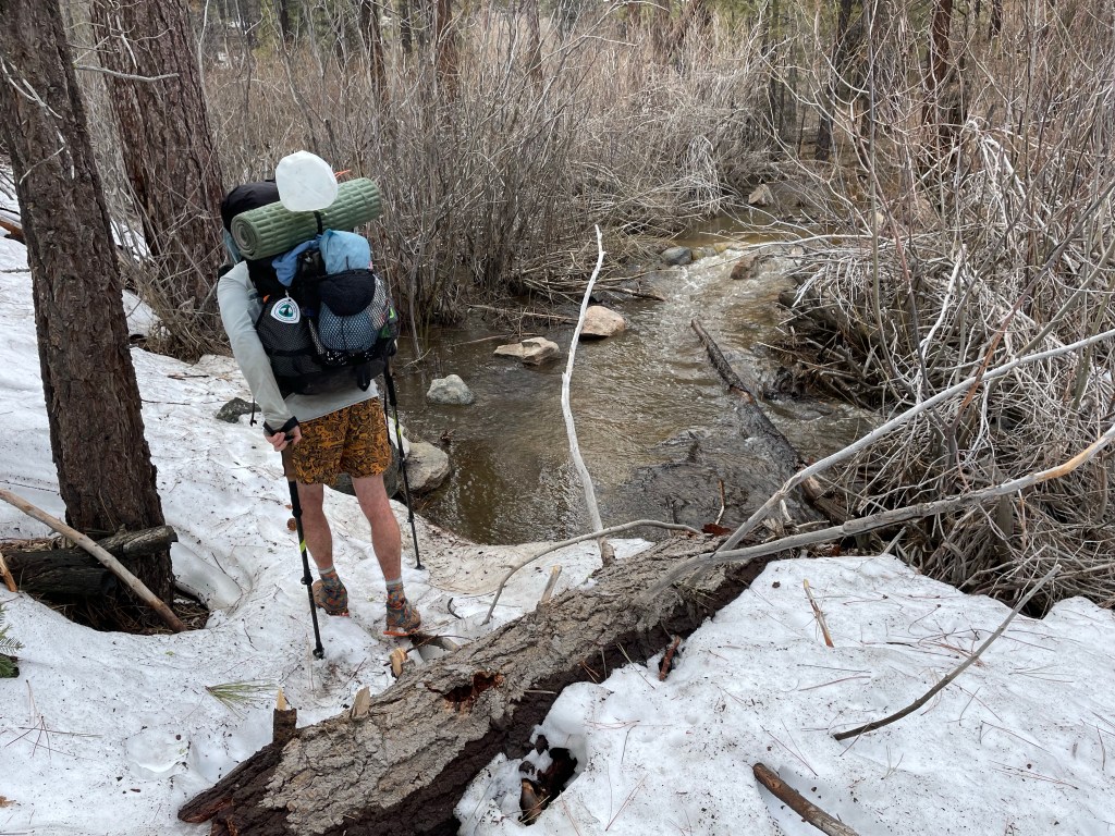
Other (southbound) hikers had described more snow in trail ahead and so we put on our dry socks and the snow baskets on the trekking poles. The first half mile consisted of a few creek crossings and some intermittent snow over the trail, but nothing like we had been told. Before we knew it we were out of the forest and back to the desert.
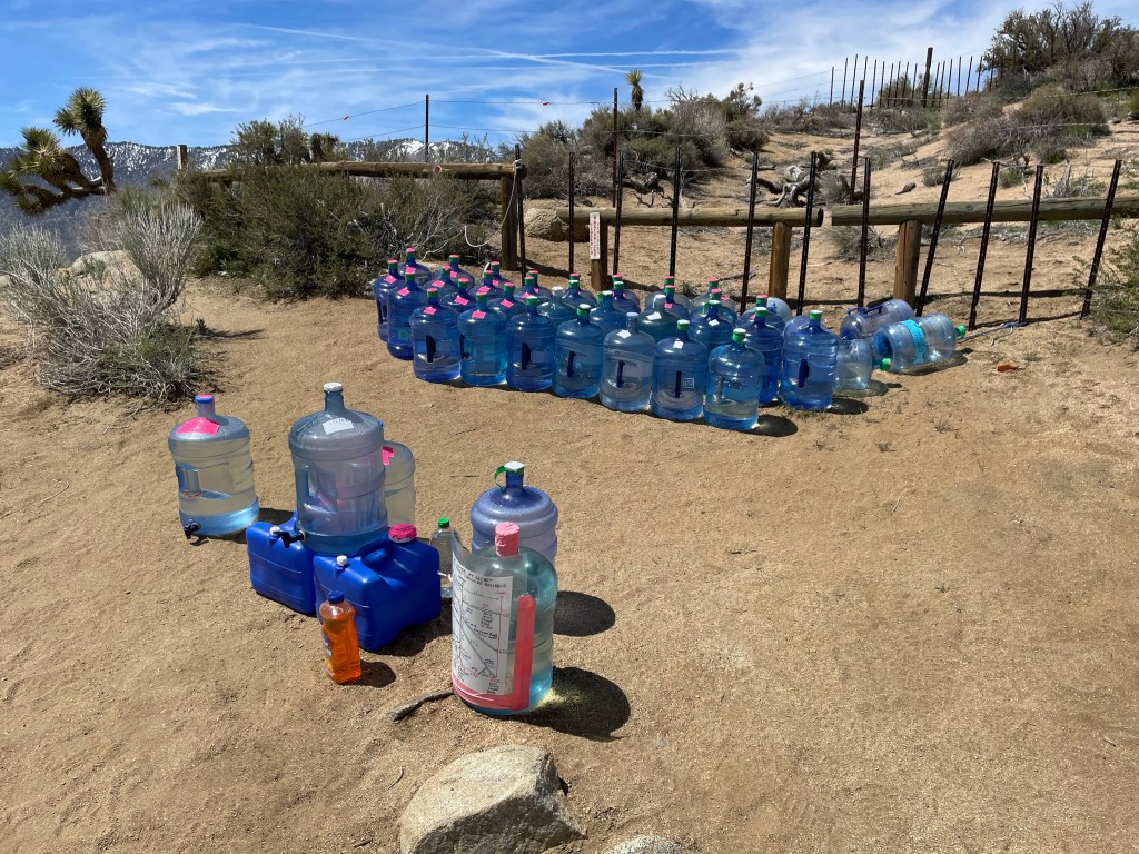
It was a long grind to make it to our next water source. We made the 12 mile hike to the water cache on Kelso Rd. Wow what a cache! There were at least twenty 5-gallon jugs of water! Thank you trail angels! We had an extended lunch which included planning the next trail section and deciding on how much water the carry … ugh.
Our next reliable water source was 14.5 miles away at Bird Pass Rd. The same trail angel had left water plus power banks to charge electronics. Awesome! We decided to do a max carry of 5 liters. Yay, another heavy backpack.

To pass the time on trail, we finally gave in to listening to audio on our phones. Jeff was listening to an audio book while Ellen listened to a couple pod casts. The wind really had picked up and some of the gusts almost blew us off the trail.

The time and miles clicked away and before we knew it we saw All In and Ryan at a campsite in a grove of Joshua trees, somewhat out of the wind.
We did 18 miles and now only have 27.5 until Walker pass and two days to do it in.
Day 29
Start: in the. Joshua trees – 625.5
End: McIvers cabin – 645.0
Miles: 19.5
Ascent: 3763 ft| Descent: 2626 ft
Start time: 7:39 am
End time: 5:54 pm
19.5 trail miles today! Wow. But let’s start at the beginning.
What we thought was a wind protected campsite turned out to be anything but. The wind came up the valley and right into Ellen’s side of the tent. Then the wind changed directions and swirled in from all sides. The tent was shaking hard and without the benefit of large rocks to keep the tent stakes in the ground, the main stakes were getting ripped out of the ground. The tent was on the verge of collapsing. Jeff got out and used some rope he had brought to tie the tent off to a dead Joshua tree and a thorny bush. We finally got some sleep despite the flapping of the tent in the wind.
In the morning we got up at our usual time and packed up. Ryan had left at 7 and the three of us left a little after 7:30 am.

The wind was relentless for most of the morning. We did a little climb and then back down to a valley. We had about 6.5 miles to the next water source.
After about 2 1/2 hours we found Ryan at Yellow Jacket Spring. It was a confusing intersection and the spring was 3/4 mile off-trail, so he he had brought up a few liters of water to share with us. We had a snack and decided to continue to a seasonal stream a 6 miles away. This way we only had to carry 2 liters. Once we got to the stream we decided to continue on to a cabin that was by a stream.
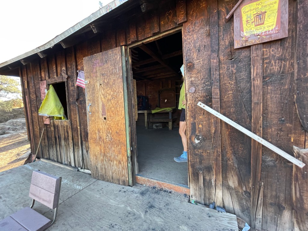

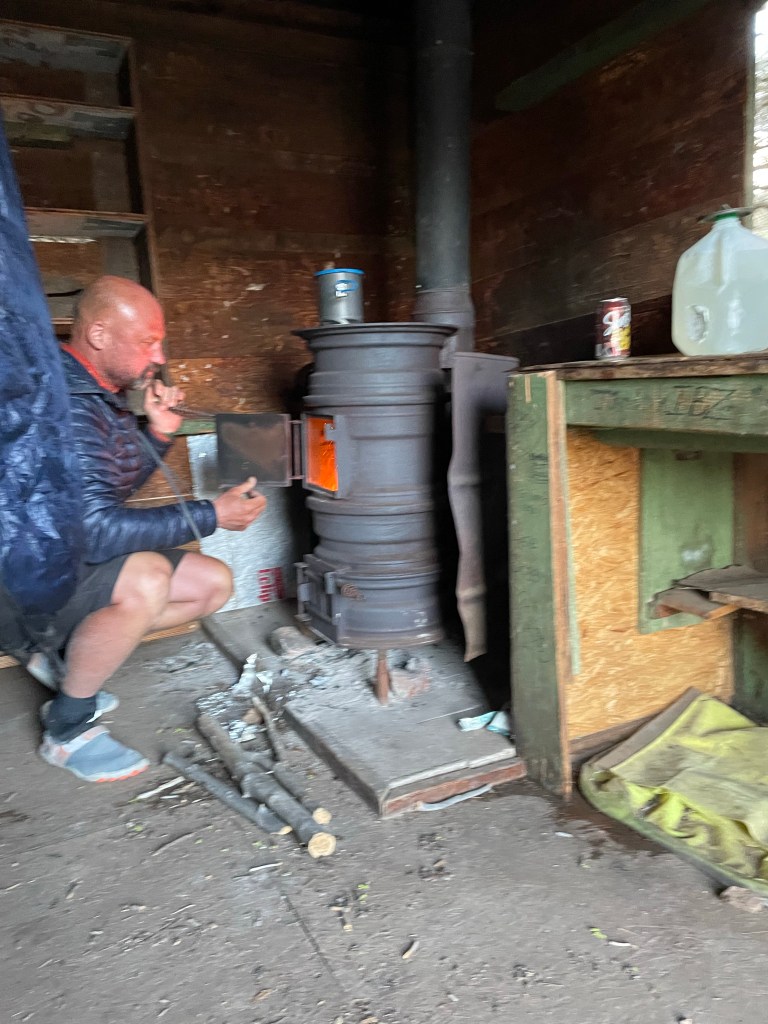
McIvers cabin is an old miners cabin that was moved to its current location years ago and now used by off road enthusiasts and hikers. It even had a wood stove! We found a flat spot to pitch our tent while All In and Ryan decided to stay inside the cabin. They made a fire in the stove and it was soon very warm inside. A nice reprieve from the wind the cold. We all had dinner inside the cabin. Total miles hiked was 19.5 on trail plus 0.2 side trail to the cabin. Personal best for all of us.
Day 30
Start: McIvers cabin – 645.0
End: Walker pass – 652.5
Miles: 7.5
Ascent: 467 ft| Descent: 2023 ft
Start time: 7:01 am
End time: 10:05 am
Town day! Ryan woke us up at 5:30 am since we all wanted to get to town. The wood burning stove in the cabin was out so it was cold. We woke up to a frozen tent. We quickly packed everything up and went to the “warmer” cabin to have breakfast.
We left the cabin cleaner than we found it and headed out. It was cold. We we’re all bundled up until the sun broke out. We all practically ran down the trail.

We got to the north side of a hill side and found a few patches of snow to deal with, but now big deal. The trail was easy and we made the 7.5 mile trek to the Walker pass campground in two hours.
It was then time to find a ride into Ridgecrest. The road wasn’t too busy, and so trying to find a hitch for four people was not working. So we split up and All In and Ryan walked down the road a bit. Within a few minutes our trail angel Charlotte stopped her car. What a sweet lady! She drove us to Ridgecrest and stopped at three different rental car places. We needed to rent a car to get us back to SoCal but for some reason all the rental car places had no cars.
We let our trail angel so we could decide how to get south. As we are walking in the parking lot, All In and Ryan showed up with their trail angel. We were all hungry as we had been dreaming of town food all day. We ended up getting pizza.
As we were discussing on how we should get sloth, Ryan suggested to rent a U-haul truck. We’ll we did. It was easy and a lot cheaper than a car. We made the four hour drive to Ellen’s dads.

We made plans with our “tramily” to meet back up in Paradise Valley Cafe in a couple days to tackle the Southern California mountains.
Here is the next video!

Agree with Ann. Always excited for the update to come !
Ironic for people living out of packs to need a UHaul. Lol
Rhonda
LikeLike
This reads like a novel. I hate to get to the end of the post as I know I will have to wait days to see the next chapter. You two are awesome!
LikeLike