Day 14
Start: – 151.9
End: – 151.9
Miles: 0.0
Zero day in Costa Mesa
After sleeping in till 8 am we got up and after breakfast decided to do laundry. We aired out our sleeping bags, cleaned the tent and looked over all of our get. Ellen was very excited about a new pair of trail runners.

We ran around town looking for some specific foods that we wanted plus some other supplies. The rest of the time was spent visiting with family.
We did got to our favorite taco place called Taco Mesa. We each got a big burrito with chips. Yummy
Day 15
Start: – 151.9
End: – 151.9
Miles: 0.0
Zero day #2 in Costa Mesa
Went to REI to get new socks. Finished putting our trail meals together and packing our backpacks.
Ellen’s brother Pete and his wife Debbie came over and we all went to Ellen’s dads favorite place- Avila’s El Ranchito for dinner.
It was early to bed since we had a long drive in the morning to get back on trail.
Day 16
Start: Vasquez Rocks – 453.6
End: Bouquet Canyon. Rd – 465.4
Miles: 11.8
Ascent: 2587 ft| Descent: 1771 ft
Start time: 8:51 am
End time: 4:03 pm
Time to get back on trail. We made the decision to skip ahead to Vasquez Rocks (mile 453.6) in order to miss the snow on Mt. San Jacinto and all the snow in the San Bernardino and San Gabriel mountains.
Jeff’s brother Jon was gracious again to give us a ride to Vasquez Rocks. After almost a 2 hour drive we finally got started just before 9 am. First order was to do the road walk through Aqua Dulce. Aqua Dulce is only one of two towns that the PCT actually goes through.

As we were walking through town several cars honked at us and gave us thumbs up. An owner of a restaurant even offered to buy us breakfast. We had miles to hike and so had to decline. People as amazing!
After about an hour we made it into the hills and left the town behind. Our packs were full and our legs were not used to hiking after sitting around for two days. It was a long climb but the view got more beautiful the higher we got. We got a glimpse of the snow covered San Gabriel mountains.

We made it to the top and then it was a long decent down to Bouquet Canyon Road. The top of this side of the mountain had a totally different feel. Gone was the desert looking environment. Instead it was forested with lush ground cover. There were still patches of snow and the ground was pretty water saturated. We found a good flowing creek and each got 2 L of water with the hopes that more water would be available down the trail. The water seemed to disappear as we got down in the valley but eventually found a small stream.
We really wanted to keep going , but the thought of carrying 4-5 liters of water up another hill for 3 miles did not seem fun. Plus, our legs and feet were tired. So we opted to make camp by the stream. We only did 11.8 miles, but we really wanted to do more.
This entire section requires careful planning for water and making camp.
Day 17
Start: Bouquet Canyon. Rd – 465.4
End: Top of fire break – 482.5
Miles: 17.1
Ascent: 3505 ft| Descent: 3086 ft
Start time: 7:23 am
End time: 5:30 pm
Our longest day yet! We woke up to a wet tent in and out because we were again camped in a low area by a creek. The trail was awesome however – no big rocks just small gravel and dirt. First order of business was the climb out of the canyon. Water seemed to be everywhere again.
After a little bit we met a recent army retiree named Dave and we kept leapfrogging with him. We also saw a lot of south bounders (SOBO) hikers that had flipped up to Tehachapi from the south to avoid the snow.
There was one great water source, a waterfall. To help prevent the trail from eroding a Boy Scout troop had placed a pipe under the trail to help move water down the hill. It was very cold water but Jeff could not help but put his head under it.

At one point Jeff and Dave started hiking together. While they were having great conversation they missed the trail at a road crossing. They ended up hiking down a dirt road for half a mile before realizing their mistake. As luck would have it, a Jeep was coming up the trail and offered to give to them a ride back back up.

At about 1:30 pm we made it down to the road to Green Valley. A trail angel had left some snacks and beverages in a tub under a tree.. nice! Now it was time for the climb back up. We weren’t sure where the next campsite was since most of the trail was carved out of the mountain side.
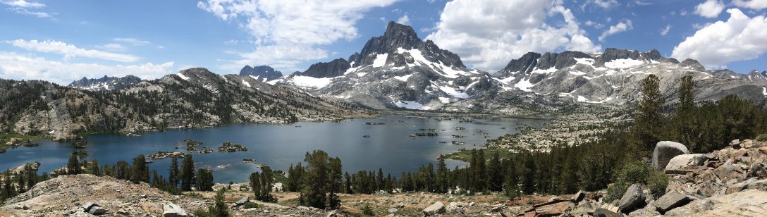
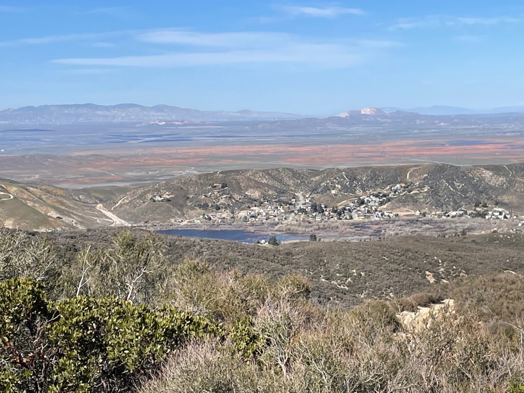
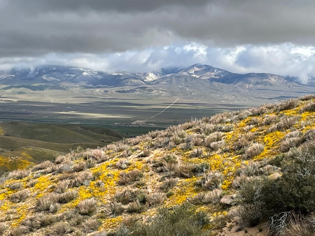
We got to the top of a ridge and saw the next valley over. Wow what a view. Antelope Valley was in bloom with the California poppies.
We crossed a couple of dirt roads but decided against camping there. It was the weekend and we had been seeing some people four wheeling and riding dirt bikes.
As it was getting late we found a fire break above the dirt road and that had a perfect flat spot. We actually had a great night with a beautiful view of Lake Elizabeth and the mountains in the distant. It was another day to be on the trail.

Day 18
Start: Top of fire break – 482.5
End: Sawmill campground – 498.2
Miles: 15.7
Ascent: 3468 ft|Descent: 2309 ft
Start time: 7:35 am
End time: 5:48 pm
What a day! From desert heat in a burn area to winter condition on the mountain.
As we got started a trail maintenance crew showed up. Many thanks to the volunteers who keep the trail in great shape. We noticed the clear trail as we made our way down to Lake Hughes road and in no time we had made the 3.3 mile hike to the road. Then of course it was time to go up. As we made our way up we met up with several SOBOs including Onward and Trish. We exchanged information about the trail and wished each other happy trails.
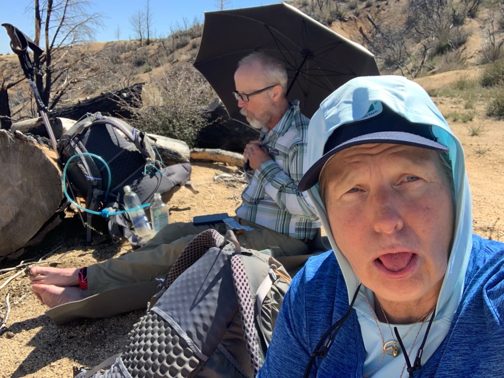
After about 4 miles we got into a major burn area. It was pretty ugly. One of the first plants to grow in a burn area is “poodle dog bush”. It is very poisonous and was literally everywhere. We were very careful not to touch it with anything, including our trekking poles.
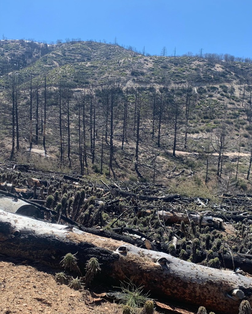
We finally found a clear spot for much. It was hot and not very fun area. We had heard there was snow nearby but at this moment we could not picture snow.
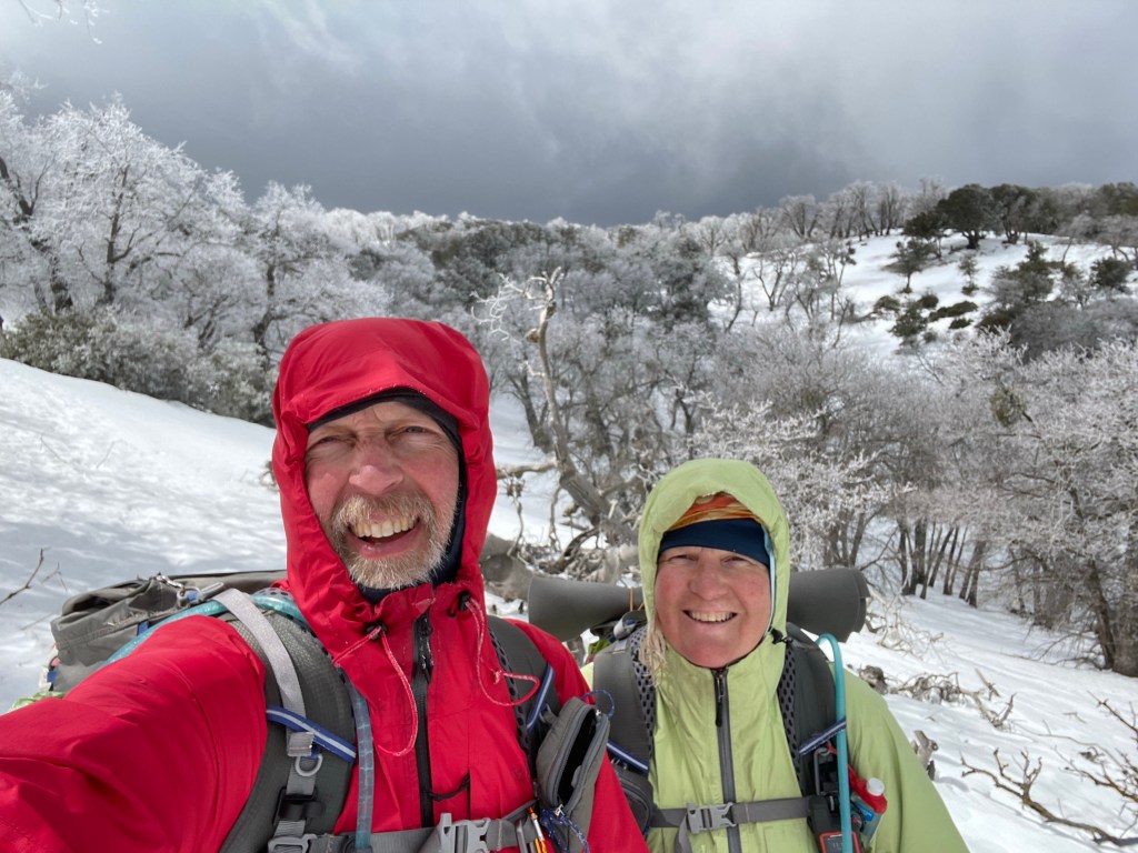
Finally after what seemed like forever, we started to climb out of the burn area and we found the snow. At first the snow was just occasional patches but the higher we went the more snow was on the trail. With it being late in the day the snow was soft and slippery. We took our time and made it to our last water source for that day and the next. We filled up and continued climbing.

We also met Mike, aka “Old Goat”, and hiked with him for the rest of the day. We were all getting very tired and were glad we made it to Sawmill campground. It had picnic benches and a pit toilet. Such luxury! We set up camp, made dinner and climbed into our tents. The wind had picked up and we knew that there was a high wind advisory for the area (30-40 mph plus higher gusts). It wasn’t until 8 pm when we went to sleep. Way past our bed time.
It was a tough day with our first encounter with significant snow on the trail.

Day 19
Location: The Desert
Start: Sawmill campground – 498.2
End: Pine Canyon rd – 510.9
Miles: 12.7
Ascent: 1841 ft | Descent: 2914 ft
Start time: 7:55 am
End time: 3:34 pm
Time wise it was a short day, hiking wise it was long. We were awakened by the shaking of our tent several times during the night. The wind was howling and gusting. It also hailed/snowed all night and our tent was frozen. We decided to stay out of the wind by cooking our breakfast in the outhouse. Yes, we know … really, an outhouse?

We along with Mike decided to walk the road that paralleled the trail for about 6 miles. We were worried about the trial conditions and the potential of blow downs due to the high winds.
As soon as we got on the road, we saw the evidence of the high winds. Many big trees had come down during the night. We were glad with our decision.

The road conditions varied from snow covered, frozen drifts, to slick mud. Also the winds continued to blow really hard along with ice pellets. For a few stretches the wind and hail was blowing straight into our faces. It felt like we were getting sandblasted with ice. Not fun. But we wkept going knowing this would end soon.
From looking at the maps we noticed that once we had to get back on trail, there the trail opened up and was wider. This made for much “relaxing” hiking. The wind continued to blow like crazy as we went down the mountain. Several time we saw some great views of the valley below with the snow storm hanging above.

The snow finally started to disappear at about the 4800’ level and we were back on dirt! There again were more trees downed from last nights wind.
We made it to the valley below to our first water source since yesterdays water fall. We stopped early knowing we would only have 6.7 miles to “Hiker Town” the next day. Another great day on trail with new experience.
Day 20
Start: Pine Canyon rd – 510.9
End: Hiker Town – 517.6
Miles: 6.7
Ascent: 881 ft| Descent: 1639 ft
Start time: 8:29 am
End time: 11:54 am
Short day today as it was town day! We were only 6.7 miles from Hiker Town. We slept in until 7:10 am! It was still cold and the wind was still strong.
After a little while Dave caught up with us again. We hiked together until we got to town. The sun tried to break thru a few times. As we made our way down we got a great view of the valley below with the Tehachapi mountains beyond.
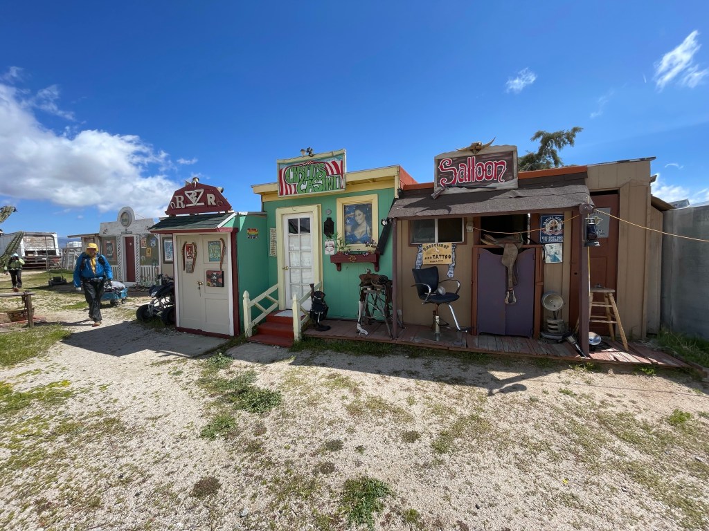
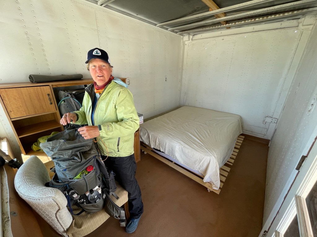
We got to the road fairly quick and then to Hiker Town. Hiker Town is a collection of tiny “buildings” converted into “accommodations” for hikers. It’s an interesting place. We checked in and we were assigned the City Hall building. We also picked up our resupply box we had mailed to ourselves.

We were all hungry for some town food. We got a ride from a local to the Neenach cafe and market. He drives hikers back and forth between Hiker Town and the market all season. We ordered some food and all worked on our blog and video.
Here is the next video!

Love love love seeing your adventure!!
LikeLiked by 1 person
Your 2 are steadfast and awesome ! You can’t hear us but we’re cheering for you ! Thanks for the update. Rick ________________________________
LikeLike
Thank you Rick. Much appreciated.
LikeLike
Thanks Rick! We hear you now! – Jeff and Ellen
LikeLike