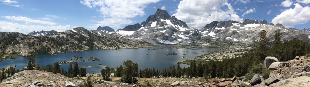
Day 76 – Back to snow
Start: Burney Falls – 1420.1
End: north of Clark creek – 1438.4
Miles: 18.3
Ascent: 4070 ft | Descent: 1901 ft
Start time: 7:06 am
End time: 7:41 pm
Current elevation: 5173 ft
We both had a good nights rest. We had breakfast, packed up and went to see the Burney Falls one more time. We did our morning video and then it was time to hit the trail.Most of the days hiking was through the forest that gave us shade. That really helped Jeff. The direct sunlight and heat zaps his energy.
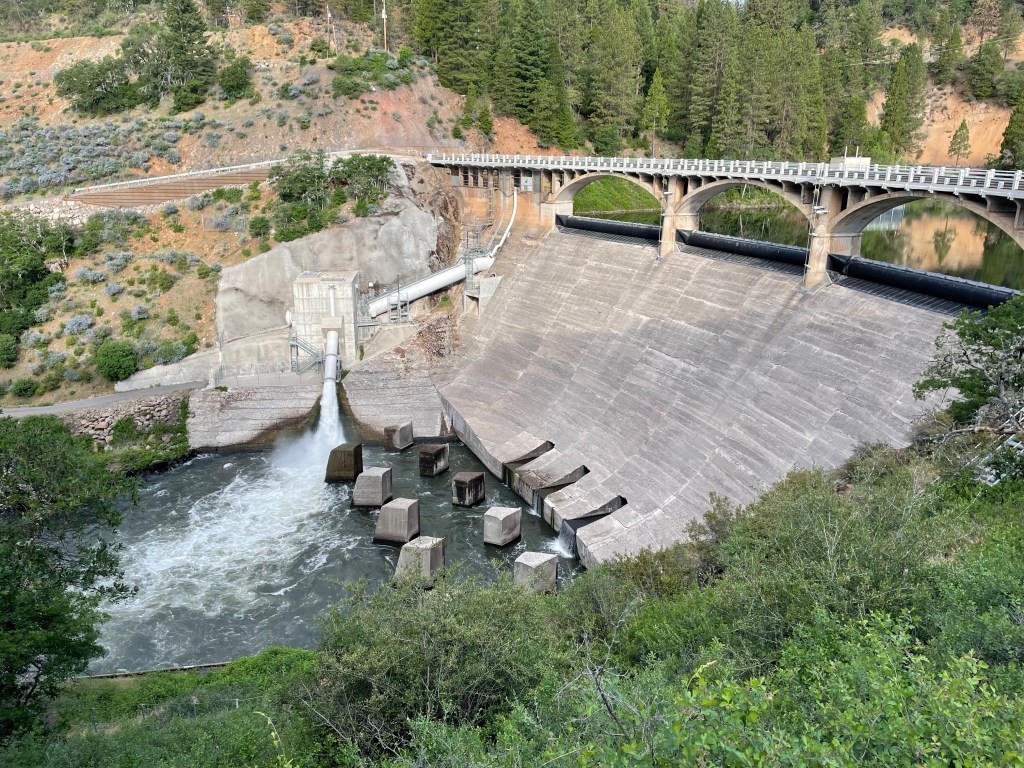
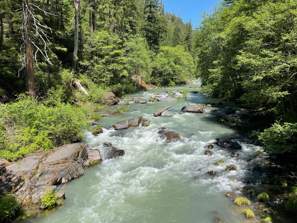
We took our time and just enjoyed the hiking this morning. The trail was soft and gently sloped. After about 2 miles we got to Pit River Dam #3 which backs up Lake Britton. The PCT crosses over the dam via a beautiful arched bridge. Water jetting out of a big tube from to the side of the dam.
The trail then climbed atop the mountain ridge with the Pit River gorge below. Supposedly, the Pit River is known for great trout fishing.

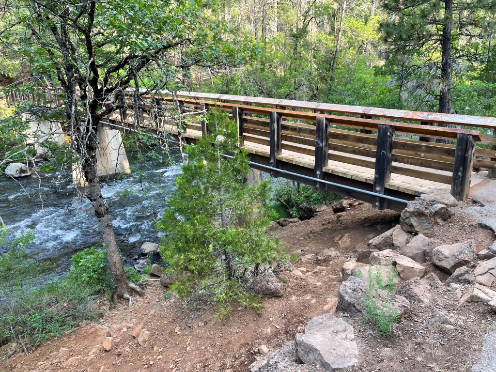
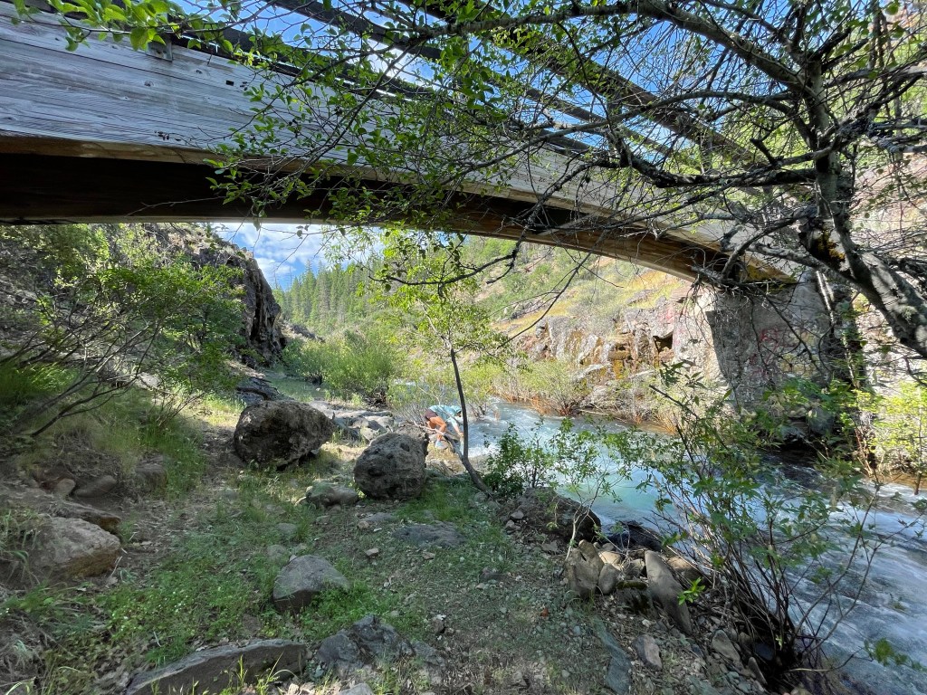
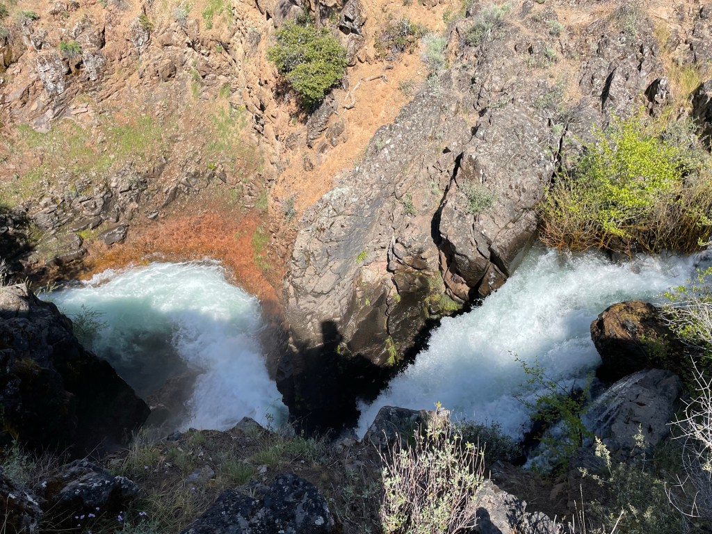
A few miles later we came to Rock Creek which feeds into the Pit River. The trail crossed Rock Creek over a wooden bridge just upstream from where the creek plummets over a tall narrow falls. It was pretty spectacular.

We got to the junction of Screwdriver Creek and decided to have lunch and collect water. It was another 9 miles to our targeted campsite for the night. We were hoping to camp water so we wouldn’t have to do a big water carry.
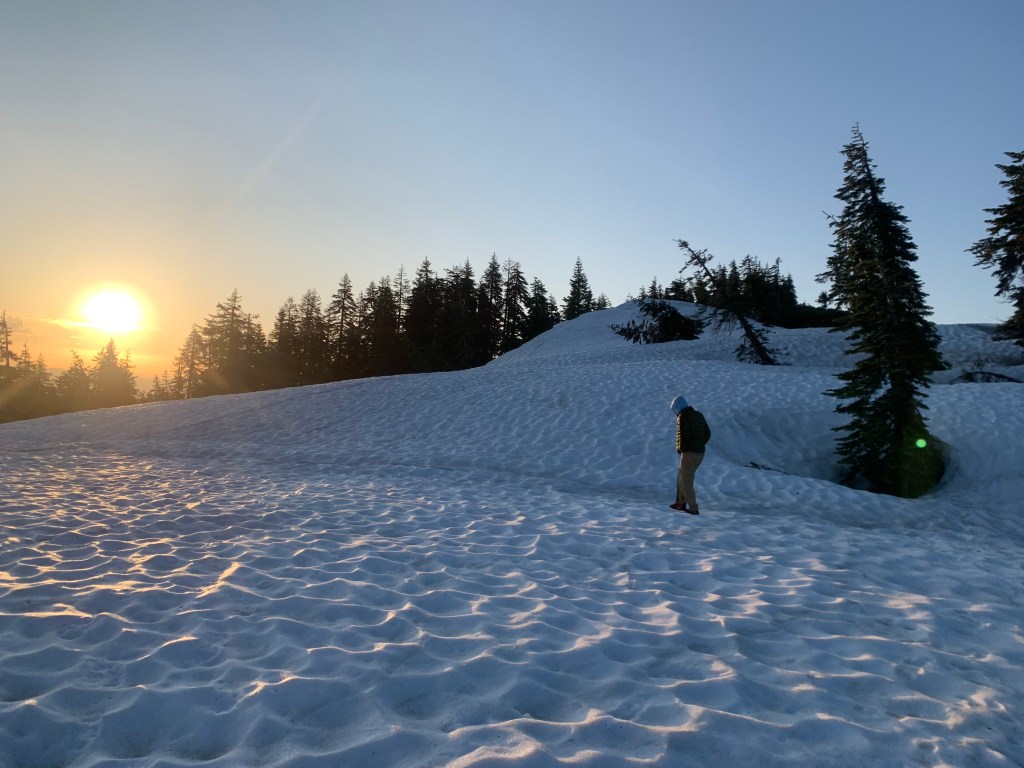
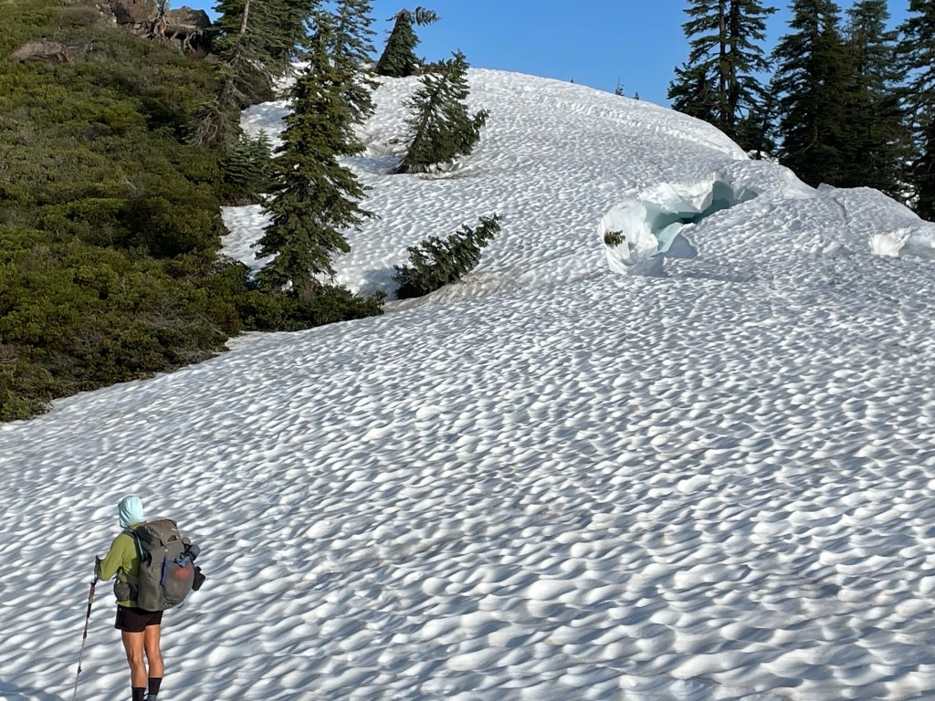
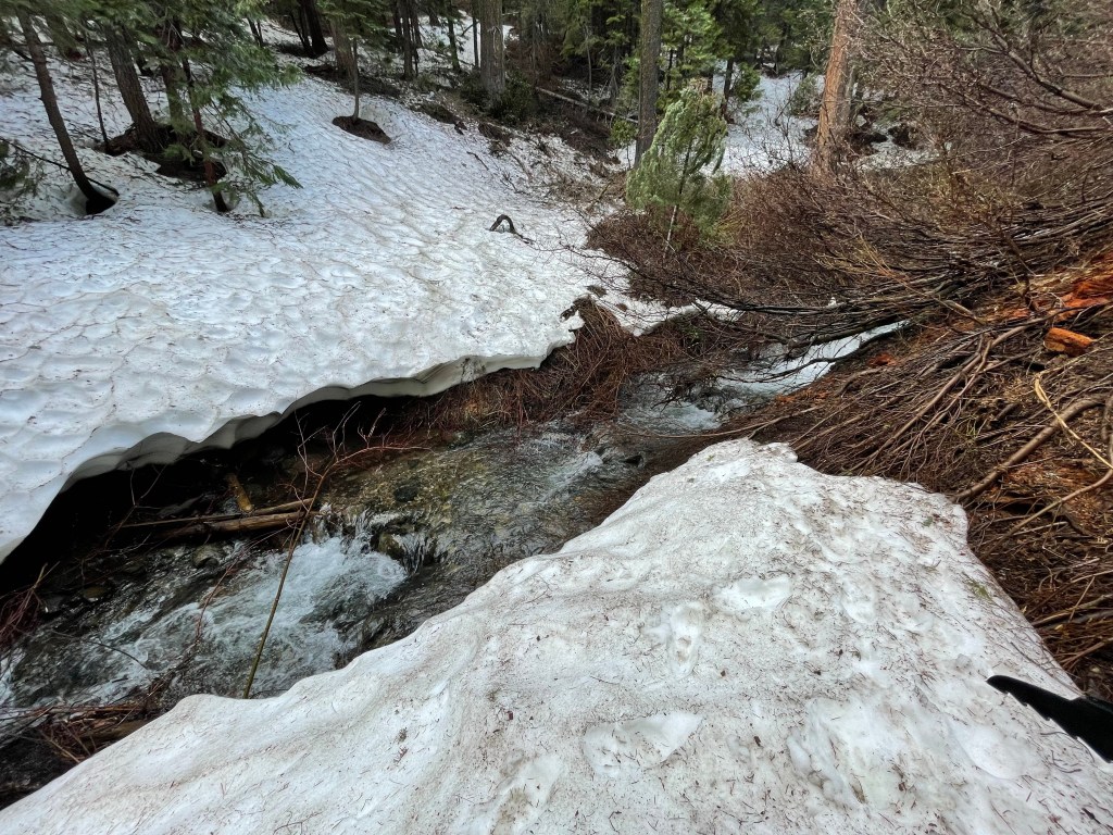
At mile marker 1432.1 we saw our first snow patch at an elevation of 4905 ft. We had been watching the reports from other hikers regarding snow and trail conditions. Reports had been that the snow level was at around 4800 ft.

The snow coverage increased the further and higher we went but it was manageable. Up ahead the trail crosses an exposed ridge but there was rain and thunder in the area and so we opted to stop and hopefully wait out the storm. It started raining so we sheltered under a pine tree, boiled some water, and had dinner.
After dinner it was still lightly raining but the thunderstorm had moved on. We were waking on some private land which the owner was in the process of logging. After a little while we found some snow free ground and made camp.
It had been a very long day, both in time and distance. Once we did hit more snow the travel got even slower. We did over 18 miles but it took 12 1/2 hours.
Day 77 – Snow, snow and more snow
Start: north of Clark creek – 1438.4
End: Top of ridge- summit lake rd – 1452.1
Miles: 13.7
Ascent: 2468 ft | Descent: 1564 ft
Start time: 7:05 am
End time: 6:55 pm
Current elevation: 6120 ft
Wow, what a day! Talk about slow going.
We woke to clear skies and a drier tent. We made breakfast ,packed up and got going. We knew that today was going to be a long snow travel day.
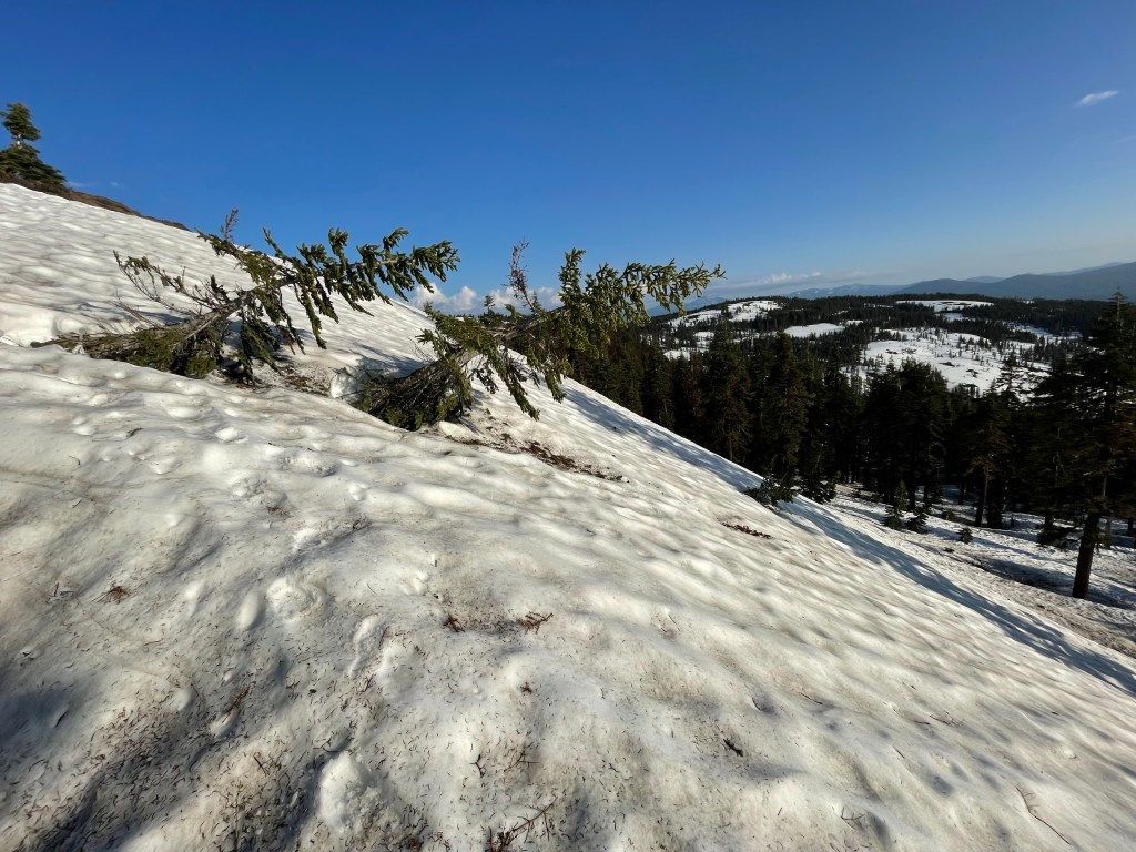
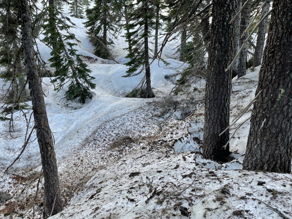
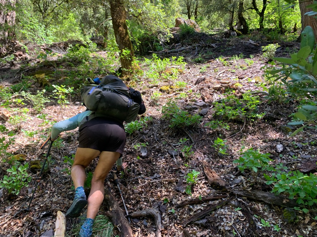
The trail was mostly under snow and the path was a traverse with lots of up and downs. This section of trail also had a lot of blowdowns we had to crawl over, under, or walk around.
There was some snow free trail, but most of the time it was snow covered. To avoid some of the steepest sections of the snow-covered PCT, it was recommended to travel the path of a snow-covered road (Summit Lake Road) which parallels the PCT but higher up on the ridge. So we did. However, the “road” is really just a two-track OHV trail.
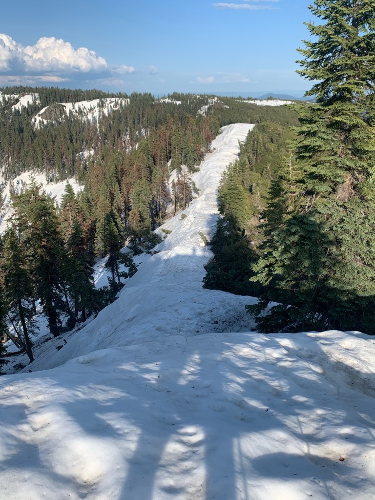
The “road” was under at least 10 feet of consolidated snow with drifts much higher. As the day wore on the snow got softer and mushier. This made for very slow travel as we kept slipping and sliding, even with our crampons. We kicked toe holes in the steepest areas and focused on making each step safely.

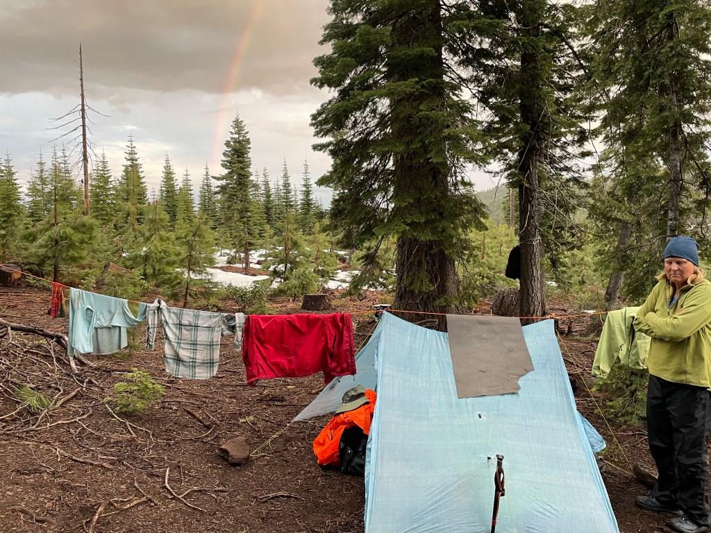
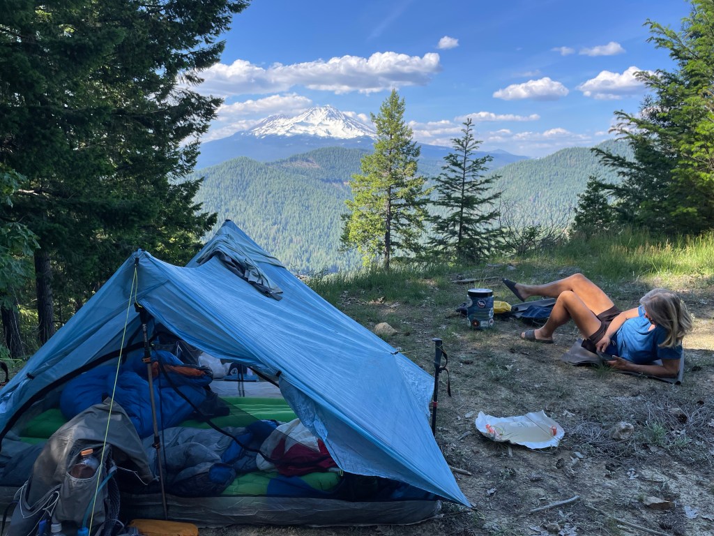
It was getting very late and we needed to find a camping spot soon. There were no snow free patches so we decided to pitch our tent on the only flat area we saw. We had a great view of the valley to the north and to the south over the ridge. It really was a pretty site.
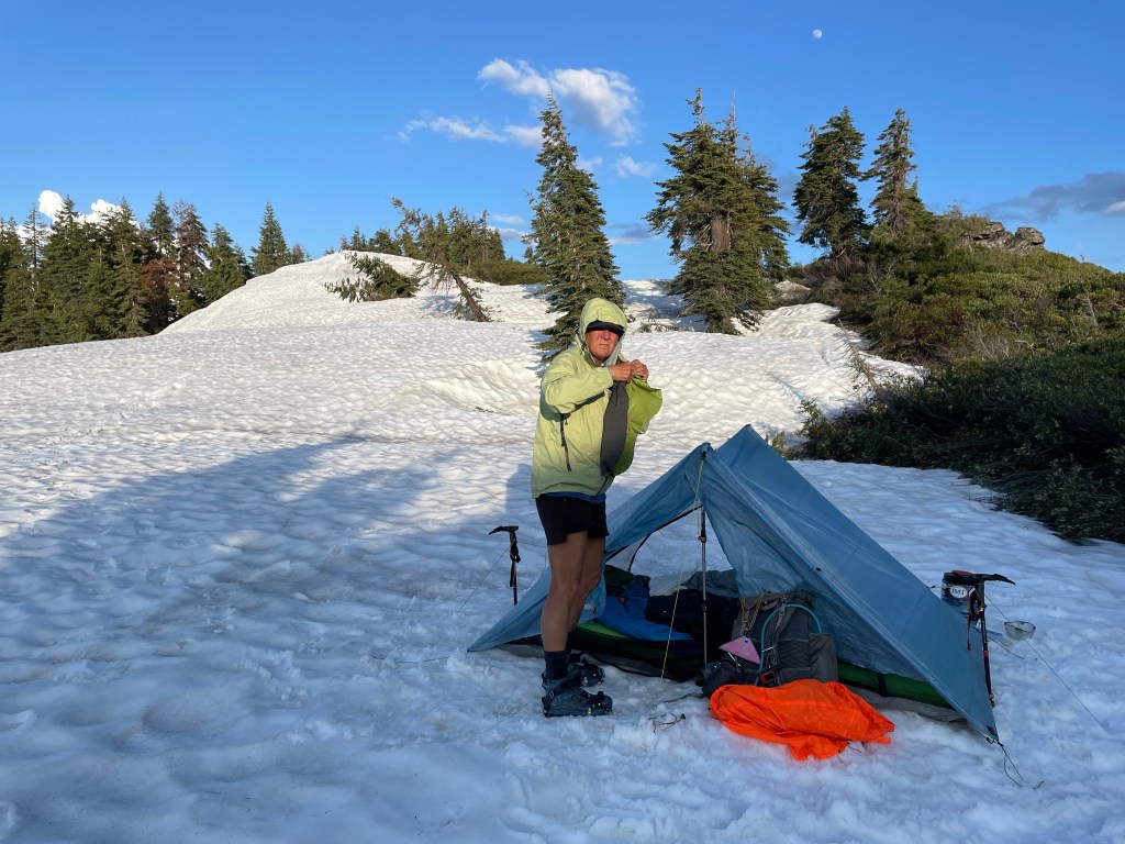
We set up camp, melted snow for water and had dinner. We finally were able to take off our crampons and wet shoes and socks. We were tired but satisfied with our progress.
Day 78 – Decisions
Start: Top of ridge- Summit Lake Road – 1452.1
End: Deer creek – 1465.0
Miles: 12.9
Ascent: 1478 ft | Descent: 3303 ft
Start time: 6:35 am
End time: 7:19 pm
Current elevation: 4188 ft
We got up to a beautiful sunrise. We had a quick breakfast, packed up and it was time to go. The snow had hardened a little it and we wanted to take advantage of that. It’s a lot easier to walk on hard snow with crampons. First order of business was to climb up and over the the snow drift that was next to camp.
Much of the day was spent trying to follow boot prints and checking our own navigation to ensure they went in a sensible direction. Note, we do not say “correct “ direction. We’re all bushwhacking our way over the snow while trying to discern the location of the trail and road. We would walk 30 seconds and then check our map and make corrections as necessary.
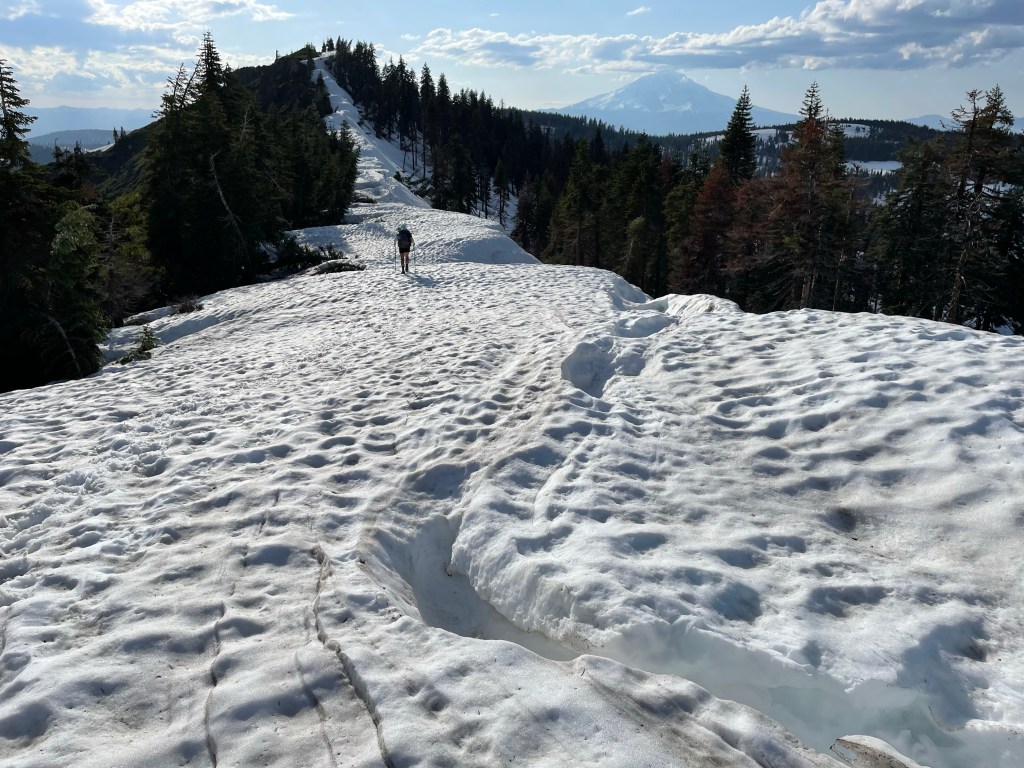
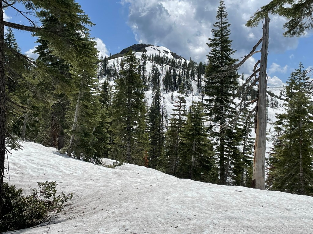
Prior hikers had advised to take Grizzly Peak Road to the north side of Grizzly Peak and so avoid a potentially hazardous section of the PCT in the steep south side. Once again, the “road” is just an ORV trail. So we took an hour to trudge through the snow and up the road towards the junction that would take us around the peak.
Once there we looked at the peak and said “heck no”! The road was straight up with a steep and sketchy snow covered traverse, plus tall snow cornices on the far side. So we turned around and he back towards the trail.
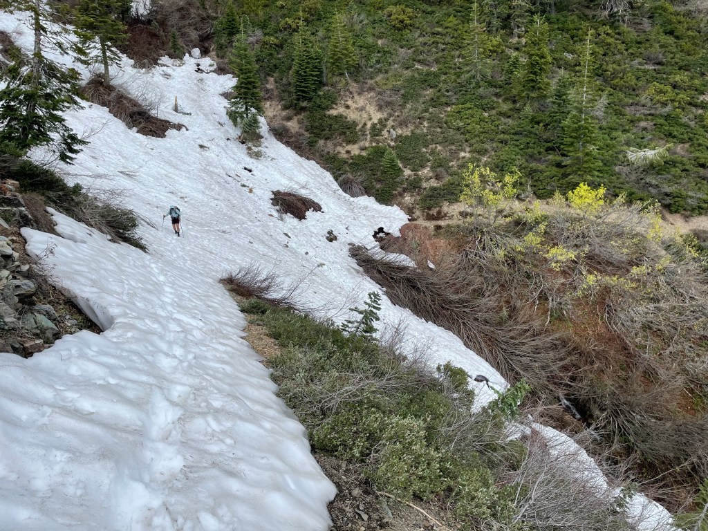
It only took us 10 minutes to hike and glissade (slide) down to where we came from. We also cut some time by bushwhacking through the snowy woods and then another 150 feet through and over the thick manzanita. Once on the trail, the trail was mostly snow free except for two steep and snowy chutes.
We had seen the trail below Grizzly Peak from far away and noticed several snow shutes. They looked steep and had originally scared us off. The trail was actually mostly snow free except for the snowy chutes which required careful attention. Each chute was steep and had water flowing underneath the snow. However, once there each section was not as scary as we thought and we made it safely across by kicking footholds as we went.
Once past Grizzly Peak we thought we would be out of the snow, but the trail had other ideas. We had to go down the Deer Creek canyon. This was a very deep and long canyon with steep slopes and about 9 miles long. The north facing sides had snow while the south facing sides was clear of snow. It rained for a an hour.
Several miles into the canyon, we found a tent site near a creek. Another hiker, Hans from Denmark, was two days into his hike southbound and he shared our site. We talked over dinner and informed Hans a the snow travel he would start the next day.

Day 79 – It could have been really bad!
Start time: 7:13 am
End time: 7:03 pm
Current elevation: 3150 ft
Start: Deer creek – 1465.0
End: West Trough creek – 1483.0
Miles: 18.0
Ascent: 3389 ft| Descent: 4584 ft
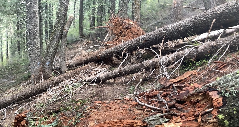
We said our goodbyes to Hans and continued hiking down Deer creek canyon. The trail was covered with small and large trees that had fallen down during the harsh winter. We enjoyed the shade provided by the tall pine tree canopy.
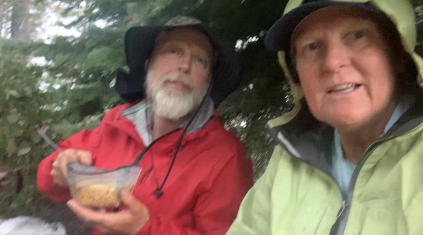
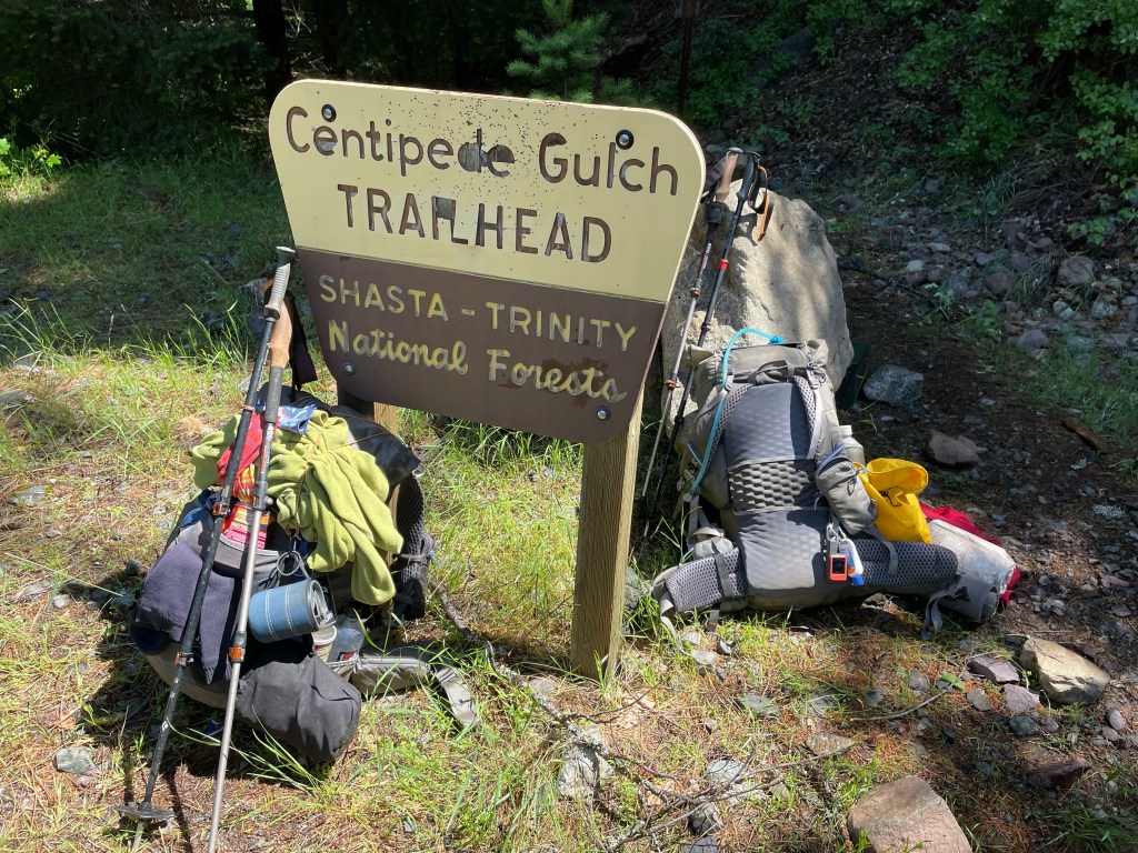
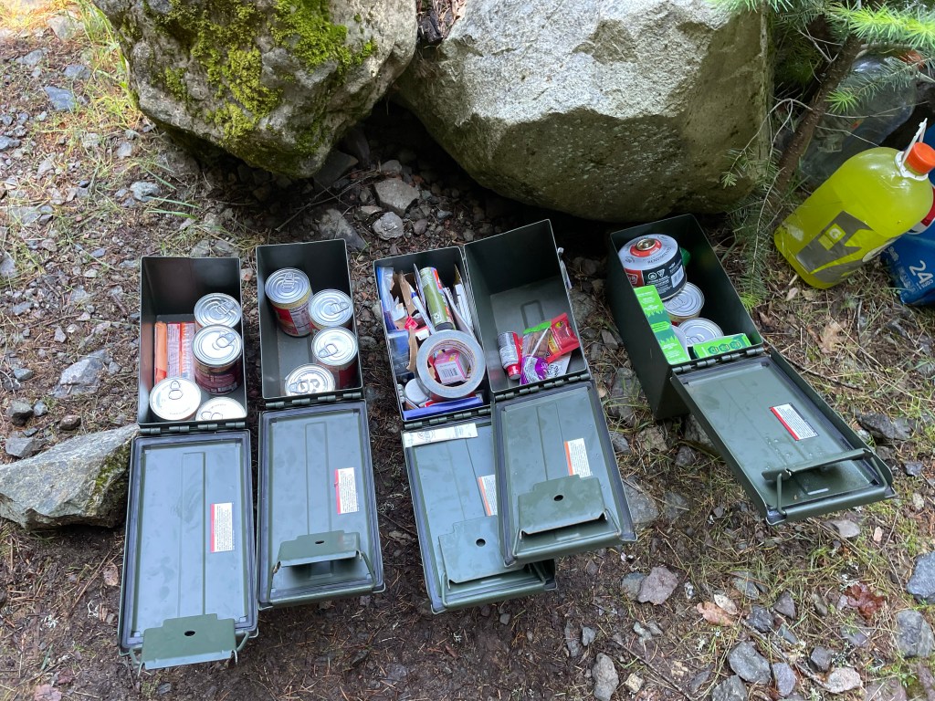
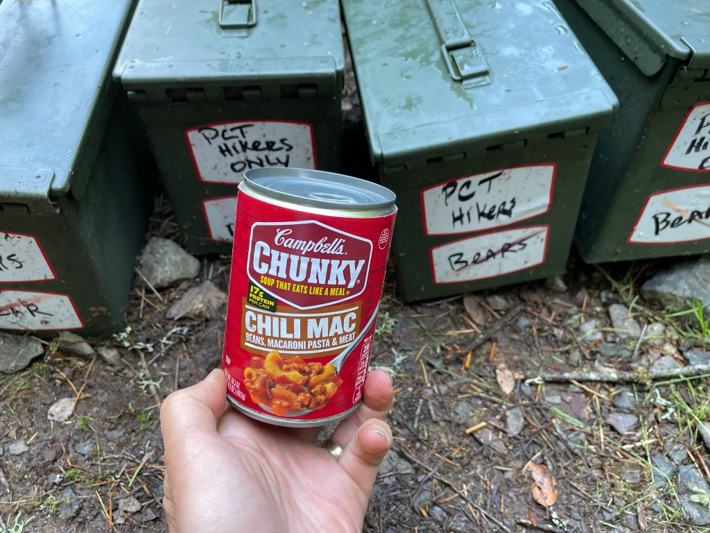
Having finally left Deer Creek, we were now following Butcherknife Creek. Then we got some serious trail magic. As we entered the parking lot for Centipede Gulch we noticed five metal army ammo boxes along with a gallon jug of Gatorade and some Pepsis. Inside the boxes were snacks, canned food, batteries, head nets, medicines, head lights, etc. This trail angel knows what hikers needed. We were sort of light on food so we each took a can of Chili Mac with pasta for dinner. We usually don’t do canned food on trail, but we couldn’t resist this and we only had to carry the for a short time.
We continued on and then over the bridge that crossed the McCloud River. It was a beautiful greenish-blueish river. With the green trees and the color of the river along with some whitewater from water flowing over rocks, it was really pretty.
Then we had an incident that could have turned out really bad. A very large tree trunk had fallen down over the trail and it was too big and sloped to climb over. The only way past was to climb down the steep mountain side along side the down tree, then back up along the other side.
For safety, we decided to first hand out packs over the tree. Ellen climbed down and around first and then Jeff handed over her backpack. However, once over, the pack slipped from her hands and started tumbling down the mountain! All we could do was hope and pray that it would stop before it got to the river.
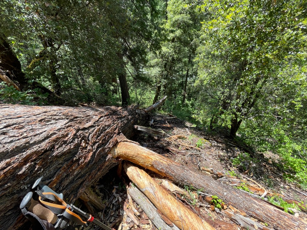
External items started flying out and we were expecting the pack itself to explode. We estimate the pack tumbled about 150 vertical feet down an 80% slope.
Once it stopped there was only one thing to do; climb down this steep slope and start retrieving all of Ellen’s stuff. Jeff went down first and found a few items in the debris field. Ellen went next and half way down found her cell phone.
We then had to make the trek back up the hill with Ellen carrying her full pack. It was steep and we were both slipping as the loose dirt and rocks gave way. We made it back to the top relieved that nothing was lost and the pack was still in one piece. Miraculously, the only things that broke were a bungee cord and the small pocket ripped on the pack. Jeff sewed the pocket later that night with mint flavored dental floss.
Further along, we noticed the trail was in much better condition. A trail crew had been through here and it was nice to walk on a trail without dodging sticks and tree trunks. A bit later we met the trial crew. There were six young adults from the SCA – student conservation association. They were led by “Mr. Kitchen” (his trail name) from the PCTA. We thanked them for their hard work and told them how much we appreciated their efforts.
We left the McCloud river and went up another drainage towards Trough Creek. By now we were both almost out of water. Another couple miles we were at our campsite by West Trough Creek. We cooked up our canned Chili Mac and then went to bed. It had been an eventful and long day.
Day 80 – Oh Shasta!
Start: West Trough creek – 1483.0
End: view of Shasta – 1497.5
Miles: 14.5
Ascent: 3004 ft | Descent: 2462 ft
Start time: 7:36 am
End time: 3:59 pm
Current elevation: 3748 ft
Our plan was to hike about 14 miles, leaving just another 5 miles to hike out to Interstate 5 the following day. Our next water source would be Squaw Creek in 2.8 miles and then no more water after that. So we each carried four liters from Squaw Creek to cover our needs that day, night, and morning.
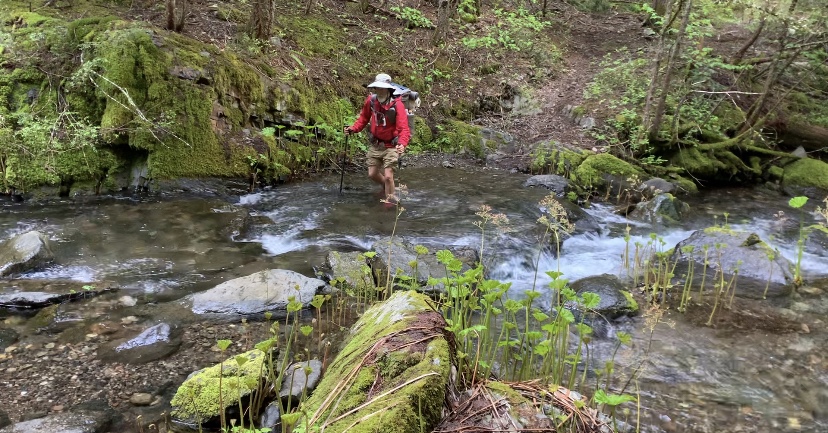
As per usual we had to get our feet wet the first thing in the morning as we crossed West Trough Creek. The trail wasn’t too bad, some small and some large blow downs.
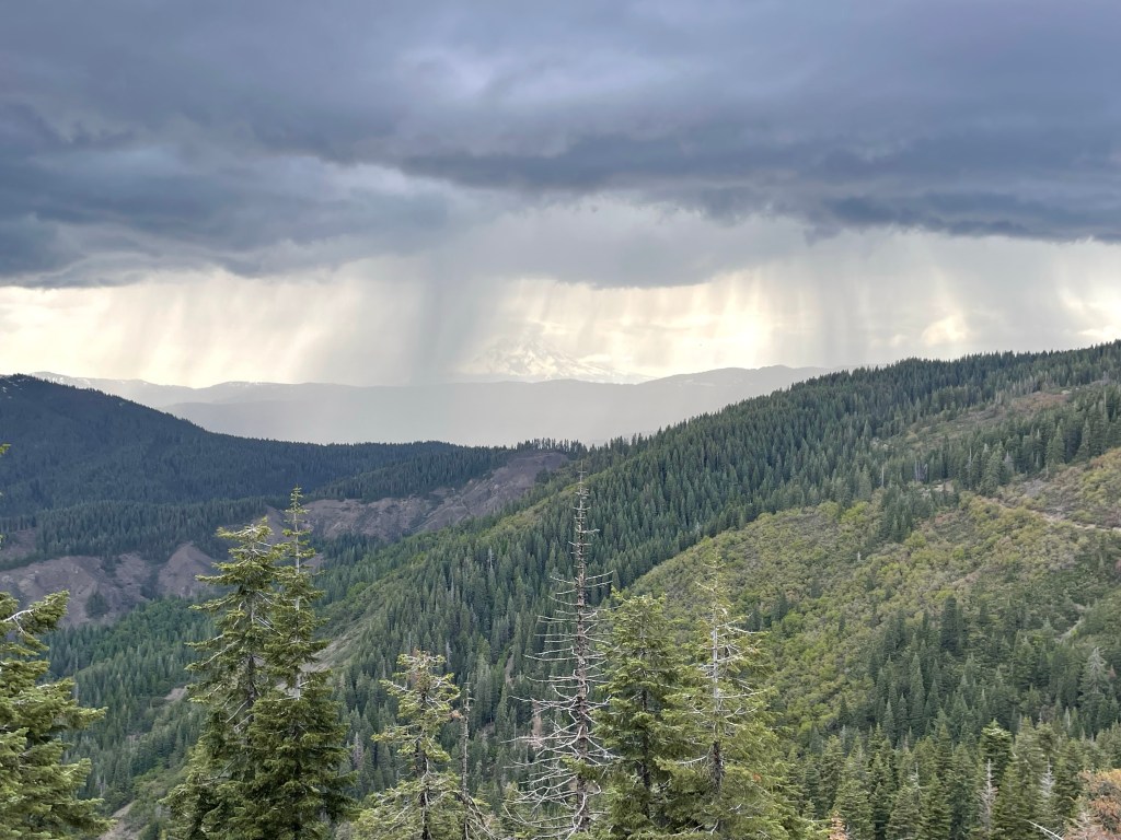
We rounded a corner and we’re hiking on a northern facing slope with great view of Mt. Shasta!
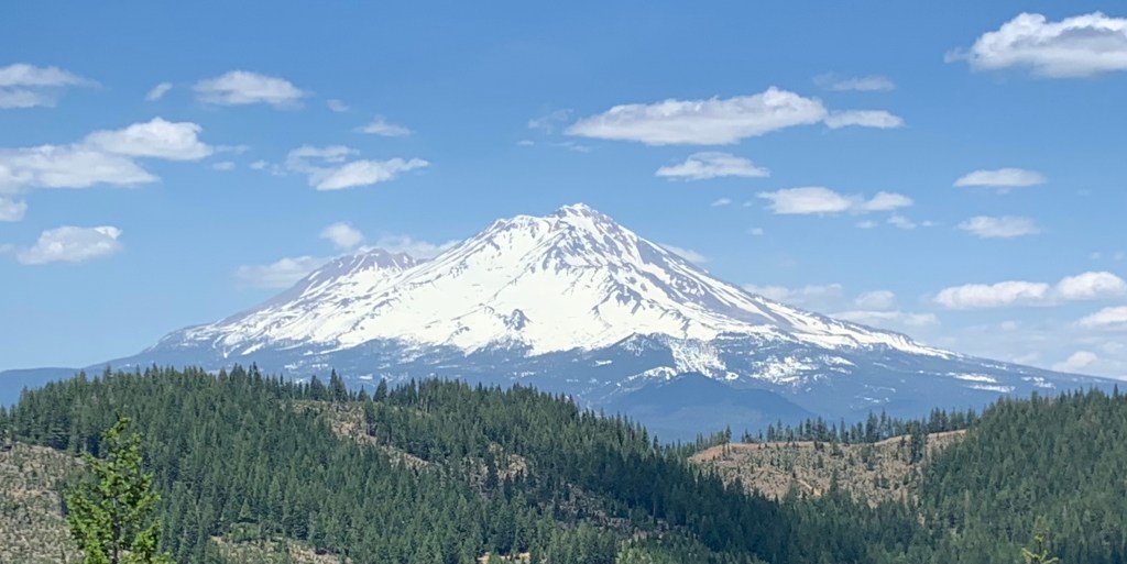
Our camp for the night was only 4.8 miles from the interstate highway and still with an awesome view of Mt Shasta.
Day 81 – Town day!
Start: view of Mt Shasta – 1497.5
End: I-5, Castle Crag – 1502.3
Miles: 4.8
Ascent: 338 ft| Descent: 1942 ft
Start time: 7:42 am
End time: 10:09 am
Current elevation:1502 ft
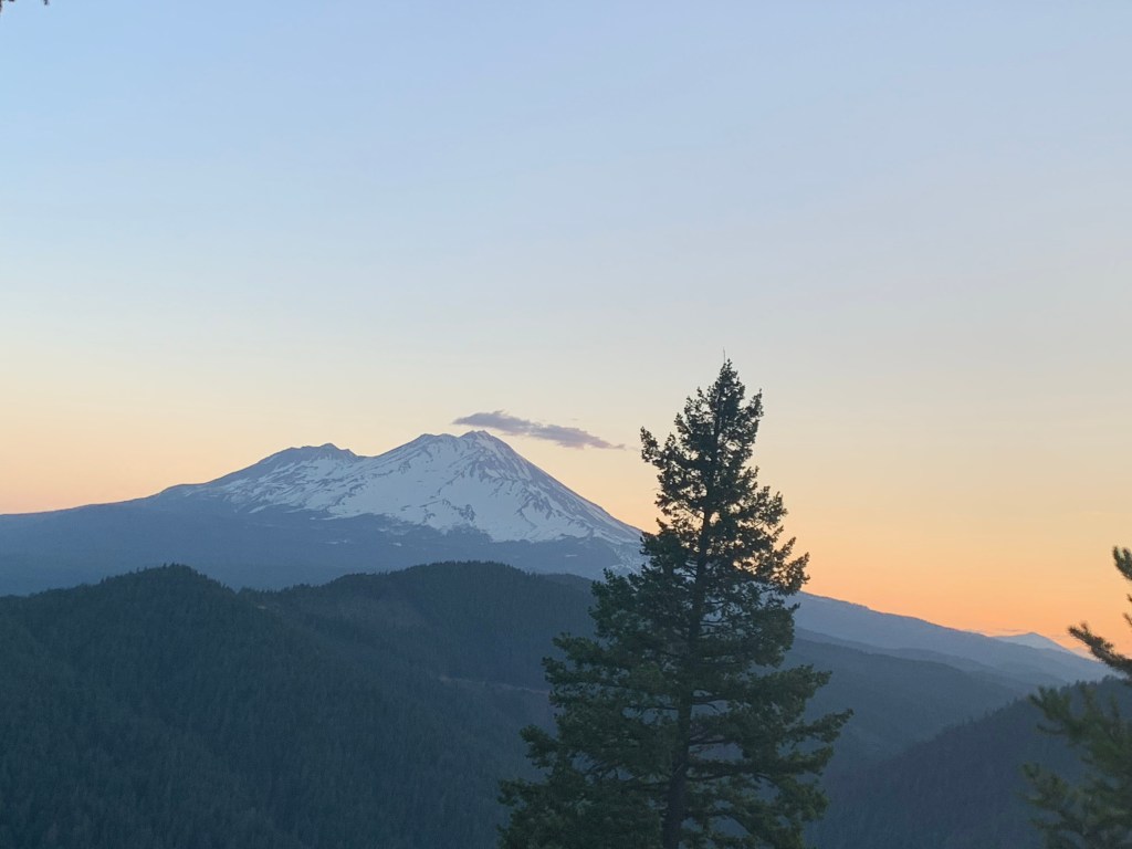
We woke up kind of late – 6:30 am and we were back on trail at 7:42 am. We had a great sunrise view of Mt. Shasta.
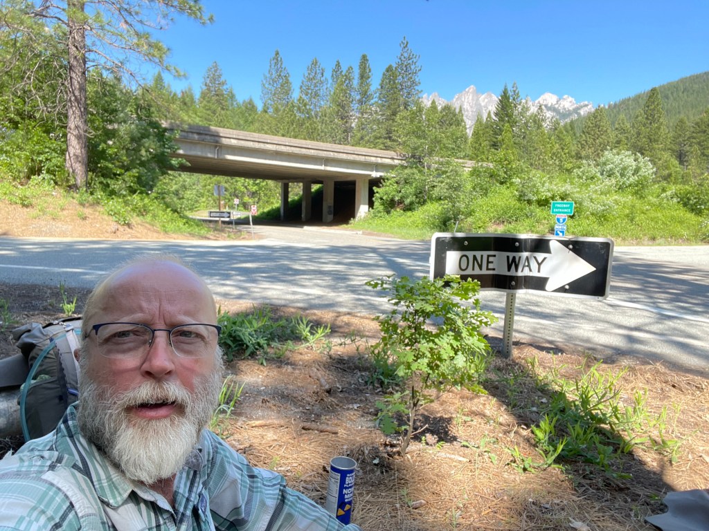
We had a really short day to the I-5 junction with the PCT so sleeping in was ok. The trail was pretty nice. Only a few blowdowns that were small and the debris on the trail was minimal. However, it was all downhill which didn’t bode well for Jeff’s right leg which started hurting the day after the bushwhacking around Grizzly Peak. We made it down to I-5 just after 10 am.
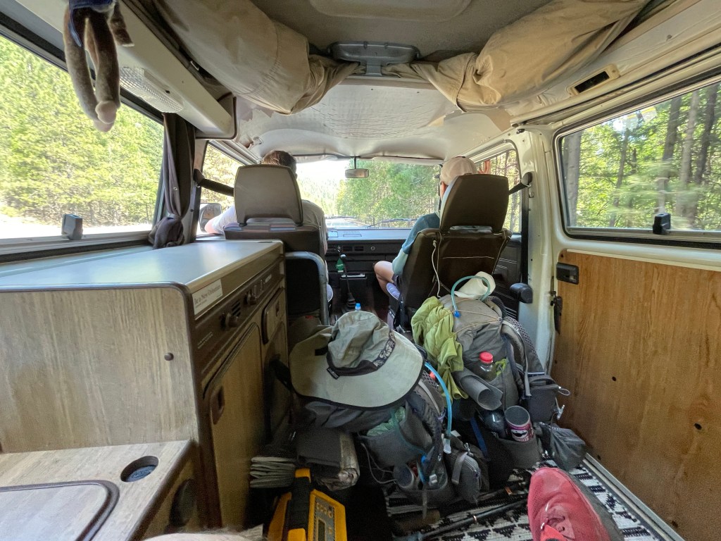
Since we had cell service we both made some phone calls. Our Trail Angel Peter showed up just before 11 am to take us down the road to Dunsmuir. He drove a 1971 VW camper bus which was pretty cool.
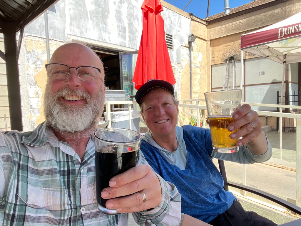
Peter dropped us off at our hotel but we couldn’t check in until 2 pm. We had 3 hours to kill so went to the brewery and had lunch and then walked to a small park and laid around under the tree in the shade. It was 90 degrees!
Meanwhile, Ellen was trying to figure out how to get to Redding from Dunsmuir. The options were very limited and complicated. She posted a request on the NorCal PCT Facebook page and got a response from Noelle – Peter’s wife who is part of the Trail Angel group.
Well, as luck would have it, Peter planned to drive down to Sacramento via Redding and offered to give us a ride although he wouldn’t be leaving until 8 pm. That’s fine, but we now had even more time to kill.
We got our backpacks from the hotel, cancelled our room and went back to our little park. We hung around there for a bit and then went back to the brewery for a beverage, a snack, and to charge our phones and battery bank.
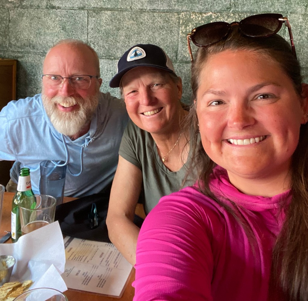
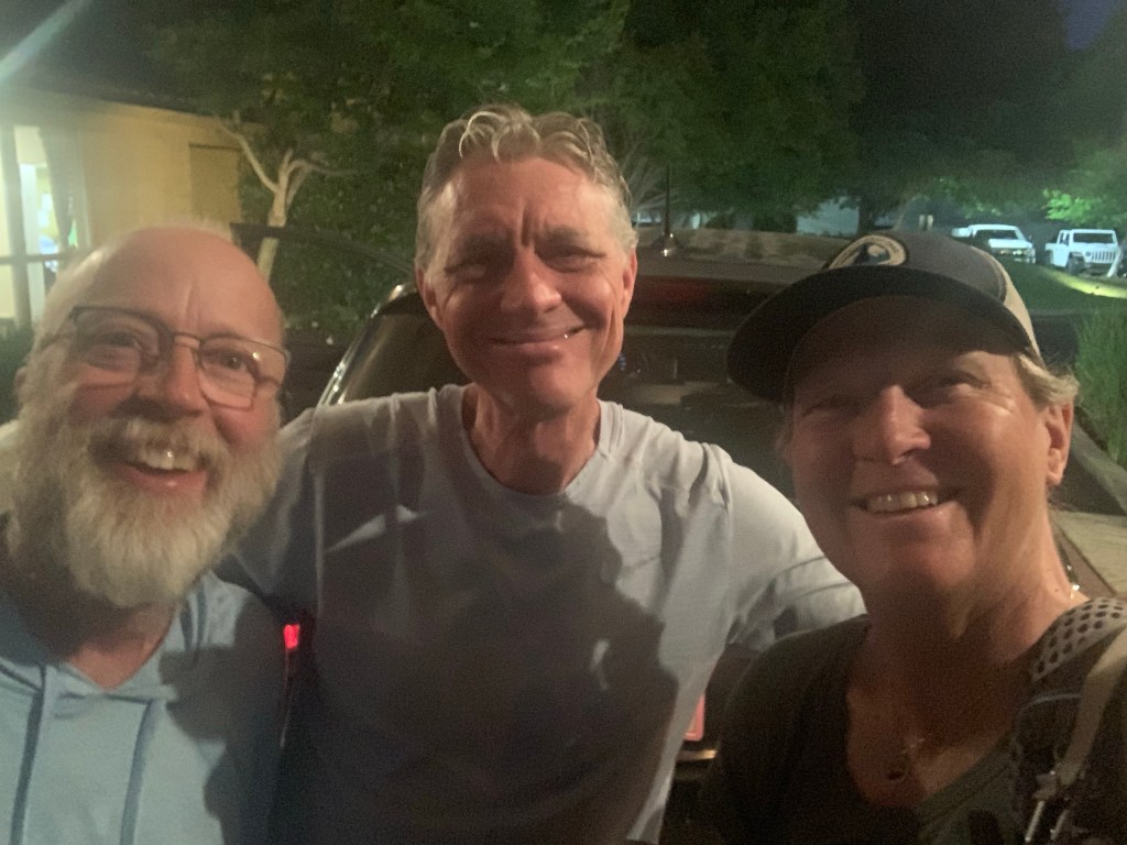
At the brewery we met Courtney, also known on trail as “PBS”, or the “Unpolished Princess”. Courtney was a PCT hiker who had a rough time in the snowy section we just just hiked through. It was cool meeting her and swapping stories.
We then went to the local pizza place for dinner and made more phone calls while we waited for our ride. Peter picks up around 8pm and gave us a ride to our hotel in Redding. We checked in, showered and went to bed. It was a long day of sitting around and waiting but glad to be showered and in a hotel for the night.
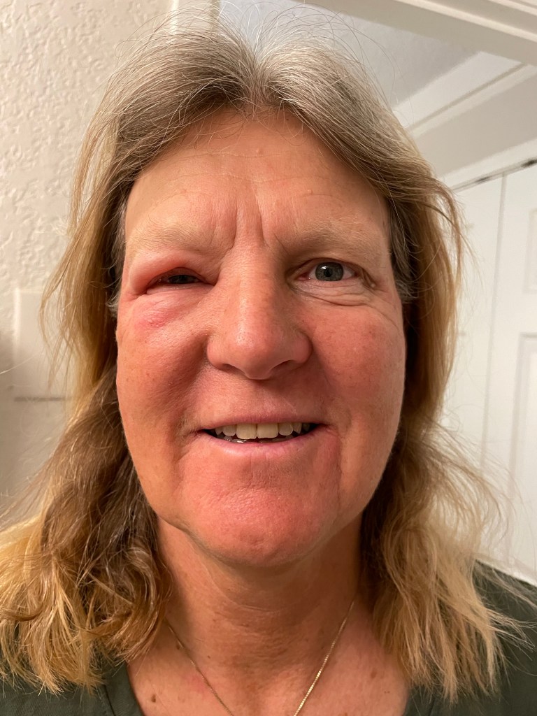
By now ellen also had a raging case of poison oak rashes spreading over her body and closing up her right eye.
Day 82 – Taking a week off
Start: I-5, Castle Crag – 1502.3
End: – 1502.3
Miles: 0.0
We got up early so we could make it to the urgent care before they opened. We Uber’ed over and we were second and third in line.
Ellen got her steroid shot she needed for the poison oak plus some steroid pills and a cream. Jeff had to go to another place to get an x-ray of his lower right shin. It showed no fracture so it must be only banged up.
Ellen got the rental car, we did laundry at the hotel, and finally around 2 pm we left the hotel. Time to get some groceries for our road trip. But we had to find a styrofoam cooler. It took some doing but we found one at BigLots. We stocked up on food for a couple days and off we went on our road trip!
So what is our plan now? We are taking a week off trail to heal our bodies and to let some of the snow melt.
We’ll drive to Redwoods National and State Parks to see tall, tall trees. Then drive up the coast to Oregon. After a week we will reassess the hiking situation.
Here is the next video covering our PCT hike through Shasta National Forest. Sorry, it is a bit long but hopefully as interesting on camera as it was in person!
